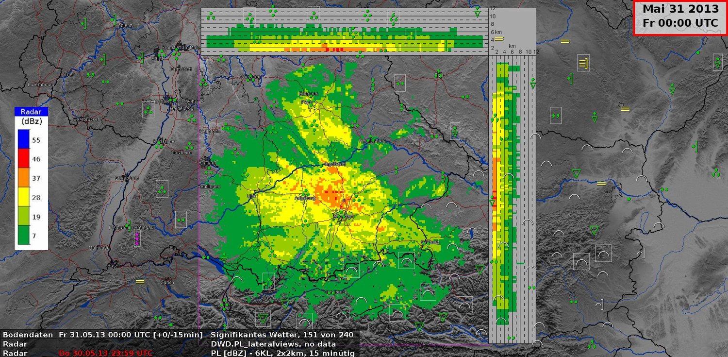
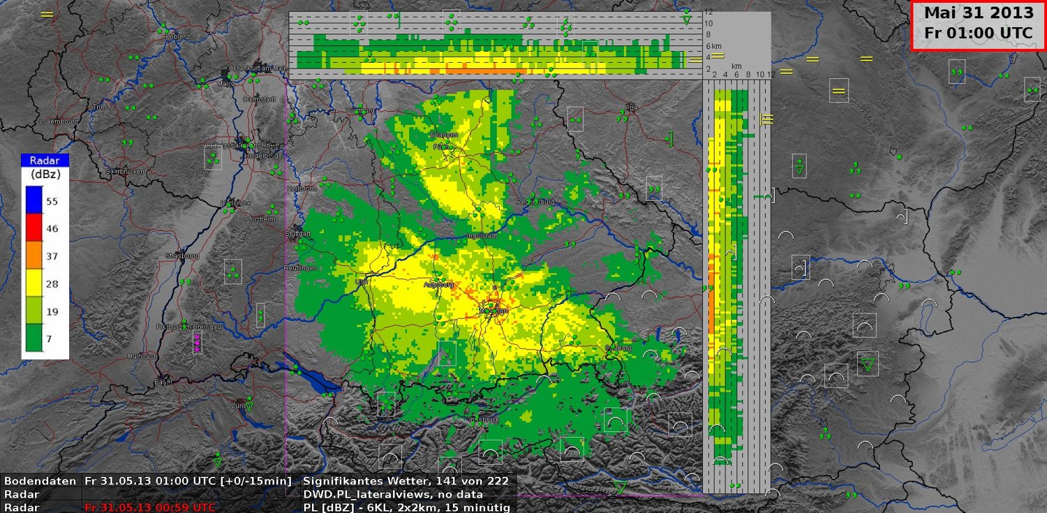
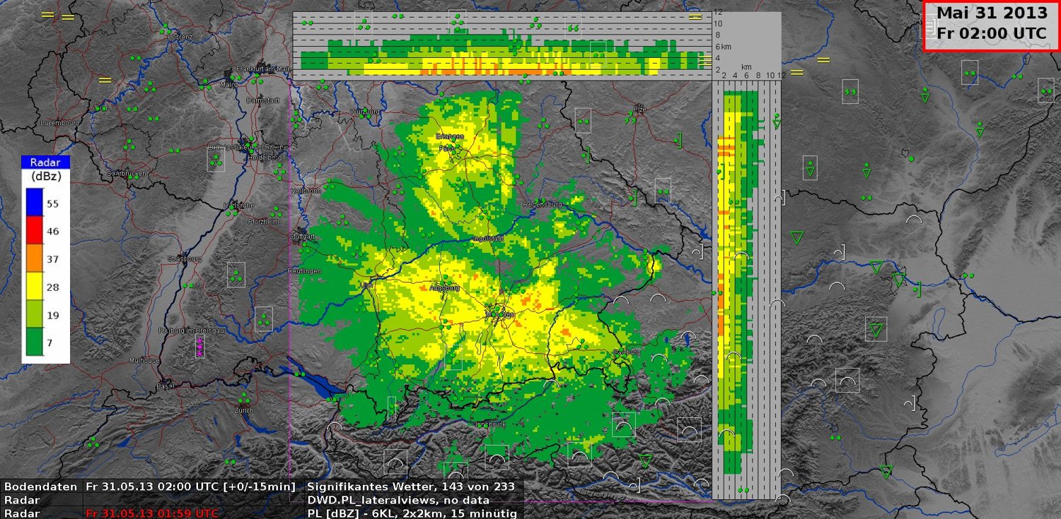
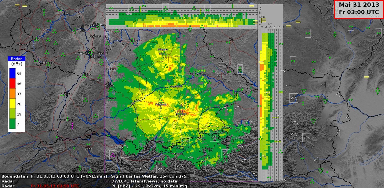
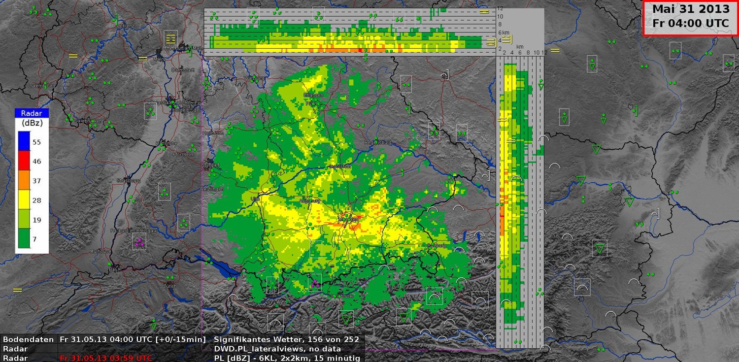
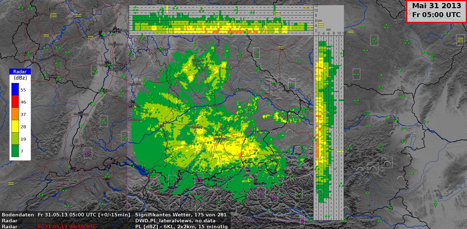
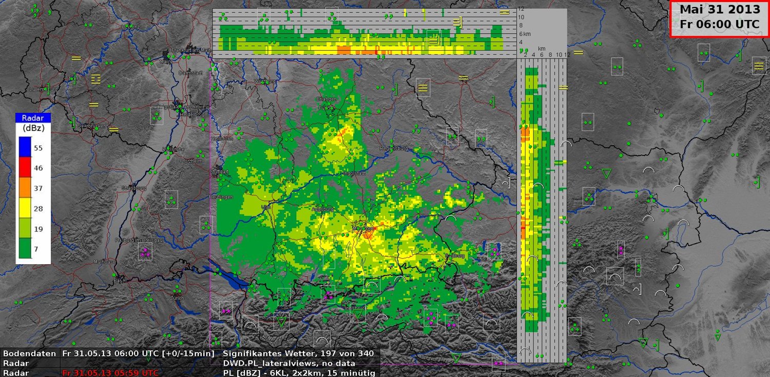
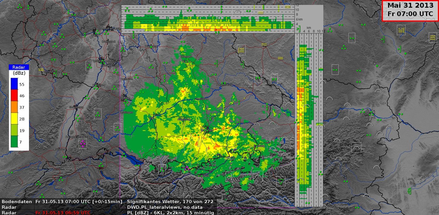
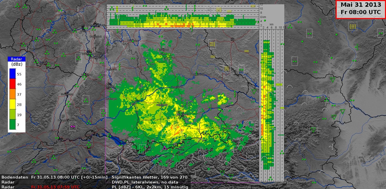
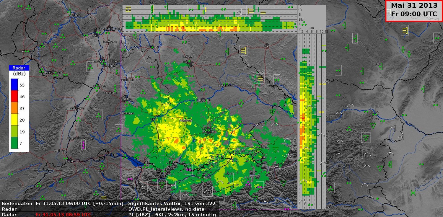
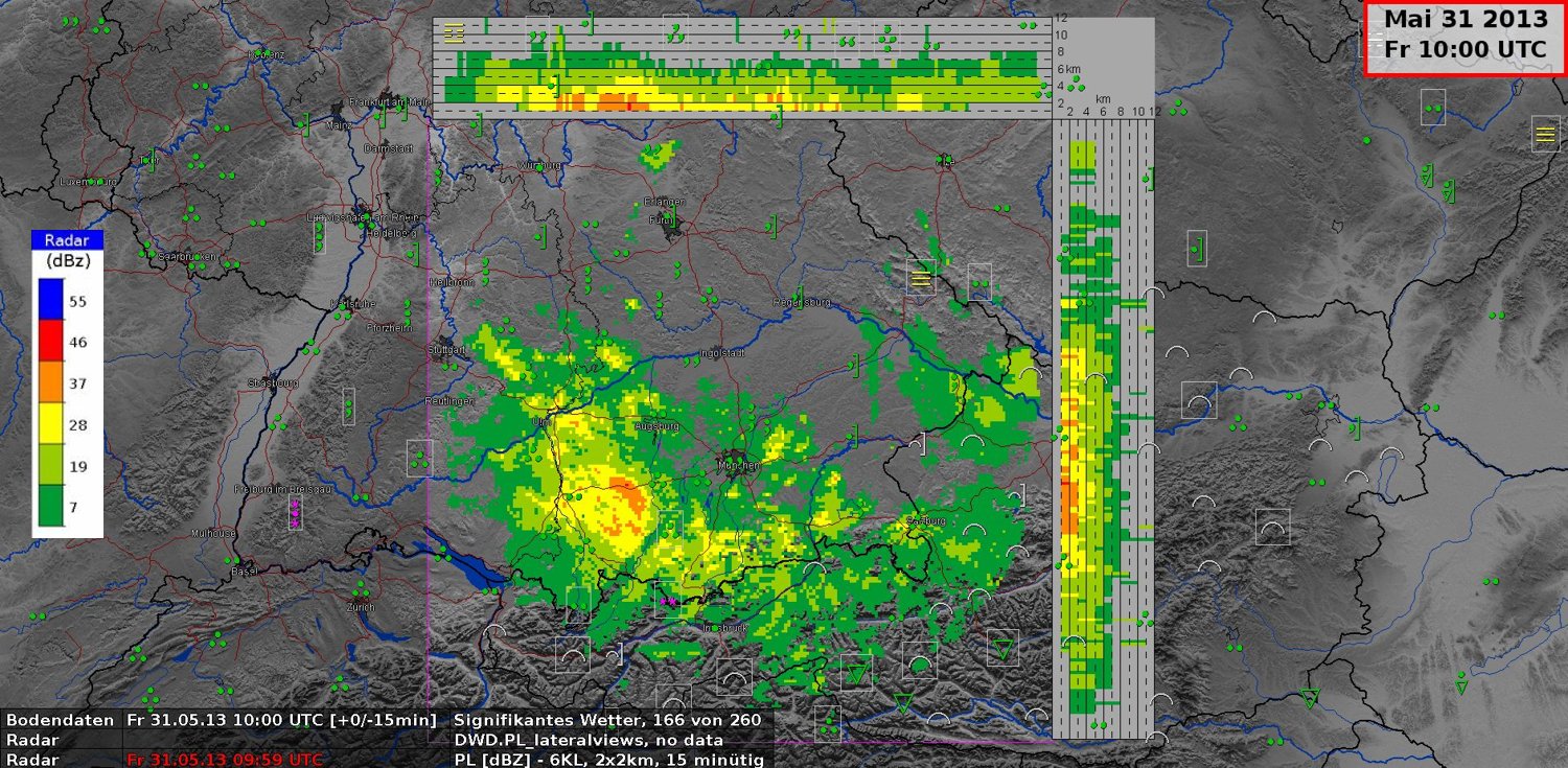
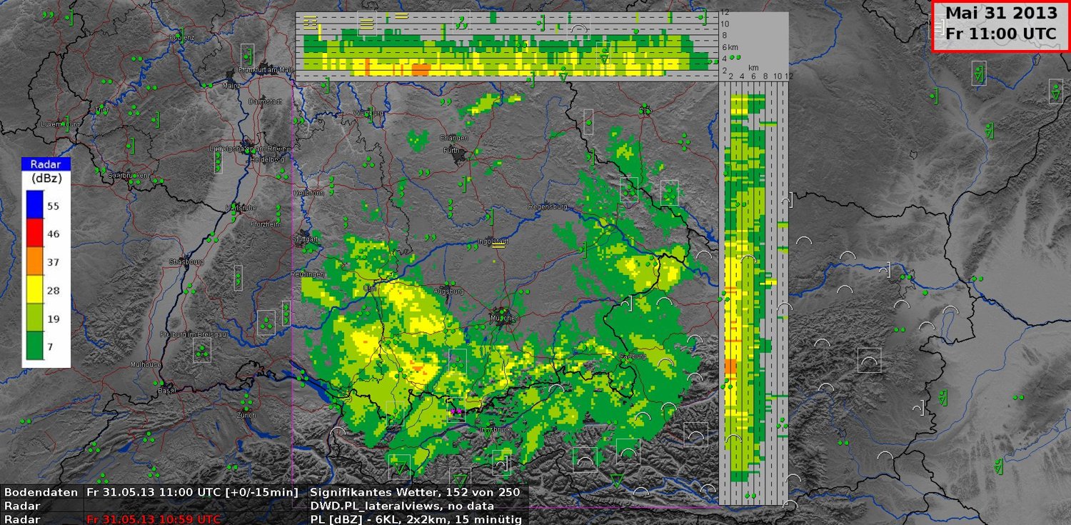
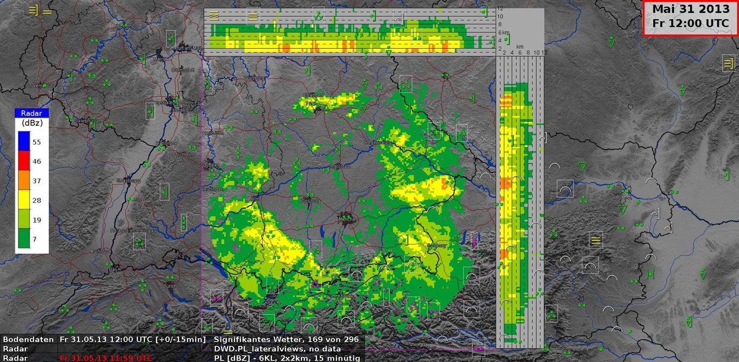
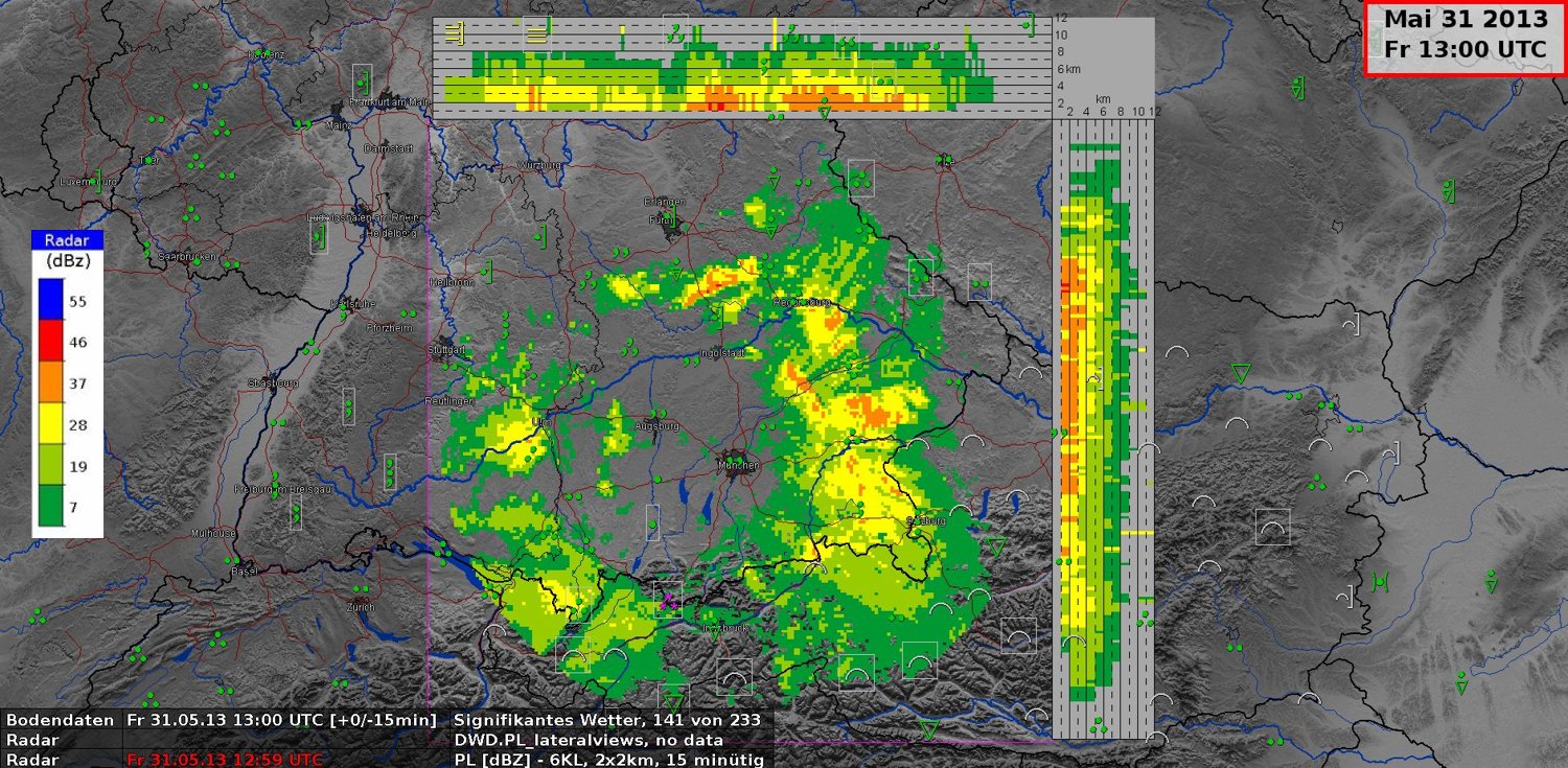
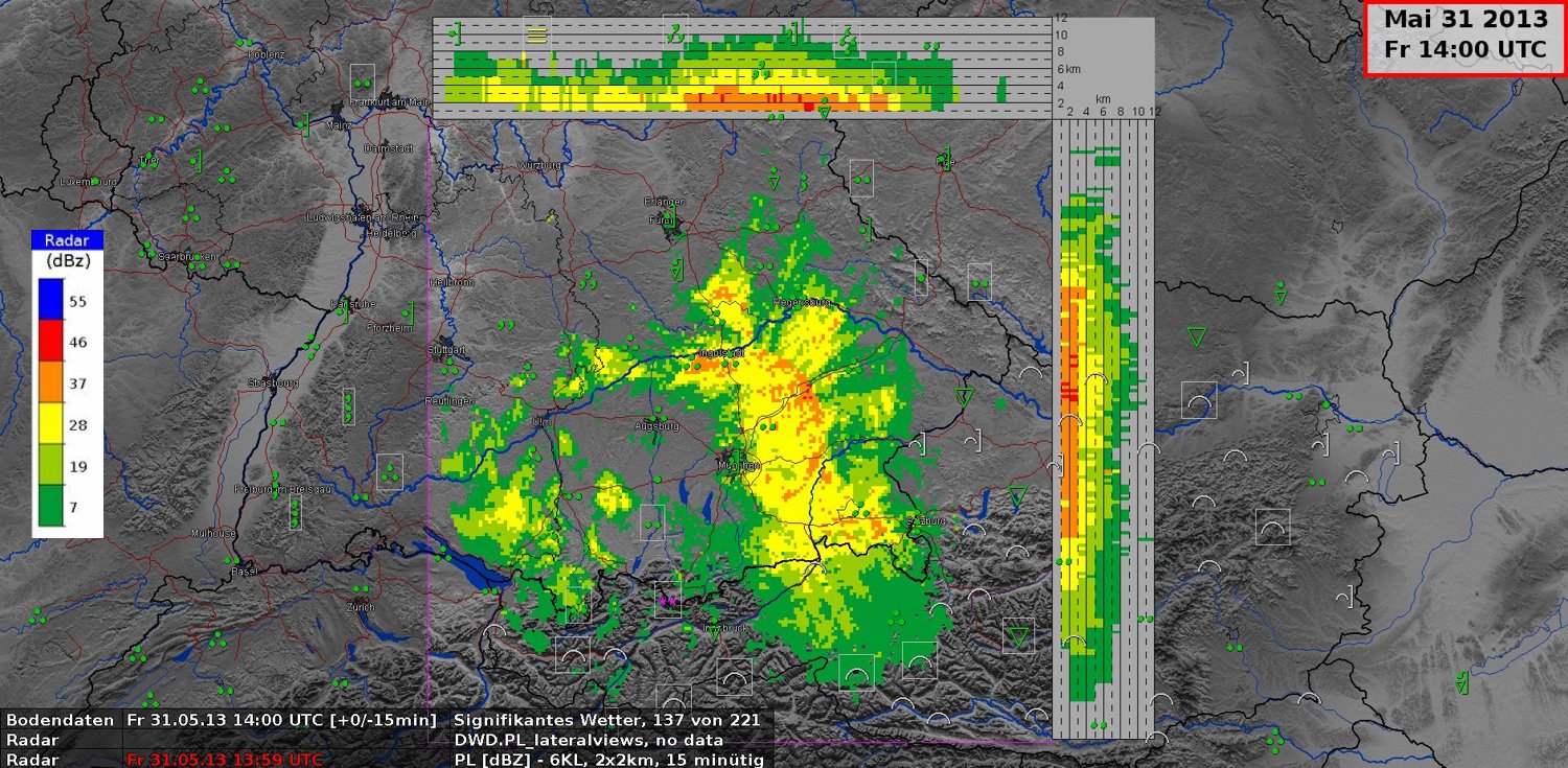
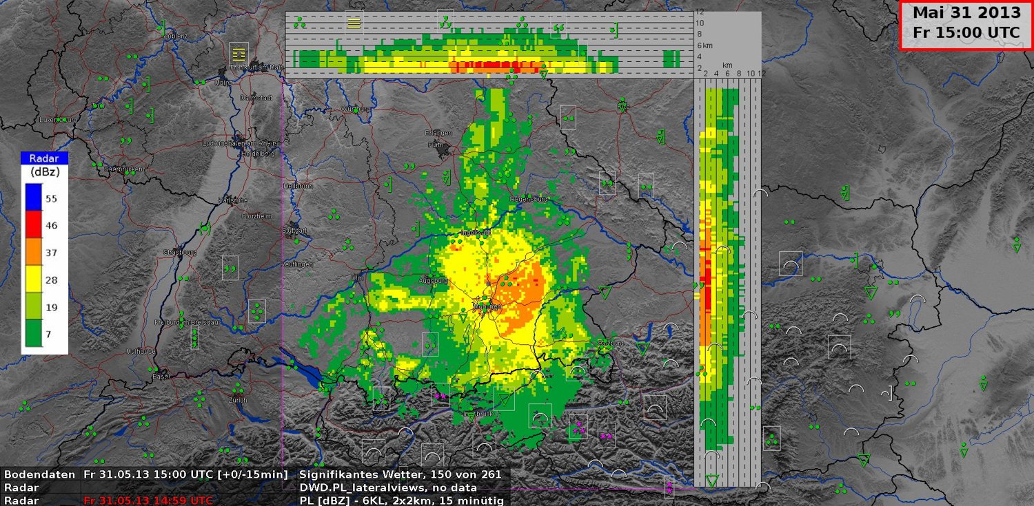
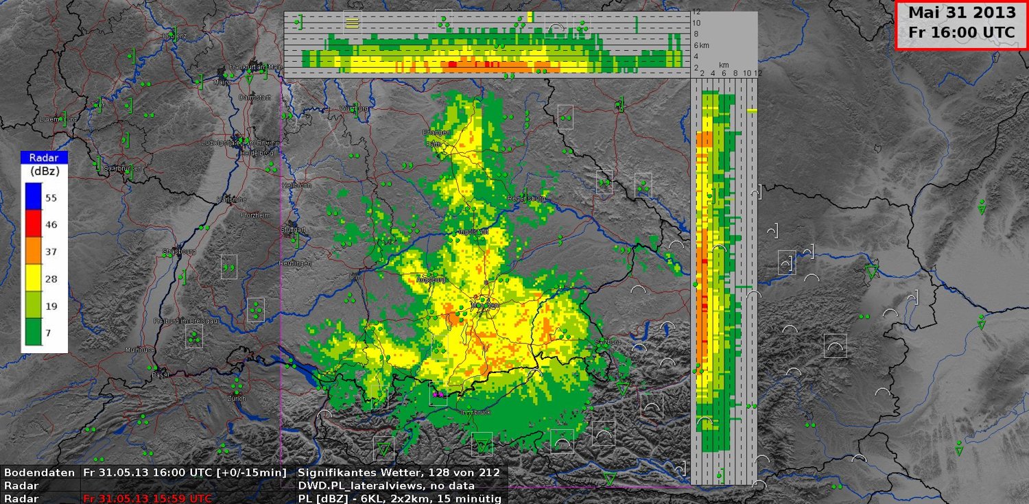
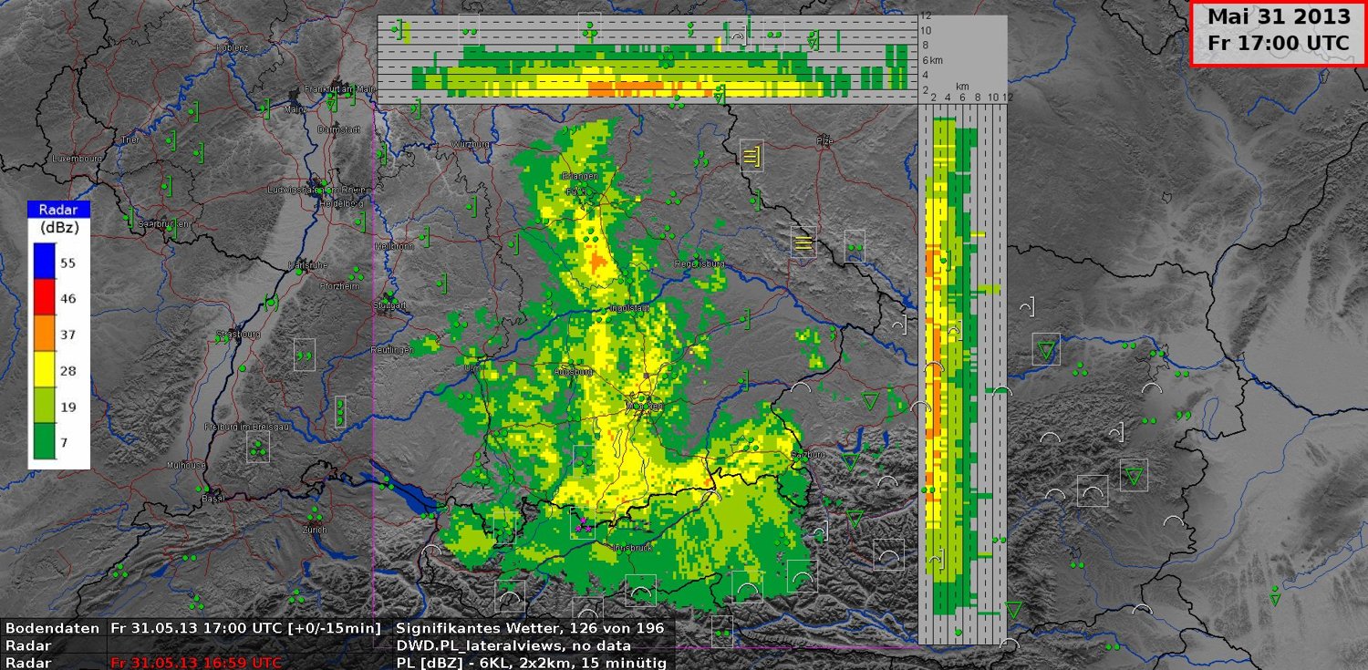
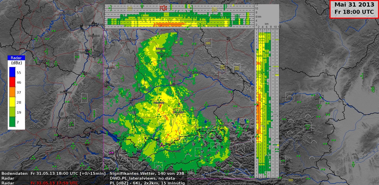
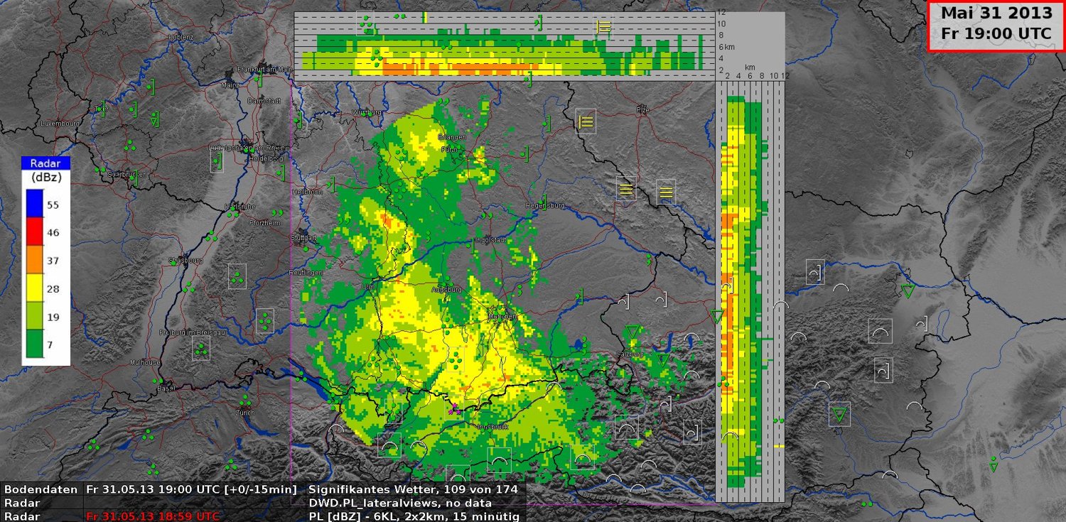
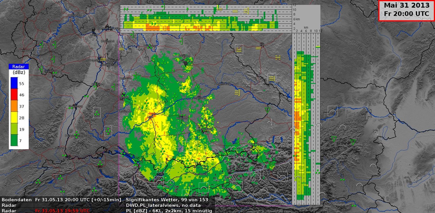
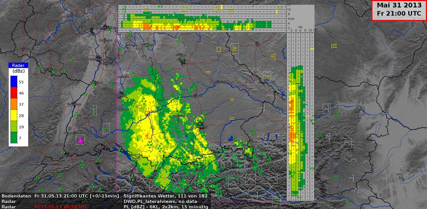
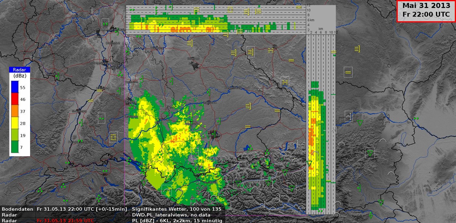
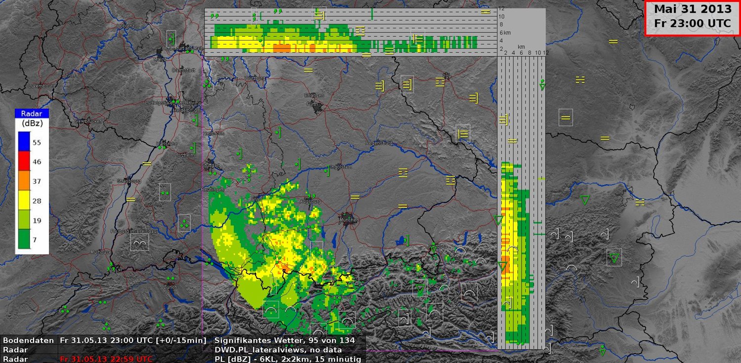
Local radar image "PL" from a volume scan in the Munich area
With 3-dimensional information, the forecaster will have an idea about the vertical precipitation structure up to 12 km. Here we see precipitation from nimbostratus clouds, with ice particles which have lower reflectivity shown in yellow and greenish colors above 3 km. In the melting layer between 2 km and 3 km, the reflectivity is very high with more than 46 dBZ, shown in a reddish color. This is seen clearly at 15:00 UTC. At lower altitudes the radar signals have lower reflectivity due to the presence of rain droplets.