The Training Bulletin

Joint newsletter related to new activities and resources
in European meteorological training

// Issue XV - April 2019

Activities & events
//image missing//

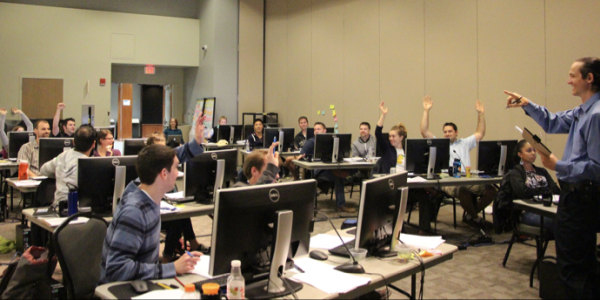
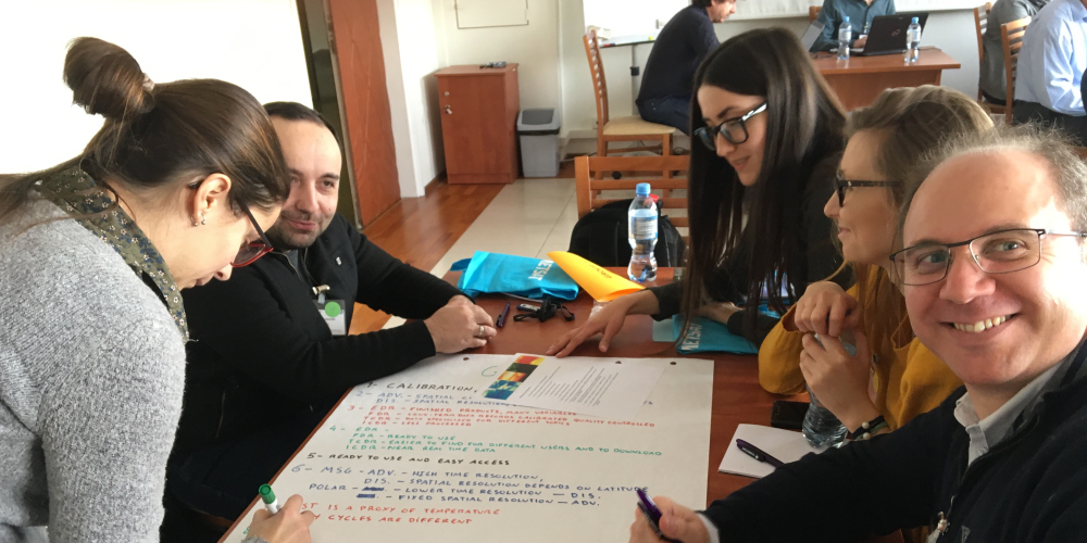
EUMETCAL/CALMet Conference - Inspire, Share and Collaborate

17-20 September 2019 / Darmstadt, Germany

The joint EUMETCAL/CALMet XIII Conference 2019 will be an event that brings together educators, trainers and managers from universities, research institutions, and National Meteorological and Hydrological Services. It will provide an opportunity for a community from around the world to collaborate and network on workforce development in support of the global weather, water and climate industries.

During the forum, participants will share experiences, expectations, and new ideas for applying emerging technologies and strategies in meteorology and hydrology education and training.

The deadline for submitting the abstracts has been extended to Friday 12 April. You can submit your abstract and register to attend the conference at https://www.eventsforce.net/eumetsat/5/home

We are looking forward to seeing you in Darmstadt in September.

//image missing//

Eumetcal2

In January 2019 Eumetcal started the EUMETNET Phase 2019-2023 with a new Coordinating Member and a new Programme Management Group. A consortium consisting of KNMI (Koninklijk Nederlands Meteorologisch Instituut) and DHMZ (Meteorological and Hydrological Service of Croatia) now leads Eumetcal 2. Heleen ter Pelkwijk is the Programme manager and Tomislav Marekovic is the Technical Support Officer.

In the next five years Eumetcal 2 should become a central partner for all E&T related challenges in the EUMETNET community. This means that Eumetcal 2 will not be limited to the forecasting capability area alone, but will actively stimulate collaboration throughout the whole of EUMETNET, to solve the most urgent training needs in all capability areas. Given the limitations, Eumetcal 2 will not be able to solve these challenges alone, but will do this by connecting parties with the same kind of E&T needs and offers. Eumetcal 2 will support this process by connecting parties, as long as the infrastructure that is needed for some members is available. Furthermore, it will support and enhance the trainers’ community. This will need time to develop.

Heleen reports: "We consider the training infrastructure, the communication of training activities, the Eumetcal workshop, and the WMO train-the-trainers as the most important features of the previous Eumetcal projects. Therefore, our first actions are the continuation of these features to enable the members to continue their E&T activities, preserving all training material, knowledge and opportunities on collaborating projects. Next we will do an extensive assessment of training and infrastructure needs among all members. We will keep you updated on our actions!

We need your help to make a success of this Eumetcal phase, so please keep in touch, via info@eumetcal.eu. We look forward to working with you!"

More information about the new Eumetcal Programme can be found at http://eumetnet.eu/activities/forecasting-programme/current-activities-fc/eumetcal/.

//image missing//

2019 MSC-COMET Winter Weather Course: Adding Value to NWP Through Winter Applications

1 September – 26 October 2019 Online Course
28 October – 1 November 2019: Optional Residence Course
2 November 2019 – 31 January 2020: optional Post-Course Componenent / Online; Classroom: Boulder, CO, USA

The 2019 Winter Weather Course offers a unique, operationally oriented learning experience that matches training to the realities of the forecasting environment. Participants will be immersed in interactive activities focused on addressing key forecasting challenges, including diagnosis of complex, multi-scale weather processes; model initialisation assessment, and model agreement.

Satellite analysis techniques will feature prominently in the diagnosis and model assessment sessions. These topics, and more, will be examined in the context of winter weather case studies and laboratory exercises.

Participants will interact closely with experts in the field. They will be able to build connections and network with other meteorologists internationally, as the course frequently includes forecasters from Asia, Canada, Europe and the USA, as well as instructors from universities and national hydrometeorological services.

Moreover, the course is for early to mid-career forecasters, and is aligned with the WMO PWS Competency Framework for Forecasters.

This year's course is in a blended online-residence format. Participants may register for the online component only, or the combined online and residence session experience.

If you are interested in attending, or would like more information, please contact Bryan Guarente at the COMET Program (guarente@ucar.edu).

//image missing//

A new EUMETSAT session at the European Meteorological Society Annual conference

5-9 September 2019 / Copenhagen, Denmark

EUMETSAT will chair a new session on climate applications of satellite data at the 2019 EMS meeting, taking place in Copenhagen, 9– 13 September.

The session will present existing applications and products based on Satellite Climate Data Records and "near real time" data, with relevance to climate to motivate and support the use of satellite data. A broad ensemble of thematic variables contributions is encouraged, from climate monitoring to atmospheric composition. Contributions may address novel science-driven (operational) applications, methodological approach, data fusion and innovative products and services.

A few keynote talks are foreseen, to provide an overview of the current applications of satellite climate datasets with potential downstream applications.

Deadline for abstract submission is 13 April.

//image missing//

Convection Week 2019

20 May to 24 May 2019 / Online

At the end of May, EUMeTrain is organising an Event Week on Convection. Being held shortly before the main convective season starts, this event will focus on topics like thunderstorms, tornadoes, storm damage, and the use of satellite products in one week. The target audience comprises meteorologists from all fields, but especially forecasters, students and model developers. One major point of emphasis will be on NWCSAF and H-SAF products and new developments in this field. The use of satellite and other remote sensing products for forecasting thunderstorms will also be included.

The access to the event week is free and open to all, but prior registration is needed. Self-registration is simple and you can register for one or several sessions.

Registration links will be available at eumetrain.org in April 2019.

//image missing//

Do you need to prepare your people for situations with Severe Convection?

See website

The European Severe Storms Laboratory (ESSL) provides different kinds of forecaster training on convective weather, throughout the year. Theoretical courses, given by expert trainers, are combined with practical sessions, where participants practise forecasting/nowcasting severe convection cases in small groups. By discussing and evaluating these forecasts using observations, ESSL provides forecasters with the opportunity to gain experience on forecasting severe convective weather, which is difficult to do during individual shifts.

For the latest training programme, please visit https://www.essl.org/cms/upcoming-events/. Since 2019, ESSL also provides trainingspecifically designed for aviation forecasters.

//image missing//

SALGEE workshop hosted at EUMETSAT

14-17 Oct 2019 / Darmstadt, Germany

SALGEE is a user group led by the Bulgarian NIMH, with focus on drought and fire monitoring by means of satellites. It was initially concerned with Eastern Europe, as an area plagued with fires, in particular during the summer period. However, following the spread of fires in the warmer climate scenarios, the area of action of the group extends to cover most of Europe (Sweden was affected by fires last summer), the Middle East and Northern Africa.

In the past NASA, ECMWF, NOAA, LSA SAF, and Italian and Greek universities, have shared their expertise during the three day conference.

The previous meetings took place in Bulgaria, Turkey, Portugal, Italy and Armenia. This year it will be held at the EUMETSAT headquarters in Germany, with a special focus on climate and include the Climate SAF consortium, as a contributor to the implementation of the EUMETSAT SAF strategy related to climate monitoring.

// Issue XV - April 2019
Resources & Tools
//image missing//

Monitoring the Ocean from Space – MOOC material now available on new website

Online

The material from the 'Monitoring the Oceans from Space' Massive Open Online Course (MOOC), developed by EUMETSAT as part of the Copernicus programme, is now available to download and share and is freely available.

The short videos and the interactive tasks introduce the many applications of ocean satellite data, covering a broad range of topics from ocean circulation, to fisheries, climate, and the socio-economics of managing ocean resources. The course has been run twice since the launch of the first Sentinel-3 satellite in February 2016.

Questions about the MOOC content can be asked on the EUMETSAT Copernicus Marine User Forum: http://forums.eumetsat.int/forums/forum/copernicus-marine-calval/.

The MOOC content is available from this website: http://www.oceansfromspace.org/.

//image missing//

Product Tutorial on Sandwich products

Online, EUMeTrain

A product tutorial on Sandwich Products was recently published on the EUMeTrain website. The aim of the tutorial is to help users (weather forecasters and/or other experts) to understand and use these composite images, by giving them the most relevant background information and examples.

A short (two-pages) Quick Guide on Sandwich Products is also available on the site. The present product tutorial provides a deeper inside into the topic by providing more detailed guidelines, physical background, benefits and limitations, plus several examples of the cloud top features which can be observed in sandwich images.

//image missing//

New free lesson: Basic Satellite and NWP Integration

COMET MetEd Library

NWP is one of the most important forecasting tools in our toolbox. Yet identifying when/where it is not capturing reality is difficult. In the short-term forecasting range, it is important for a forecaster to identify when/where NWP output isn’t matching reality. Then they can make appropriate changes to the forecast output.

To find those mismatches anywhere in the world, one of the best tools is satellite imagery. This latest ASMET lesson, published in February 2019, focuses on a few cases using satellite imagery to help identify mismatched features/processes between the satellite imagery and the NWP.

Anyone trying to add value to short-term NWP forecasts could benefit from taking this lesson to learn a process for assessing NWP output compared to observations. This lesson focuses on fog and convection in Africa, however it lesson can apply to many other cases, and is generalised enough to help forecasters from anywhere in the world.

The lesson was prepared by the experts from Morocco, Niger, Kenya and South Africa, in partnership with EUMETSAT and COMET and you can access it here.

//image missing//

News from ePort

Online

The EUMeTrain satellite data hub ePort PRO has recently been updated with new satellite data.

To provide a full Earth coverage with geostationary satellite data, GOES-17 image data have been included into ePort. Five geostationary satellites (Meteosat-8, Meteosat-11, GOES-16, GOES-17 and Himawari) now provide a complete scan of the Earth’s atmosphere, four times a day. The GOES RGB palette has been extended by the Day Microphysical and the Snow RGBs, so it now provides the same range of RGBs as the MSG satellites.

For the Arctic region, Metop-A images (VIS and IR) have now been complemented by Metop-B image data. The most recent overpass is always displayed before any earlier overpass.

The image frequency of the operational MSG satellite (MSG-11) and MSG-8 (IODC) has been increased to a three-hour interval. This also includes the accompanying satellite products and NWP fields. This reduced time interval will be beneficial when analysing rapidly changing weather phenomena, like convection.

Finally, a new Web Mapping Client has been provided by Sergio Gallego from the Catalonian National Weather Service. This WMS complements ePort and ePort Pro, and offers functionalities based on JavaScript, as an alternative to the other portals which are based on Flash.

// Issue XV - April 2019
Stories & Achievements
//image missing//

Training team supported the Monitoring Atmospheric Composition MOOC

5 November 2018 to 5 February 2019 / Online

EUMETSAT organized and ran with Copernicus Atmosphere Monitoring Service (CAMS) a monitoring atmospheric composition MOOC. This was a free, five-week online course that provided an introduction to the latest achievements in space technology and the networks of sensors and instruments that track conditions closer to Earth. The course, hosted by FutureLearn gathered more than 2500 participants and included videos, practical assignments, articles, peer reviews, forum discussions and quizzes.

Mark Higgins and Federico Fierli from the EUMETSAT training team joined the video production and animated the live-session with participants broadcasted on the EUMETSAT Facebook account.

//image missing//

Competency Assessment Course

4 – 6 Dec 2018 / Exeter, UK

The Met Office and Eumetcal delivered a residential course on Competency Assessment at the Met Office in Exeter, UK, in December 2018.

Competency-based assessment continues to have increasing relevance in the operational meteorological community, and this course followed on from work an Expert Team completed in identifying the underpinning requirements of competence-based assessment.

The course covered the main stages of the assessment cycle, with background theory, followed by discussion of best practice, and the opportunity to assess, as well as be assessed, in a couple of practical simulations. There was also the opportunity to discuss areas related to the Human Factor when assessing, and QMS.

For the course to be a success it needed the full involvement of the delegates, whose contributions made sure there were excellent points raised and the opportunity to progress best practice ideas in the competence assessment environment. There were eight delegates, from Denmark, Estonia, Kosovo, Poland, Serbia and Montenegro.

//image missing//

5 years of Baltic+ courses

The Baltic+ course is a joint initiative of the National Meteorological Services of Estonia, Latvia, Lithuania and Poland, running since 2015. Forecasters from Belarus, Russia and Ukraine are also invited to participate. This year was the fifth course.

Each year one of the NMSs takes responsibility to organise the course, in cooperation with the other NMSs and EUMETSAT. This year it was organised by the Estonian Environmental Agency (ESTEA).

The course (comrpising three weeks online and three days in the classroom) is an annual refresher and meeting point for the forecasters. It gives them the opportunity to improve their competencies in operational meteorology and communication. The course leader Taimi Paljak from ESTEA said: "It has become more and more important to inform institutions and the public about what kind of impactsdifferent extreme weather situations can have. This is especially important when delivering warnings to the decisionmakers such as Rescue Services."

The success of the past five years of Baltic+ courses has been possible thanks to the commitment of partner institutes. The training team is regularly meeting online or face to face to develop the course programme, which is crucial for keeping the course current and useful for forecasters.

//image missing//

Simulator Build Workshop

11-13 December 2018 / FMI, Helsinki, Finland

The Russians are coming!

Helsinki is too close to the EU outer frontiers to have the SIMS course that was being run by FMI, EUMETSAT and Eumetcal to go unnoticed by our Russian colleagues. As a result 13 applications for the course came from Russia. Thanks to local organisers at FMI, who managed to provide a bigger room, we were able to offer the course to everybody who applied, the Russians included. So what do the Russians think about the course they completed in Helsinki?

  • "I had no prior experience with such a simulator. A unique solution that allows the user to be as close as possible to the actual conditions"
  • "Simulators… help to plunge into unfamiliar environment, give the opportunity to experiment and analyze the results of the decisions made."
  • "Simulators provide an excellent opportunity to live through complicated situations that are unlikely in the operational forecasting practice."
  • "The workshop was especially useful for me in further planning of such training activities."
  • "I will use this tool in my work as an element of gamification."
  • "I will surely use this knowledge in my future projects and will try to practice it more."

So if you notice the growing number of weather simulators in Russian language, you now know how it all begun!

//image missing//

Including VIIRS imagery in the RGB Colour Interpretation Guide

Online, EUMeTrain

The RGB Colour Interpretation Guide (CIG) contains short guides on several satellite instruments, RGB types, colours, and phenomena. It also contains the recipes of the RGB types and a tool helping with the analysis of RGB images.

Each guide is about a phenomenon (e.g. snow, dust, clouds...), demonstrating how it looks in a specific RGB from a specific satellite instrument. The short guides describe the typical colour of the given phenomenon in the given RGB, together with specific examples, the most important information, remarks, and the explanation of the colour (physical background).

The aim of the RGB Colour Interpretation Guide is to help weather forecasters (and other RGB users) to work with RGB images, in conjunction with the two-page RGB Quick Guides and the longer, more detailed RGB training modules.

The CIG already contains SEVIRI and AVHRR guides and some VIIRS RGB recipes and guides were recently added. As VIIRS measures in channels that will be in the future FCI instrument (imager of the Meteosat Third Generation satellites), VIIRS data can serve as proxy data for the future standard Meteosat RGB types. The guide is continuously being expanded, so it’s always worth checking.

The CIG can be accessed at the EUMeTrain website.

//image missing//

EUMETRAIN Event Week on Aviation

3-7 December 2018 / Online

The EUMeTrain Event Week on Aviation Meteorology took place from 3 till 7 December. During this week, nine online lectures were given in eight sessions. Several presentations focused on turbulence — both clear air turbulence and convective turbulence. Different satellite products and their usage in aviation forecasting were shown. One session was dedicated to volcanic ash detection, as it has a large impact on aviation. Some special topics of aviation meteorology were also included, such as balloon forecasting or space weather.

At the end of the event week, the participants gained some knowledge about products and techniques helpful in forecasting for aviation.

The participation of the event was free and a good number of people attended each session. Every lecture will be published on the EUMeTrain website.

//image missing//

EUMETSAT Winter School on “The Use of Satellite Data for Climate Services - Europe”

25 Feb – 1 March 2019 / IMGW-BIP, Krakow, Poland

For the first time, the SAFs on Climate Monitoring, Land Surface Applications and Atmospheric Composition, collaborated to provide the 2019 EUMETSAT Winter School on the Use for Satellite Data for Climate Applications.

The classroom phase followed a two week online phase, which prepared participants for the practical work during the classroom phase. Participants explored climate data records from the three SAFs, such as Solar Radiation, Sunshine Duration, Land Surface Temperature, Vegetation Indices, Evaportranspiration, and NO2 concentration, while working on mini projects. In addition to the data, different software tools, such as the CM SAF R Toolbox and R Instat, were explored to compare station data with satellite information and to analyse the provided time series in time and space.