The Training Bulletin

Joint newsletter related to new activities and resources
in international meteorological training

// Issue IX - Mar 2017

Activities & events
//image missing//

Seminar: Forecasting Severe Convection II, Dynamics and Prediction of Severe Thunderstorms

12 – 16 June 2017 / Wiener Neustadt, Austria

This is a seminar for advanced meteorologists and experienced warning forecasters, organised by ESSL. The goal of this seminar is to provide the participants with a robust, up-to-date conceptual understanding of the governing processes and forecasting strategies.

Specific topics covered include synoptic- and mesoscale lift; the spectrum of convective storm organisation; severe weather phenomena, such as large hail and tornadoes; and ingredients-based forecasting.

The forecasting aspect is focused on assessing the overall severe convective threat over a given region, as well as nowcasting storm development —including the convective evolution once storms are underway. The morning sessions cover the background material, and in the afternoon there will be hands-on analysis and forecasting exercises using real-world cases.

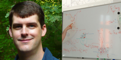
The seminar is given by renowned researcher and instructor Dr Matthew D Brown Parker, of North Carolina State University (USA).

Participants will be provided with a certificate of participation at the end of the course. They may also choose to take an exam of the covered material. The result of this exam will then be provided as a testimonial.

For more information and registration, visit: this page.


//image missing//

CALMET 2017

29 August - 1 September 2017 / Melbourne, Australia

The next gathering for the international CALMet community takes place in Melbourne, Australia, from 29 Aug–1 Sept, hosted by the Bureau of Meteorology Training Centre (ABoM).

The themes of the CALMet 2017 joint conference and workshop will be:

  • Best practices in implementing learning and development activities
  • Core competencies training
  • Active teaching techniques
  • Future training needs
  • Collaboration

The call for proposals is now open until 14 April. The registration link is available on CALMet 2017, along with information on registration, accommodation, travel routes, visa requirements, and social events.

Do not miss this opportunity to spend four days sharing best practices in training for the meteorological, hydrological, and climate workforce. This joint conference and workshop offers learning and networking opportunities for all participants and institutions in the CALMet community and is guaranteed to include a diverse and motivated group of training professionals.

//image missing//

International Remote Sensing Summer School

20 - 29 September 2017 / Bracciano, Italy

In September 2017, the 16th edition of the International Summer School on Applications with the Newest Multi-spectral Environmental Satellites is being run by the Centro Nazionale per la Meteorologia e la Climatologia Aerounautica (CNMCA) of the Italian Airforce and EUMETSAT.

The course gives an in depth explanation of the methods and techniques used to extract information from environmental satellite data, with emphasis on the latest measuring technologies. It consists of lectures, laboratory sessions, group lab projects and quizzes.

English is the official language of the school and all material will be in English. The participants must have an academic degree either in Meteorology, Physics, Environmental Sciences or Environmental Engineering. Candidates are selected on the basis of their proven experiences in environmental remote sensing and their curriculum vitae.

Applications will soon be available on http://training.eumetsat.int/.

//image missing//

The ESSL Testbed 2017

5 – 9 June, 19 – 23 June, 26 – 30 June and 3 – 7 July 2017 / Wiener Neustadt, Austria

The ESSL Testbed is an annual event to enhance severe weather forecasting across Europe, which has been organised since 2012.

The Testbed provides forecaster training and evaluates forecasting tools. Participation is aimed at forecasters of Europe’s weather services, as well as developers of forecast tools.

At the Testbed, participants will make experimental probabilistic forecasts of severe weather for Europe, together with experts in convective storms from Europe and the USA. Participants will be using novel forecasting and nowcast tools for which feedback will be collected, including satellite and high-resolution NWP data, as well as radar-based products. Each forecast is subsequently verified and evaluated. With this hands-on approach, the participants’ understanding of convective storms, and of the role of the various forecast tools, is deepened.

Participation is in one of the indicated four weeks above from Monday to Friday. A certificate of participation is provided at the end of the course. For more information and registration, see:

http://www.essl.org/testbed.


//image missing//

NOMEK 2017

24 - 28 April 2017 / Oslo, Norway

The year will be the 23rd NOMEK course and the main subjects will be the use and application of satellite and radar products, NWP applications, probability forecasts and communication.

The course will hosted by MET Norway in Oslo, on 24-28 April and will consist of lessons and practical sessions (real-time weather room exercises, demonstrations and case studies).

NOMEK has been developed jointly by the Education and Training Managers of FMI, MET Norway, SMHI, DMI and IMO. The program started in 1995 and aims to increase the knowledge and capacity of operational forecasters working in the northern part of Europe, who, on many occasions, face similar weather and technology-related issues.

//image missing//

Meteorological Warnings Course

5 - 15 November 2017 / Tel Aviv, Israel

The Regional Training Centre (RTC) Bet-Dagan, Israeli Meteorological Service (IMS) and the World Meteorological Organisation (WMO), in cooperation with MASHAV, Israel’s Agency for International Development Cooperation, are inviting professionals to participate in the international Meteorological Warning course, being held in Tel Aviv, Israel, 5–15 November.

Thanks to the cooperation between Eumetcal and IMS, the course is also open to Eumetcal member institutions (maximum five participants).

Course content

  • The role of the warning system.
  • Warning types.
  • International requirements and standards.
  • Definitions of thresholds for warnings.
  • Forecaster tools for the forecasting of dangerous conditions and timely issue of warnings.

For details on applying, registration etc. see: http://www.eumetcal.eu.

For further information and access to the application form, please contact the following email contacts: rmtc@ims.gov.il; rtc.bet.dagan@gmail.com; gershteing@ims.gov.il.

//image missing//

Training Workshop in Moscow

6-9 June 2017 / Moscow, Russia

This workshop on satellite data and product applications is specifically designed for National Hydrometeorological Services of Commonwealth of Independent States (CIS) countries.

The event will familiarise participants with the capabilities of new-generation meteorological satellites, highlighting the challenges associated with new-generation satellites, and possible solutions. The new capabilities from Meteosat-8 (Indian Ocean Data Coverage) and Electro-L N2 enables the multi-spectral imagery and products be utilised in new regions.

The participants will have an opportunity to learn about these capabilities and new applications, in theoretical and practical sessions through case studies and demonstrations. The focus of the event will be on Atmospheric, Sea and Land monitoring applications.

The event is organised and hosted by the Russian Federal Service for Hydrometeorology and Environmental Monitoring (ROSHYDROMET) and SRC Planeta, in cooperation with EUMETSAT. This event is a contribution to the WMO CGMS VLab.

//image missing//

Training module on Metop AVHRR RGB images

Middle of 2017 / Online module

A new training module on Metop AVHRR RGB images will be published soon.

The module has been tuned to create good quality Metop/AVHRR RGB images, as close to the EUMETSAT-recommended SEVIRI RGB schemes as possible.

Four RGB types (Natural, Cloud, Night and Day Microphysics RGBs) are discussed separately, following logical structure:

  • The aim of the RGB type
  • Physical background
  • How to create the given RGB type
  • Typical colours
  • Examples of interpretations
  • Benefits and limitations
  • Comparisons with the most similar standard SEVIRI RGB type
  • Exercises

After discussing the four RGB types separately the daytime RGBs are compared to each other, and the effect of the scanning geometry is also discussed.

The main aim of the training module is to help the users (weather forecasters and other experts) to understand and use these RGB types, by giving them background information, examples and exercises.

The module will be available from the EUMeTrain website.

//image missing//

Quick Guides on standard SEVIRI RGB types

Middle of 2017 / Online module

New Quick Guides on EUMETSAT-recommended standard SEVIRI RGB types are being published in the coming months.

For each standard SEVIRI RGB type a two-page guide is being created with the most important information:

  • The aim of the RGB type
  • Area and time period of its main applications
  • Guidelines
  • Physical background
  • Benefits and limitations
  • Examples of interpretation with typical colours
  • Comparison to other products
  • Useful links

The aim of the Quick Guides is to help the users (weather forecasters and/or other experts) to understand and use these RGB types by giving them the most relevant background information and examples of interpretations.

They will be available from the EUMeTrain website.

// Issue IX - Mar 2017
Resources & Tools
//image missing//

Training module on gravity waves

Online, www.eumetrain.org

Wave phenomena can be found at any level of the atmosphere and can be detected by infrared, visible and water vapour channels. Their regular pattern may extend over hundreds or thousands of kilometres.

But, why is it so important to locate atmospheric waves?

Waves are vertically oscillating air masses which means aircraft passing through such regions are subject to strong vertical accelerations or turbulence. Turbulence is a major threat to aircraft and passengers. Past aviation accidents have shown the vulnerability of planes which entered a region with severe turbulence caused by lee waves.

The module starts with a retrospect on the accident of BOAC Flight 911 in 1966, which illustrates the danger of atmospheric mountain waves. In the subsequent chapters, the reader learns more about the characteristics of lee waves in different spectral channels, and on the physical mechanisms behind atmospheric wave phenomena. One chapter is dedicated to the most prominent wave producing wind in Europe: the Foehn.

Gravity waves over the ocean, their origins and development in time are explained. The final chapter is on the Kármán vortex street, an atmospheric wave phenomenon but not a gravity wave. There are test exercises at the end of each chapter.

Link to the module.


//image missing//

Invitation to the voyage of the vessel “Polarstern” over the Atlantic

21 March to 20 April 2017 / Online Blog

"If you would like to experience a sea voyage from southern Chile to northern Germany on a research vessel demonstrating the importance of meteorological satellites to maritime safety — but the risk of seasickness isn’t your thing — stay tuned!" So says Dr Oliver Sievers, from Deutscher Wetterdienst (DWD), in his posting on the EUMETSAT Science Blog.

Dr Sievers is a forecaster specialising in sea-surface and wave models, and ship-route forecasts, who is blogging from aboard the Alfred Wegener Institute’s Polarstern research vessel on her 30-day voyage from Punta Arenas, Chile, to Bremerhaven, Germany.

In his first entry he says: "I hope to be able to inspire people about how important weather is on the sea and that they are fascinated by the atmosphere at sea."

You can follow Dr Sievers’ journey on the EUMETSAT Science Blog and look for satellite images around the vessel on the EUMeTrain website.

We wish you an interesting virtual voyage!

// Issue IX - Mar 2017
Stories & Achievements
//image missing//

Expert Exchange Workshop on the Copernicus Marine Data Stream

29 – 30 November 2016 / IOC Project Office for IODE, Oostende, Belgium

EUMETSAT operates the Marine component of the Sentinel-3 mission, on behalf of the European Commission.

In November 2016 selected ocean experts were invited to the specialist workshop to promote access to the Copernicus Marine Data Stream and to get feedback on the services and training needs.

The main focus of the workshop was Ocean Colour, Sea Surface Temperature, and Altimetry data and products. Product development experts introduced the data and products derived from the Ocean and Land Colour Imager (OCLI), the Sea and Land Surface Temperature Radiometer (SLSTR), and the Sentinel Radar Altimetry L (SRAL) instruments onboard the Copernicus Sentinel-3 satellite. Participants discussed the products with the experts and explored them using SNAP and scripting languages, such as R and MatLab.

Participants provided valuable input about training needs, and the requirements in the different communities of ocean research and operational applications. As a result, an ocean training concept, focusing on the usage of the CMDS, will be developed.

Feedback on data accessibility, data format, and applied retrieval algorithms has been collected and will be evaluated for changes /adaptations.

This workshop was the first of its kind on the EUMETSAT's Copernicus Marine Data Stream, regular user workshops will follow.

//image missing

Operational Marine Surface Analysis using EUMETSAT's Copernicus Marine Data Stream

10 – 15 December 2016 / Pretoria, South Africa (South African Weather Service facilities)

The course on Operational Marine Surface Analysis using EUMETSAT's Copernicus Marine Data Stream (CMDS) has now been run on two occasions. The course consists of an online phase (three weeks) and a face-to-face phase (four days). So far, the face-to-face phase of the course has successfully taken place in Supetar (Croatia) and in Pretoria (South Africa).

The aim of the course is to support professionals with expertise in marine surface analysis in the use of EUMETSAT's CMDS. The course covers the following competencies:

  • Continually monitor and analyse the marine weather situation
  • Warn of hazardous marine meteorological phenomena

The face-to-face phase chiefly consisted of hands-on practical sessions — working with both past case study data and live current data, and, on the final day, participants presented a short case study demonstrating some of the skills they learnt on the course.

During the delivery of the face-to-face phase we received invaluable assistance from staff from NOAA and KNMI, who brought considerable expertise in scatterometer and altimeter data to the course.

//image missing//

Dust event

5-9 November 2016 / Tehran, Iran

At the invitation of IRIMO, the Barcelona Dust Forecast Centre, EUMETSAT and AEMET presented a one-week dust course in Tehran.

Dust is a particular issue in the country and the Iranian government plans to instigate investments to monitor dust occurrences and mitigate their effects on transportation and health.

The participants willingly took part in intense discussions and raised particular problems they currently meet in their scientific work. This strong motivation turned the course into a lively exchange of experiences and solutions.

The organisers were invited to set up a further course in 2017, which, due to schedule issues, will take place in Turkey.

For more information click on this link.

//image missing//

Satellite Applications course for French speakers

20-24 February 2017 / Niamey, Niger

This was the 14th course in the series on the applications of satellites in the analysis of weather events. This year the focus was on dust and convective phenomena.

The professional team at EAMAC was in charge of delivering some talks and facilitating the work in groups by the participants. They came from 13 countries in western and central Africa.

This classroom course could only be attended after successful completion of a four-week online asynchronous phase, when the basic concepts were revised and exercised.

After the classroom session, some meteorologists attending the training expressed their wish for a longer presentation phase, allowing more time for discussions. They liked the case studies and practical work, but asked for advanced tools to enable them to practise as in a real forecasting environment. EUMETSAT already promotes the use of simulators in response to this type of request.

//image missing//

Agricultural Applications of the Meteorological Satellites

24 – 28 October 2016 / Harare, Zimbabwe

This Agricultural Applications of the Meteorological Satellites course proved to be both colourful and successful.

Organised in cooperation with WMO, EUMETSAT , the Joint Research Centre (JRC) of the European Commission, and several local centres, it was a showcase of solutions in agricultural monitoring and climate analysis for small regions of interest.

Both commercial and, mainly, non-commercial solutions were discussed by participants and presenters (some of whom presented remotely).

This course is the sixth in a series of regional events in Africa to highlight the possibilities of meteorological satellites in the absence of cloud. Drought monitoring, vegetation evolution, soil composition were some of the points for discussion.

The national meteorological service facilitated the discussions and encouraged the local media to cover the event.

//image missing//

International Autumn School on the Use of Satellite Data in Nowcasting High Impact Weather

12-16 September 2016 / Thessaloniki, Greece

Every September since 2013, the University of Thessaloniki has organised international satellite meteorology training workshops.

Held in Thessaloniki, the one-week Autumn School on the use of satellite data in studying and forecasting extreme weather events and in nowcasting severe convection and precipitation, is always successful. It is attended by more than 80 participants, from 20 countries, consisting of forecasters, staff scientists, and post-graduate students from the National Meteorological Services and universities.

The training workshops are mainly addressed to forecasters from south-eastern European and North African countries. Participants are shown new developments in satellite meteorology, focusing on the use of processes, principles, practices, tools and products for nowcasting and short-range forecasting high impact weather, such as storms, cyclones, tornadoes, heatwaves, and droughts.

In 2016, a week before the workshop, a flash flood hit Thessaloniki, and the hotel’s ground floor was flooded. This case was processed with McIDAS-V and discussed in detail during the workshop. Also, during the week, some interesting storms developed around the Thessaloniki area, which were also discussed during the course. The date of the workshop is well-chosen as at that time of the year there is usually a lot of convection over the Mediterranean.

//image missing//

Online Educa Berlin (OEB) Conference

December 2016 / Berlin, Germany

The 2016 OEB conference is a global, cross-sector conference on technology-supported learning and training, showcasing examples from the realm of training, sociology, politics and Artificial Intelligence (AI).

Held in Berlin in December 2016 the conference highlighted the importance and role of educators to inspire, motivate, enable and increase empathy and reduce bias, and to be inclusive and free of prejudice.

While technology can, and most likely will, slowly replace humans in carrying out a number of educational tasks, it is to be seen to what extent the implications will be beneficial to learners and teachers. The future of MooCs and accreditation and the role and usefulness of evaluation were also discussed at the conference.

A high number of technology providers were present, making it an interesting venue for those in the field of educational technology to meet.

It was attended by more than 2.000 registered participants from 93 countries, including four professional training officers from the European training community.

Several conference sessions were recorded and can be found online.

"It's not university what will carry you through life, it is the ability to think & re-think, to invent & reinvent yourself." —  Andrew Keen #oeb16, Twitter

The next OEB conference will take place 6–8 December. The theme is Learning Uncertainty and how we can learn to accept and manage it in an era marked by rapid global change.