The Training Bulletin

Joint newsletter related to new activities and resources
in international meteorological training

// Issue VIII - Dec 2016

Activities & events
//image missing//

Workshop on the Use of Gridded Satellite Data for Climate Services

20 – 24 March 2017 / Krakow, Poland

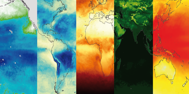
The worksop aims to instruct active and future users, from National Meteorological Services and research institutions, on the use of CM SAF products for operational climate monitoring and climate research.

Participants will learn how to handle CM SAF data using free software tools, such as climate data operators (cdo) and R (CM SAF tools) and QGIS, and explore opportunities to use CM SAF data in their daily work.

Climatologists from NMHSs, universities and other institutions, with any level of experience in the use of satellite data for climate applications, are invited to apply. Excellent English language skills are mandatory to attend the workshop.

The event is free. EUMETSAT will support a limited number of participants, covering travel or/and subsistence costs.

If you’re interested in attending you can apply via the EUMETSAT Training Zone. Applications must be made by 20 January 2017.
//image missing//

New Copernicus Marine Data Stream course in Riga

24 – 28 April 2017 / Riga, Latvia

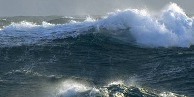
Following the success of this year's Copernicus Marine Data Stream courses, a new edition of the Operation Marine Surface Analysis course will be organised by EUMETSAT.

The event will be held in Riga, Latvia on 24–28 April, hosted by the Latvian Environment, Geology and Meteorology Centre – LVGMC.

The course is suitable for experts from operational centres with responsibilities to monitor the Baltic Sea, with any level of experience in the use of satellite data for marine analysis. The course will, again, have an online asynchronous component followed by a classroom workshop.

The course is free and financial support is available for a limited number of applicants.

Keep an eye on the EUMETSAT Training Zone for updates. You can apply via:

Apply for Courses

Image by Gail at Flickr: license


//image missing//

CALMet 2017 joint conference and workshop

29 Aug - 1 Sept 2017 / Melbourne, Australia

The international CALMet community; next in-person gathering event takes place 29 Aug - 1 Sept 2017 in Melbourne, Australia, hosted by the Bureau of Meteorology Training Centre (ABoM).

Do not miss this opportunity to spend four days sharing best practices in training for the meteorological, hydrological, and climate workforce. This joint conference and workshop offers learning and networking opportunities for all participants and institutions in the CALMet community. It is assured to include a diverse and motivated group of training professionals.

Call for proposals will be open from 9 January - 14 April 2017. The link will be posted as soon as available on the CALMet 2017, along with information on registration, accommodation, travel routes, visa requirements, and social events.

The themes of the CALMet 2017 joint conference and workshop will be:

  • Best practices in implementing learning and development activities
  • Core competencies training
  • Active teaching techniques
  • Future training needs
  • Collaboration


//image missing//

Baltic+ 2017 Course

13 February – 3 March 2017 (Online phase); 14-16 March 2017 Classroom phase / Lithuanian Hydrometeorological Service

The Baltic+ course is a joint initiative of the National Meteorological Services of Estonia, Latvia, Lithuania and Poland. It aims to increase the knowledge of, and skills in, using satellite observations, and provide a meeting place for exchanging ideas, practices and knowledge.

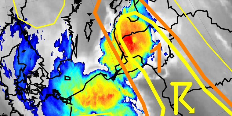
The main topic of the course is dedicated to severe summer convection in the Baltic region. The purpose of the training is to improve nowcasting and warnings issued. EUMETSAT satellite and NWP data will be used to identify clouds, MCS, their development and weakening.

The course will consist of two parts: online and classroom. To prepare participants for the classroom part and reduce differences in their knowledge, an online phase is being run in February 2017. The Moodle platform will enable participants to go through training resources, use discussion forums, learning activities and self-assessment quizzes. The three day workshop in Vilnius will mostly focus on practical issues.

Certificates in both phases of training will be given to successful participants.

For more information, send an email to: contact@meteo.lt.

//image missing//

Weather Radar Applications in Nowcasting for Weather Forecasters

Distance phase: 15 March - 17 May 2017, Classroom phase: 29 May - 02 June 2017 / Langen, Germany

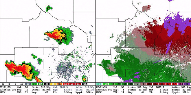
In Spring/Summer 2017 Eumetcal and DWD will offer training in radar meteorology and nowcasting tools for forecasters. This course has been run since 2008 and covers seven topics in radar meteorology.

The course format will be blended — the first part is an online phase (self-study and live presentations, tests, and homework for students), for the second phase group of students will attend a one-week classroom course at the DWD training centre in Langen. Registration for this course is now open and deadline for applications is 15 January 2017.

More details about the course, including registration and timetable, are available here

//image missing//

Third EUMeTrain Marine Forecasting Course

Spring, 2017

Following the success of the 2015 EUMeTrain Marine Forecasting Course, in which 23 Marine Forecasters from several weather services across Europe actively participated, a new edition of this course will take place next Spring. As in the past, the planned 2017 course will be in line with WMO Marine Weather Forecaster Competence Standards. It will run online on asynchronous mode, taking advantage of a Moodle platform, and with the support of Eumetcal.

Marine Weather Forecasters are invited to apply for the course at EUMeTrain website, EUMeTrain, beginning of in early 2017.

// Issue VIII - Dec 2016
Resources & Tools
//image missing//

New Conceptual Models for Southern Hemisphere

Online Manual

The conceptual model library for southern hemisphere is now available, with seven new Conceptual Models.

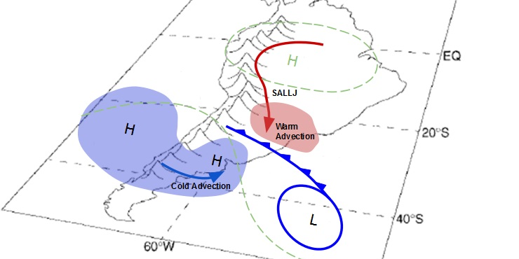
Conceptual Models for Southern Hemisphere (CM4SH) was a joint project between four southern hemisphere Centres of Excellence: Argentina, Australia, Brazil and South Africa, reinforced by the expert group from the Agency for Meteorology, Climatology and Geophysics, Indonesia (BMKG). The project was co-funded by WMO and EUMETSAT. The first CM4SH project was completed in March 2014, and the second project in June 2016. In total, the teams created and published 15 new Conceptual Models.

The purpose of the project was to improve warnings and awareness of weather risks through the use of conceptual models. The philosophy of using satellite material, together with other meteorological material, was agreed during the development of Conceptual Models. Conceptual Model (CM) descriptions are materials widely used in weather forecasting, as well as in training at universities and other meteorological training centres.

As the outcome of the project, seven new Conceptual Models were recently published at CM4SH. They are also available in the SatManu Conceptual Model library.


//image missing//

New RGB Survey on Training and Information Needs of Trainers

Survey

If you a trainer/ teacher of RGB applications to operational meteorologists, we would like to invite you to take a few minutes and share your training needs with us using a quick anonymous survey available here.

The Virtual Laboratory for Training and Education in Satellite Meteorology (VLab) Community is currently investigating the training and information needs of trainers involved in teaching RGBs. The audience of this survey and any resulting action isanyone who teaches RGB applications to operational meteorologists at any level, either formally in classroom, online, blended, or informally.

The outcome of the survey will be used to design training resources and possibly an online course. We are looking forward to hearing from you. Please do not hesitate to share this within your community and organisation.


//image missing//

ASMET 8 cases now also available in French

Online Lectures

Two ASMET 8 cases are now available in French. Registration is required to access these resources:


The case are jointly produced by EUMETSAT, the COMET Program and the ASMET project (African Satellite Meteorology Education and Training).

The ASMET project produces online lessons to help African forecasters better enhance their forecasts by making use of meteorological satellite images and products. Find out more about ASMET by clicking here.


// Issue VIII - Dec 2016
Stories & Achievements
//image missing

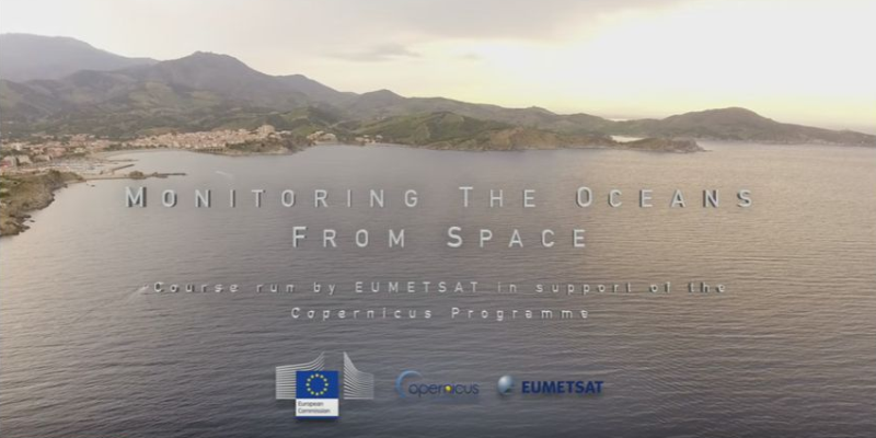
Eumetsat's Mooc Story Wrap-up: Monitoring Oceans from Space

24 Oct-4 Dec 2016 Play the youtube video

For five weeks, the Monitoring of Oceans from Space MOOC brought together experts from around the world to tell the story of how satellites monitor the oceans from space.

Designed around numerous high quality videos, more than 5,000 registered learners were given the opportunity to explore emerging technologies and learn from, and get in touch with satellite, environmental and ocean monitoring experts from EUMETSAT and its research partners, including Plymouth Marine Laboratory, the National Oceanography Centre, CLS, Mercator Ocean, and the NASA Jet Propulsion Laboratory.

The course explored key questions such as:


  • How do the oceans play a key role in the Earth’s climate system?
  • How do satellites help to monitor, quantify and preserve ocean biodiversity?
  • How can the public get involved in ocean science?

The course was timed to coincide with the availability of operational satellite data and products from the Sentinel-3A satellite, part of the EU’s flagship Copernicus Programme.

A second edition of the online course will run in spring 2017 and will be open to anyone who wants to learn more about Earth Observation (EO) and ocean monitoring from space. It is ideal for new potential EO marine data users, as well as existing professionals working in other areas of EO, oceanography, or environmental science.

Keep an eye on EUMETSAT’s website and YouTube channel for more information.

//image missing//

XIV IMTR-EUMETSAT Satellite Application Course 2016

May-August 2016 / Online

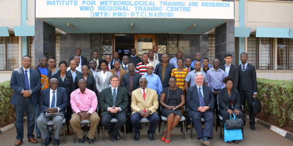
The Institute for Meteorological Training and Research (IMTR) is the training arm of the Kenya Meteorological Department (KMD). Together with EUMETSAT, IMTR organised a blended Satellite Application Course, IE-SAC XIV.

The course started with an online training phase in May, followed by classroom training in August. The online phase contained five active weeks working with satellite products and applications. The participants took part in weather discussions online, completed various assignments, and explored various satellite training resources online.

Successful online participants came to Nairobi well prepared and motivated. The face-to-face phase aimed to deepen the satellite skills of the participants. They took part in daily weather discussions, group work, simulator exercises, and weather forecasting. Lastly ,they prepared an individual presentation as a final assessment.

African Satellite Meteorology Education & Training (ASMET) Project team , together with EUMETSAT and COMET, is currently working on further improving the IE-SAC course. The course with the completely updated online phase will be piloted in 2017.

//image missing//

XI Eumetcal Workshop - "Developing communication capabilities for meteorological and climate services"

10 to 13 October 2016 / Langen, Germany

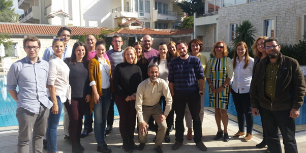
The XI Eumetcal Workshop was held in Langen, Germany, from 10-13 October 2016, and kindly hosted by Deutscher Wetterdienst (DWD). The workshop gathered together approximately forty Education and Training Experts, mainly from the European countries but representatives from Canada and US also participated. The workshop also gathered trainers for side meetings, for example the NOMEK admin group held their annual course planning meeting.

The title of the workshop is Developing communication capabilities for meteorological and climate services.

The choice of this topic was motivated by the fact that national weather and climate services across Europe are moving towards providing impact-based weather and climate services. This requires a change in emphasis in the way services are implemented and in customer/meteorological service communication. The workshop week included several workshops and practical demonstrations of how to address different challenges when communicating meteorological information to different stakeholders. Several presentations showed current NMHS (Netherlands, Norway, Portugal, Germany and Canada) activities and products to better meet their clients needs and deliver information in a more fluent way.

//image missing//

Two Operational Marine Surface analysis using Eumetsat's Copernicus Marine Data Stream Course

10-14 October 2016 / Supetar, Croatia

This course was aimed at professionals with expertise in marine surface analysis.

Held on 10-14 October in Supetar, Croatia, it was attended by 16 participants from seven European countries, plus Morocco and Egypt. The course instructors were Zorana Jelenak (NOAA), Ad Stofellen (KNMI) and Ian Mills (EUMETSAT).

The online phase was hosted on the EUMETSAT Training Zone between June-July 216. It was designed to introduce professionals to the use of satellite-observed ocean winds and wave heights using scatterometers and altimeters.

Overall, the course (online and classroom phases) covered the following competencies: continual analyssis and monitoring of the marine weather situation; forecasting marine weather phenomena, variables and parameters and warning of hazardous marine meteorological phenomena.

At the end of the course, the participants were asked to prepare a topical presentation related to satellite derived winds or altimetry, which resulted in a number of very high quality presentations with interesting cases of the participants’ local weather.

The second edition of the course will be run in December in South Africa.

//image missing//

EUMeTrain Event Week on MTG/I Satellite

7-11 November 2016 / Online

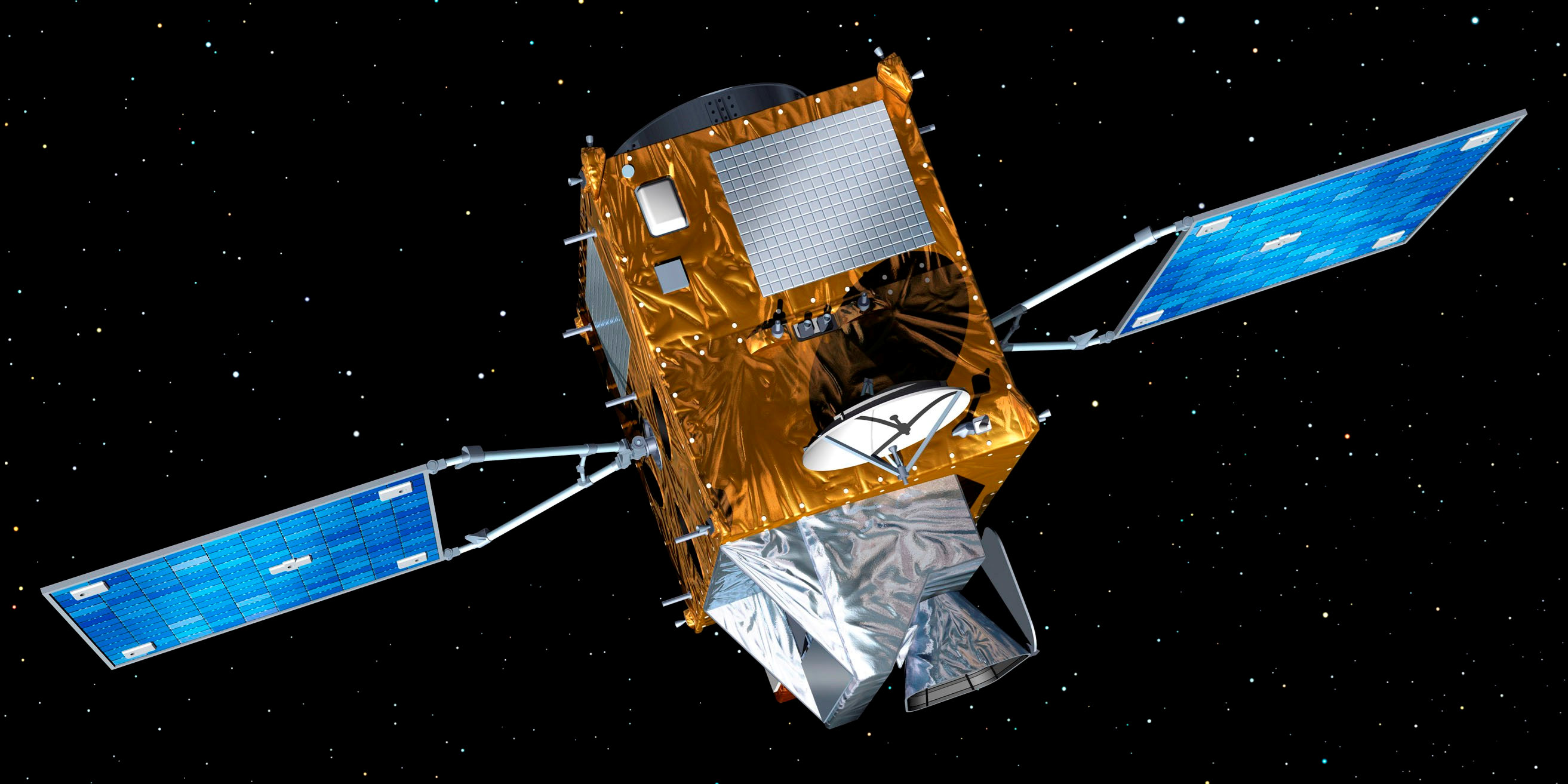
EUMeTrain Event Week on MTG/I satellite took place 7th and 11th of7–11 November 2016. During this week 11 online lectures were given in eight sessions. The FCI instrument onboard MTG satellite was introduced, along the Himawari AHI and GOES-R ABI instruments, as these satellites act as pre-cursor (and proxy) for MTG. The benefits of the new channels were shown, new RGB products were introduced, and the expected improvement of products was discussed. MTG will also carry the Lightning Imager (LI) instrument which was presented, along with the GOES-R GLM. The benefits and possible usage of the satellite lightning data were also shown during the week.

At the end of the event week the participants gained a better knowledge of the MTG/I satellite, the instruments, and also what data can be used as proxy before the satellite is launched.

The participation of the event was free; there were a good number of people attending each session. Every lecture will be published at the EUMeTrain webpage.

//image missing//

Operational use of RGBs (part 2)

February 2016 / Online

A new training module was published recently on four SEVIRI RGB types: HRV Fog RGB, Snow RGB, Night Microphysics RGB and Ash RGB.

These are those EUMETSAT- recommended standard SEVIRI RGB types, which were not discussed in the’ ‘Operational use of RGB’s training module published several years ago.

The main aim of the training module is to help the users (weather forecasters and/or other experts) to understand and use these RGB types, by giving them background information, examples and exercises.

The logical structure of the discussion is the following:

  • The aim of the RGB type
  • Physical background
  • How to create the given RGB type
  • Typical colours
  • Examples of interpretations
  • Benefits and limitations
  • Comparisons with other RGB types and/or single channel images
  • Exercise

Access the training module, click here.

//image missing//

XIII Ibero-american course on Satellite Meteorology

26 Sept- 7 Oct / Antigua Guatemala

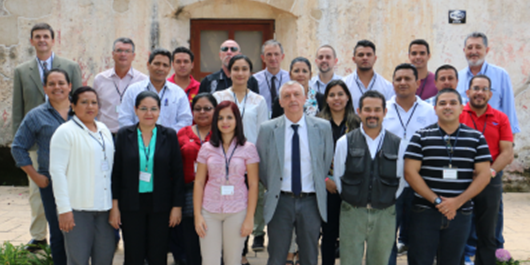
From 2004, when this series of courses started in Santa Cruz de la Sierra, Bolivia, this course has helped train 250 forecasters and climatologists in the region. Participants frequently enjoy their first exposure to working with satellite data, identifying key elements for forecasting and looking at details they had not even suspected they could find in Meteosat or GOES imagery.

With the coming closure of EUMETcast Americas, they are looking forward to using alternative sources of meteorological information.

Carolina E. López, from Paraguay, said: “We would like to contribute case studies of our region to the EUMETSAT pages and creating data-bases which neighbour countries can take advantage of.”

Some institutes in South America, like LAPIS in University of Alagoas, have been supplying services to users for six years, and supported the station installation and the product tuning.

“We will continue our grassroots work to help the meteorological community in Brazil.”.

//image missing//

VI Training course on the use of satellite products for drought monitoring and agriculture

24-28 October 2016 / Rainbow Towers hotel, Harare

Starting 2012, WMO and EUMETSAT embarked on a series of events to increase attention on software to identify drought, based on satellite data, which offers the best horizontal resolution in Africa. In-situ data is scarce and not guaranteed for good calibration. The Land SAF offers information every 30 minutes on evapotranspiration and other vegetation- related variables.

Several universities and stakeholders showed their data processing solutions, so that abundant side-dialogue started during the meeting. The next event in this successful series will be in Europe, in Budapest, April 2017. Previous meetings took place in Niamey, Accra, Ouagadougou, Addis-Abeba and Tbilisi. The course tends to convert into a show-case of monitoring and forecasting formulas which can be used with satellite information, to create products. Distance presentations complete the tight schedule.

//image missing//

Workshop on Agrometeorology in Ljubljana

9-10 November 2016 / Ljubljana

The workshop Agrometeorologist for farmers in hotter, drier, wetter future took place in Ljubljana, Slovenia on 9 and 10 November 2016. It was supported by the Netherlands Foundation Solco W. Tromp, WMO, FAO and Eumetcal (mainly in terms of visibility). A significant number of well known experts in the field of agrometeorology gathered in order to strengthen networking in Europe and the Mediterranean area; to share best practices in the supply of agro-meteorological services; to identify gaps in existing knowledge and practices, and to compile recommendations for future research, development and networking.

Additional information can be found in the Training Portal.