The Training Bulletin

Joint newsletter related to new activities and resources
in international meteorological training

// Issue I (Jun - Dec 2014)
Activities & events
cc2014

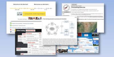
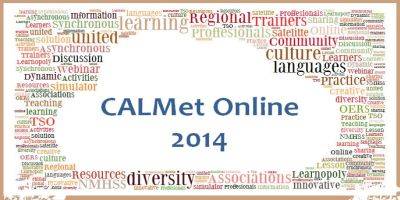
CALMet Online 2014 – Diverse in Culture, United in Learning

6 October – 28 November 2014, Online

CALMet Online will gather together meteorological and hydrological trainers, as well as related disciplines facilitators, from around the world. As the event is totally online and free, you will not need a travel budget to participate.

During the sessions we will share experiences and innovations in training, mainly in the field of hydro-meteorology, and together find new approaches for improving our training activities and programmes.

To make taking part easy and flexible , the event will be based on several asynchronous sessions, each of them which will be accessible for one, or even several, weeks. Each session will be hosted by a leader or group from a specific WMO Regional Association, demonstrating a new learning solution, experiment or innovation. The participants will have an opportunity to discuss, test and give feedback about the learning solution.. The resources are intended to be reusable after each session. Interest participants in the event should get a tangible benefit from the experiences they gained in each session.

The event will be hosted in English, but some sessions may contain parallel regional activities in other languages. A schedule and list of sessions will be announced at CALMet Commons soon.

ecal_ws_i1

9th Eumetcal Workshop approaching

10 - 13 June 2014, Warsaw, Poland

There are now only a few weeks left to the ninth international EUMETCAL Workshop. It will be held on 10 - 13 June 2014 in Warsaw, Poland and is hosted by the Institute of Meteorology and Water Management – National Research Institute (IMGW-PIB).
We are pleased by the large amount of registrations and proposals submitted — once again showing the level of the interest among the meteorological training community to share and learn new practices, ideas and suggestions.
We are looking forward to a valuable workshop experience, which will help strengthen international cooperation; to learning from each other, and to improving the European training infrastructure.
Additional information available here.

synoptic_course_i1

Course on Synoptic and Mesoscale Analysis of Satellite Images - 2014

September /November 2014, Online + Langen, Germany

The students will be trained on how to parse satellite images into corresponding conceptual models and on how to retrieve a 4D mental picture of weather situations like cyclogenesis, poplar lows, mesoscale structures (comma, fronts), convection and shallow phenomena. The course is designed for operational forecasters and meets the requirements of the WMO. It is a blended course: online phase from 25 September (opening) to 11 November 2014; classroom phase from 24 to 28 November in Langen (Germany). Online participation only will be possible under special circumstances. You will find additional information here.

hiw_i1

Event Week on High Impact Weather

8 - 12 September 2014, Online

High impact weather is to be the specific phenomena that has high influence on lives, property and economy of affected areas. It is essential to have a firm prediction of those, in order to protect ourselves but also to gain a better understanding of background processes.
During this event week you will learn about the features of various types of high impact weather through the 'eyes' of satellites. The event week will consist of a set of online lectures, held every day throughout one week. Participation is free and the registration will be available soon on eumetrain.org

testbed_i1

Eumetcal support the European Severe Storms Laboratory (ESSL) Testbed 2014

2 - 27 June 2014, Online

Free spaces to participate in the ESSL Testbed 2014 are being offered to staff members from Eumetcal Participant NMSs. The five free seats are being offered in exchange for supporting the European Severe Storms Laboratory (ESSL) Testbed 2014 with the online set-up for remote attendance. The Testbed will be held 2-27 June 2014, with remote online sessions be held every weekday, except 9 June, from 09;00–10;30 UTC. For further information on the ESSL Testbed 2014, see: http://www.essl.org/testbed

wb_i1

ePort Monthly Weather Briefings

On monthly basis, Online

Once a month EUMeTrain organises a Weather Briefing, open to everyone (register here), to discuss the present weather situation. The discussions are based on that day's satellite images and the corresponding numerical weather prediction data. A basic knowledge of the conceptual models used in satellite meteorology is an advantage.. The Weather Briefings are performed by meteorologists from Croatia, Portugal, Finland and Austria. At the end of the briefings, participants have the opportunity to talk to the presenters. The sessions are recorded and made available in the internet. You can register to the upcoming event here.

sc2014_i1

Online Basic Satellite Meteorology Course 2014

May/June 2014, Online

This online course in May/June, focuses on satellite systems, sensors and instruments; on the content of spectral channels, and on the variety of meteorological products. This course is aimed at students and professionals in meteorology who want to keep up-to-date with the present status and recent developments in the field of satellite meteorology. Recordings of the past sessions will be available, but you can still register for remaining lectures via course page.

// Issue I (Jun - Dec 2014)
Resources & Tools
wv_1i

Training module on Water Vapour imagery Pallet

Training module, online

This training module gives an overview on applications of MSG water vapour channels for operational weather forecasting. It handles the concept of potential vorticity, is a key feature to understand the dynamic processes in the higher Troposphere such as cyclogenesis. The CAL module also shows practical applications of the WV images, from the geostationary satellites, for locating tropopause foldings, clear air turbulence and deformation zones. It handles the effects of WV boundaries on the initiation of convective processes and, finally, presents some meteorological products heavily based on WV imagery.

asmet_i1

Online version of the first ASMET lesson

Lesson, online


The Basics of Visible and Infrared Remote Sensing is an online version of the first ASMET (African Satellite Meteorology Education and Training) lesson published on CD-ROM in 1997.

The concepts and capabilities presented are common to most international geostationary (GEO) and low-Earth orbiting (LEO) meteorological satellites since their inception, and continue to apply to both current and newer satellite constellations. The lesson reviews remote sensing and radiative transfer theory through a series of conceptual models.
Discussions contain explanations of the different Meteosat First Generation imager channels and the phenomena that they can monitor, individually and in combination.

Although the images have not been updated, the concepts are fundamental and remain relevant today. Most of the images are from Meteosat and depict weather conditions over Africa, although some GOES imagery is also included.

Full module is available on MetEd website

Note that there is also a downloadable version available for offline viewing. In addition, it is possible to take a quiz related to this lesson to test learning.


cm4sh_i1

CM4SH Conceptual Models for Southern Hemisphere available online

Conceptual models, Online

Conceptual Models for Southern Hemisphere is a joint project between four Centres of Excellence (VLab) in the Southern Hemisphere: Argentina, Australia, Brazil and South Africa. The purpose of the project is to improve warnings and awareness of weather risks, through the use of conceptual models. This  online resource offers examples and insight into eight different conceptual models, categorised by geographical region. Each conceptual model is presented with descriptions of cloud structure in satellite images; meteorological physical background; NWP parameters; typical appearance in vertical cross-sections, and weather events. The website also lists many useful references that support this research.  The collaborative work was inspired by SatManu, a manual developed by EUMeTrain to illustrate conceptual models in the Northern Hemisphere. The project is co-funded by WMO and EUMETSAT. 

cat_m_i1

Training module on Clear Air Turbulence

Training module, Online

Clear Air Turbulence is one of the most frequent hazards for civil aviation. It is also one of the biggest challenges for forecasters to detect and warn for possible Clear Air Turbulence occurrence. In this CAL module you will learn to detect areas with a high risk for Clear Air Turbulence (CAT). This will be done with the help of satellite images, soundings, flight reports and analyses of the airflow. Practical examples will show you how to apply your knowledge.

global_i1

Global weather 2013 video

video, Online

In January EUMETSAT produced a high resolution video for YouTube which, in just eight minutes, visualised the global weather from 2013.

The video, comprised of imagery from the geostationary satellites of EUMETSAT, NOAA and the JMA, shows an entire year of weather across the globe during 2013, with commentary from Mark Higgins, one of our Training Officers.
A compressed version of this video has now been added to our Training Library for anyone to download and use for training courses, lectures, demonstrations etc.

Note: Because the full resolution version is very large (4 GB) it is only available on request, from our User Service HelpdeskOr watch it on YouTube.

Our Training Library contains a large selection of freely available training materials for anyone wishing to understand how to use and interpret satellite data.

// Issue I (Jun - Dec 2014)
Stories & Achievements
wmo_ttt_i1

2014 WMO Online Seminar for Trainers

Seminar, online

WMO, EUMETSAT, and VLab have just completed the delivery of a 10-week Online Seminar for Trainers, primarily from Africa, but also from Europe and other regions. The course had over 40 active participants and 8 primary facilitators. The seminar developed skills in the newly defined WMO Competencies for Training Providers , with a focus on developing skills for online training. The participants were highly engaged in the 20 individual learning activities, and the course forums had over 15,000 views. Participants produced a Training Development Plan during the course which many will be implementing in their services.

.

rain_i1

Feedback after the participation of the COMET Flash Flood webinars

19 and 20 March 2014, Online

Each of the two online sessions was an hour long.
The first session (19 March) showed the meteorological processes leading to intense rainfall, such as  moisture anomaly, terrain lift and instability. This was followed by information on how a forecaster can use the atmospheric indicators; radar and satellite images, and numerical models for forecasting.
The second session (20 March) focused on hHydrology. It explored the influences of intense rainfall on runoff and stream response, including soil types and land use. The flood warnings are often not of the responsibility of the weather service, but this course gave a good insight in aspects of hydrometeorology.
The course tutor was Matthew Kelsch,  a hydrometeorologist from UCAR’s COMET Program. The slides were well-structured, with easy and very clear messaging. He used a lot of nice images from different COMET modules.

The software ‘GoToWebinar’ ran easily and the acoustics were perfect. It was possible to ask questions with the chat. I would have liked to receive post- course material, in form of the recording or the presentation file, for the follow-up work. But the homepage of COMET / MetEd has a link, titled Hydrology/Flooding, to 49 modules of excellent material.