Case Study
Torrential rainfall during the second week of September caused floods in the Istanbul area in Turkey. As a result there were 32 casualties. Below we have pictured some satellite images with NWP. Striking is the Upper Level Low found over Central Turkey. This results in the advection of moist, unstable air mass from the Black Sea and topographic uplift which result in numerous rounds of showers and thunderstorms in the region. The cold temperatures found in the upper layers of the cold core low and its contrast to the warm surface causes the CBs to grow extreme in the vertical and producing lots of rain. Moreover, a weak wind field results in the slow storm movements.
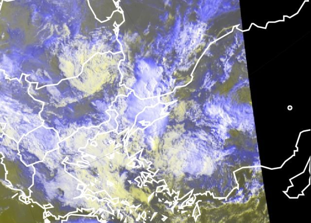
Figure 1: Meteosat 9 HRVIS RGB - 9 september 2009 06:00UTC
Striking for the development are the overshooting tops we can see as the still has a low viewing angle. This indicates to use that the updrafts are severe and we are looking at small ice particles.
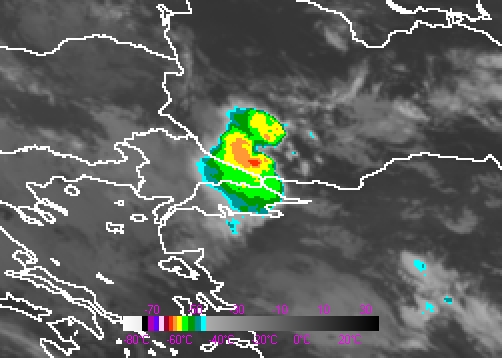
Figure 2: Meteosat 9 IR10.8 Image - 9 september 2009 05:00UTC
Deep convection is seen around 05:00UTC. The lowest BT is about -57.5 °C degree.
The C-band doppler weather radar being opearated in Istanbul by Turkish State Meteorological Service. Radar images are also supported deep convection and related heavy rain. Maximum reflectivity is around 55 dBZ.
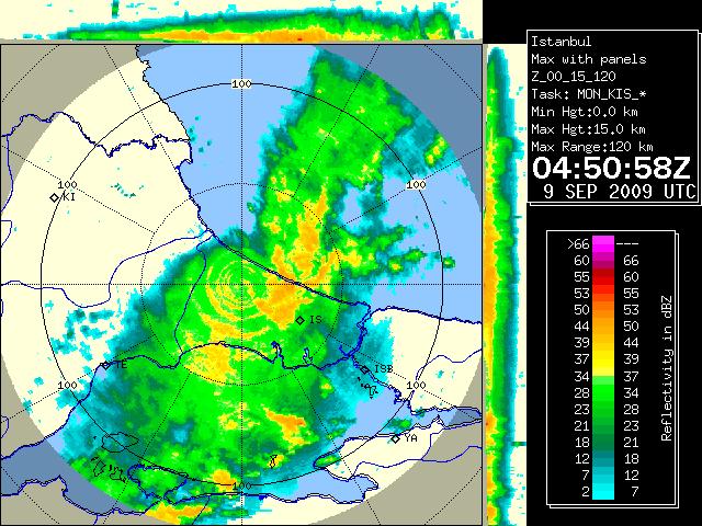

Figure 3: MAX Display radar image - 9 september 2009 04:50 and 05:00UTC
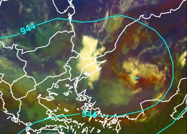
Figure 4: Meteosat 9 Airmass RGB - 9 september 2009 06:00UTC with overlay geopotential height 300 hPa.
Over Turkey the presence of a cold core low is seen. This has as a result the big temperature differences between upper layers and surface which helps to let the CBs grow in the vertical.
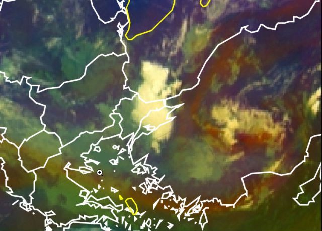
Figure 5: Meteosat 9 Airmass RGB - 9 september 2009 06:00UTC with surface winds 10m.
No wind atthe surface which makes sure that the CBs that devlop do not move and all rain out over Istanbul area.
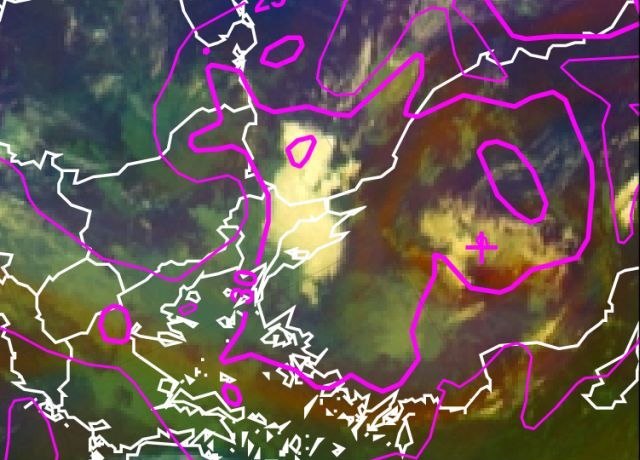
Figure 6: Meteosat 9 Airmass RGB - 9 september 2009 06:00UTC with K-index
The instability is seen here over Istanbul with values topping over 30°C
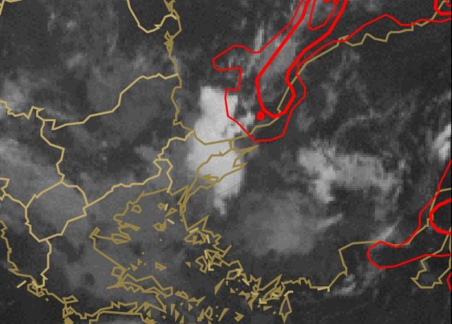
Figure 7: Meteosat 9 IR10.8 - 9 september 2009 06:00UTC with MIXED layer CAPE.
The unstable airmass coming from the Black Sea has a high potential of energy as expressed here in CAPE.
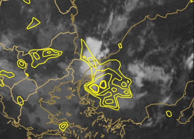
Figure 8: Meteosat 9 IR10.8 - 9 september 2009 06:00UTC with dewpointdepression.
Dewpoint depression is the difference between the Temperature and Dewpoint Temperature. The lower the difference, the more moisture there is, and the higher the relative humidity. In the lower troposphere, more moisture (small dew point depression) results in lower cloud bases and is also important to severe thunderstorms. Conversely, instability is increased when there is a mid-level dry layer (large dew point depression) known as a dry punch, which is favorable for convection if the lower layer is buoyant. This is a nice case for this theory!
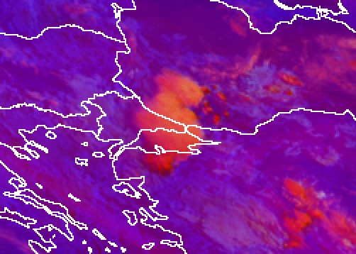
Figure 9: Meteosat 9 Severe Storms RGB - 9 september 2009 05:00UTC.
Convective system was reaching from the Black Sea coast. Phenomena is seen with Storms RGB even low viewing angle.
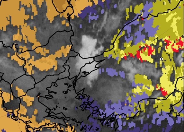
Figure 10: Meteosat 9 IR10.8 - 9 september 2009 06:00UTC with GII.
Final image. In the cloud free areas over Turkey, we also see that it is unstable for the remainder of the 9th September and favouring the onset of more TSRA during the forecast period.