Interactive overlays: 1st March 2004: 00UTC
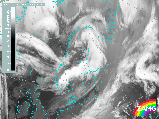
The image shows a W-E oriented cloud band from the S-part of Greenland along approximately 70 N extending eastward to the Norwegian coast. North of this cloud band along 10 W there is a big cloudmass which cannot be seen in its full content at this point of time. A NOAA images for about 1 - 2 hours later shows a rather low cloud which is not cyclonically curved.
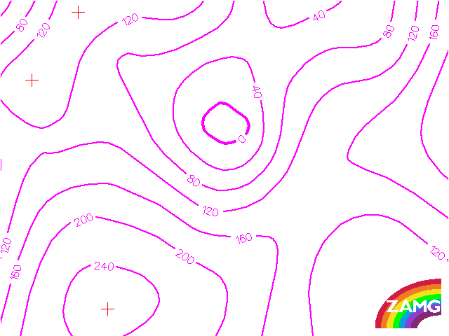
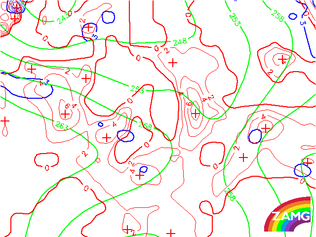
In the initial stage of the case study the cloud system under consideration is still seen far in the North. The main feature in the surface chart (Height of 1000 hPa) is the deep low over N-Scandinavia and Finland which accompanies a synoptic scale cloud spiral. However, the isolines indicate already at this point of time a secondary minimum within the large low center being close to the cold air cloudiness and which will become effective during the next two days.
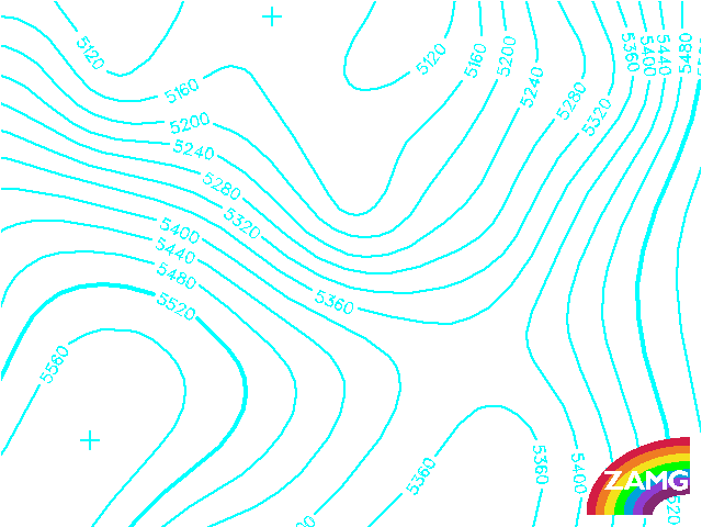
As for the surface height field, also here the main phenomenon at this point of time is the intensive upper level trough over N-Sweden and on the rear of the synoptic scale cloud spiral. The interesting feature for this case study however is found much more to the NW, an upper level trough in connection to the cold air cloudiness north of 70 degree. At this point of time this upper level trough is clearly behind the corresponding surface low.
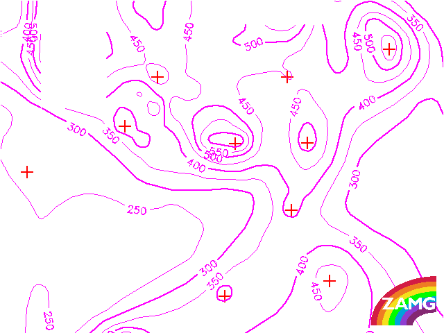
There are at least two PV anomalies (stratospheric air has protruded downward into the tropsophere, consequently the height of PV = 1 unit is lower than approx. 500 hPa) in the nordic panel. The one is the center of the occlusion spiral over N-Sweden which is not followed further in this case study. The second is along the rearward edge of the frontal cloud band but is not so intensive.
The area of interest where the cloud spiral of this case study develop, the cold air behind the frontal cloud band is not clearly diagnosable. It seems as if the isolines of height would “jump” down to the surface.
A region with high values of PVA can be recognized superimposed on the cloudfeature of interest. Cloudenhancement is expected in regions with high PVA.
There are two different cloud phenomena of interest:
- The cloud band extending along 70 N southeastward to the Norwegian coast.
- The area to the north where in the cold air the first signs for the comma cloud can be recognised.
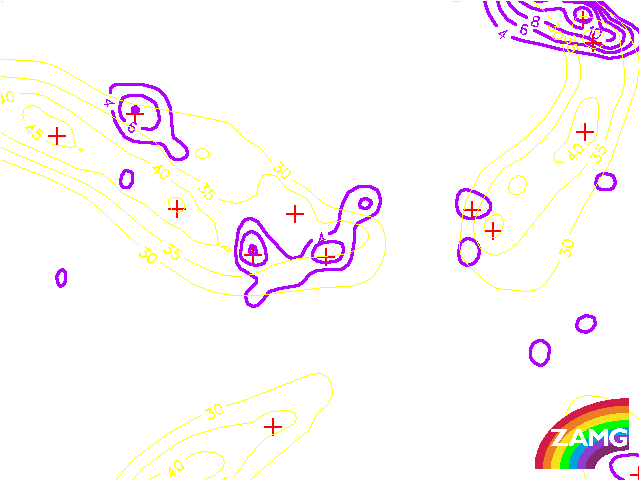
The cloud area to the north is within a thickness ridge and WA at the boundary to a distinct CA center. From these parameter distributions it can be concluded that the initial stage of the cloud spiral under investigation is within a complete different physical state of the troposphere than the cloud band to the south. There are no frontal conditions in the area of the comma at the time being. The big cloud field can be called cloudness in the thickness ridge. This can be seen much better in a parameterfield (not shown here) of equivalent potential temperature at 850 hPa. This supports the idea that the wide spread cloud field is driven by the lower layers.
There is a pronounced jet streak along the frontal cloud band but its axis are not along the rearward edge but within the cloud band. A reason for this could be found in the fact that in these very northern latitudes the height of 300 hPa does not represent the real jet axis, however it should then be expected even more to the north.
Apart from this question there is a quite pronounced PVA maximum at the cyclonic side in the area of the cloud development in the cold air. This PVA maximum can be related to the left exit region of the western jet steak maximum.
Consequently there is a clear relation between the development of the cloud system under consideration and a PVA maximum in high levels.