Fully developed cyclones in the Gulf of Genoa are often the cause for local winds like the Bora and the Mistral whether they originate from a lee cyclogenesis or not.
The Mistral is a strong, cold north-westerly wind that blows from southern France into the Gulf of Lion and the northern Mediterranean Sea. Wind speeds of more than 90 km h-1 are observed, especially in the Rhône Valley. The Mistral blows when there is an area of high pressure over the Bay of Biscay and an area of low pressure around the Gulf of Genoa.
The development of lee cyclogenesis over the Gulf of Genoa often creates a synoptic situation that is favourable for the Mistral, especially when a cold front has passed over France from the northwest to the southeast. This confirms the typical character of the Mistral as a strong, cold wind under a cloud free sky.
The example below shows the wind barbs over southern France during a Mistral episode caused by an intense low-pressure system over the Ligurian Sea. Although the surface wind is strongest over the open sea, a bulge of higher wind speeds can be seen along the Rhône Valley (red line in Figure 1).
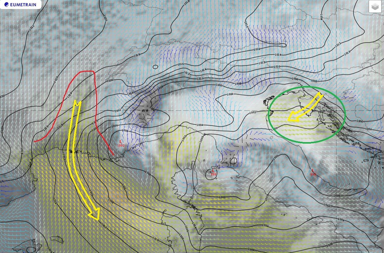
Figure 1: IR10.8 image from May 5, 2019 at 12:00 UTC. 10-metre wind barbs and mean sea level pressure (black).
During the same synoptic setup, lee cyclogenesis can induce downslope gusty wind called Bora when moving south-eastwards (green circle in Figure 1). The Bora is most frequent during the winter and spring season when cold polar air is located over the snow-covered plateau behind the Dinaric coastal mountain range.