The leeward vortex that develops in the lower troposphere is, strictly speaking, not the process of lee cyclogenesis. The term lee cyclogenesis is commonly used to describe a well-developed low-pressure system that affects the whole tropospheric column and that moves away from its place of creation in the lee of a mountain range. The leeward vortex is a necessary pre-condition, the starting point for the formation of a mesoscale cyclone. We will examine the triggers that are necessary for the transformation of a leeward vortex into a mesoscale cyclone in Chapter 4.
Another important factor influencing the formation of a leeward vortex at the western Alps is the unique topography of this mountain range. For an air flow crossing the Alps from the north-west to the south-west, the cyclonic curvature of the wind flow around the Alps and the flat topography of the Mediterranean Sea are strongly supporting the creation of a leeward vortex at the southernmost end of the mountain range (see Figure 1).
|
|
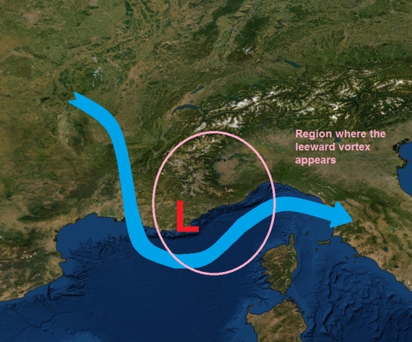
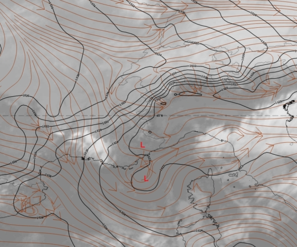
Figure 1: Schematic showing the low-level airflow against the western Alps (blue arrow) from the north-west. On the other image, a case from January 5, 2019 at 12:00 UTC showing the mean sea level pressure (black) and streamlines near the ground (1,000 hPa, red). Use the slider to compare both images.
The factors influencing the creation of vortex systems at the leeward side of an obstacle can be very complex and depend on many facts such as wind speed, height of the barrier, stability, and on the shape of the obstacle. For an idealised, brick-like obstacle, the leeward vortices develop similarly to that depicted in Figure 2.
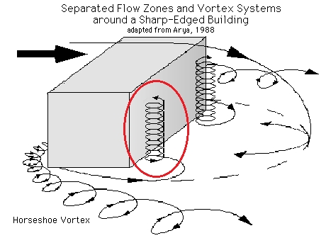
Figure 2: Schematic of the air streams behind an idealised obstacle. Clockwise (anti-cyclonic) and anti-clockwise (cyclonic) eddies develop on both sides of the obstacle.
For the western Alps, the creation of a leeward vortex is supported by the cyclonic circulation of the air around the southern tip of the mountain range. The surface low pressure area is resulting from the forced cyclonic circulation at lower levels (see red circle in Figure 2). The resulting vortex is quasi-stationary and does not involve airmass boundaries. The circulation pattern is not visible in WV imagery as it affects only the boundary layers. Nevertheless, the circulation pattern might influence the displacement of low clouds such as fog or stratus; an effect which can be observed in visible and infrared (IR) satellite imagery.
Such a low-level leeward vortex is also observed at the opposite end of the Alps, although less pronounced; the so called "Vortex Vindoboniensis" (see Figure 3). This phenomenon is most frequent in the winter season coinciding with stably stratified air and southerly flow against the Alps. This vortex is a low-level phenomenon caused by a surface pressure anomaly that might in some cases detach to travel north-eastward up to Poland, without developing further into a mesoscale cyclone. This leeward vortex is known among meteorologists to influence the propagation and spread of fog during the winter season.
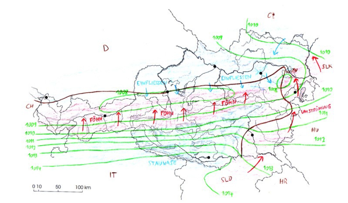
Figure 3: Schematic showing the Vortex Vindoboniensis. © Georg Pistotnik.
N.B.:
Lee vortices are often seen behind islands. They are named after the Hungarian Physicist Theodore von Kármán as "Kármán Vortex Streets". These vortices usually detach from the lee region and consist of symmetric whirls (see Figure 4).
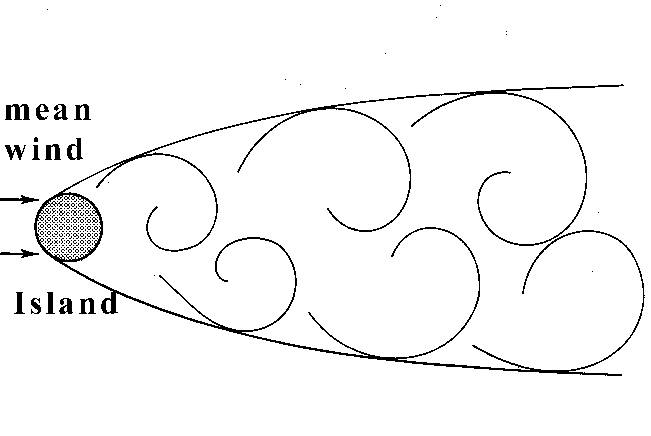
Figure 4: Kármán vortices diverge as they become larger further downstream in the wake.