Satellite meteorology training with a focus on the vessel Polarstern
Since April 2012, EUMeTrain has followed the voyages of the research vessel Polarstern through different climate zones and weather situations in three oceans - Arctic, Atlantic and Antarctic. Here the weather encountered by the Polarstern is brought into the classroom. This is also the headline of an article in the WMO Bulletin from 2012 (Vol 61 (2) - 2012).
Click on this image to read the article
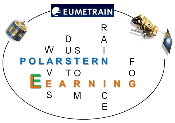
Figure 1-1: (E)Learning with the vessel Polarstern. Source: DWD.
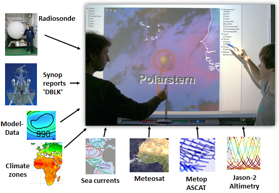
Figure 1-2: Learning to describe the weather and climate using different forms of data around the vessel Polarstern. Source: DWD.
The EUMeTrain webpage www.eumetrain.org will show you with the button "ePort PRO" measurements from the vessel from the actual position, model data from ECMWF and satellite images from MSG and MetOp. You can combine the various kinds of information easily to describe the weather situation around Polarstern (Figure 1-2).
The Polarstern Project is a good way to work on different subjects in all climate zones between the Antarctic and Arctic. It provides a chance for both, teachers and students to open a door for new experiences and train important forecasting skills.
The goal of the "Polarstern Satellite Logbook" module
The typical weather station on land is fixed and always in the same climate zone. The advantage of the station on Polarstern is its mobility. The vessel's course runs from the Arctic to the Antarctic through many climate zones, and you will have the chance to train your forecasting skills and the interpretation of satellite images in all of them.
We will single out some interesting weather events around the Polarstern from the last few years. These Anchor Dots may mark the passage of trade winds or the intertropical convergence zone.
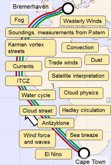
Figure 1-3: The route between Cape Town (South Africa) and Bremerhaven (Germany) is marked. Along the way the vessel encountered many interesting meteorological phenomena. Source: DWD.
In this module, we will focus on the Atlantic crossing between Cape Town (South Africa) or Punta Arenas (Chile) and Bremerhaven (Germany).
If you want more information about the interpretation of satellite images or about the conceptual model, you will find many links in this module, e.g. from EUMeTrain and COMET.
The main goal of EUMeTrain is to provide training relating to satellite images. At the beginning of this module, we will highlight some important material from EUMeTrain:
-
Basic Satellite Meteorology Course 2014
e.g. Solar Channels, IR Channels (EUMeTrain)
http://www.eumetrain.org/courses/basic_satellite_2014.html -
Training Module: Operational use of RGBs Part 1 (EUMeTrain) for detailed information about the basics of the red, green and blue components and the following RGBs:
Natural Colour RGB, Day Microphysics RGB, HRV RGB, Airmass RGB, Dust RGB, 24 hour Microphysic RGB, Severe Storm RGB
http://www.eumetrain.org/resources/operational_use_rgb.html -
Training Module: Operational use of RGBs Part 2 (EUMeTrain) for detailed information about the following RGBs:
HRV Fog RGB, Snow RGB, Night Microphysics RGB, Ash RGB
http://www.eumetrain.org/resources/operational_use_rgb2.html -
RGB Colour Interpretation Guide (EUMeTrain) for the most important things you will need.
http://eumetrain.org/RGBguide/rgbs.html?page=1&sat=-1&rgb=-1&colour=-1&recent=false
We recommend using a small analysis tool for the red, green and blue components. The advantage of this tool is that you can see each color's contribution to the brightness temperature (BT) and brightness temperature differences (BTD) at a glance. You can find instructions for installing this tool here:
http://www.eumetrain.org/RGBguide/instructions.html
First you select the RGB from a list of RGB images (here Dust RGB).
Next, select the "Click & Drag" tool and, while holding the left mouse button, move the cursor to the part of the image whose color components you wish to display.
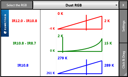
Figure 1-4a: The RGB Analysis tool applied to a pinkish part of an image. Source: EUMeTrain.
With the button "Reset Settings" you can view and control the values of the Dust RGB.
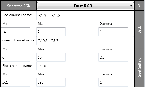
Figure 1-4b: RGB Analysis tool with the settings of the Dust RGB. Source: EUMeTrain.
You can study the given dates as well as all the other days of the cruises in the following chart.
| Expedition | Duration | Description |
|---|---|---|
| PS79 or ANT-XXVIII/5 | 10 April - 15 May 2012 | Punta Arenas - Bremerhaven |
| PS81 or ANT-XXIX/1 | 27 Oct. - 27 Nov. 2012 | Bremerhaven - Cape Town |
| PS83 or ANT-XXIX/10 | 8 March - 13 April 2014 | Cape Town - Bremerhaven |
| PS88 or ANT-XXX/1 | 25 Oct. - 29 Nov. 2014 | Bremerhaven - Cape Town |
You can find more information about the expeditions here:
https://www.pangaea.de/expeditions/cr.php/Polarstern
Experts from Deutscher Wetterdienst (DWD) and the onboard webcam
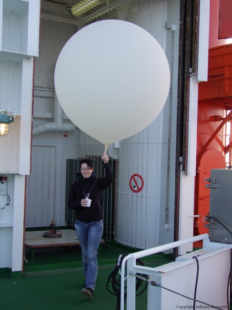
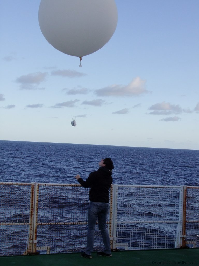
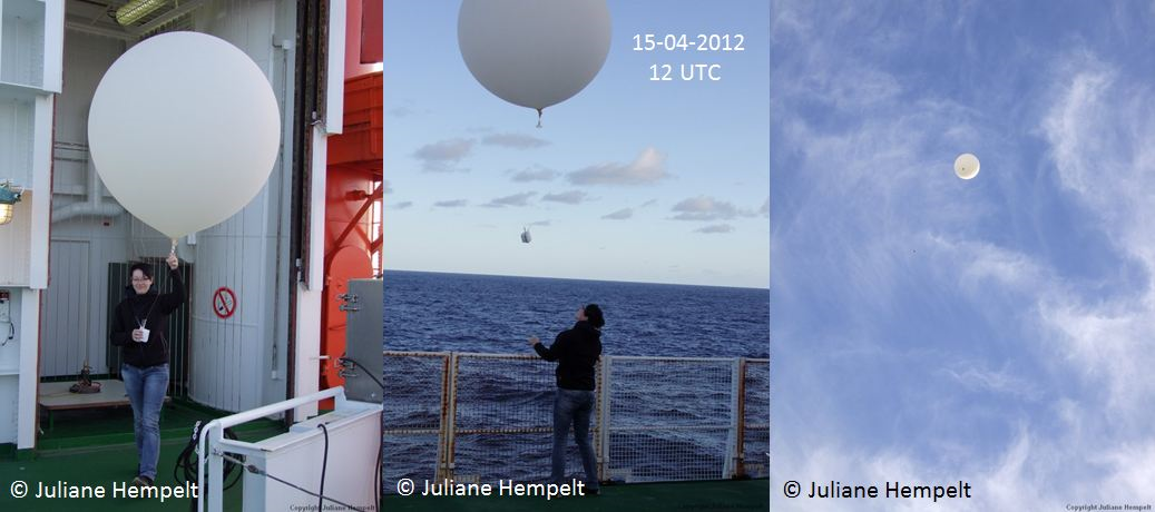
On every expedition of the Polarstern, a forecaster from Deutscher Wetterdienst (DWD) is responsible for important weather forecasts. The realization of most maritime expeditions and helicopter flights depends on good weather conditions, which is why the daily weather briefing for the crew and scientists is very important (Figure 1-5). The second staff member of Deutscher Wetterdienst is an observer/technician whose responsibilities include weather observation and radio soundings (Figures 1-6a to 1-6c).
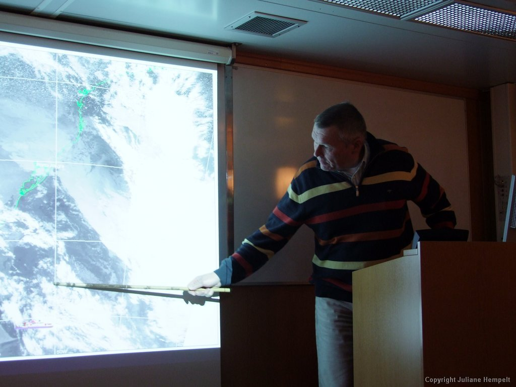
Figure 1-5: Forecaster from Deutscher Wetterdienst (DWD) during the daily weather briefing. Source: Juliane Hempelt (DWD).
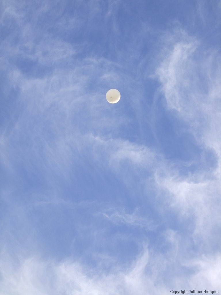
Figure 1-6: Observer/Technician releasing a weather balloon at 12:00 UTC. Source: Juliane Hempelt (DWD).
Note: Click on the image to go through individual images.
In the following EUMeTrain Webcast Dr. Thomas Bruns (DWD) talks about the work of a forecaster (called Onboard Meteorologist):
http://www.eumetrain.org/resources/the_german_research_vessel_polarstern_2012.html
There is also an onboard webcam (Figure 1-7), which the Alfred Wegener Institute (AWI) allows us to use to take pictures of clouds and waves, providing important information.
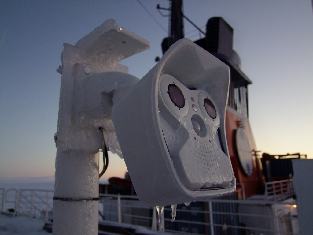
Figure 1-7: Webcam on the port side of the Polarstern, used for taking images of clouds and waves. The picture is from October 2016 in the Arctic. Source: Juliane Hempelt (DWD).
A summary about the research vessel Polarstern
The Research Vessel Polarstern is the most important resource of German polar research and the flagship of the Alfred Wegener Institute. Polarstern operates an average of 310 days a year, typically cruising in the Antarctic from November to March and pursuing research in the Arctic during the summer months. In the process, the ship covers ca. 50.000 nautical miles every year - the equivalent of two trips around the Equator. A veritable powerhouse, the research icebreaker can even operate in the pack-ice zone. Polarstern is equipped for sustained operations at temperatures down to -50 °C, and can even winter in the ice of the polar seas.
Thankfully, it's not nearly so frosty in the ship's hold, where a crew of up to 44 plus up to 55 researchers and technicians work and live. In nine scientific labs, international experts conduct biological, geological and geophysical, but also glaciological, chemical, oceanographic and meteorological research. Though Polarstern has a basic complement of scientific equipment on board, between expeditions she is largely "stripped." Which specific types of lab equipment and which scientific instruments will be required, and whether there is a need for additional lab containers, this all depends on the research questions and objectives of the researchers involved in a certain expedition.
In addition, Polarstern normally has two helicopters and inflatable boats on board. They are essential as they allow the researchers to take measurements and gather data outside of the area influenced by the ship. For example, the helicopters are used for observing whales and deploying equipment like the EM-Bird, a device that can measure ice thickness from the air. An onboard computer system ensures that the vast amounts of scientific data from various projects are regularly recorded, saved and, if need be, forwarded. (Alfred Wegener Institute)
Here you will find a video about the Polarstern's mission:
https://www.youtube.com/watch?v=js1-WddHz5o
Figures 1-8a through 1-8i show the Polarstern from various angles and in different environments.
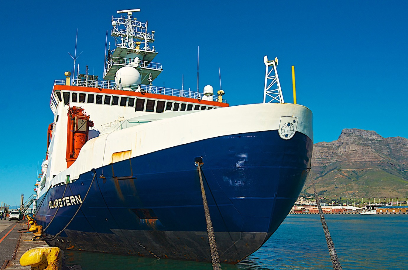
Figure 1-8a: Polarstern at the pier in Cape Town.
Source: Stephanie von Neuhoff, Alfred Wegener Institute (AWI).
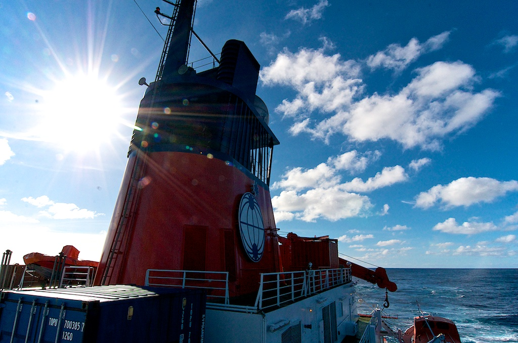
Figure 1-8b: Sunshine in the Southern Atlantic.
Source: Stephanie von Neuhoff (AWI).
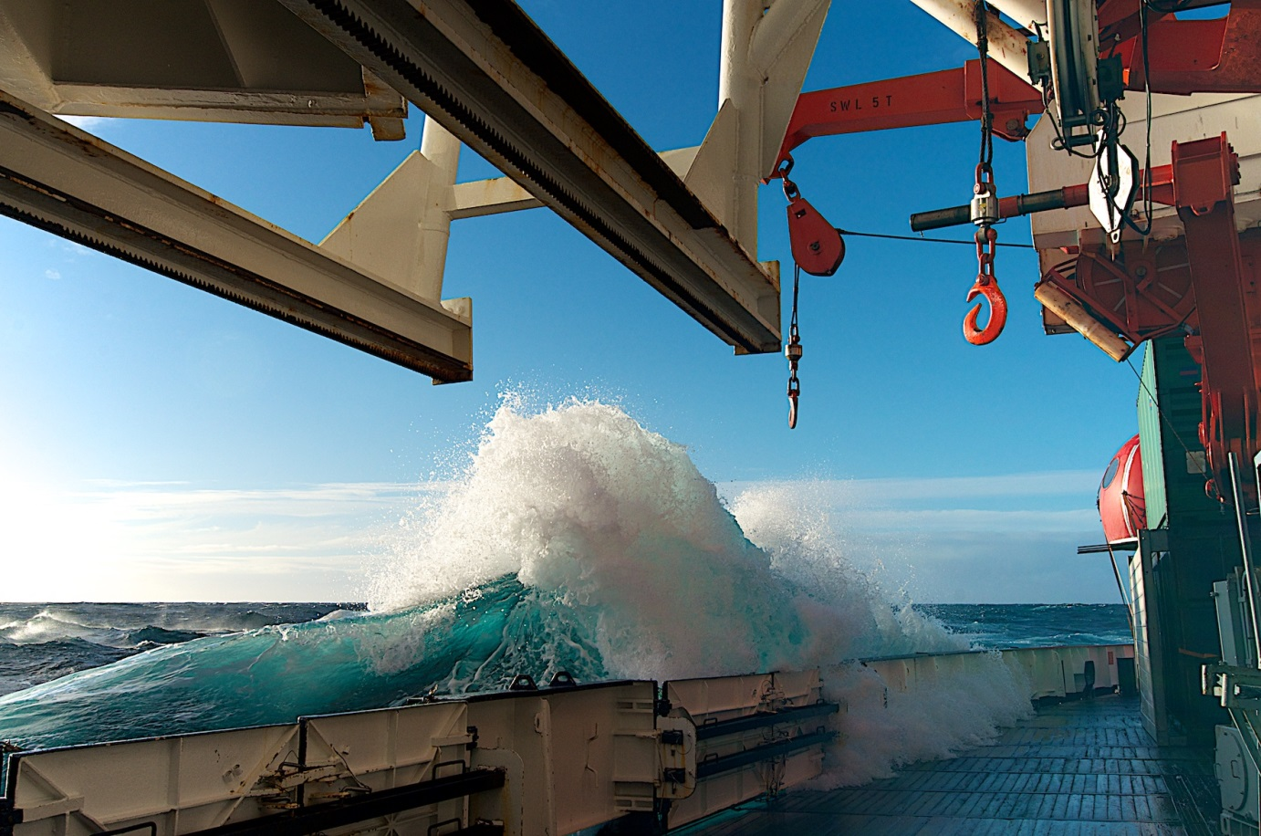
Figure 1-8c: Waves flooding the working deck. Source: Stephanie von Neuhoff (AWI).
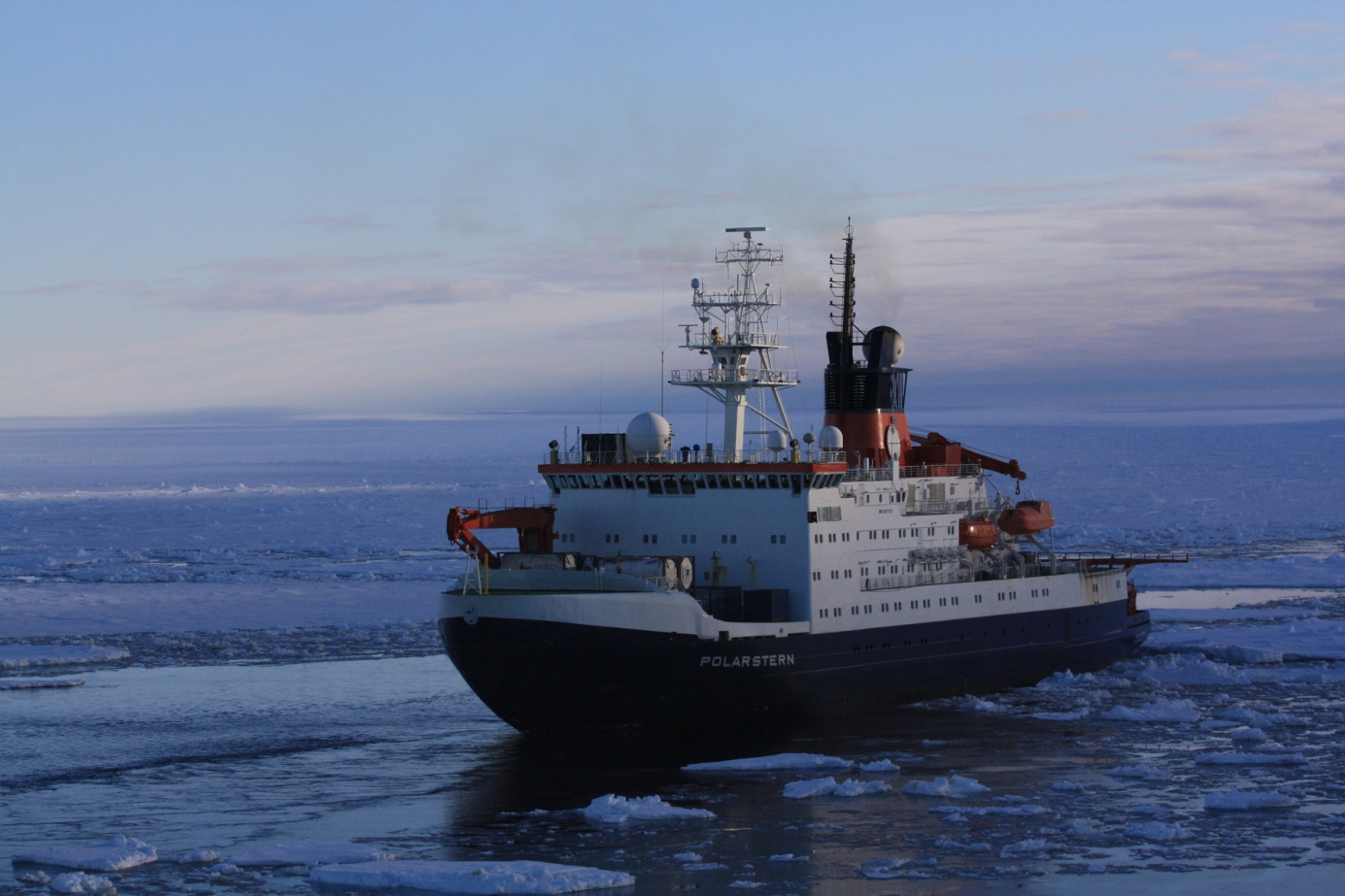
Figure 1-8d: At the end of the polar night. Source: Folke Mehrtens (AWI).
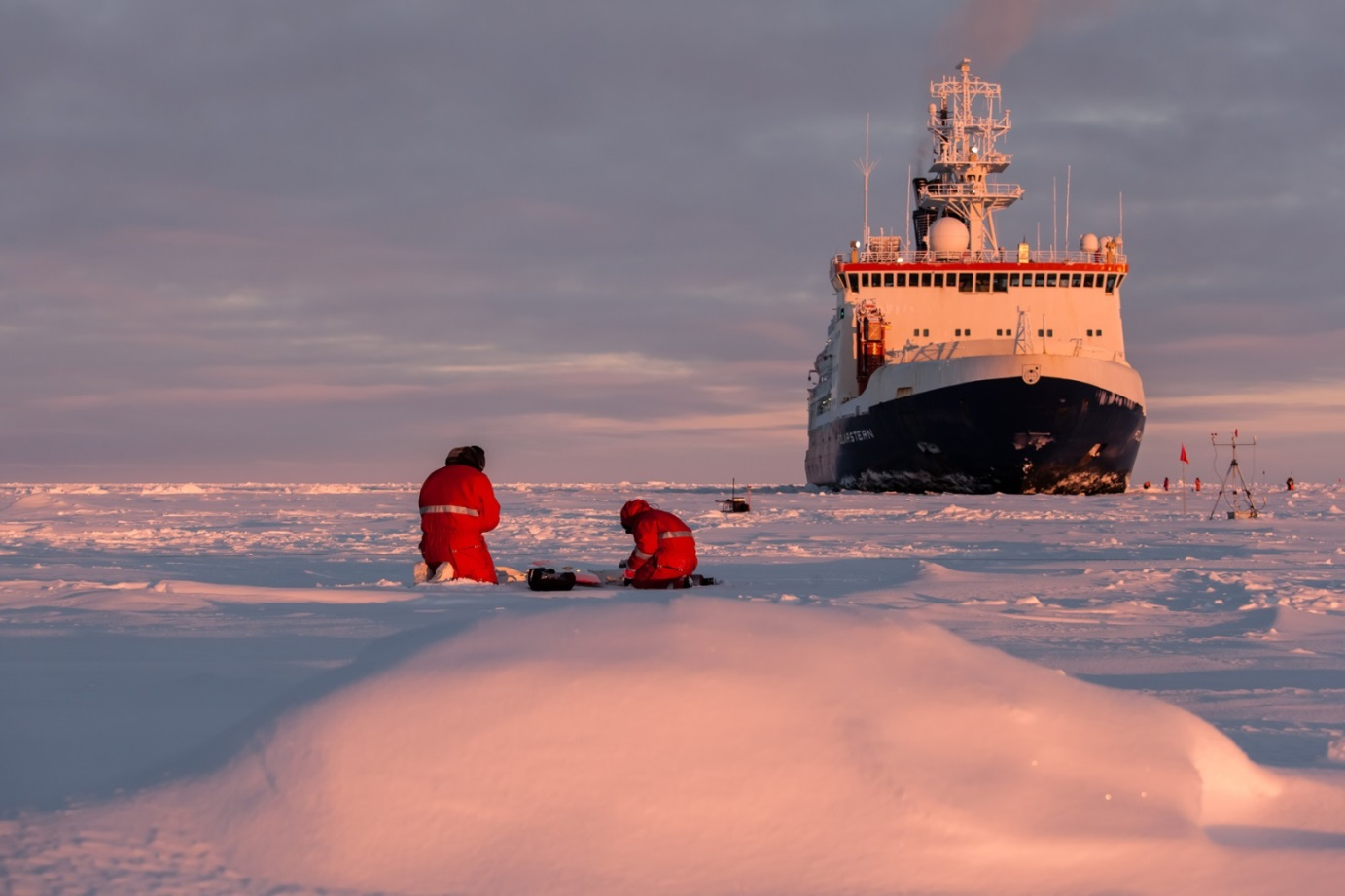
Figure 1-8e: Scientists working on the ice. Source: Mario Hoppmann (AWI).
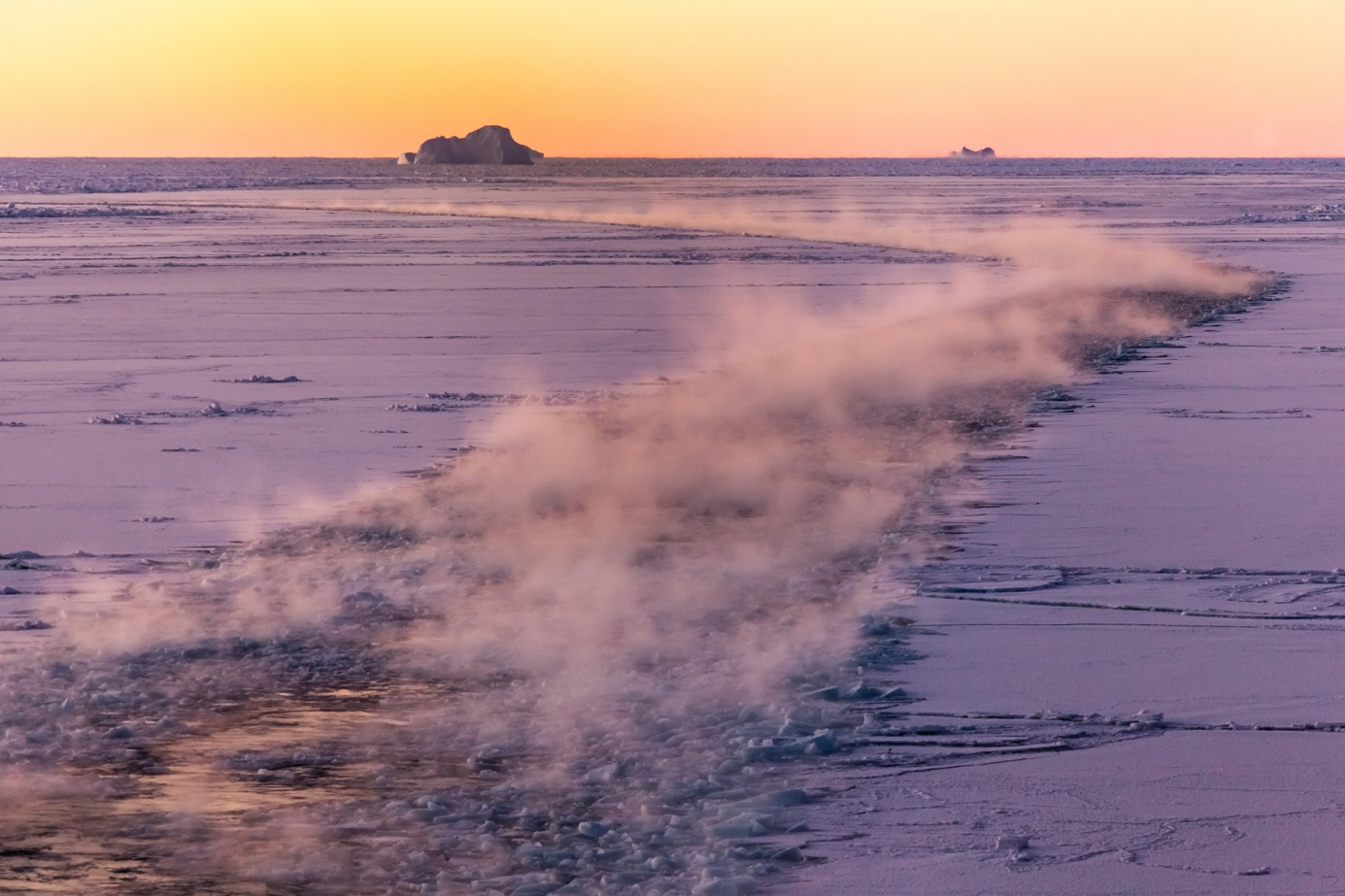
Figure 1-8f: Sea mist forming in the Polarstern's wake; water temperature -1,8°C, air temperature -20°C. Source: Mario Hoppmann (AWI).
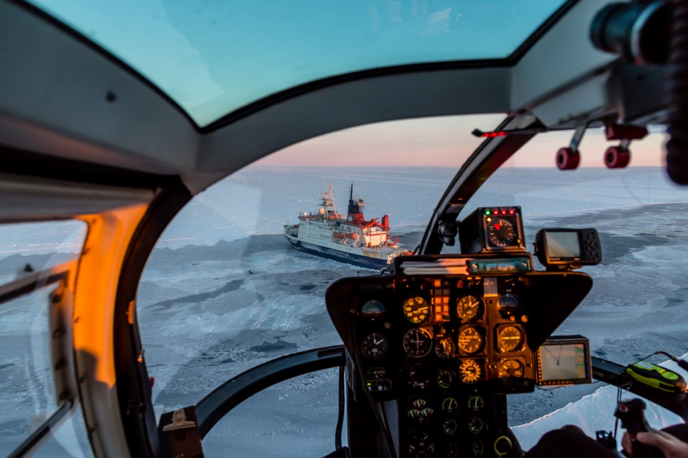
Figure 1-8g: View from a helicopter on its landing approach back to the Polarstern after a measurement flight. Source: Stefan Hendricks (AWI).
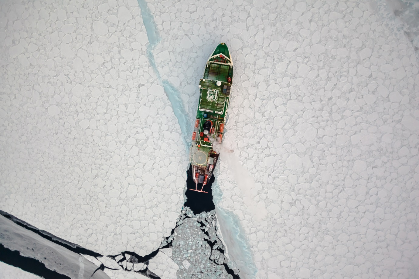
Figure 1-8h: The Polarstern cutting through thicker pancake ice. Source: Mario Hoppmann (AWI).
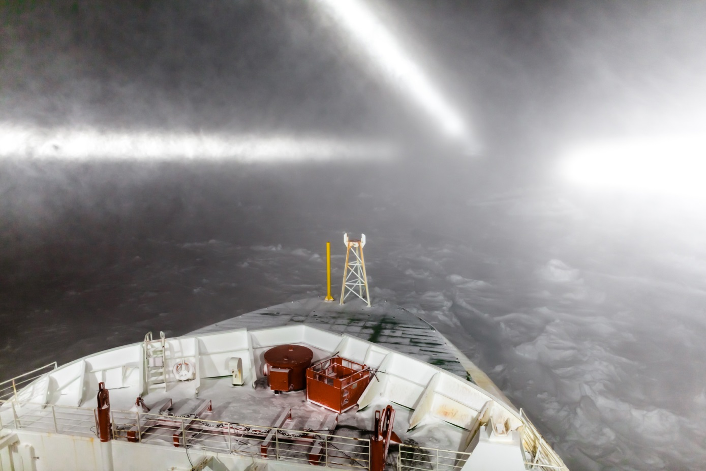
Figure 1-8i: A snow storm raging over the frozen Southern Ocean. Source: Stefan Hendricks (AWI).