LST from the EUMETSAT Satellite Applications Facility on Land Surface Analysis
The EUMETSAT Satellite Applications Facility on Land Surface Analysis (LSA SAF) produces LST maps from SEVIRI sensor on board MSG each 15 minutes
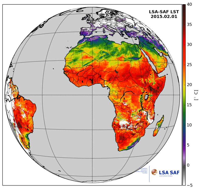
Fig. 32: Daily composite map of LSA SAF LSF for the 1 Feb 2015
Instrument: SEVIRI on board MSG satellites
Target accuracy: 2 K
Algorithm: Generalized split windows
Spatial coverage: MSG-Disk
Temporal frequency: 15 min.
Spatial resolution: 3 km subsatellite point
Projection: GEOS
Archive data: yes (since 2005)
File Format: HDF5
Data producers: EUMETSAT Satellite Application Facility (SAF) on Land Surface Analysis (LSA)
Products available at http://landsaf.ipma.pt/