Detached Warm Front and subtypes
The typical synoptic situation can be summarized as:
- Detached Warm Front crosses the Alpine region accompanied by a distinct thickness gradient
- WA maximum crosses the region
- PVA mostly existing but impact not clear
- Main cloud features: Detached Warm Front cloud, Warm Front fibres, Stau features
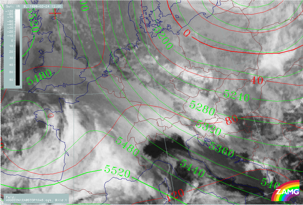
Two main cases have been selected: the 18 February 06.00 and 12.00 UTC and the 24 February 12.00 UTC. For the complete sequence of satellite images during this phase see Overview - Phase 6 and Overview - Phase 11 .
|
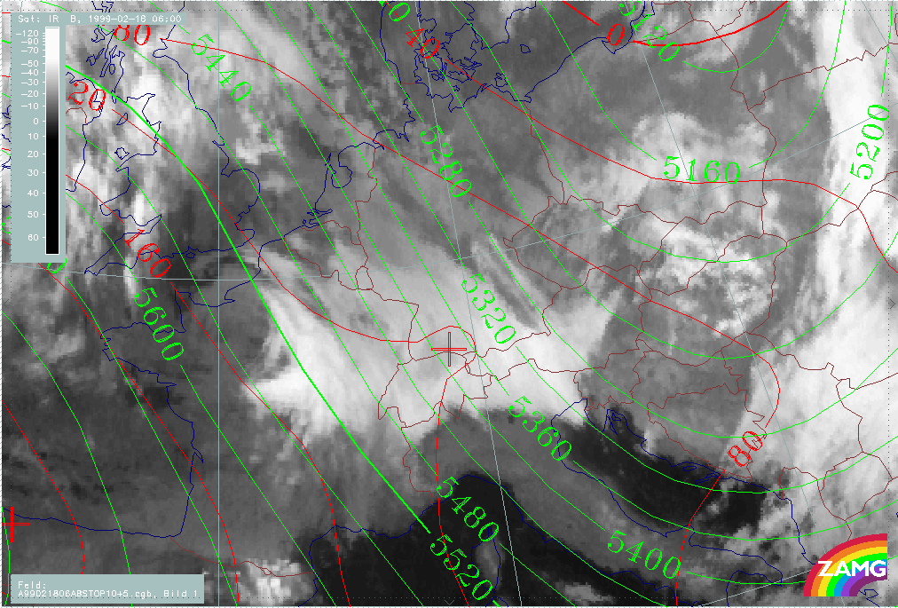
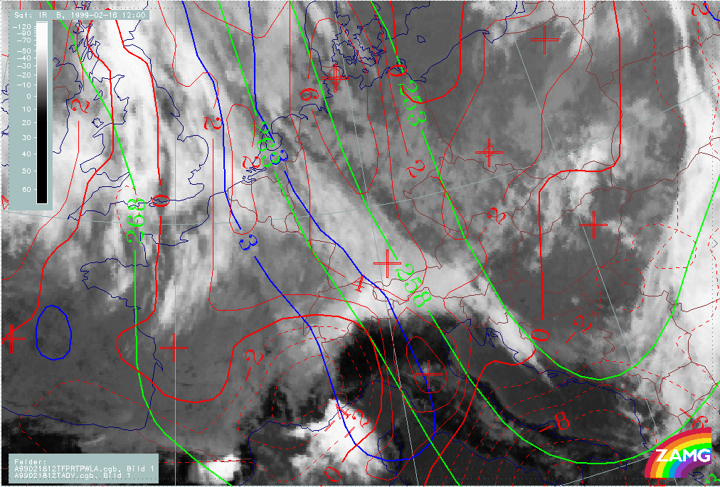
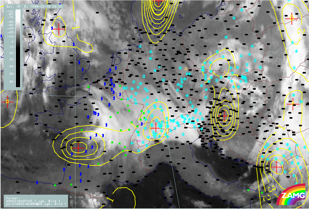
18 February 1999/06.00 UTC - Meteosat IR image; red: height contours 1000 hPa, green: height contours 500 hPa
|
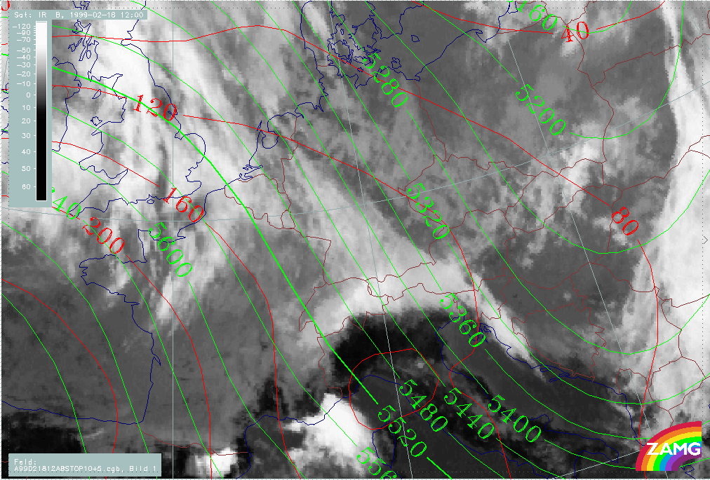
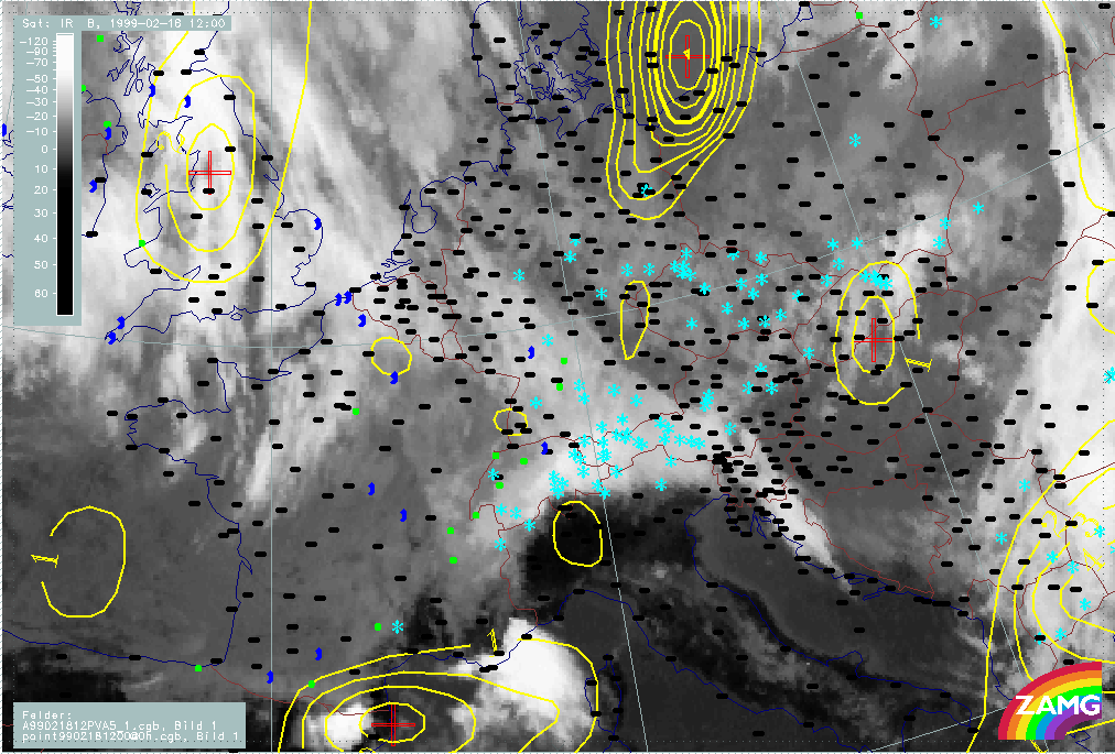
18 February 1999/12.00 UTC - Meteosat IR image; red: height contours 1000 hPa, green: height contours 500 hPa
|
|
|
|
|
|
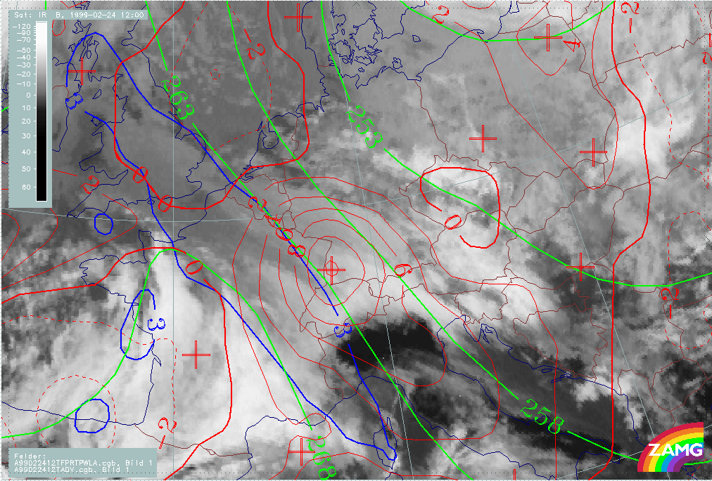
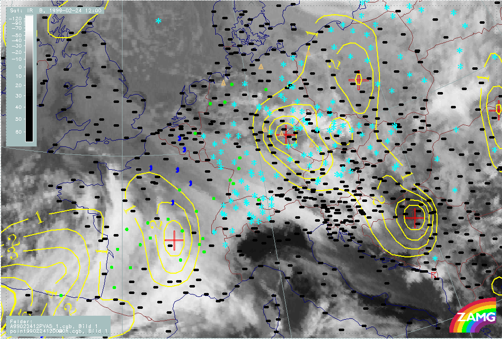
24 February 1999/12.00 UTC - Meteosat IR image; red: height contours 1000 hPa, green: height contours 500 hPa
|
|
The typical cloud configuration consists of a rather isolated cloud field extending from north of the Alps (France - Germany) southward across the Alps into parts of Italy, the Adriatic Sea and Slovenia. Cloudiness is generally lower north of the Alps and becomes brighter at the Alpine mountains and in the areas where cloudiness reaches into the south. Stau cloud types exist only in the area of the West Alps while detached WF cloudiness overflows the Alps in the Central and eastern parts.
A distinct common feature can be found in the upper level height field in the form of a strong broad NW flow to the rear of an upper level trough over the Balkan Peninsula or even further east. The surface field varies somewhat between the different examples, but there is no surface low. On the contrary, a surface ridge is present in the area of the Alps.
|
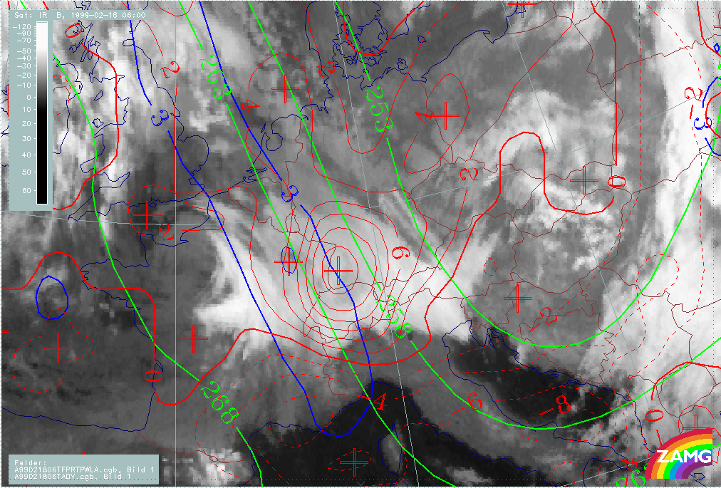
18 February 1999/06.00 UTC - Meteosat IR image; green: equivalent thickness 500/1000 hPa, red solid: temperature advection - WA 700 hPa, red dashed: temperature advection - CA 700 hPa,
blue: Thermal Front Parameter (TFP)
|
18 February 1999/12.00 UTC - Meteosat IR image; green: equivalent thickness 500/1000 hPa, red solid: temperature advection - WA 700 hPa, red dashed: temperature advection - CA 700 hPa,
blue: Thermal Front Parameter (TFP)
|
|
|
|
|
|
24 February 1999/12.00 UTC - Meteosat IR image; green: equivalent thickness 500/1000 hPa, red solid: temperature advection - WA 700 hPa, red dashed: temperature advection - CA 700 hPa,
blue: Thermal Front Parameter (TFP)
|
|
Additionally, the frontal conditions are very distinct: a well developed thickness gradient extends from the North Sea across the Alps into the Mediterranean. This is to the rear of a thickness trough over the Balkan Peninsula and the eastern Mediterranean. The TFP on the warm edge of this gradient extends from the North Sea and England across the W. Alps (France - Switzerland). Detached Warm Fronts are accompanied by a very distinct WA maximum north as well as over the Alps but, as it is embedded into the NW upper level stream, this maximum moves across the Alps into Italy during the process.
|
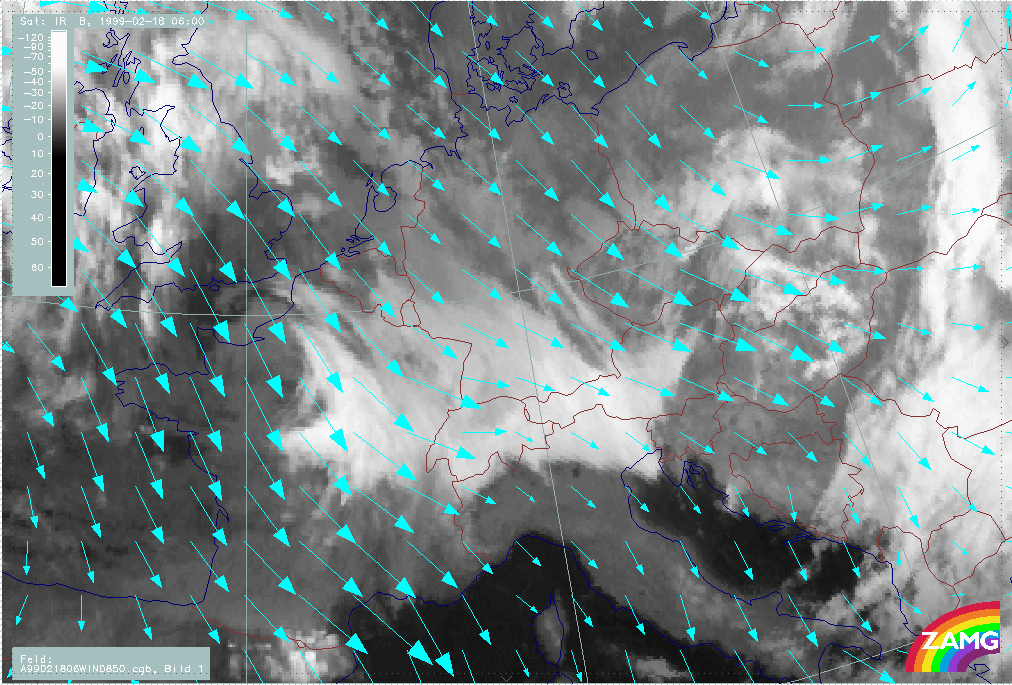
18 February 1999/06.00 UTC - Meteosat IR image; cyan: wind vectors 850 hPa
|
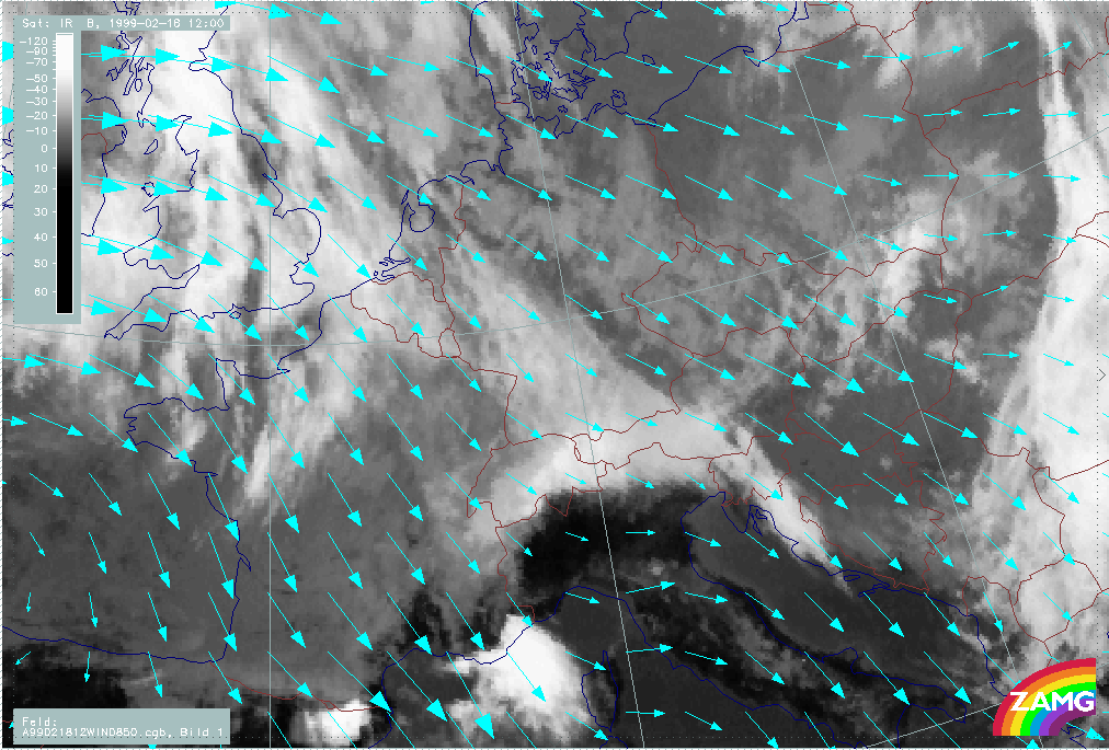
18 February 1999/12.00 UTC - Meteosat IR image; cyan: wind vectors 850 hPa
|
|
|
|
|
|
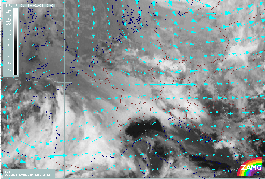
24 February 1999/12.00 UTC - Meteosat IR image; cyan: wind vectors 850 hPa
|
|
|
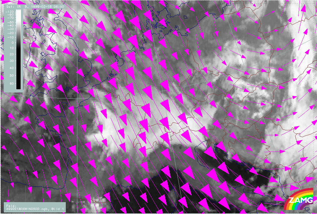
18 February 1999/06.00 UTC - Meteosat IR image; magenta: wind vectors 500 hPa
|
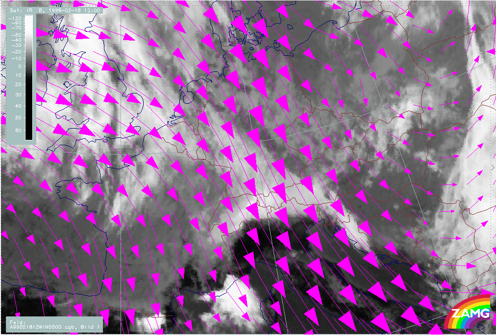
18 February 1999/12.00 UTC - Meteosat IR image; magenta: wind vectors 500 hPa
|
|
|
|
|
|
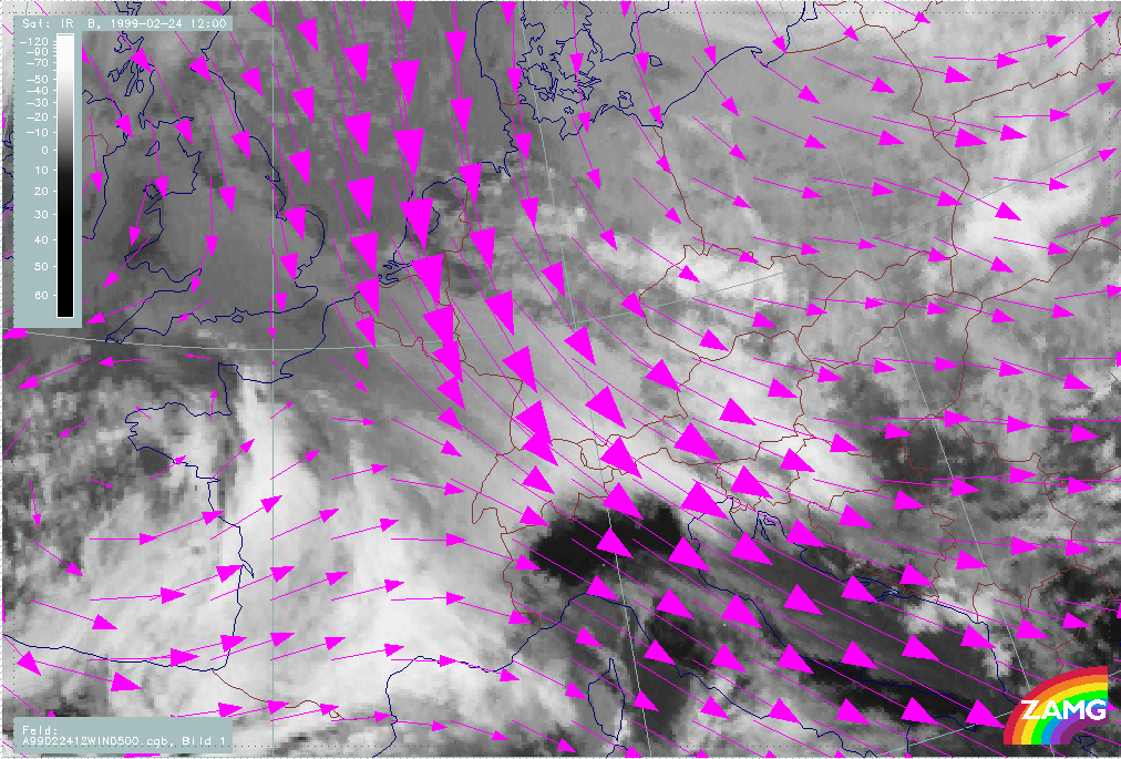
24 February 1999/12.00 UTC - Meteosat IR image; magenta: wind vectors 500 hPa
|
|
In the wind fields, it can be seen that the detached WF cloud and the 500 hPa wind vectorsare generally parallel. This is especially true for those parts of the Warm Front cloud which move across the Alps into southern regions. As this takes place mostly over Italy, Slovenia and Croatia and never over the W. Alps, reasons might be found in the different orography and the different orientation between upper level wind and orography but, so far, there are no convincing answers.
The wind fields at 850 hPa are not as easy to compare as for the high levels, but there is a tendency for NW components.
|
18 February 1999/06.00 UTC - Meteosat IR image; yellow: positive vorticity advection (PVA) 500 hPa; weather events (green: rain and showers, blue: drizzle, cyan: snow, red: thunderstorm
with precipitation, purple: freezing rain, orange: hail, black: no actual precipitation or thunderstorm with precipitation)
|
18 February 1999/12.00 UTC - Meteosat IR image; yellow: positive vorticity advection (PVA) 500 hPa; weather events (green: rain and showers, blue: drizzle, cyan: snow, red: thunderstorm
with precipitation, purple: freezing rain, orange: hail, black: no actual precipitation or thunderstorm with precipitation)
|
|
|
|
|
|
24 February 1999/12.00 UTC - Meteosat IR image; yellow: positive vorticity advection (PVA) 500 hPa; weather events (green: rain and showers, blue: drizzle, cyan: snow, red: thunderstorm
with precipitation, purple: freezing rain, orange: hail, black: no actual precipitation or thunderstorm with precipitation)
|
|
Detached Warm Fronts are associated with intensive precipitation at the Alps as the upward motion from frontal and Stau conditions act together. This is also reflected in the cases presented here. But it can also be clearly recognised that the cloud fibres extending from the Alpine mountain range to the south are only middle and high cloudiness without precipitation. PVA maxima exist in several cases, but they are not really a typical feature of Detached Warm Front situations.
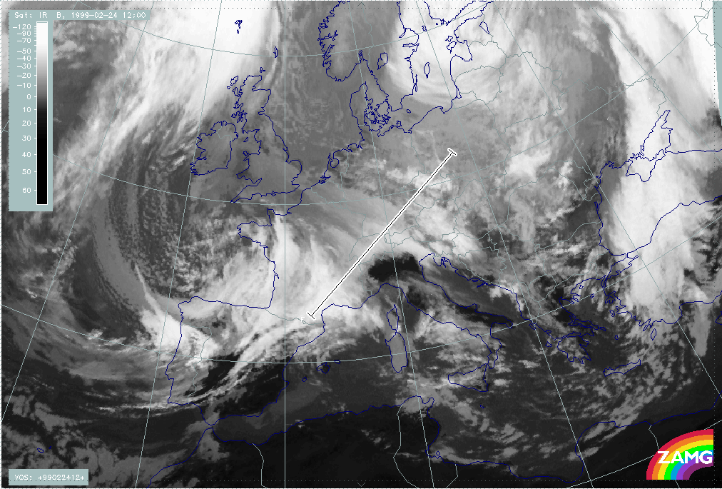
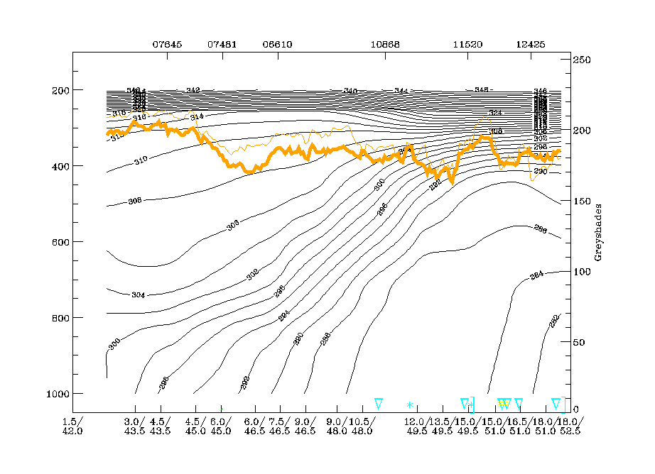
The intensity of the Detached Warm Front can be demonstrated with the help of vertical cross sections. As results are very similar for the different cases, the case of 24 February is chosen as an example. The vertical cross section line is oriented from SW to NE and is perpendicular to the Detached Warm Front cloud immediately north of the Alps. In the south-westernmost part some cloudiness belonging to a succeeding system is also present.
|
24 February 1999/12.00 UTC - Meteosat IR image; position of vertical cross section indicated
|
24 February 1999/12.00 UTC - Vertical cross section; black: isentropes (ThetaE), orange thin: IR pixel values, orange thick: WV pixel values
|
|
|
A broad frontal zone is characterised by a high gradient of isentropes. In this case, the gradient looses intensity in the surface layer but reveals two surface fronts which might accompany the two cloud systems contained in the cross section.
|
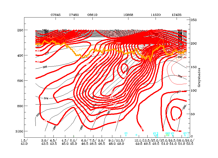
24 February 1999/12.00 UTC - Vertical cross section; black: isentropes (ThetaE), red thin: temperature advection - CA, red thick: temperature advection - WA, orange thin: IR pixel
values, orange thick: WV pixel values
|
|
|
Intensive WA lies within and above the frontal surface and, again, there are some indications of a double structure.
|
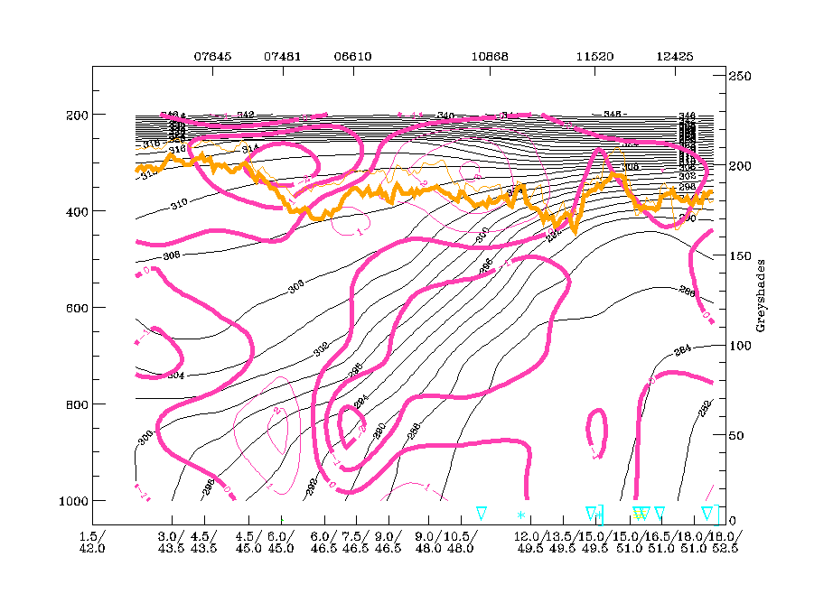
24 February 1999/12.00 UTC - Vertical cross section; black: isentropes (ThetaE), magenta thin: divergence, magenta thick: convergence, orange thin: IR pixel values, orange thick: WV
pixel values
|
|
|
The frontal surface of the Detached Warm Front is accompanied by a zone of intensive convergence. This parameter does not reveal the double structure shown by in other parameters. On the contrary, the more south-western surface front lies in an area of divergence.
|
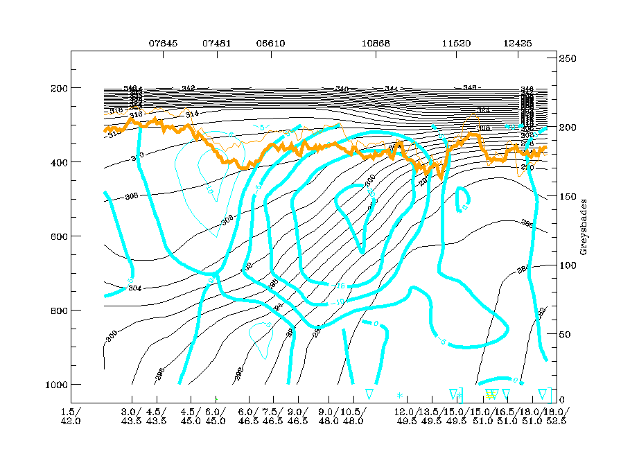
24 February 1999/12.00 UTC - Vertical cross section; black: isentropes (ThetaE), cyan thick: vertical motion (omega) - upward motion, cyan thin: vertical motion (omega) - downward
motion, orange thin: IR pixel values, orange thick: WV pixel values
|
|
|
Upward motion is very pronounced in the broad frontal surface but is connected to levels above 850 hPa.
So, concluding from these different parameters one can say that Detached Warm Fronts are very well marked in the vertical cross section. In this special case the surface frontal layer shows some signs of dissipation.
Relative streams on two isentropic surfaces within the frontal surface (294K and 300K) reveal that Detached Warm Fronts are somewhat different from classical Warm Fronts.
|
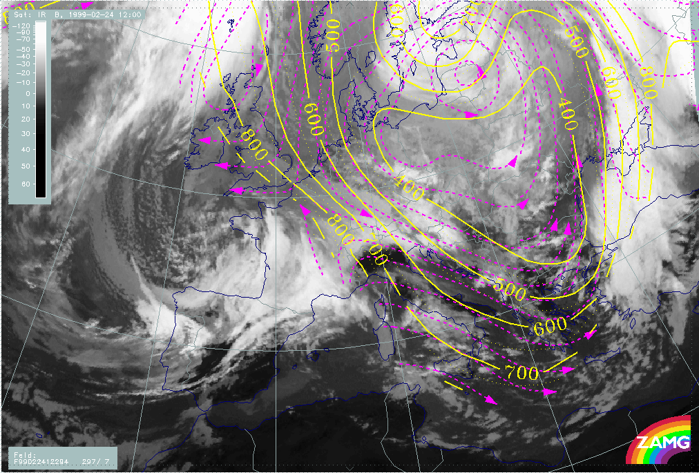
24 February 1999/12.00 UTC - Meteosat IR image; magenta: relative streams 294K - system velocity 297° 7 m/s; yellow: isobars
|
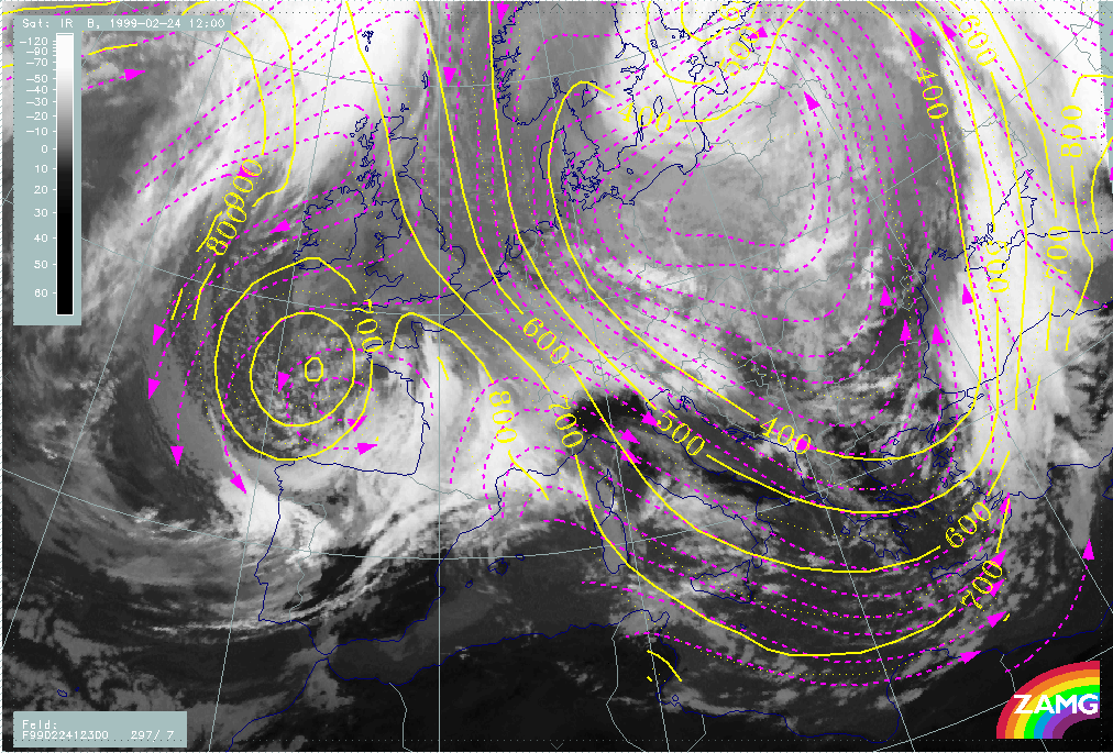
24 February 1999/12.00 UTC - Meteosat IR image; magenta: relative streams 300K - system velocity 297° 7 m/s; yellow: isobars
|
|
|
The dominating conveyor belt accompanying the detached Warm Front cloudiness is the upper relative stream which is rising in the area of the cloudiness. The Warm Conveyor Belt, which is the dominating relative stream for the classical Warm Front cloudiness, is only to the south-west and, in higher surfaces, connected to the Warm Front system over France.