Table of Contents
- I. Introduction
- II. Flood Catastrophe 06 - 08 August 2002
- Initial Weather Situation
- Development of Genoa Cyclone
- Floodphase
- III. Flood Catastrophe 10 - 13 August 2002
- Initial Weather Situation: Intrusion of cold air into the western Mediterranean
- Development from Wave into Occlusion stages
- Floodphase
- "5b Path": Propagation of Mediterranean low northeastwards
Introduction
In August 2002 two Mediterranean low pressure systems developed, taking a so-called 5b path. Such occurrences are rather unusual in summer as was the very rapid repetition rate of two events within about 8 days. The first event happened between 06 and 08 August, the second between 10 and 13 August.
|
|
|
|
As can be seen in the schematic above - which shows the relative positions of low centres - a 5b cyclone develops in the Mediterranean over the Gulf of Genoa and moves northward across N. Italy, Slovenia, E. Austria and Hungary and further across the Czech Republic to Poland. From there the classical 5b cyclone turns to a more easterly direction.
5b cyclones are very weather intensive phenomena as air masses are involved which contain high amounts of humidity. During their path northward the cloud system becomes occluded and as a consequence of the inherent circulation, significant Stau effects happen at the northern region of the Alps as well as over the Slovakian and Czech mountains. Therefore, countries which usually suffer from such bad weather are Austria, Slovakia, Czech Republic, some parts of Germany, as well as parts of Hungary and Poland.
When such a weather situation is associated to extremely high amounts of humidity, floods can occur and as the major rivers like the Danube and the Elbe carry their flood water downstream, countries like Hungary and Germany also become affected. But before these big rivers come into play, flooding smaller rivers within single countries can already cause serious damage.
This was the case in Austria where, during the first phase, damage was caused by smaller rivers in Salzburg and Lower Austria (for instance the Kamp valley). In parallel, and during the same phase, there were high water levels in the Danube in Bavaria and consequently in the second flood-event the flood water came from both, the Danube and again the smaller rivers.
From a meteorological point of view the model forecasts of these events are of utmost importance. For Austria the global model of ECMWF and the Aladin and Aladin-Vienna Local Area Models (LAM) were used. Generally speaking, both models (with different strengths and weaknesses) had produced very good forecasts of amounts and the locations of precipitation.
The reasons for the major damage and the critical situation with respect to human security cannot be blamed upon lack of warnings from weather forecasters. These catastrophic flood event once more showed problems arising from other sources; for instance:
- Building new houses within areas which have a high probability of flood
- The timely use of precipitation forecasts in hydrological models
- Inappropriate plans for protecting property and evacuating persons in catastrophic situations, taking into account all the necessary psychological background
From the viewpoint of the Conceptual Model Approach a detailed investigation of the various models involved and their evolution is of high interest and could lead to impproved modelling of these situations and the earlier issue of warnings.
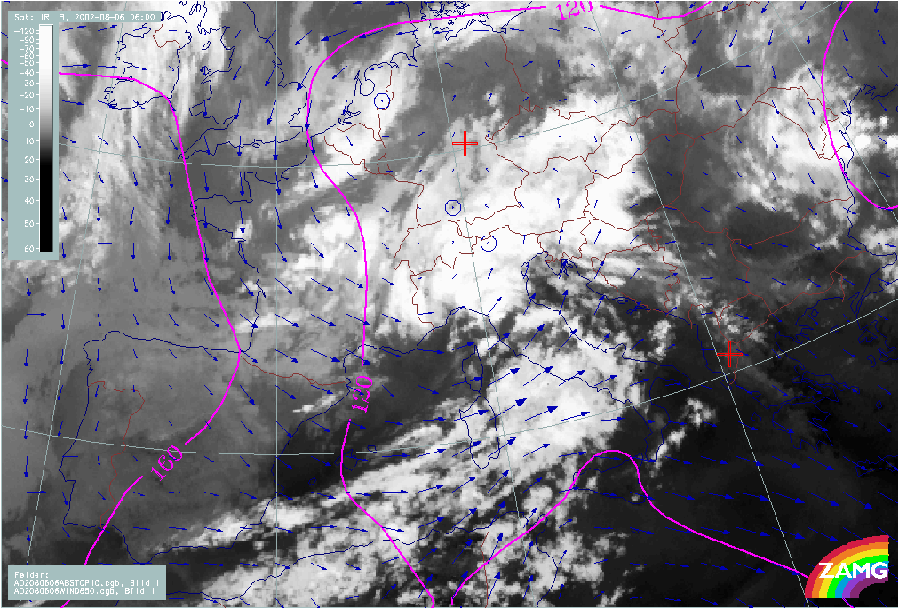
Initial Weather Situation
|
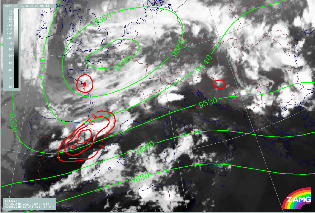
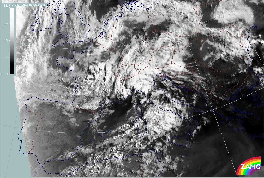
05 August 2002/18.00 UTC - Meteosat IR image
|
05 August 2002/17.00 UTC - Meteosat VIS image
|
|
|
|
|
|
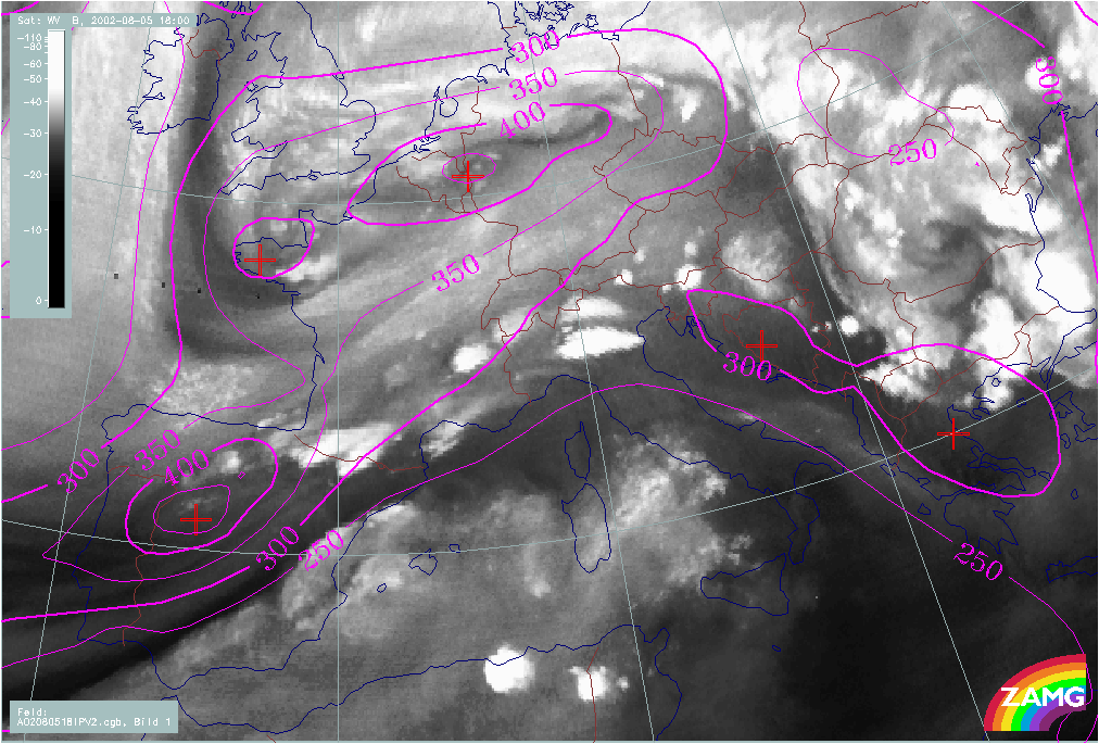
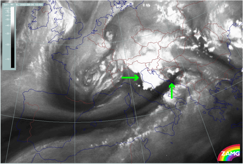
05 August 2002/18.00 UTC - Meteosat WV image
|
|
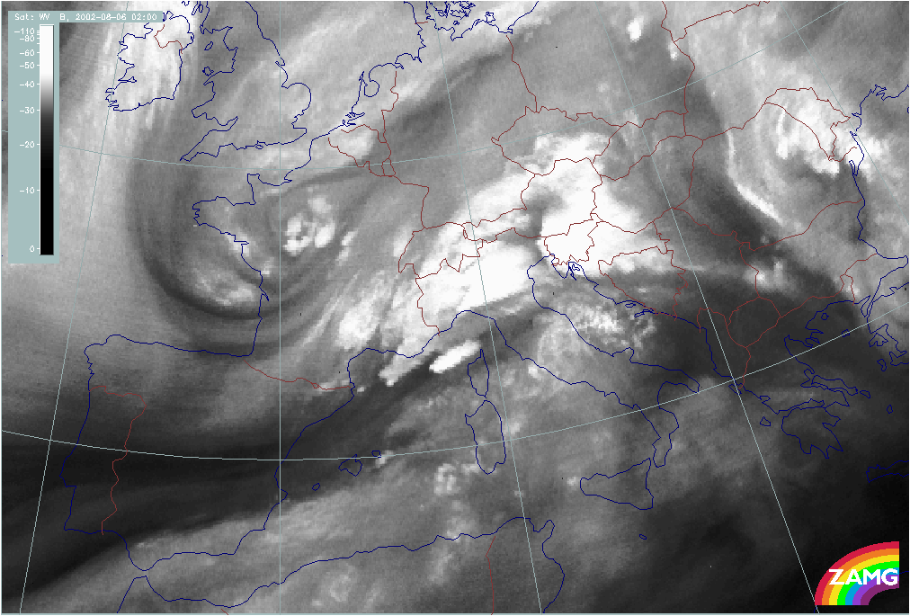
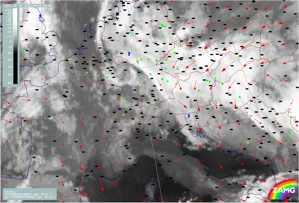
The above Meteosat images, in the three spectral channels, show the cloud systems at the initial stage of the first flood event in August 2002:
There are two synoptic scale cloud bands:
- The northern one extends from N. Spain across France and Switzerland to Austria. Many MCSs are embedded along its southern boundary; they are very well developed and have a high vertical extent. The future development of the flood situation takes place largely as a result of this cloud band, which represents a warm and highly unstable air mass.
- The southern band extends from S. Spain across the western Mediterranean and Sardinia to mid Italy.
Both cloud bands are separated by a broad Dark Stripe in the WV image.
The images also show a distinct cloud spiral to the north:
- The main spiral can be found over Belgium and Germany
- A secondary spiral shows up as a Dark Stripe in WV imagery over Brittany; it is well recognisable and shows features which indicate further development.
Synoptic Situation and air mass characteristics
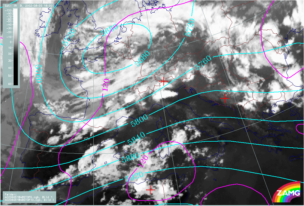
|
05 August 2002/18.00 UTC - Meteosat IR image; magenta: height contours 1000 hPa, cyan: height contours 500 hPa
|
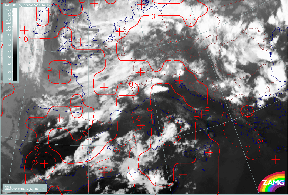
05 August 2002/18.00 UTC - Meteosat IR image; red: temperature advection 700 hPa
|
|
|
|
|
|
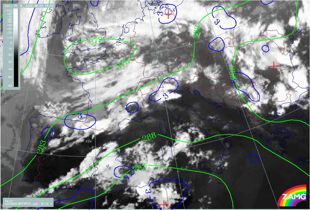
05 August 2002/18.00 UTC - Meteosat IR image; blue: thermal front parameter (TFP) 500/850 hPa, green: equivalent thickness 500/850 hPa
|
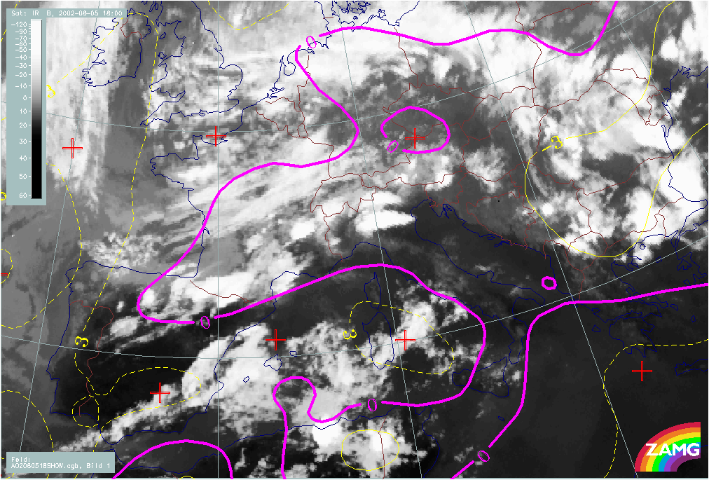
05 August 2002/18.00 UTC - Meteosat IR image; magenta, yellow: Showalter index
|
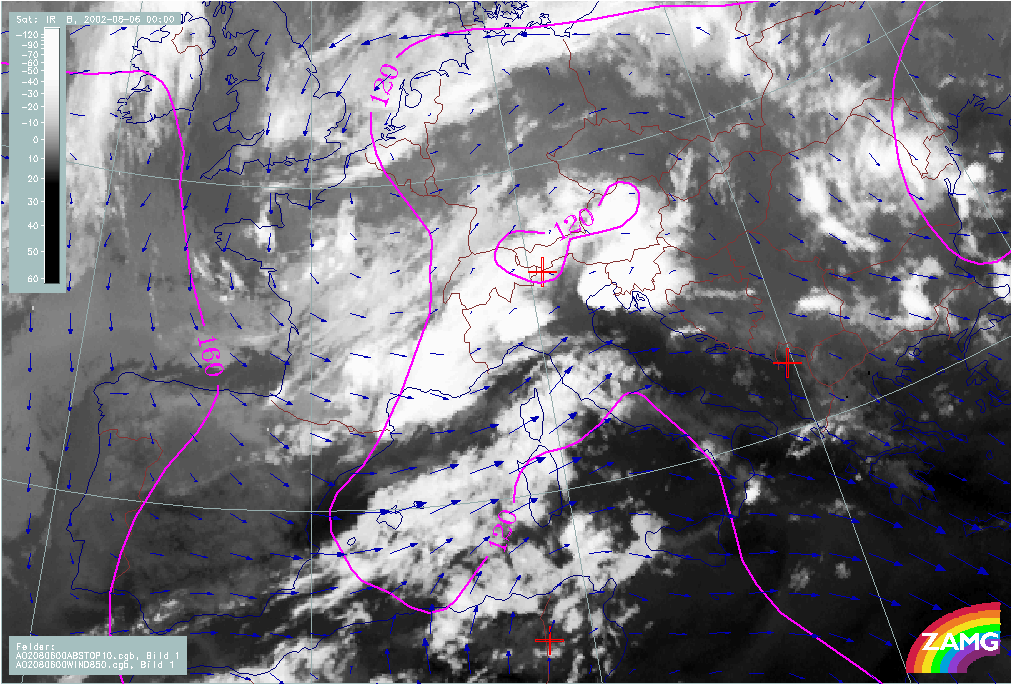
While there are only very weak pressure gradient at surface levels (1000 hPa), an intensive Upper Level Low (ULL) dominates at a height of 500 hPa with its centre over Belgium and an upper level trough extending from Brittany to N. Spain.
Two baroclinic zones - represented by a high gradient of thickness and a TFP, but only weak temperature advection - are associated with the two cloud bands.
In the image including Showalter index, values of < 3 indicate an unstable air mass, but it is even more unstable near the northern Baroclinic Boundary which contains many MCSs and is accompanied by a Showalter index < 0.
Upper Level Features
|
05 August 2002/18.00 UTC - Meteosat IR image; red: positive vorticity advection (PVA) 300 hPa, green: height contours 300 hPa
|
05 August 2002/018.00 UTC - Meteosat WV image; magenta: height of PV = 2 units
|
|
|
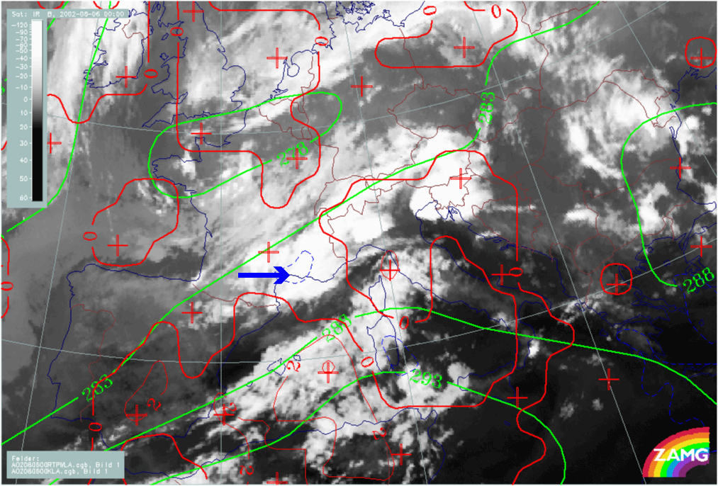
Pronounced upper level features are involved in the weather situation; they are indicative of developments triggered by processes taking place in the middle and upper troposphere:
- PVA max at 500 and 300 hPa (not shown here) located over central N. Spain and Brittany indicate the approach of upper level troughs
- Distinct PV anomalies in the same areas indicate that stratospheric air has penetrated downward to approx. 450 hPa. As in well developed cases, there is a strong relationship between the PV anomalies and black areas/vortices in the WV image.
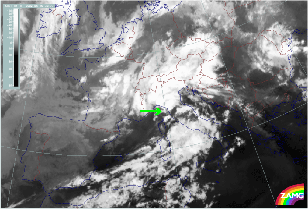
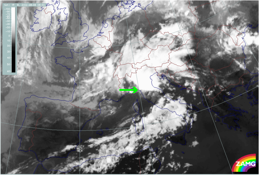
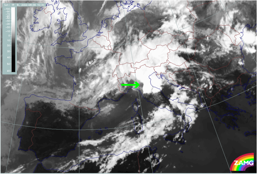
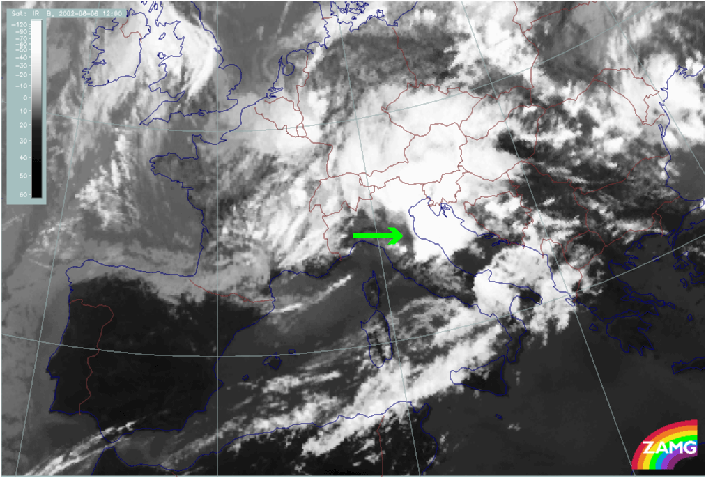
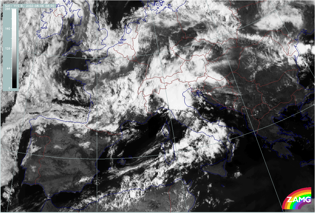
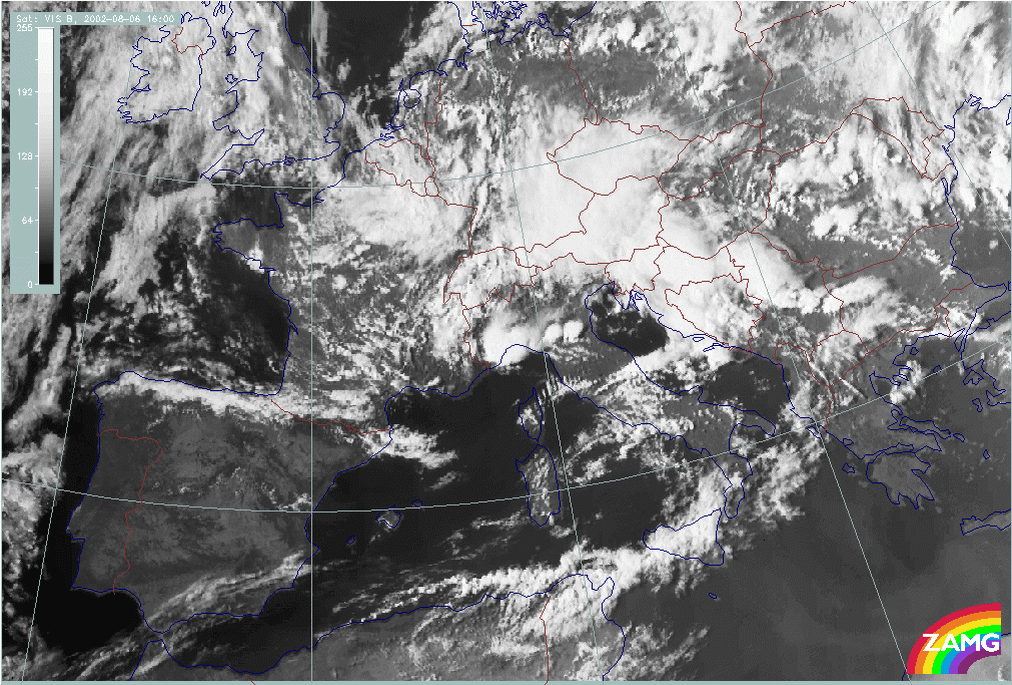
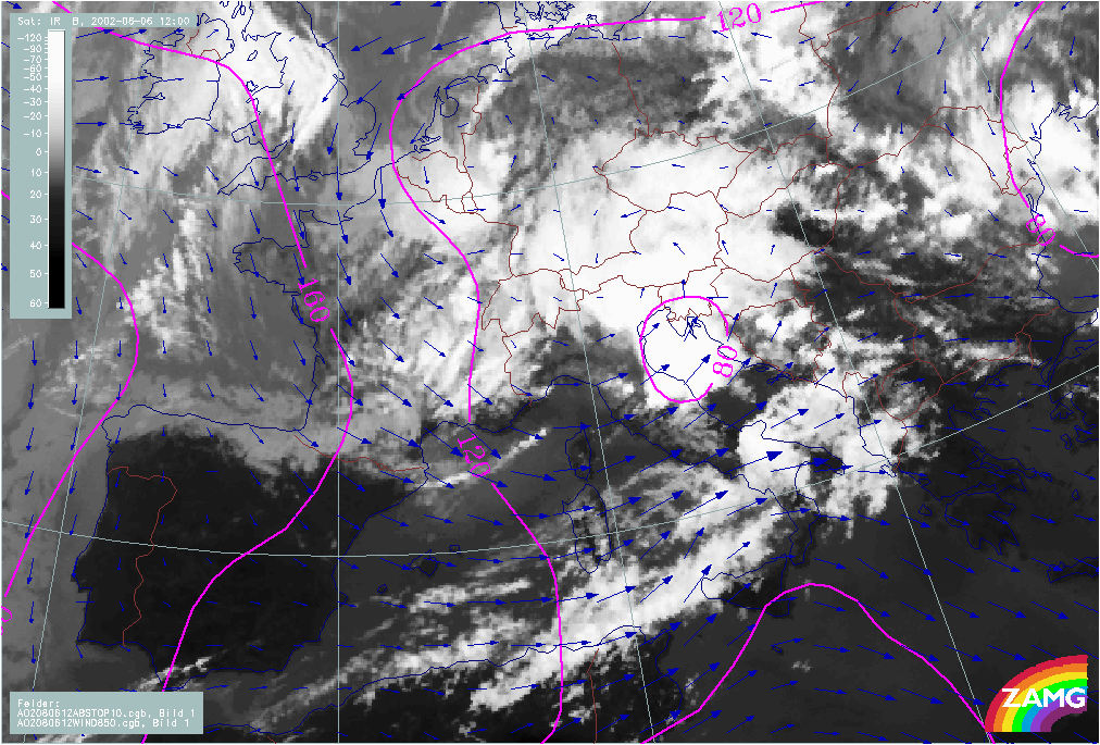
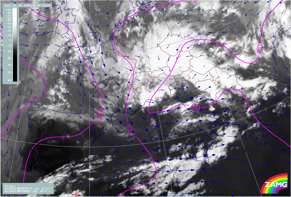
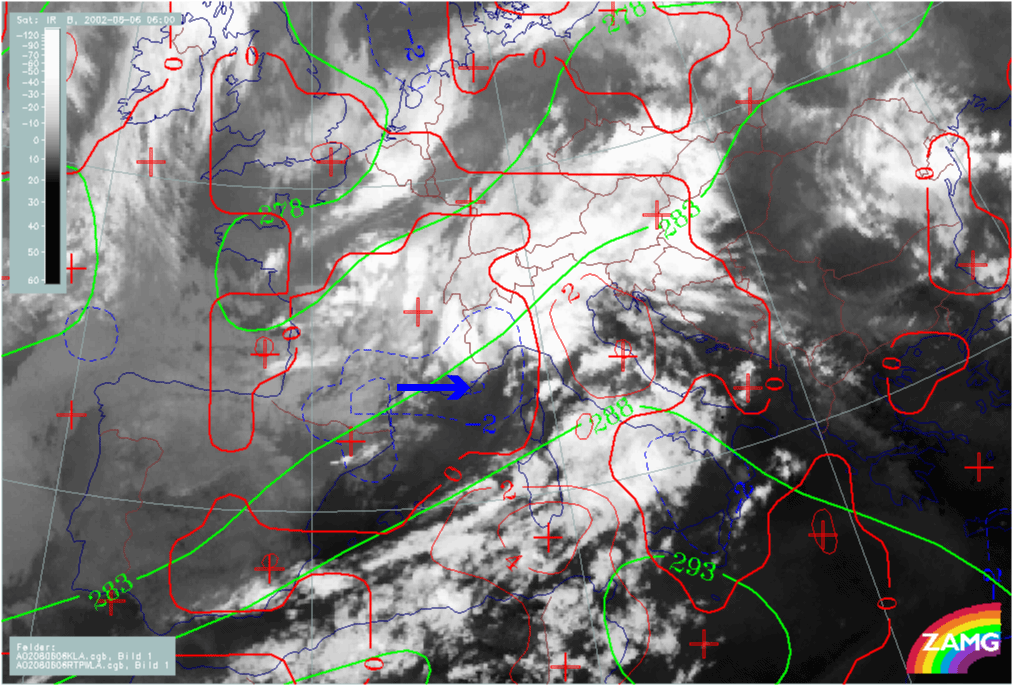
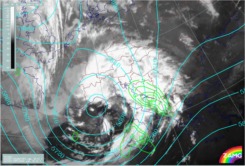
Development of Genoa Cyclone
Development of a Genoa Cyclone in satellite imagery
The IR, WV and VIS image loops shown below show the phases of development of a Mediterranean low in the Gulf of Genoa.
|
06 August 2002/00.00 UTC - Meteosat IR image; 00.00 - 18.00 UTC 2-hourly image Loop
|
|
In the first of development (approx. 00.00 - 03.00 UTC) convective clouds are developing between the two baroclinic cloud bands which are near Italy. Consequently, a connection between the two cloud bands takes place, leading to the impression of a Cold Front (the former southern cloud band) and an Occlusion spiral (the former northern band).
But the main process takes place from 03.00 UTC, with the development of cyclonic rotation in the area between Corsica and Genoa. This rotation produces to a cloud spiral and is accompanied by the development of huge convective cells and extensive MCS. The spiral moves NNE.
From 15.00 UTC, a new development of MCSs takes place over the Gulf of Genoa. This is to the rear of the cloud system responsible for the flood and, consequently, (although it is a very interesting feature) it is not directly connected to the flood situation and is not studied further here.
|
06 August 2002/00.00 UTC - Meteosat WV image; 00.00 - 18.00 UTC 2-hourly image Loop
|
|
The development seen in the IR loop can also be followed in the above WV loop. Additionally, distinct Dark Stripes can be recognised accompanying the development.
As is often observed, convective cells develop at the end of the Dark Stripe (over Gulf of Genoa and mid Italy). From 07.00 UTC a splitting of the Dark Stripe takes place with:
- One branch overrunning the southerly system and extending into Bosnia
- Another branch remains to the rear of the spiral over Italy, indicating the initiation of cyclogenesis by processes at higher levels.
|
06 August 2002/00.00 UTC - Meteosat VIS image; 06.00 - 16.00 UTC 2-hourly image Loop
|
|
The loop of VIS images above shows the development of the spiral structure very well but the most impressive features are the developing MCSs.
The development of the Genoa cyclone in the relevant model fields
The contribution of relevant numerical parameters, such as height contours, winds and temperature advection, to the development of a Mediterranean low in the Gulf of Genoa can be evaluated from the loops shown below.
|
06 August 2002/00.00 UTC - Meteosat IR image; magenta: height contours 1000 hPa, blue: wind vectors 850 hPa; 00.00 - 18.00 UTC 6-hourly
Loop
|
|
Initially, there are only weak gradients at surface levels (1000 hPa); later, the development of a surface low over N. Italy and the Adriatic Sea can be observed which is increasing in size: to the NE and SE as well as to the W (Gulf of Genoa). At the same time a cyclonic circulation develops at 850 hPa over the W. Alps and moves eastward.
|
06 August 2002/00.00 UTC - Meteosat IR image; green: equivalent thickness, red: temperature advection - WA 700 hPa, blue: temperature
advection - CA 700 hPa; 00.00 - 18.00 UTC 6-hourly Loop
|
|
TA is an important feature in the development of a Genoa cyclone. In this case the intensification of CA over France and its movement into the Gulf of Genoa can be observed (positions of maximal CA are indicated in the loop above). CA areas broaden and merge with other areas of CA to the South. The intensification of WA within the cloud mass which forms the cloud spiral is a distinct feature towards the end of the sequence, leading to the development of a distinct thickness ridge there.
Initiation of a Genoa cyclone from above
The role of physical processes at upper levels, such as potential vorticity and vorticity advection, in triggering the development of a Mediterranean low in the Gulf of Genoa, is demonstrated with the images below.
|
06 August 2002/00.00 UTC - Meteosat WV image; magenta: height of PV = 2 units
|
06 August 2002/06.00 UTC - Meteosat WV image; magenta: height of PV = 2 units
|
|
|
|
|
|
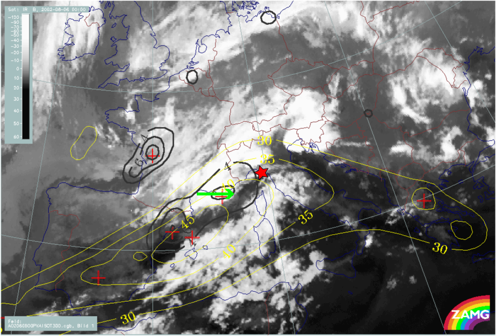
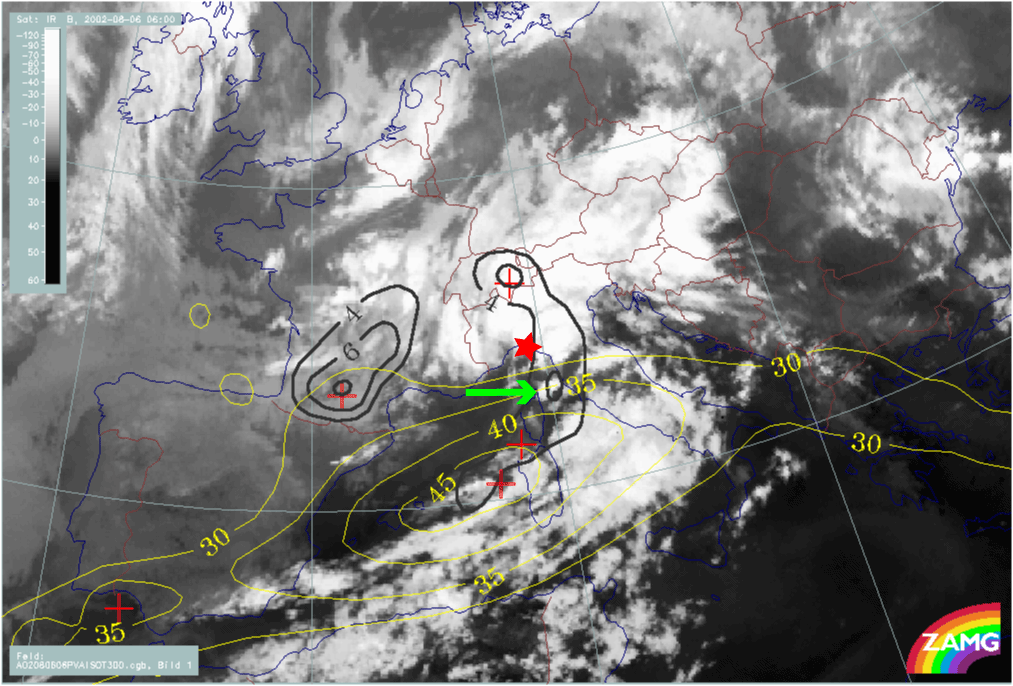
06 August 2002/00.00 UTC - Meteosat IR image; yellow: isotachs 300 hPa, black: positive vorticity advection (PVA) 300 hPa
|
06 August 2002/06.00 UTC - Meteosat IR image; yellow: isotachs 300 hPa, black: positive vorticity advection (PVA) 300 hPa
|
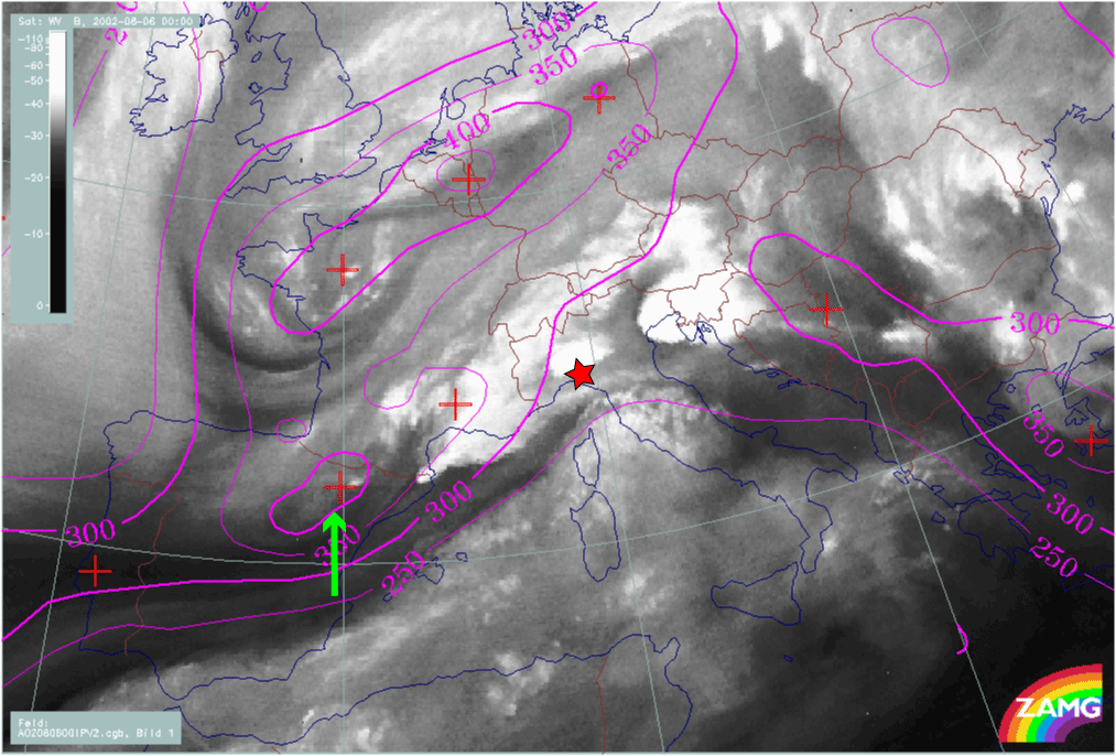
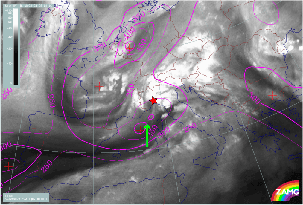
Between 00.00 - 06.00 UTC a PV anomaly (arrow in the upper images) moves from Spain into the area of the cyclogenesis at low levels in the Gulf of Genoa (red star in the images above); at 12.00 UTC (not shown here) there is good correspondence between the PV anomaly and intensive MCS development. The sinking PV anomaly that approaches a low level baroclinic zone is thought to be the main reason for the initiation of the Genoa cyclone.
If the same area (red star) is studied from the viewpoint of jets streaks and PVA maxima, this area is identical with the one where there was intensification by PVA in the left exit region of a jet streak (green arrows in the two lower images).
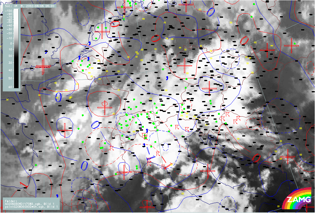
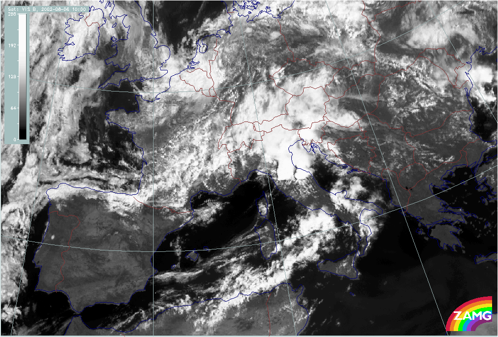
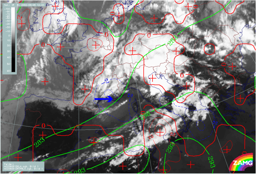
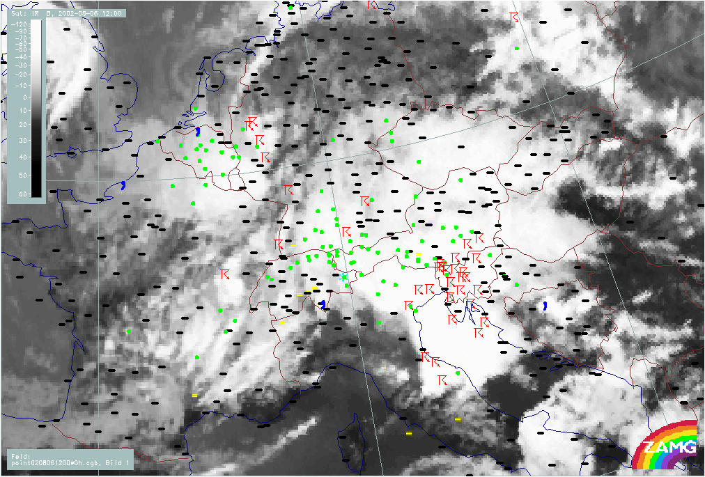
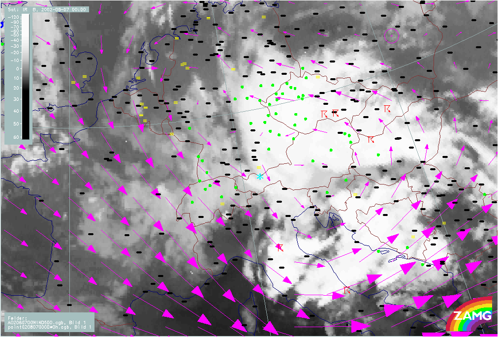
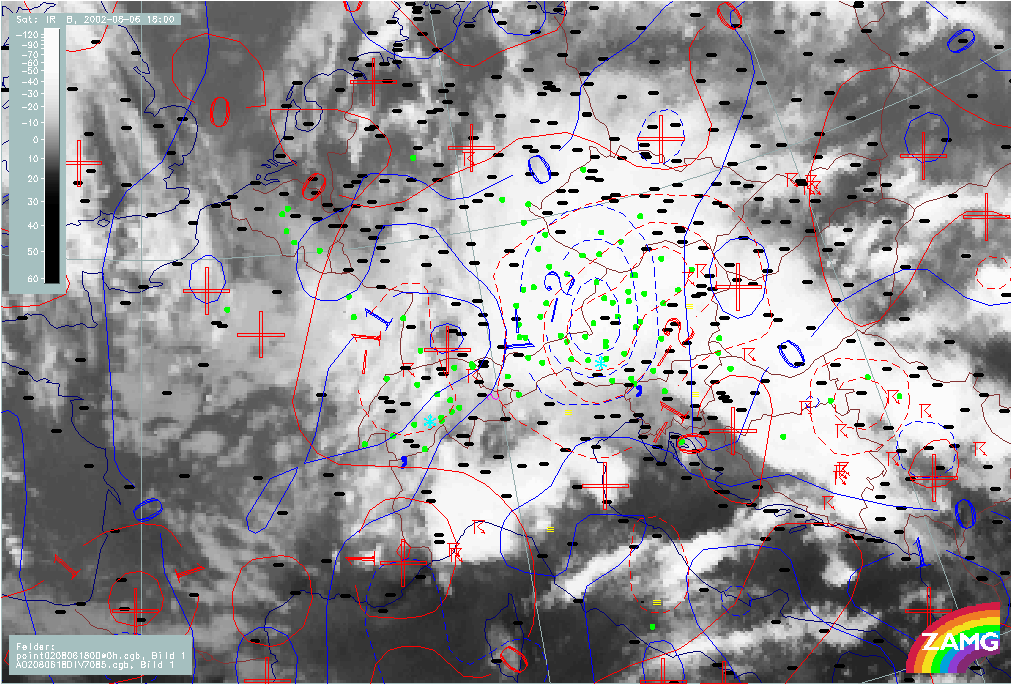
Floodphase
Sequence of weather: Rain amounts
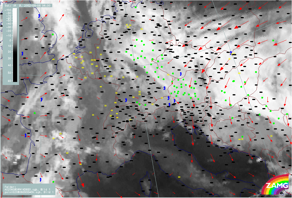
Development Phase: 06 August 02/06.00 - 18.00 UTC
|
06 August 2002/06.00 UTC - Meteosat IR image; weather events (green: rain and showers, blue: drizzle, cyan: snow, red: thunderstorm
with precipitation, purple: freezing rain, orange: hail, black: no actual precipitation or thunderstorm with precipitation); 06.00 -
21.00 UTC 3-hourly image Loop
|
|
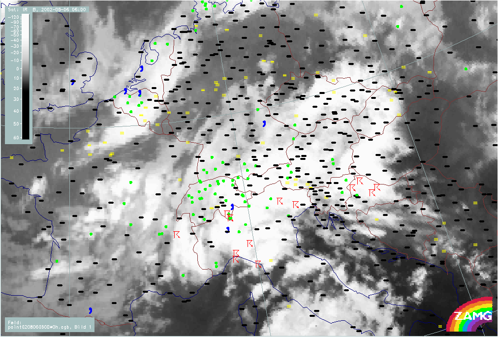
The period of 06 August 06.00 - 18.00 UTC marks the phase of the development of the Genoa cyclone and the start of its NNE movement: It can be regarded as pre-flood phase. Thunderstorms prevailm in the S. and E. part of the cloud features, but over Switzerland and W. Austria an extensive area of precipitation develops which gradually moves towards mid Austria.
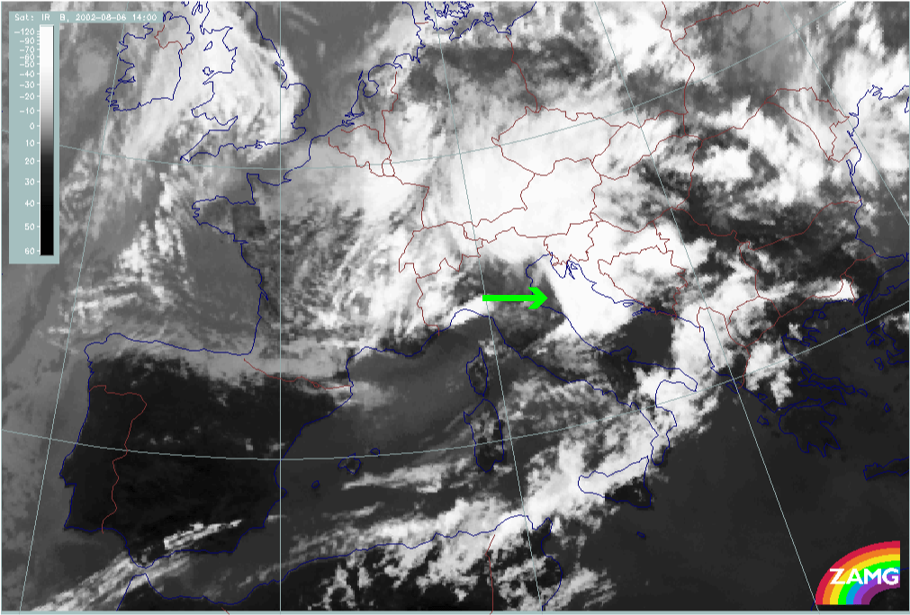
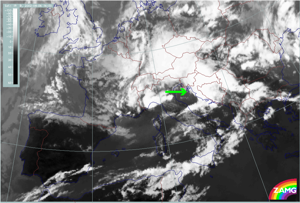
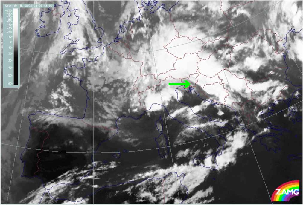
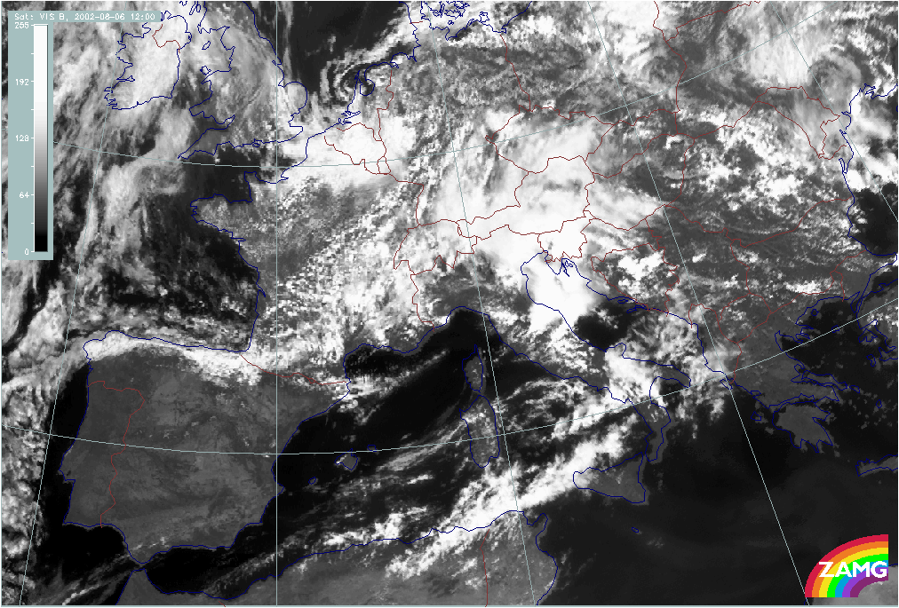
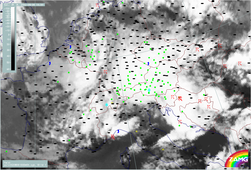
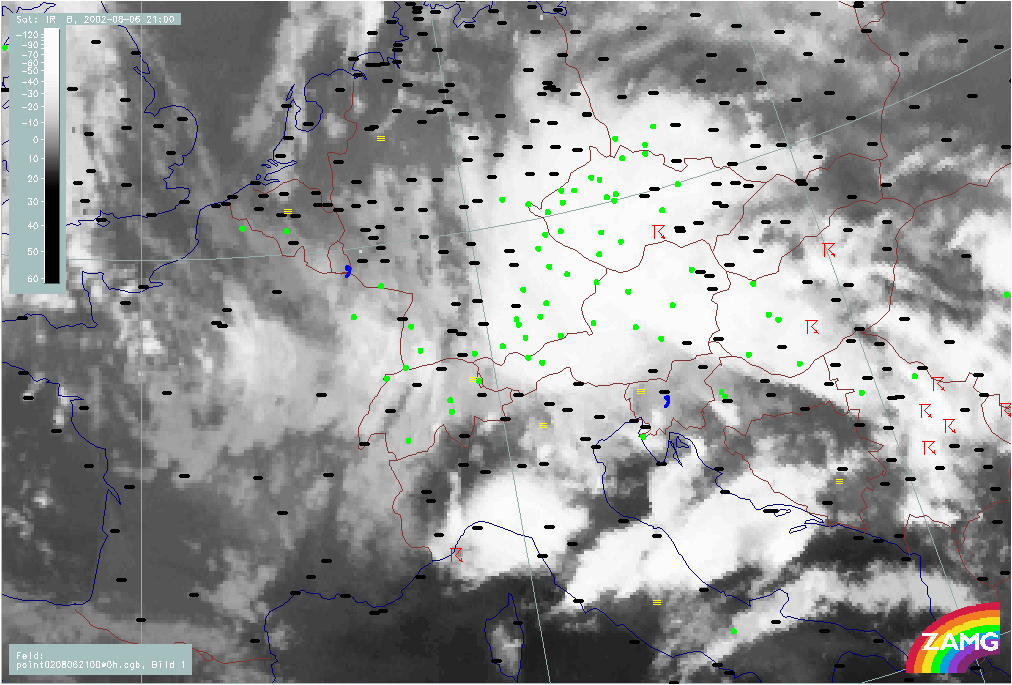
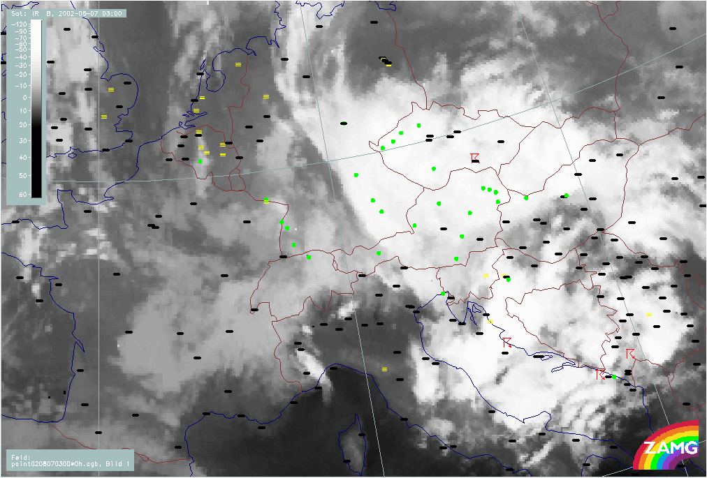
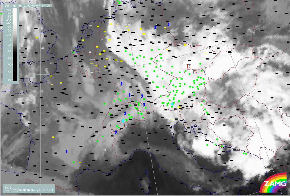
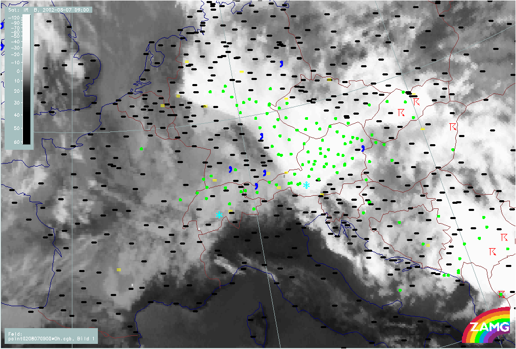
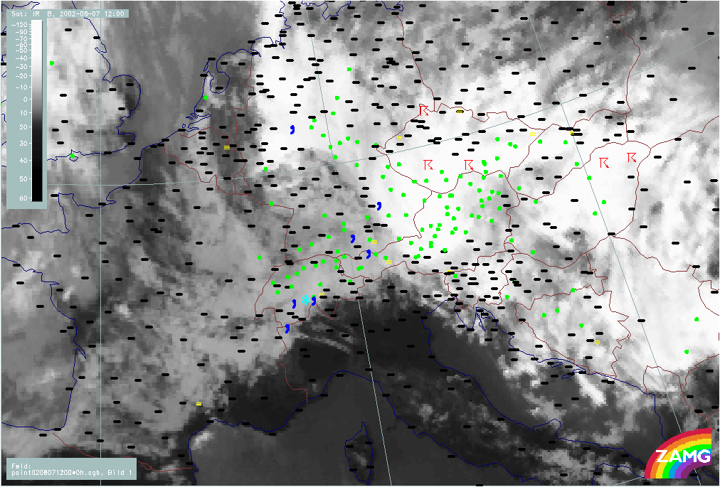
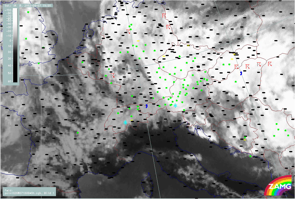
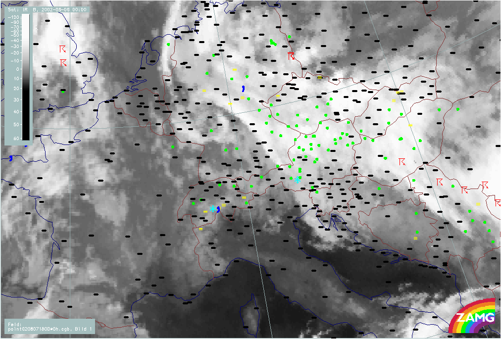
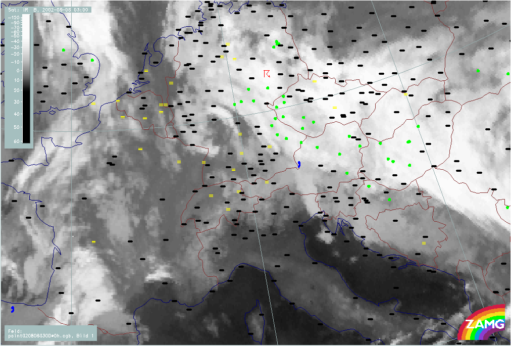
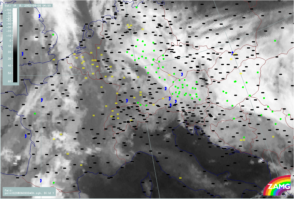
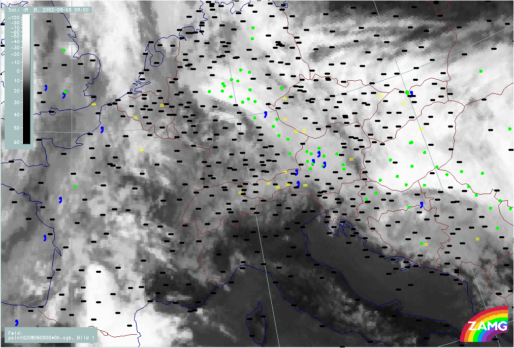
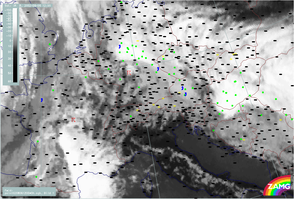
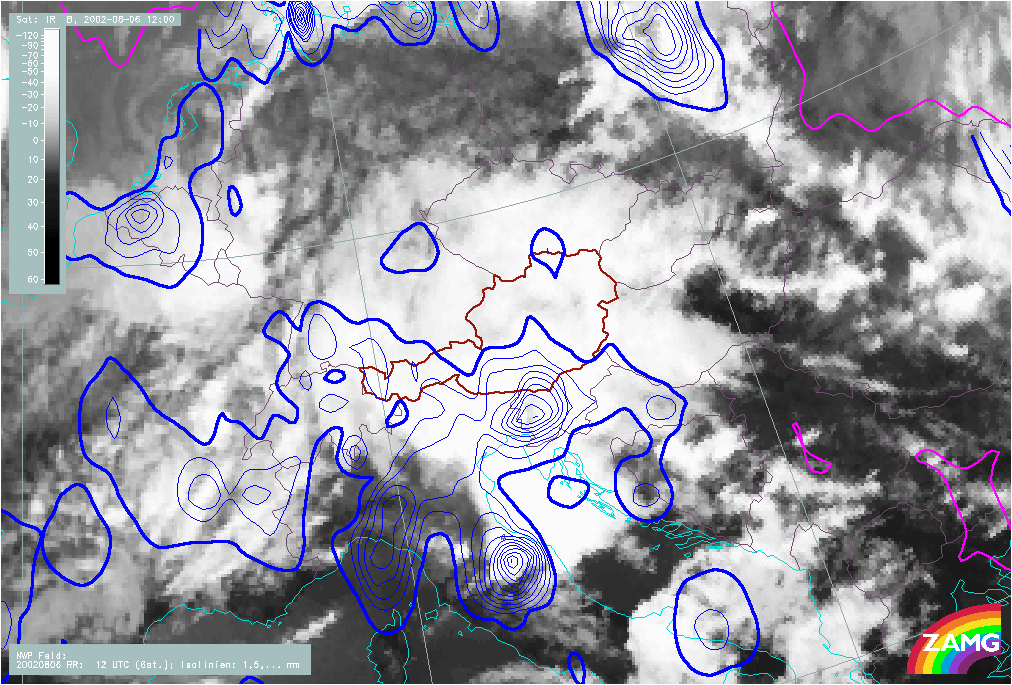
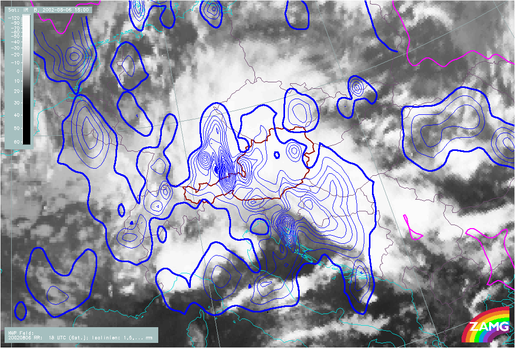
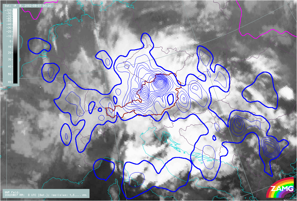
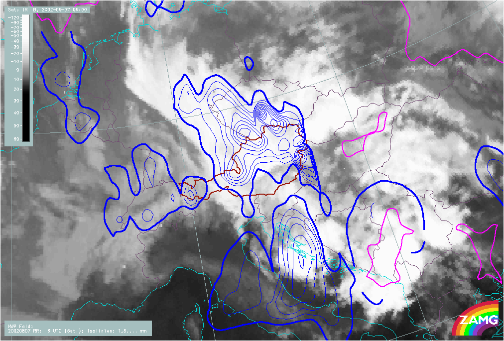
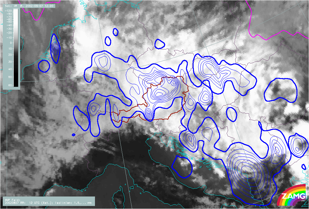
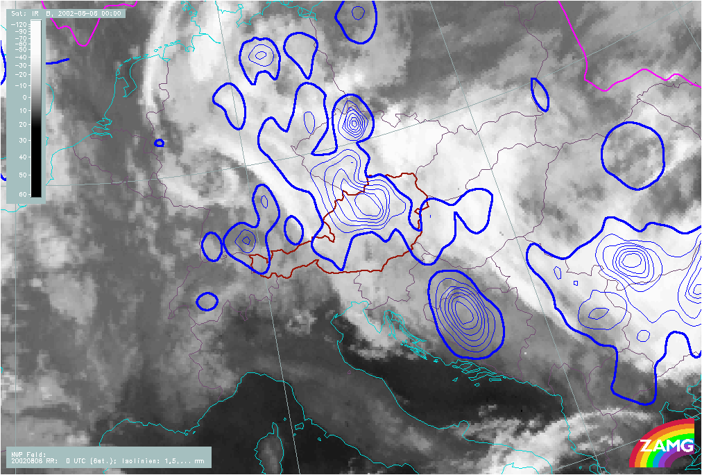
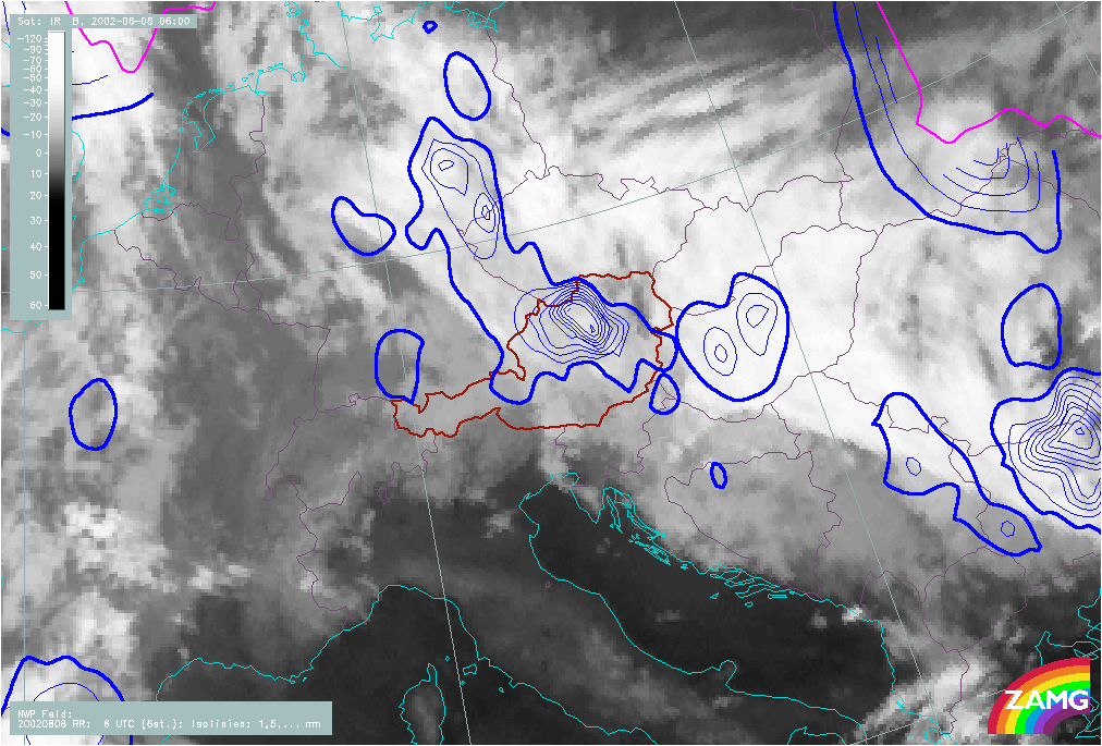
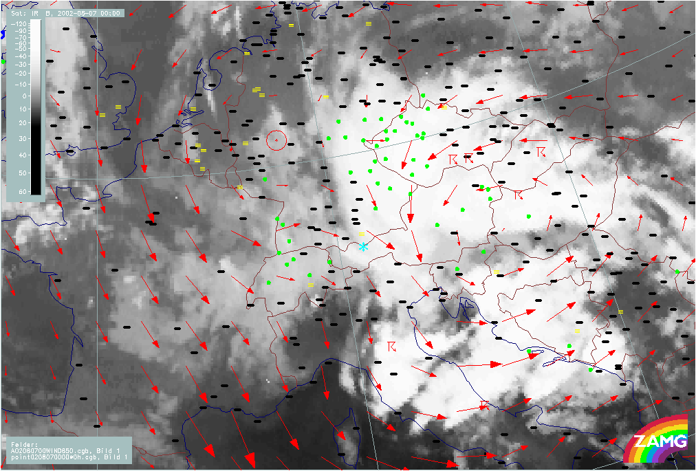
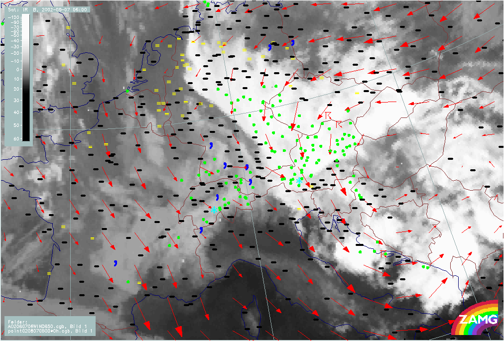
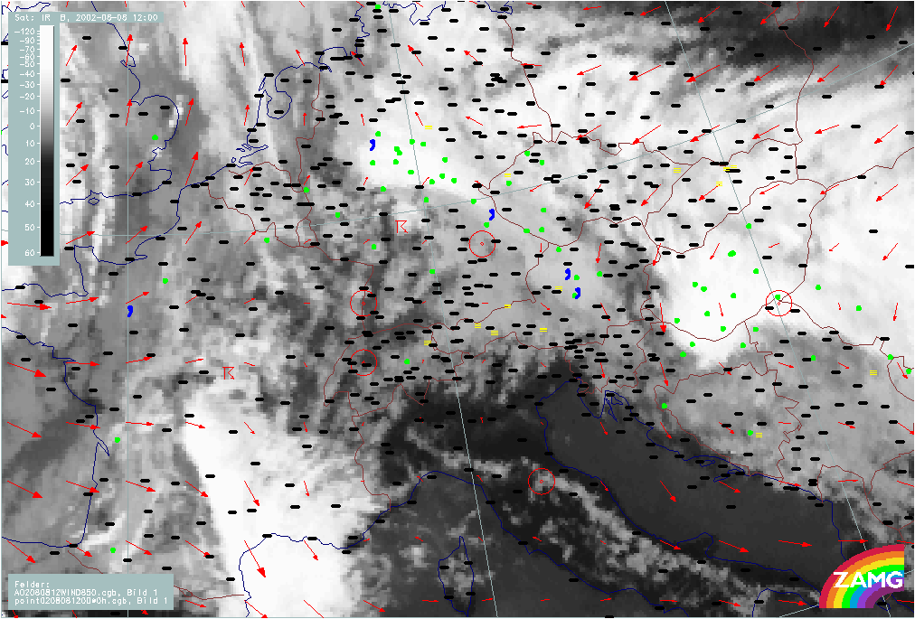
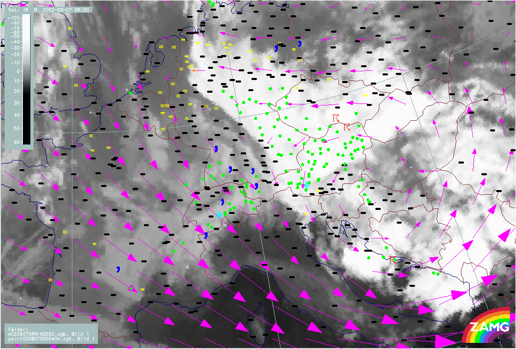
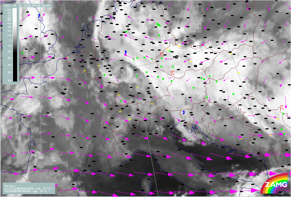
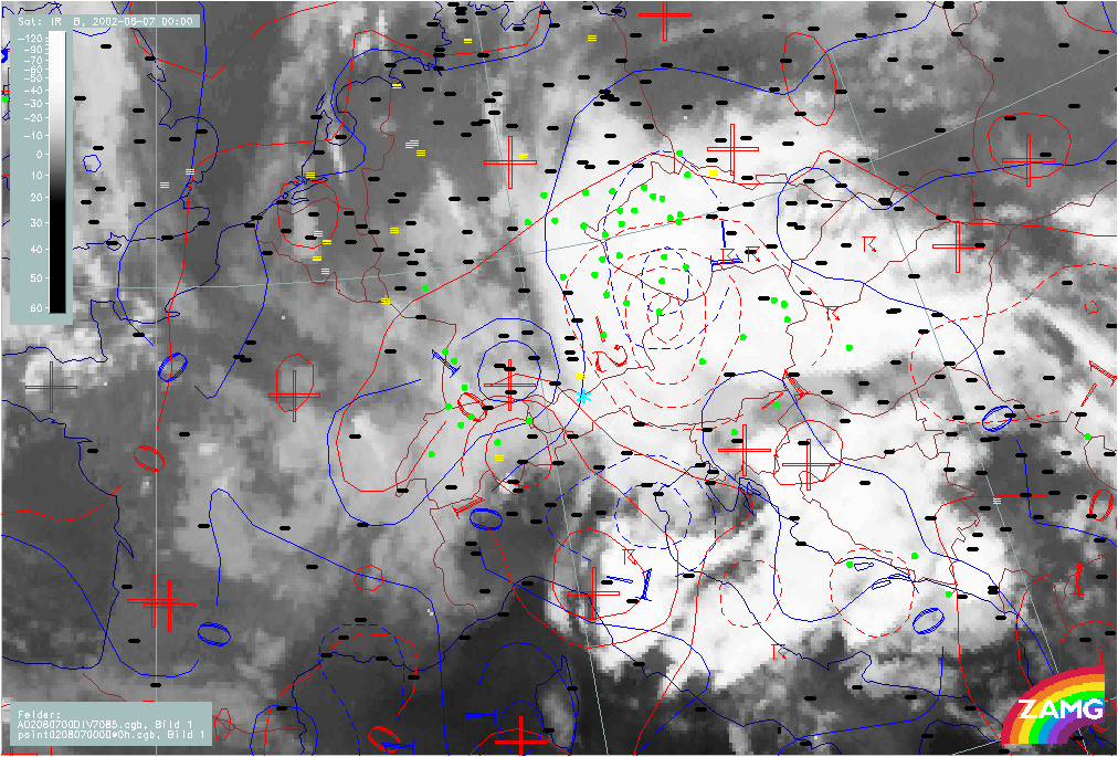
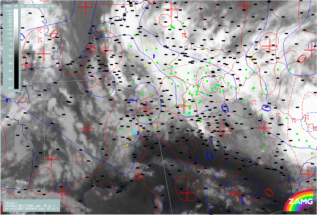
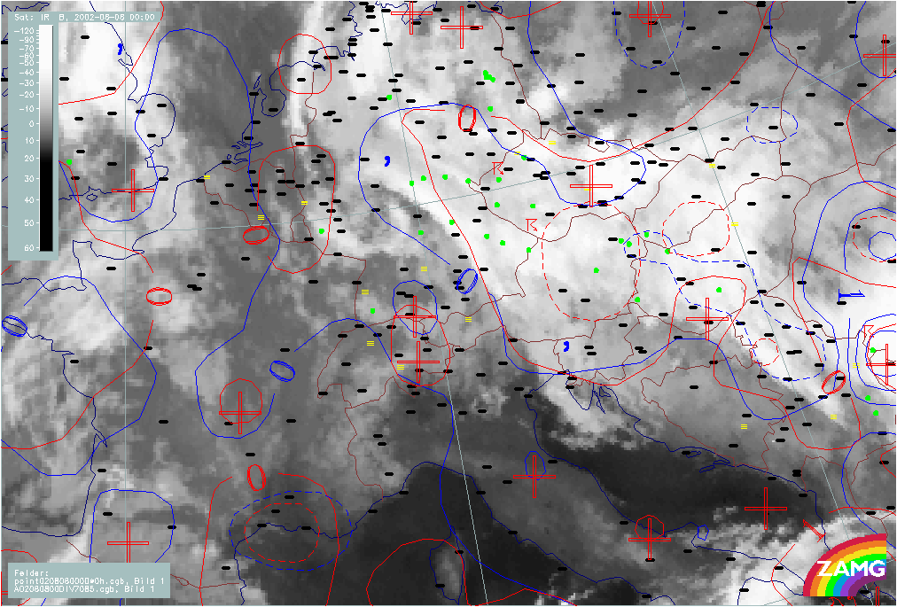
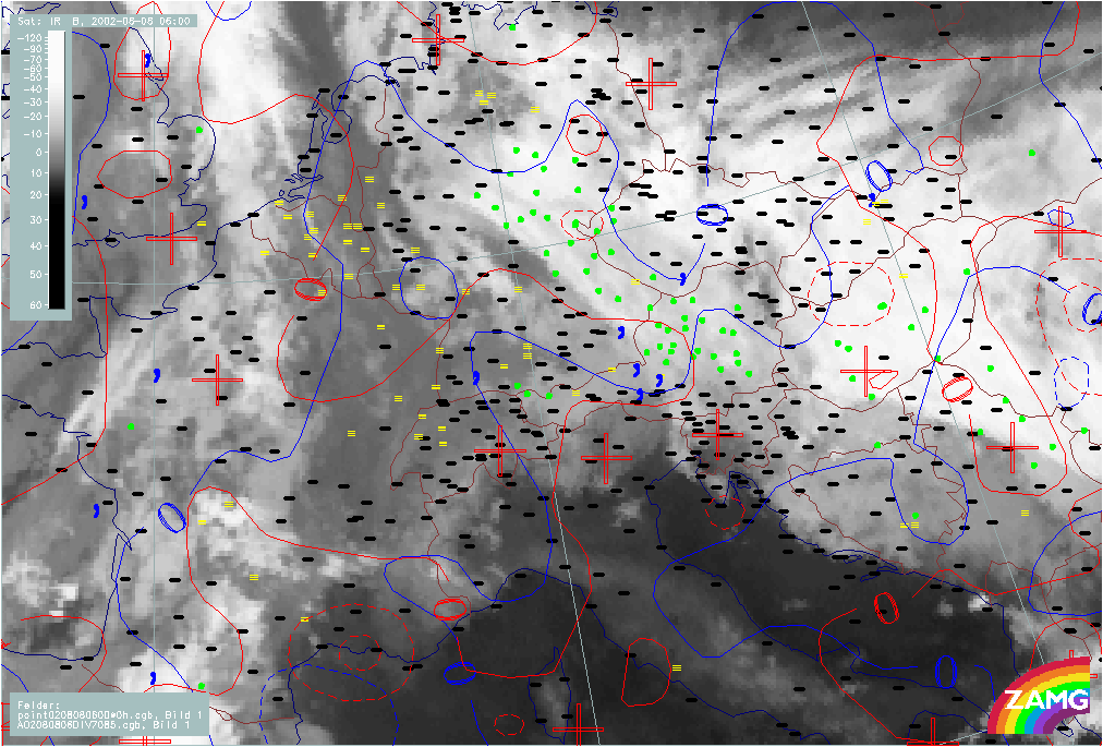
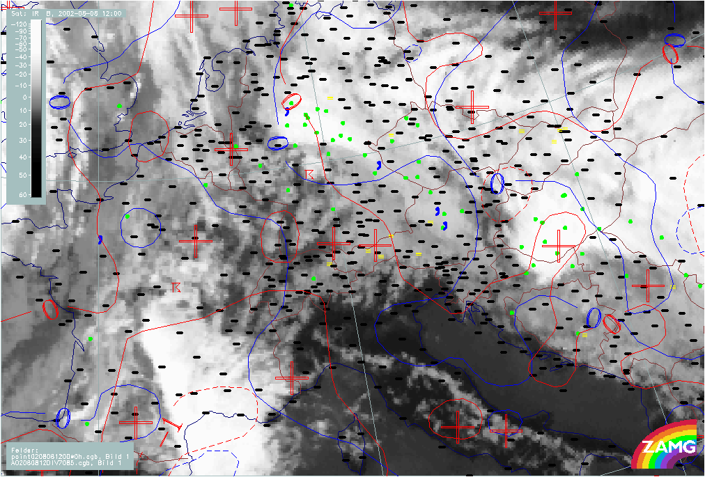
Flood Phase: 07 August 02/00.00 - 08 August 02/12.00 UTC
|
07 August 2002/00.00 UTC - Meteosat IR image; weather events (green: rain and showers, blue: drizzle, cyan: snow, red: thunderstorm
with precipitation, purple: freezing rain, orange: hail, black: no actual precipitation or thunderstorm with precipitation); 07/00.00 -
08/12.00 UTC 3-hourly image Loop
|
|
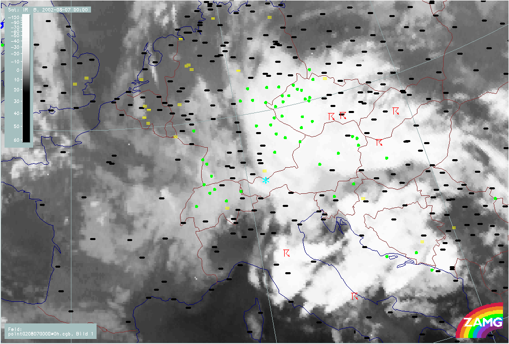
There is extensive precipitation during the whole period in Upper and Lower Austria, in the Czech Republic as well as in E. Germany and Bavaria. Within the Alpine region (especially Austria) from 08/06.00 UTC a slight shift of precipitation to the W (Salzburg and Upper Austria) can be observed.
Thunderstorms develop during whole period but they mainly form in specific areas of the occluded cloud spiral:
- In the S: Italy and (later) Bosnia
- To the NE in Czech Republic
- And later: in Germany in the area of the old main ULL
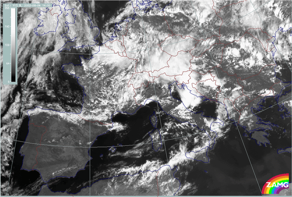
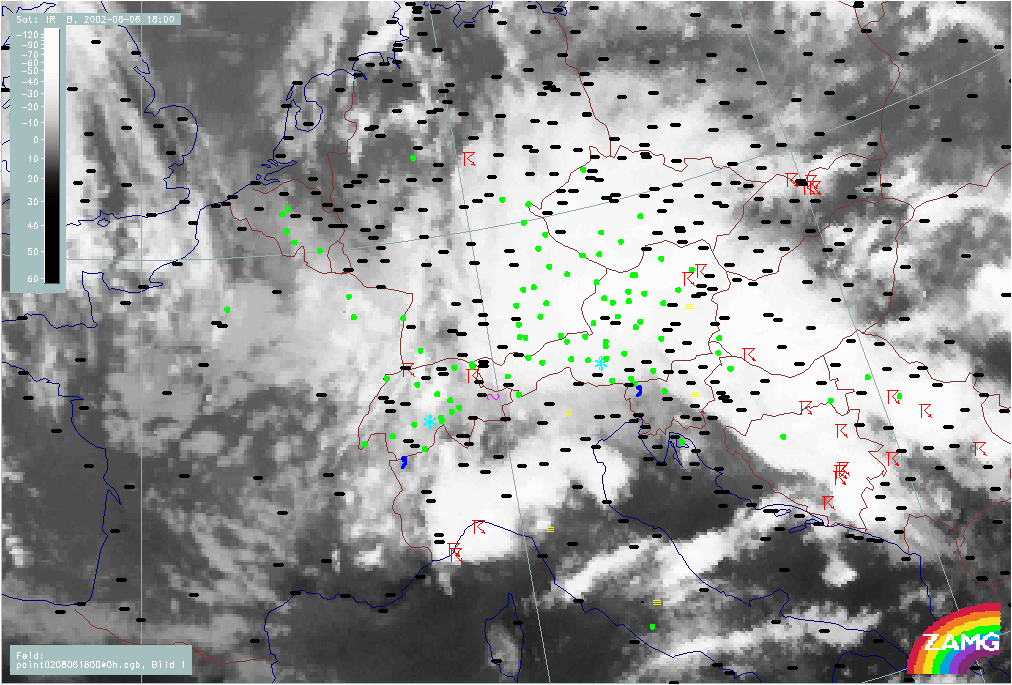
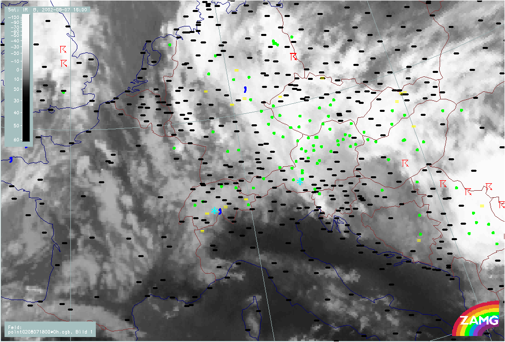
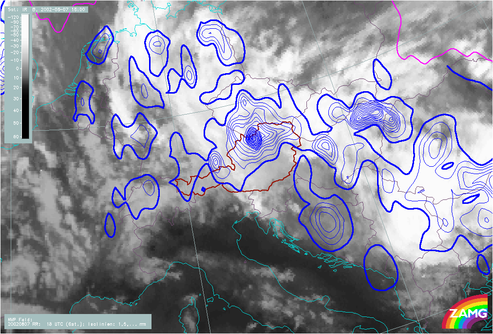
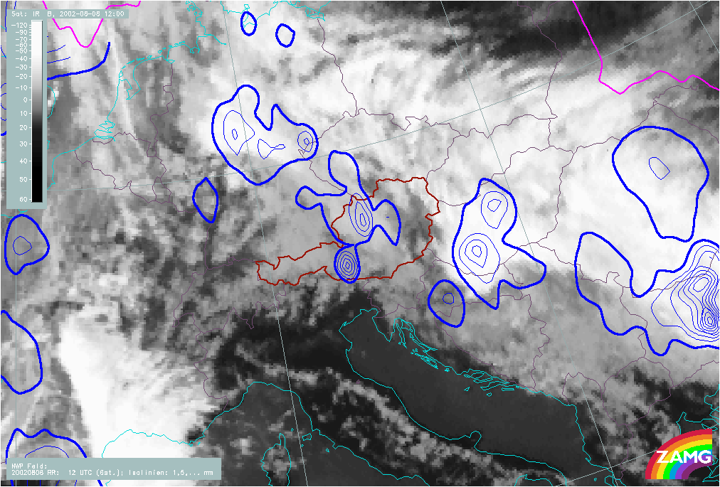
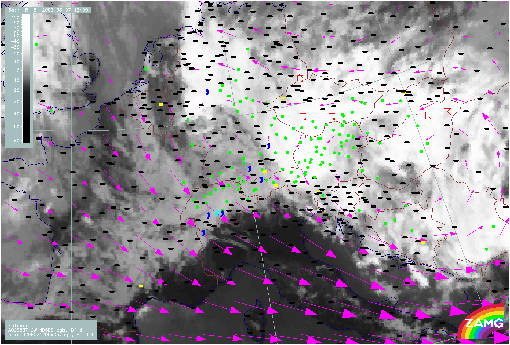
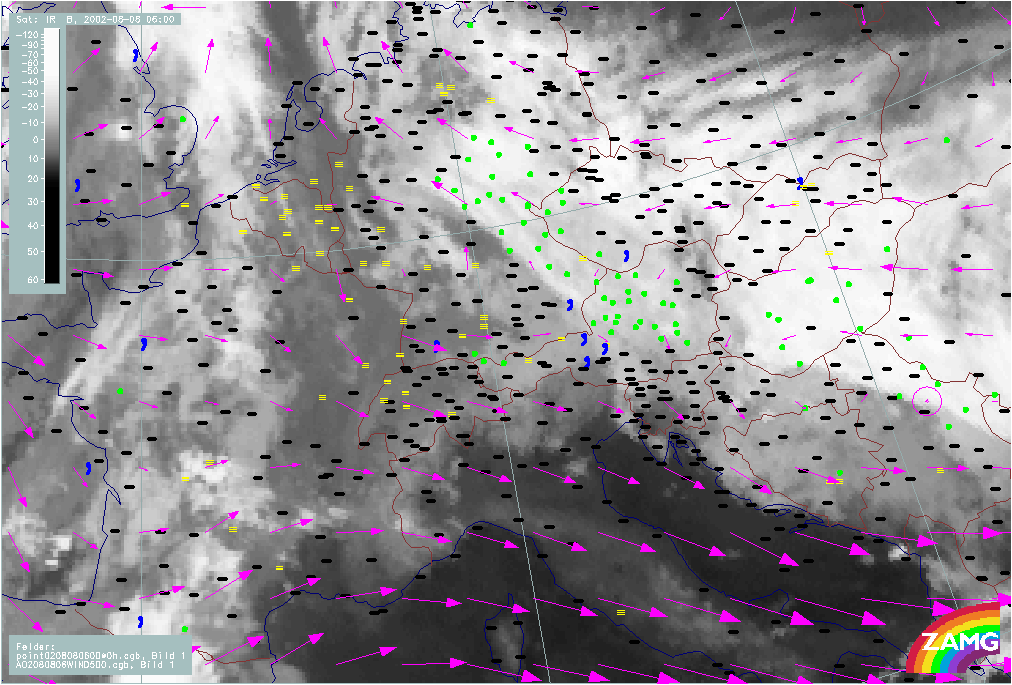
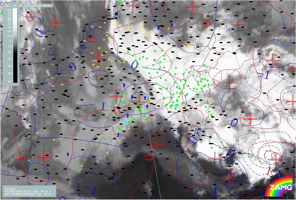
Precipitation amounts in pre-flood and flood phase
|
07 August 2002/00.00 UTC - Meteosat IR image; weather events (green: rain and showers, blue: drizzle, cyan: snow, red: thunderstorm
with precipitation, purple: freezing rain, orange: hail, black: no actual precipitation or thunderstorm with precipitation); 06/06.00 -
08/12.00 UTC 6-hourly image Loop
|
|
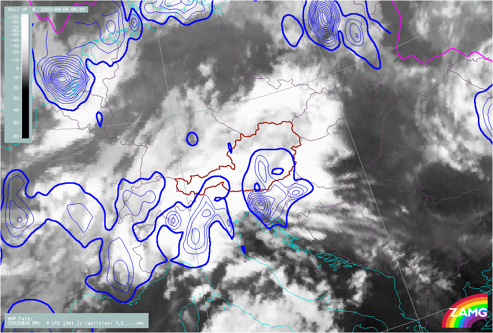
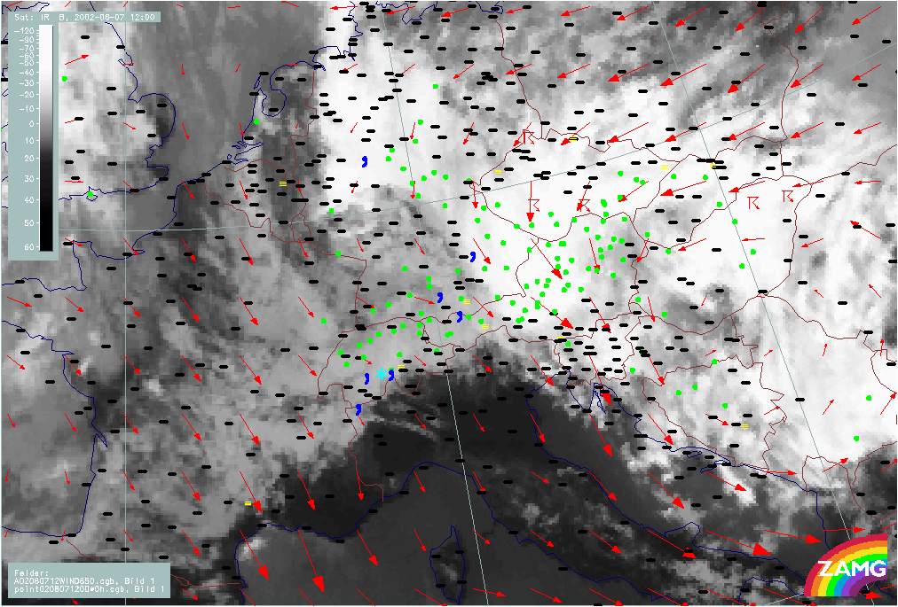
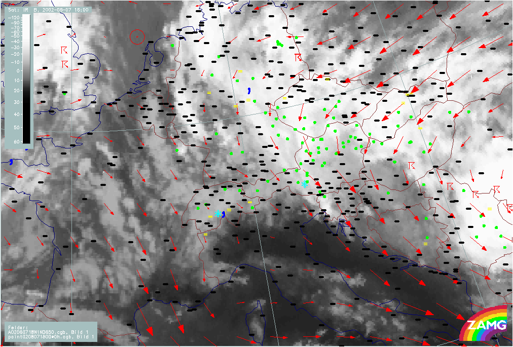
In the pre-flood phase of 06 August, till about 12.00 UTC, the precipitation is limited to N. Italy and S. Austria; then suddenly very intensive precipitation amounts appear north of the Alps which have their peak at 18.00 UTC in W. Austria (Tyrol) and Bavaria. From then on precipitation amounts move to eastern parts of Austria (Salzburg, Upper and especially Lower Austria). During this phase precipitation also appears in the eastern parts of Bavaria. From 07 August 12.00 UTC till 08 August 06.00 UTC there are also remarkable amounts of precipitation in Hungary and Slovakia.
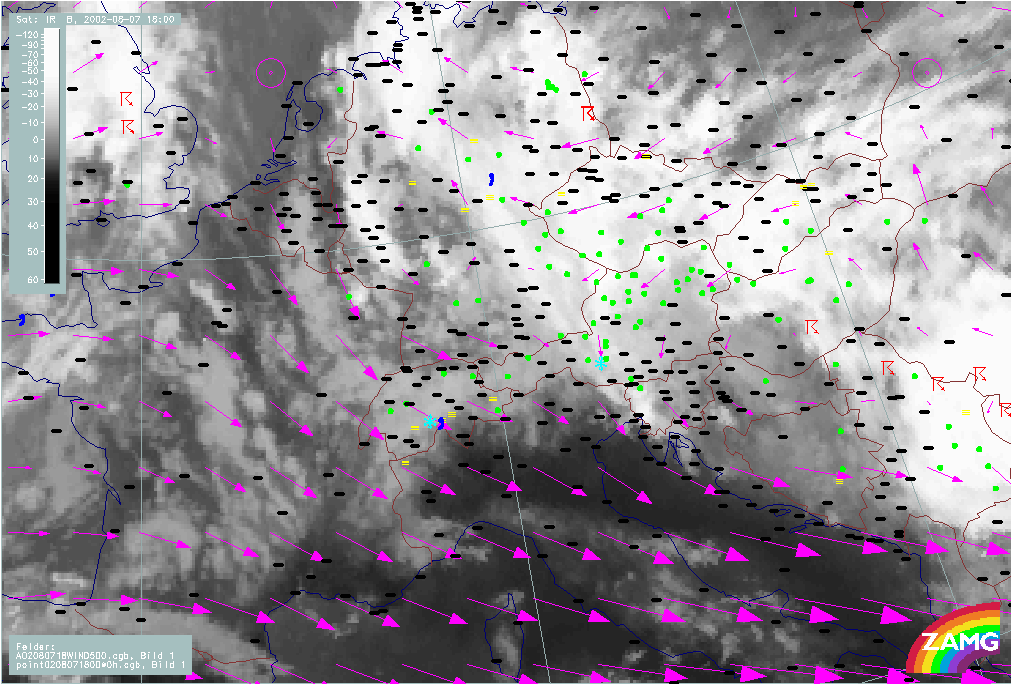
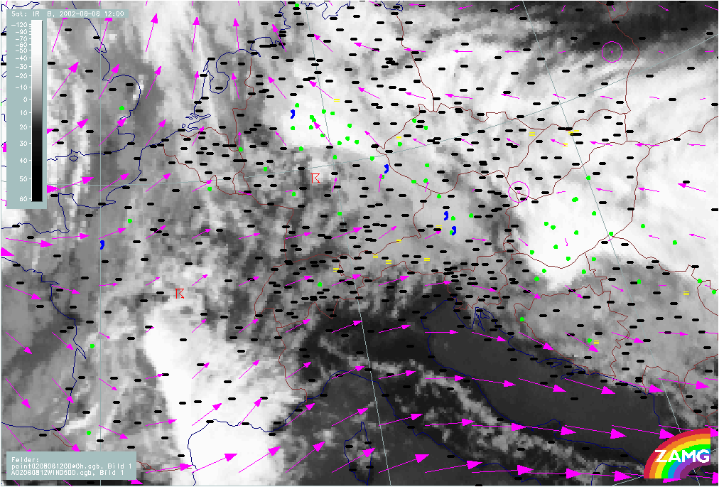
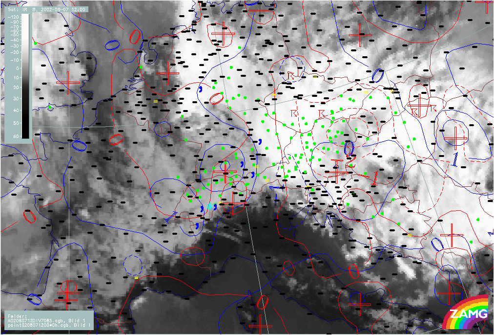
Relationship of precipitation with relevant parameters
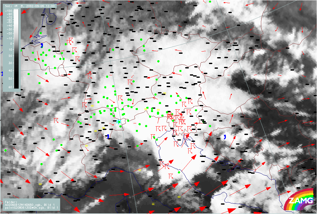
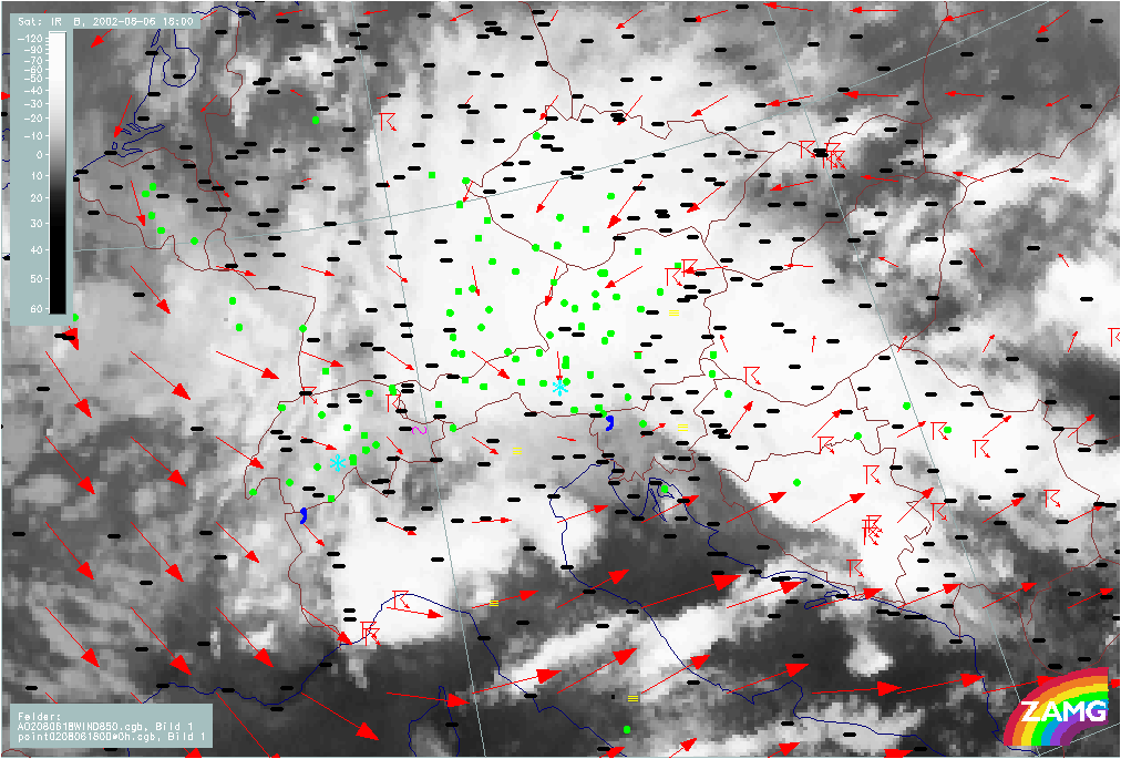
The loops below show the relationship of weather events with relevant numerical parameters, such as wind fields and convergence. The first clearly demonstrates the enhancement of weather activity by Stau effects, the latter show the dramatic effect of convergence, with an intensity and duration seldom seen in other cases.
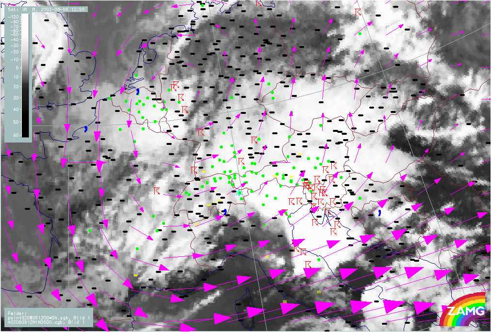
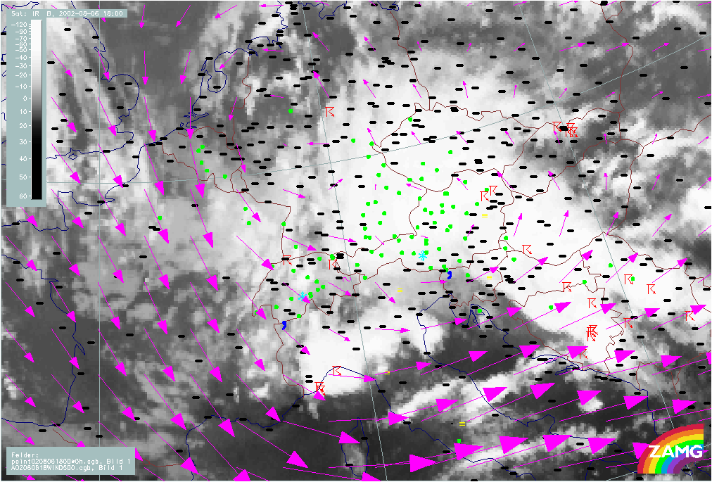
Wind fields at 850 and 500 hPa
|
06 August 2002/06.00 UTC - Meteosat IR image; weather events (green: rain and showers, blue: drizzle, cyan: snow, red: thunderstorm
with precipitation, purple: freezing rain, orange: hail, black: no actual precipitation or thunderstorm with precipitation); red: wind
vectors at 850 hPa; 06/06.00 - 08/12.00 UTC; 6-hourly image Loop
|
|
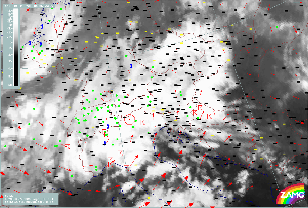
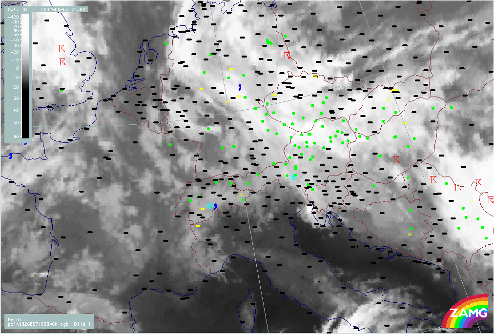
At 850 hPa a closed cyclonic circulation can be observed from 06 August 06.00 UTC which leads to remarkable Stau effects over the northern boundary of the Alpine mountain massif, and later, over the mountains in Slovakia and Czech Republic. The intense rain events in the western Alpine region and over Bavaria are in accordance with this airflow.
During the period under discussion the centre of the cyclonic rotation moves from SE Austria and W. Hungary to the east across N. Croatia and Jugoslavia to Romania. Consequently the whole area of the Czech Republic and N,NE Austria is under a N to NE stream which produces the Stau effects over the Czech and Alpine mountains.
|
06 August 2002/06.00 UTC - Meteosat IR image; weather events (green: rain and showers, blue: drizzle, cyan: snow, red: thunderstorm
with precipitation, purple: freezing rain, orange: hail, black: no actual precipitation or thunderstorm with precipitation); magenta:
wind vectors at 500 hPa; 06/06.00 - 08/12.00 UTC; 6-hourly image Loop
|
|
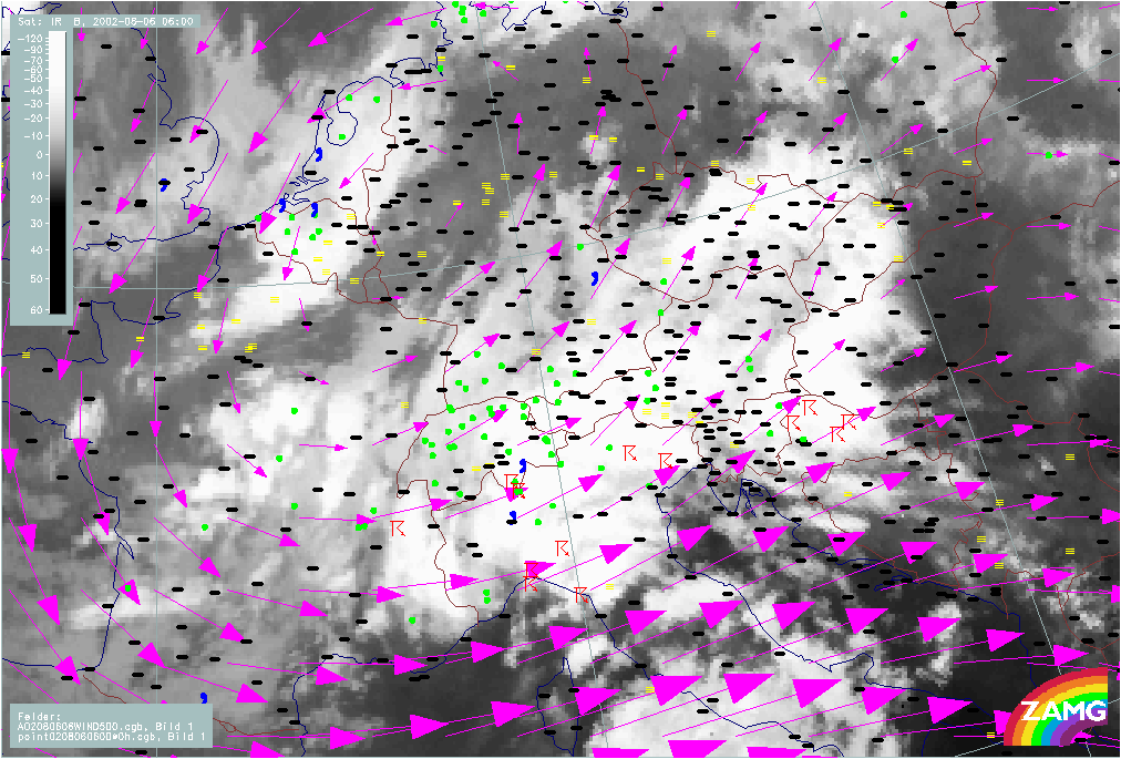
From 06 August 06.00 UTC a closed circulation at 500 hPa can be observed which creates intense Stau effects. The eddy at 500 hPa moves from S. Austria and Slovenia to S. Hungary and then to the SE. Consequently, the Czech Republic and N, NE Austria come under the influence of an E to SE stream which turns to a N, NE stream over Austria from 07/12.00 UTC.
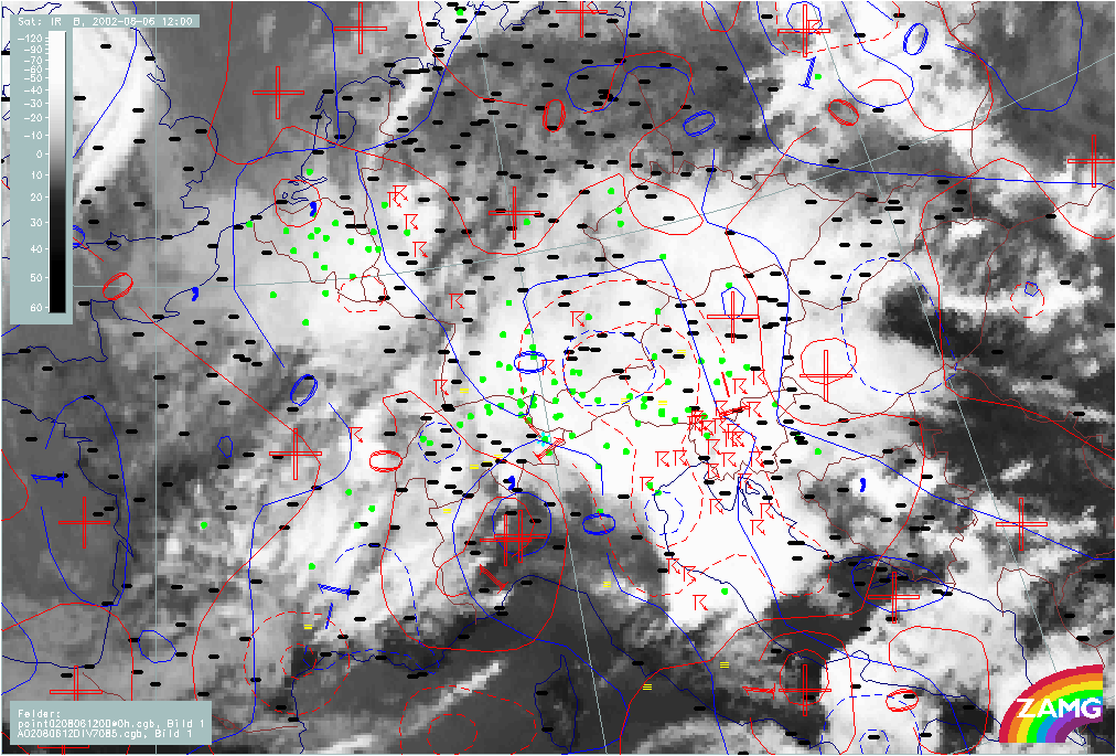
Fields of Divergence at 850 and 700 hPa
|
06 August 2002/06.00 UTC - Meteosat IR image; weather events (green: rain and showers, blue: drizzle, cyan: snow, red: thunderstorm
with precipitation, purple: freezing rain, orange: hail, black: no actual precipitation or thunderstorm with precipitation); blue:
thermal front parameter 500/850 hPa; red: divergence 850 hPa (red dashed: convergence); blue: divergence 700 hPa (blue dashed:
convergence); 06/06.00 - 08/12.00 UTC; 6-hourly image Loop
|
|
From 06 August 12.00 UTC, intense convergence develops over Austria. These areas of remarkable convergence are associated with the area of intense rainfall. A maximum value of convergence over Czech Republic and Austria can be observed at 07 August 00.00 UTC. From 07/12.00 to 08/00.00 UTC convergence at 850 hPa is still very intense over the same area, while from 08/00.00 UTC, a convergence max at 700 hPa moves to and remains over Hungary.
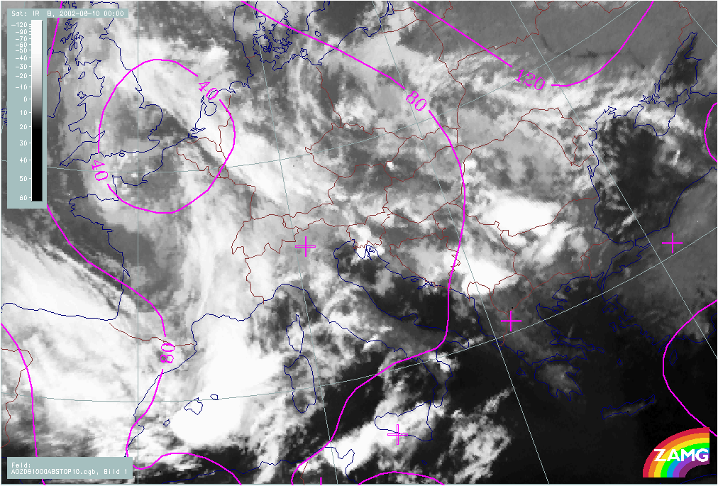
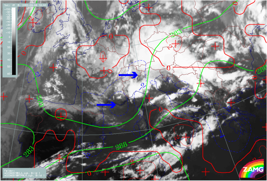
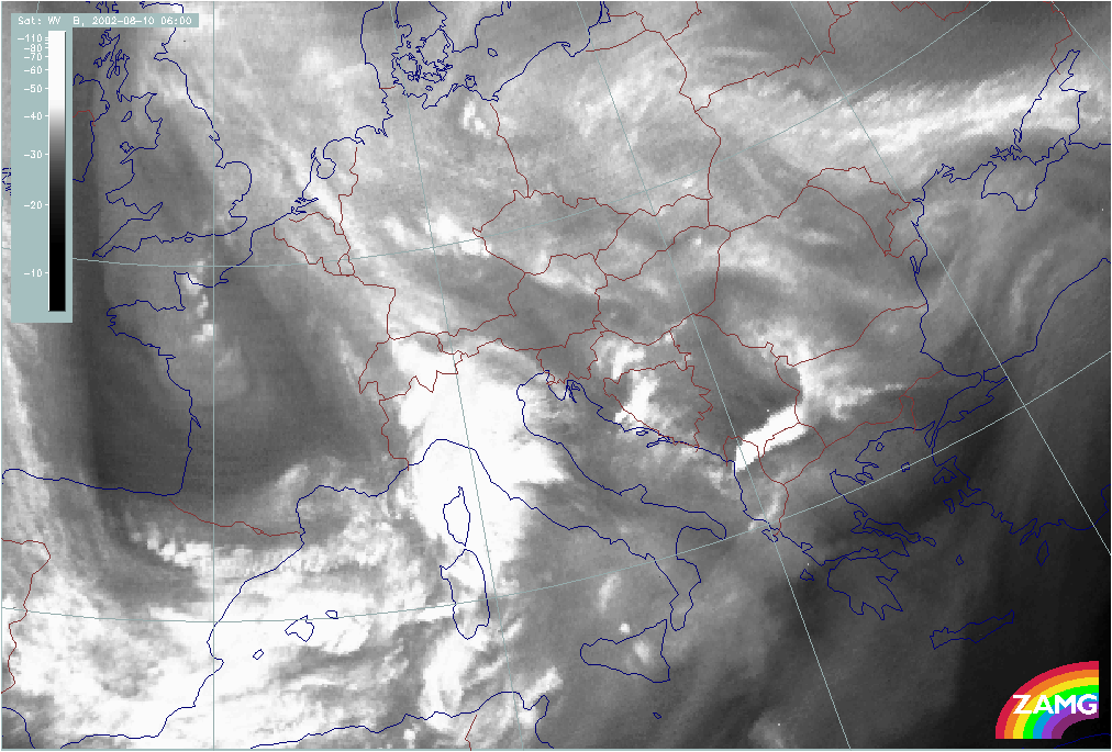
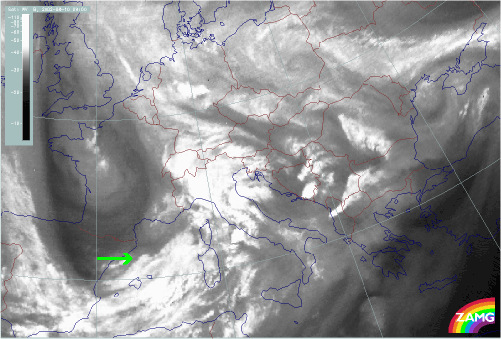
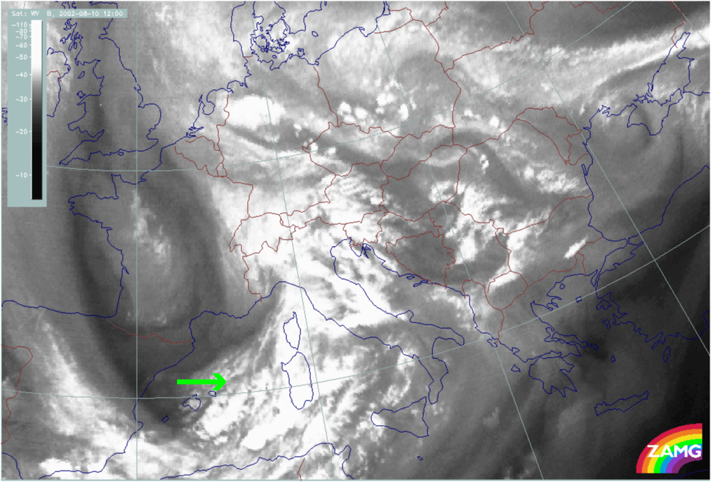
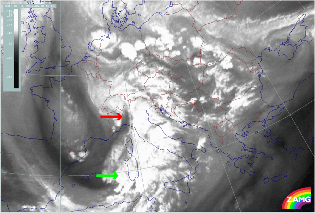
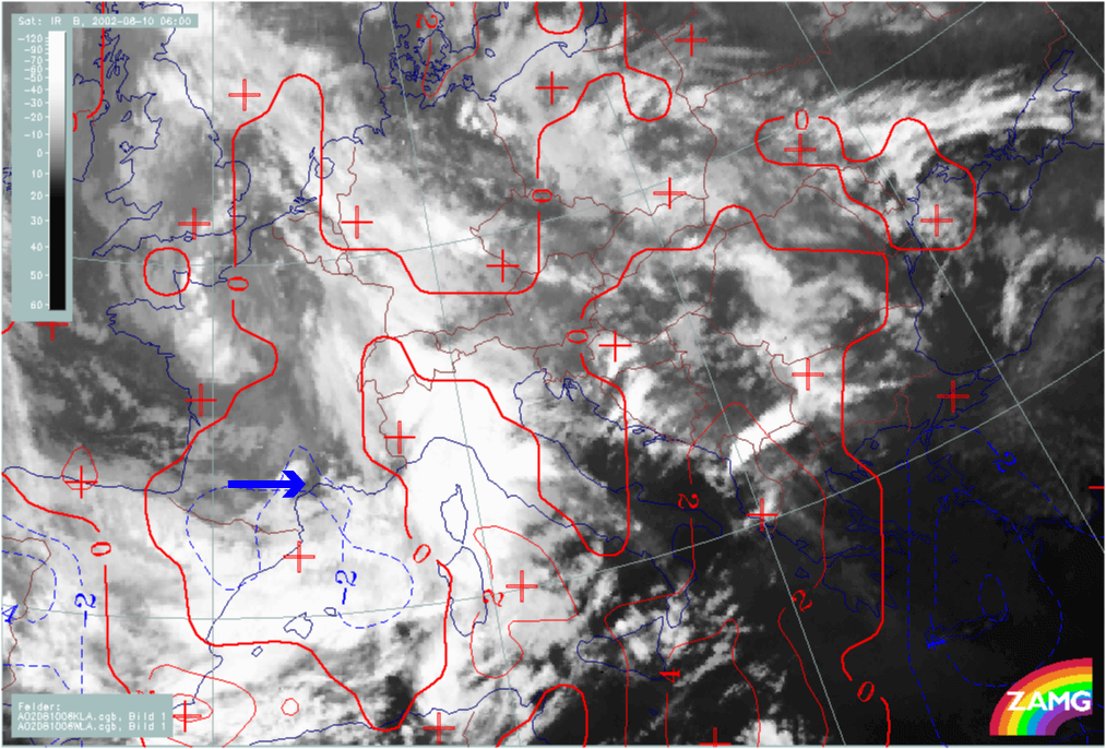
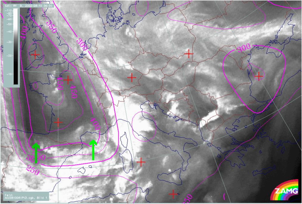
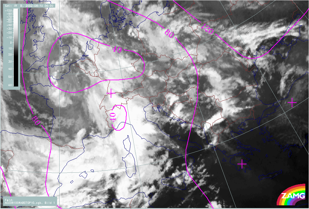
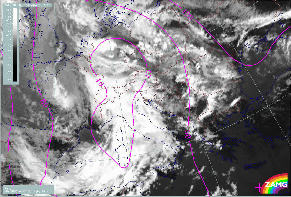
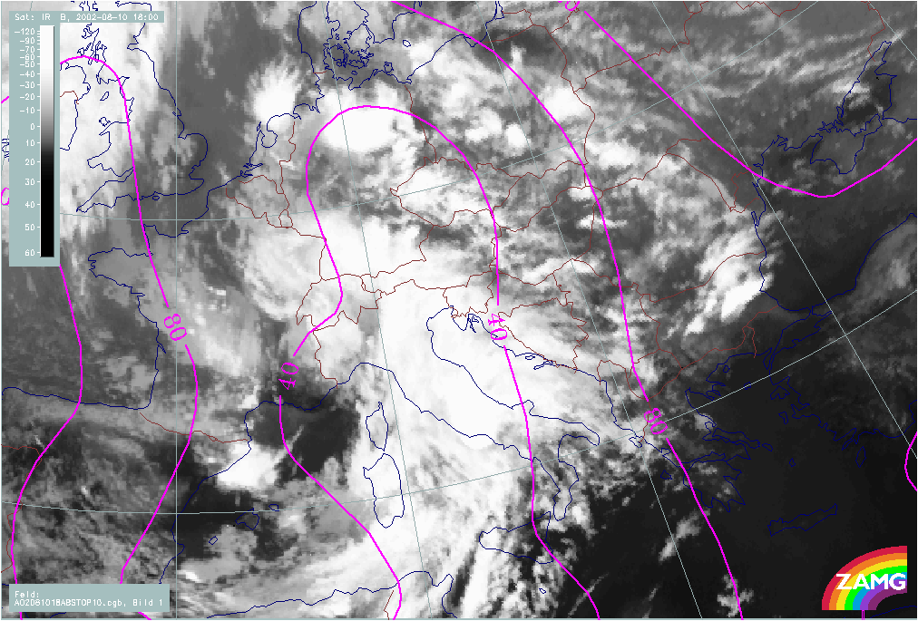
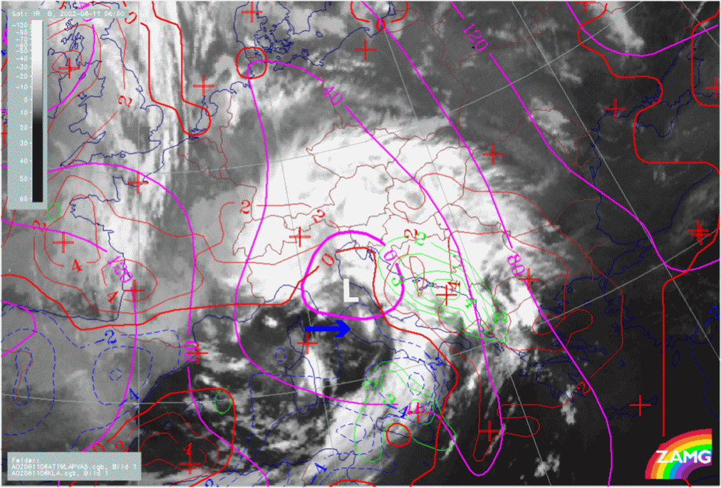
Initial Weather Situation: Intrusion of cold air into the western Mediterranean
Cloud systems in the initial weather situation
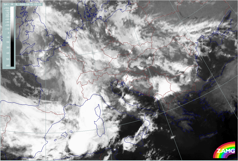
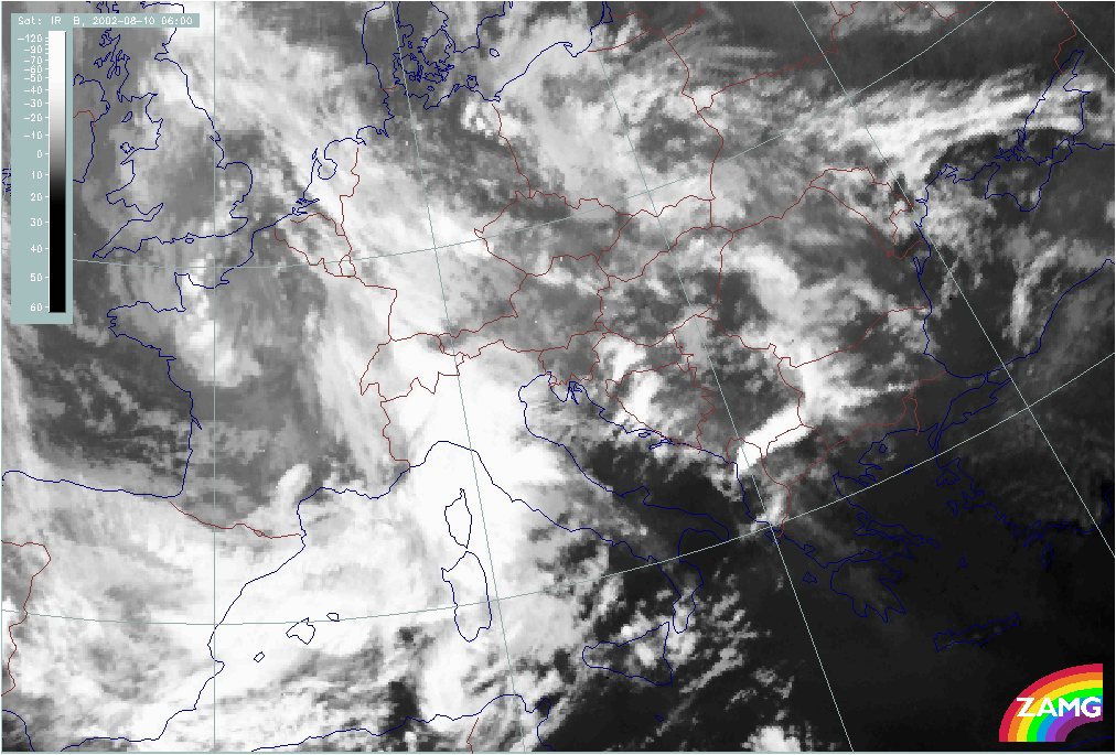
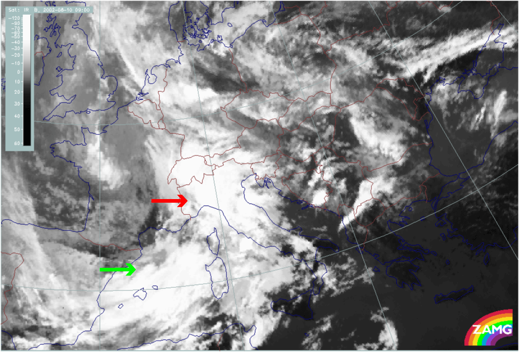
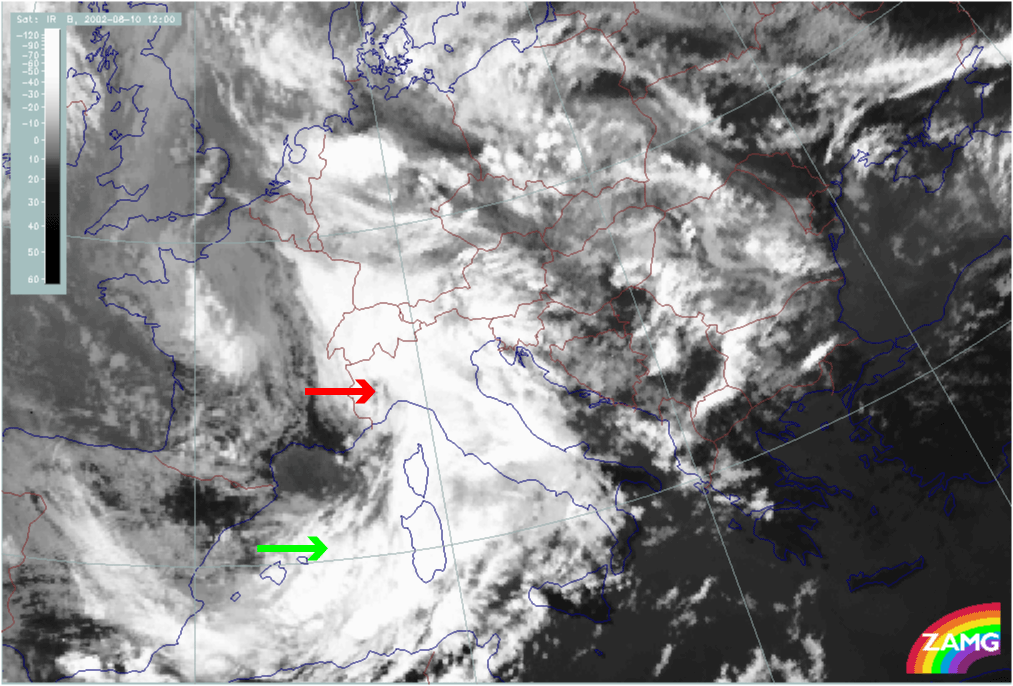
The change from the initial situation to the second flood situation can be seen in the sequence of satellite images below (IR, WV and VIS) for the 10th of August. Several processes of meso-scale Wave development and cloud enhancement are involved in the whole process.
|
10 August 2002/00.00 UTC - Meteosat IR image; 00.00 - 21.00 UTC 3-hourly image Loop
|
|
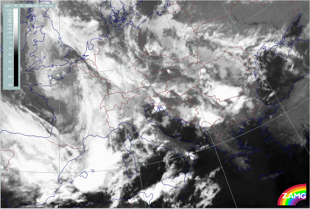
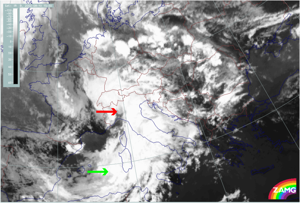
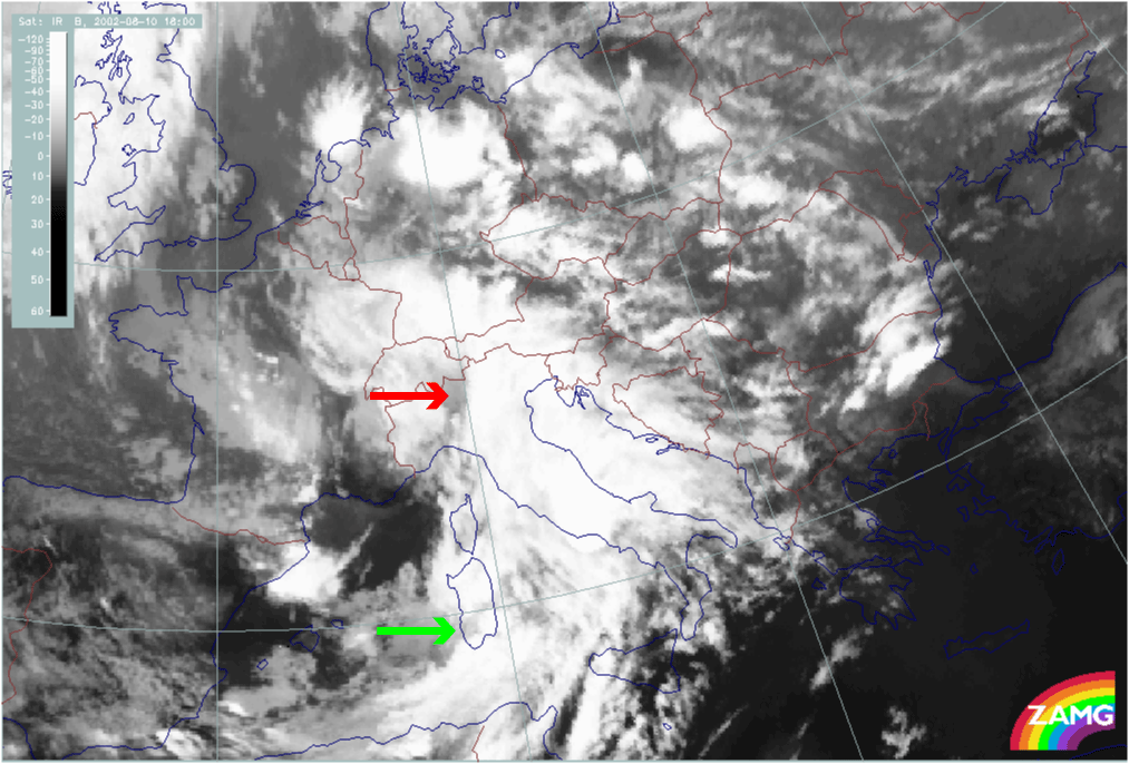
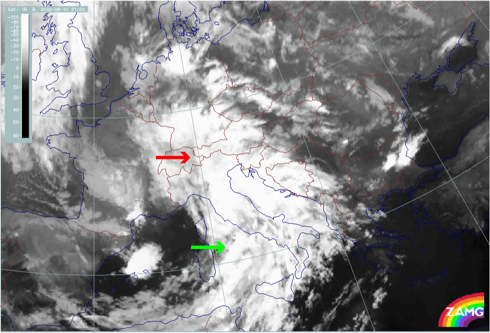
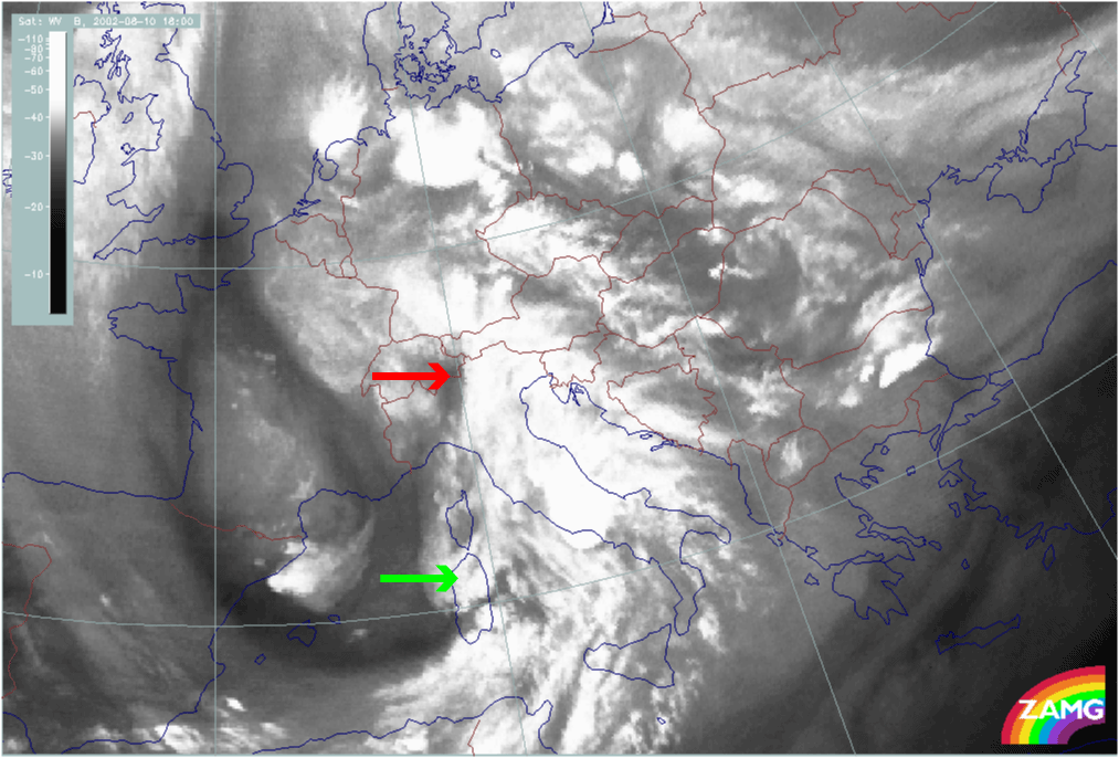
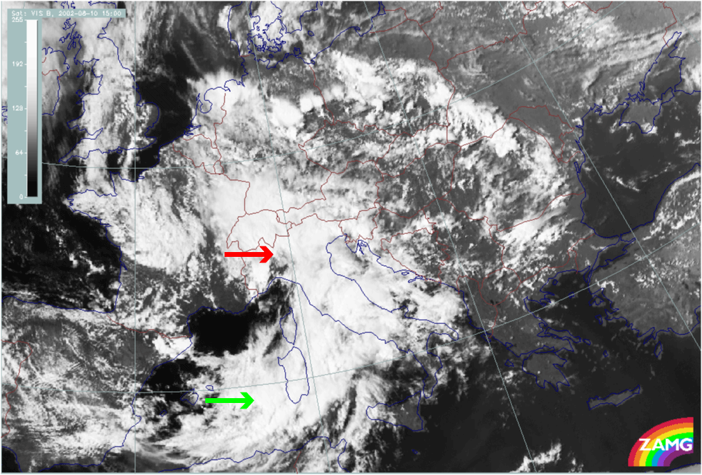
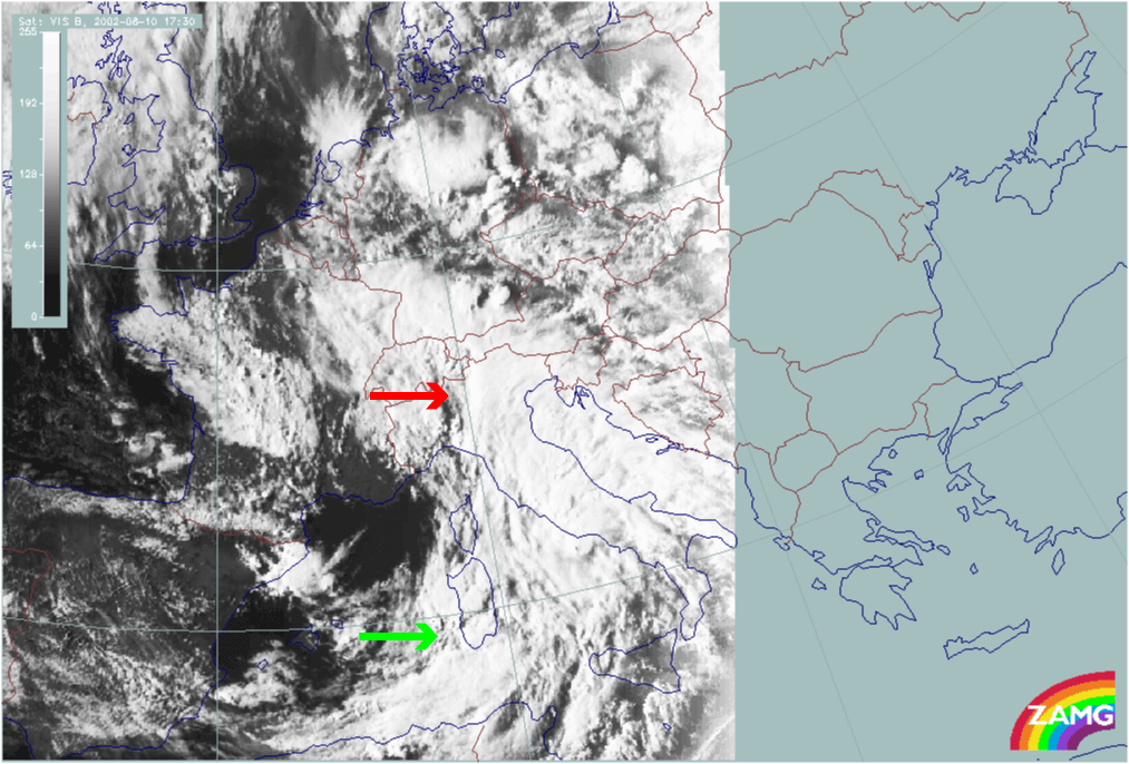
The sequence of IR satellite images shows the development of two spirals:
- A spiral structure over the W. Alps and NW Italy, best seen at 15.00 UTC; from then on the spiral decays;
- A spiral forms later over Sardinia, best seen between 18.00 and 21.00 UTC.
|
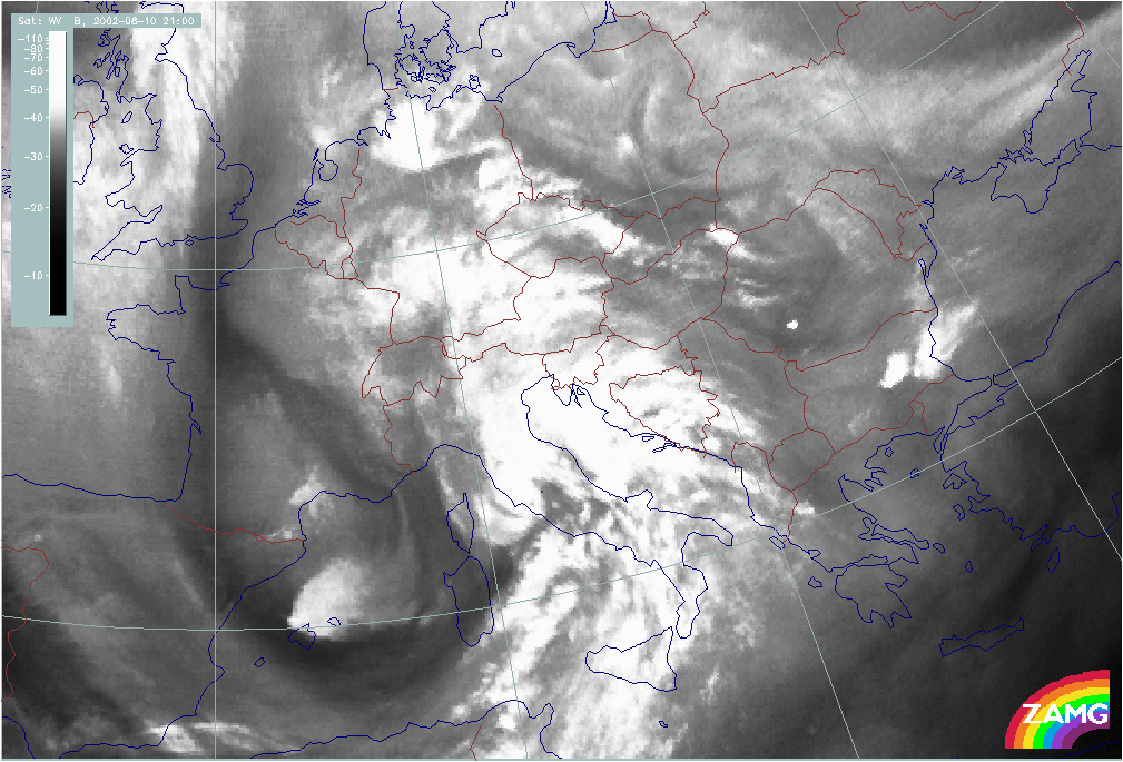
10 August 2002/00.00 UTC - Meteosat WV image; 00.00 - 21.00 UTC 3-hourly image Loop
|
|
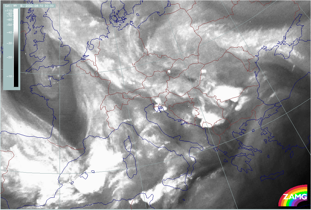
In the WV imagery, the above mentioned cloud spirals show up quite well, each associated with Dark Stripes protruding downstream:
- The main intrusion of dry air (black in WV) is into the NW Mediterranean (Gulf of Lyon); for this development the spiral structure is not as distinct in the WV as it is in the IR image; the dark area is best seen at 15.00 UTC.
- The second area of dry air (Dark Stripe) moves from the Gulf of Biscay across N. Spain and the Balearic Islands to Sardinia; for this development the spiral is very clear, even in the WV image (best between 18.00 - 21.00 UTC)
|
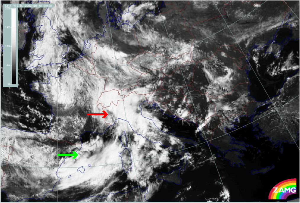
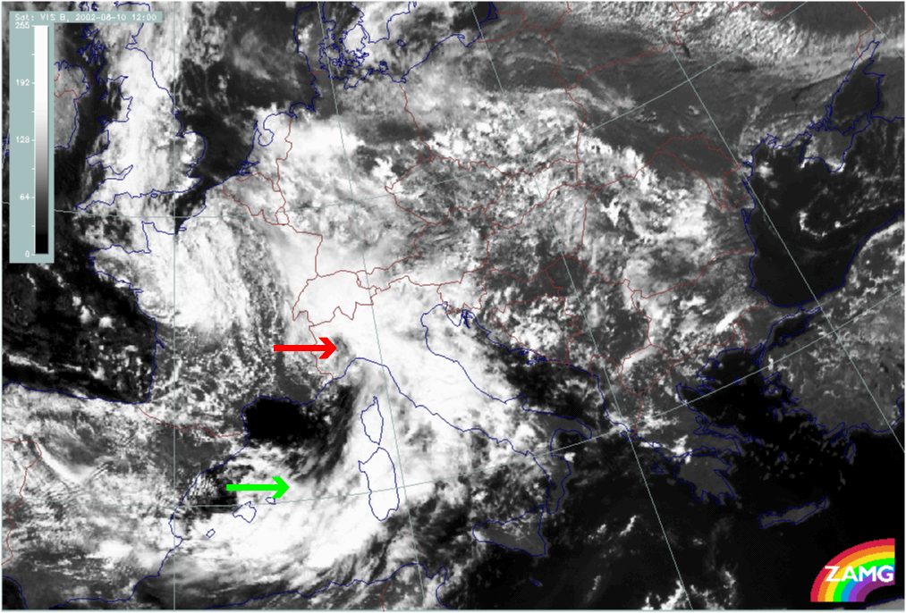
10 August 2002/06.00 UTC - Meteosat VIS image; 06.00 - 17.30 UTC 3-hourly image Loop
|
|
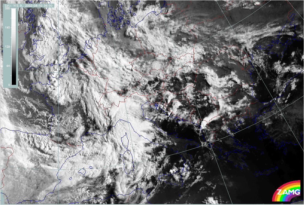
Both developing spirals can also be seen in the VIS imagery:
- The spiral structure over NW Italy is very visible in the VIS images from 12.00 UTC;
- The second spiral over Sardinia starts with a broadening area west of Sardinia at 12.00 UTC and develops into a distinct spiral at 18.00 UTC.
Initial weather situation: relevant numerical parameters
The loops of relevant numerical parameters, such as frontal and upper level parameters, help to clarify the initial situation on the 10th of August. The different meso-scale processes of Wave development and cloud enhancement seen in the satellite imagery can also be identified in the model fields below.
|
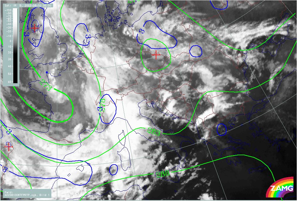
10 August 2002/00.00 UTC - Meteosat IR image; blue: thermal front parameter (TFP) 500/850 hPa, green: equivalent thickness 500/850 hPa;
00.00 - 18.00 UTC 6-hourly image Loop
|
|
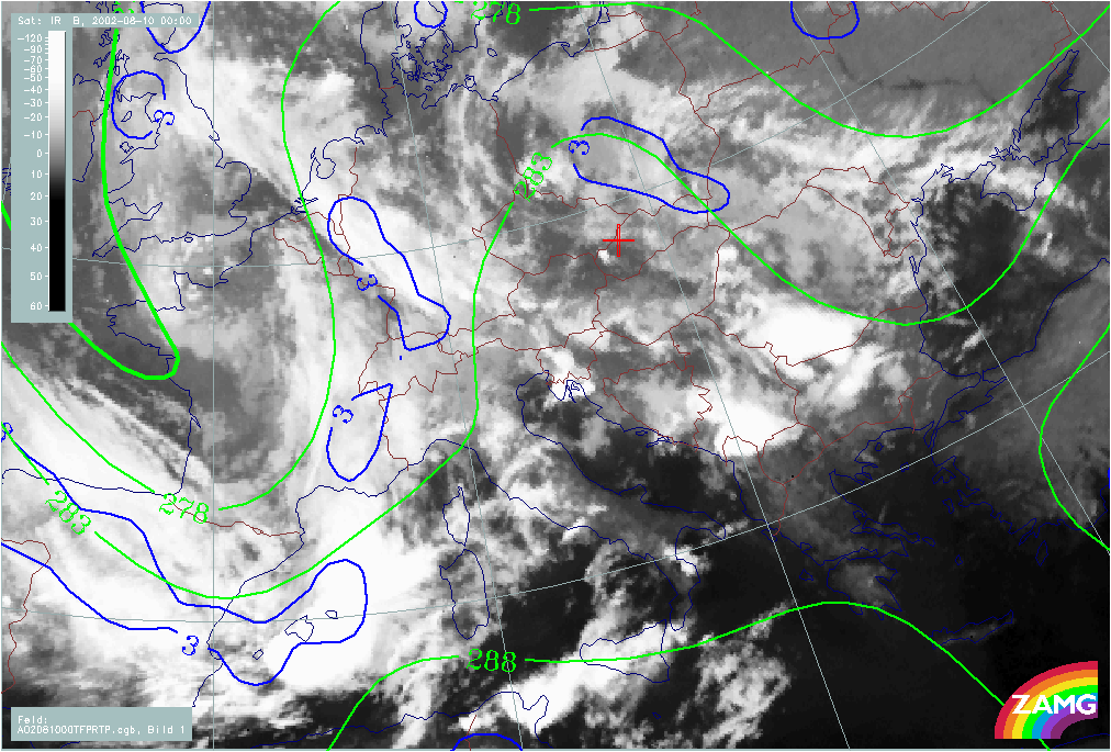
The frontal conditions represented by thickness and the TFP are well developed. Initially, a separation between a W-E and a N-S orientated branch of the front is indicated in the TFP; this is the area of transition from a distinct thickness gradient accompanying a cold front to the weaker gradient in the thickness ridge.
|
10 August 2002/00.00 UTC - Meteosat IR image; red: temperature advection - WA 1000 hPa, blue: temperature advection - CA 1000 hPa;
00.00 - 18.00 UTC 6-hourly image Loop
|
|
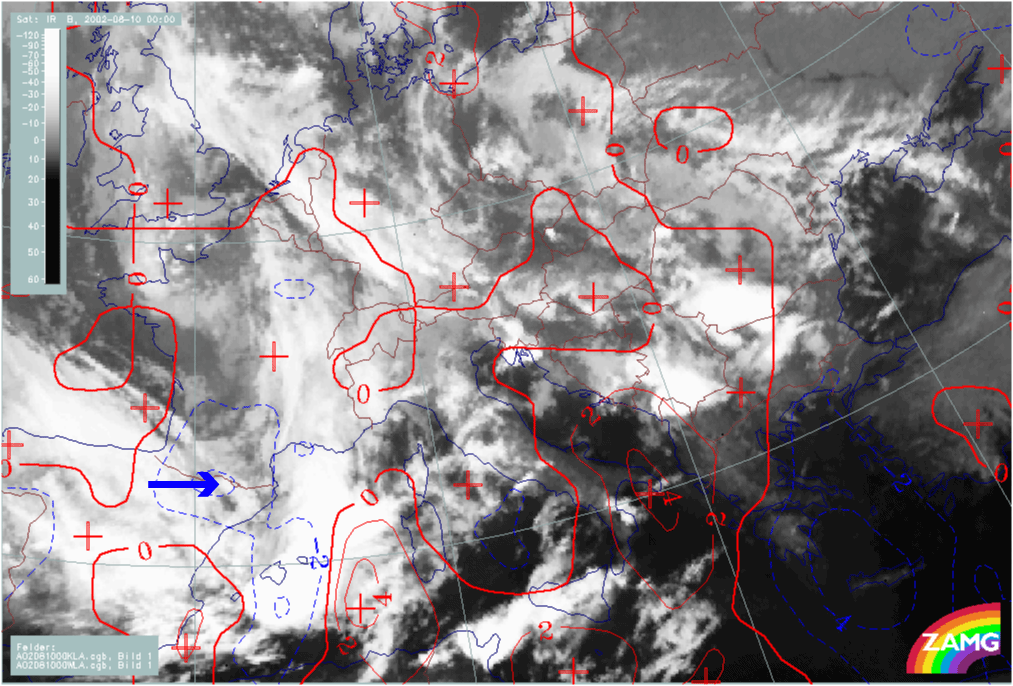
A maximum of CA moves from the Pyrenees eastward across the Balearic Islands; from 12.00 UTC an intensification of this CA maximum takes place and it is displaced to Sardinia; consequently, the main intrusion of cold air is in a SE direction. At 18.00 UTC the contrast between WA and CA (typical for a Wave) is much more distinct for the southern spiral than for the northern one.
|
10 August 2002/00.00 UTC - Meteosat IR image; black: positive vorticity advection (PVA) 300 hPa, yellow: isotachs; 00.00 - 18.00 UTC
6-hourly image Loop
|
|
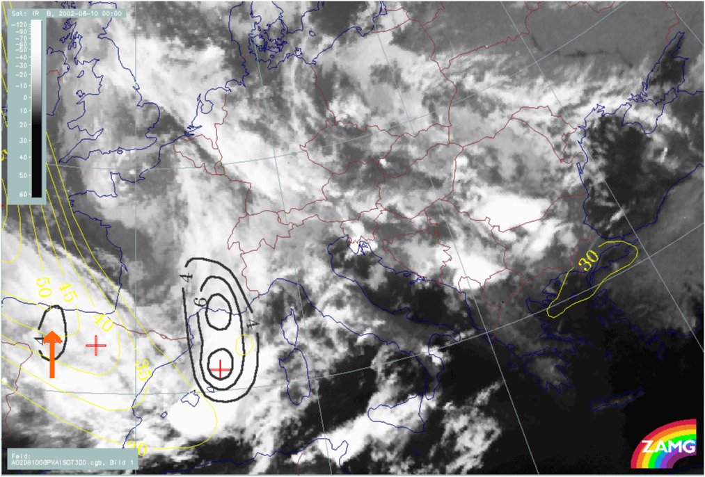
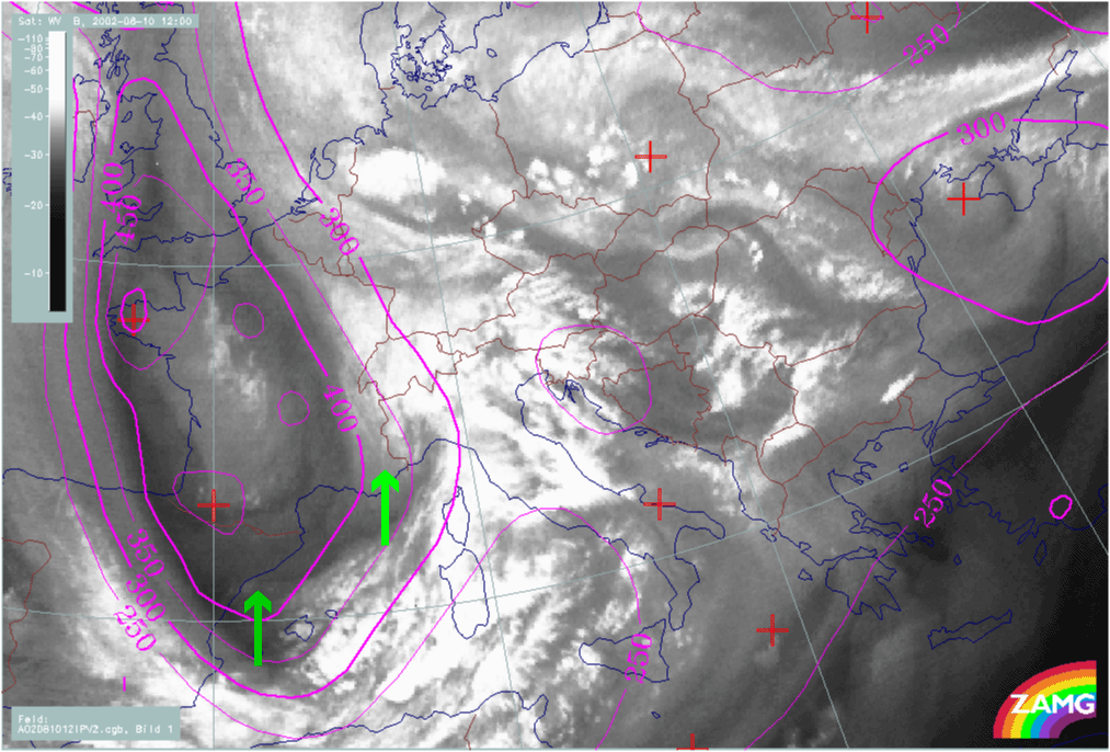
There are two distinct jet streaks and their related PVA maxima are recognisable:
- Between 00.00 and 06.00 UTC a PVA max lies in the left exit region of a NW-SE orientated jet streak (N. Spain - Balearic Islands); the PVA Maximum moves from the Gulf of Lyon to the Gulf of Genoa and is accompanied by intensifying cloud in this area (this is ahead of the spiral development over N. Italy); from 12.00 UTC this feature vanishes
- From 12.00 UTC a new PVA maximum in the left exit region of a NW-SE orientated jet streak (N. Spain - Balearic Islands) appears and moves to Sardinia and Corsica. This one is accompanied by intensifying cloud, and is a precursor of the second, southern cloud spiral over Sardinia.
|
10 August 2002/00.00 UTC - Meteosat WV image; magenta: height of PV = 2 units; 00.00 - 18.00 UTC 6-hourly image Loop
|
|
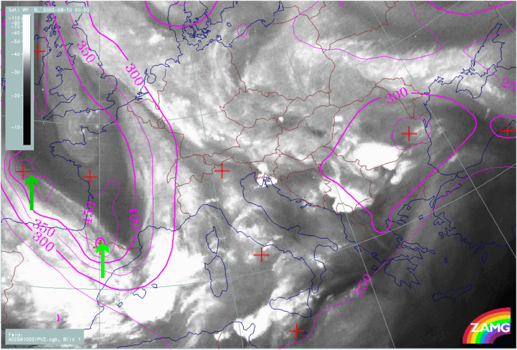
Initially (00.00 - 06.00 UTC), two PV anomalies can be followed, corresponding to the two areas of interest:
- Moving from the Pyrenees into the Gulf of Lyon
- Moving from the Gulf of Biscay to the W. Pyrenees
However, there is a suspicion that, from 12.00 UTC, the height gradient for PV = 2 units and the PV anomalies are shown too far to the N by the numerical model, as there is no longer any good correspondence with the WV Dark Stripe.
|
10 August 2002/00.00 UTC - Meteosat IR image; magenta: height contours 1000 hPa; 00.00 - 18.00 UTC 6-hourly image Loop
|
|
Normally, one would expect that all these parameters, together with the corresponding cloud features, should lead to the formation of a distinct surface (1000 hPa) low. In fact, such a development is not very spectacular:
- At 06.00 UTC only a small surface low develops over NW Italy; this corresponds to the northern cloud spiral in the satellite image, as well as to other relevant parameters
- From then the area of surface low is extending to the S, forming an area comprising both spiral developments (NW-Italy and Sardinia).
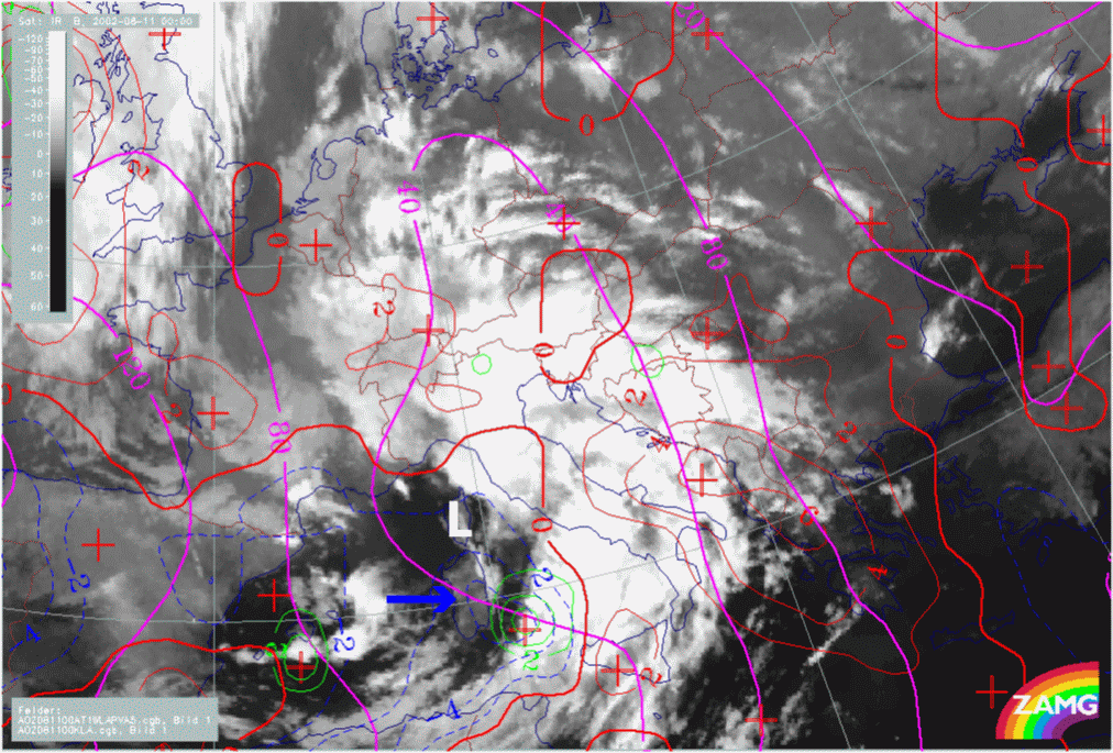
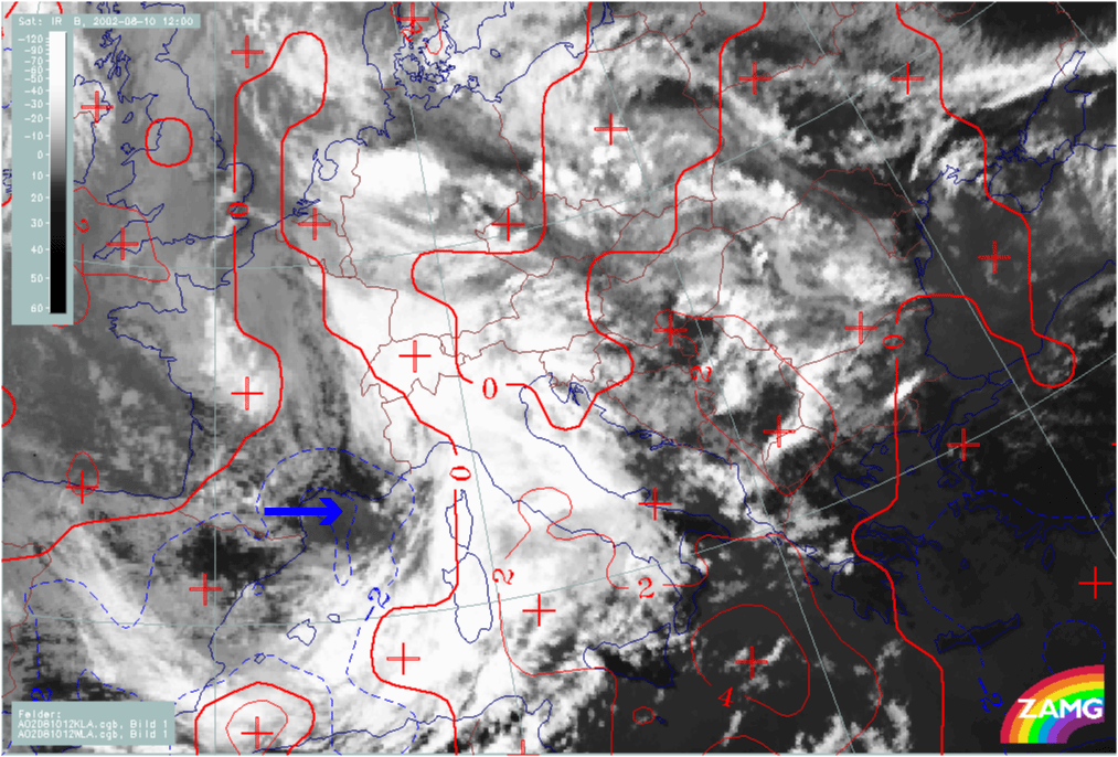
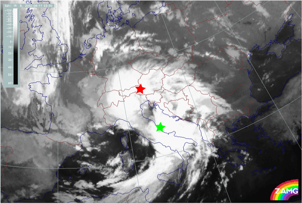
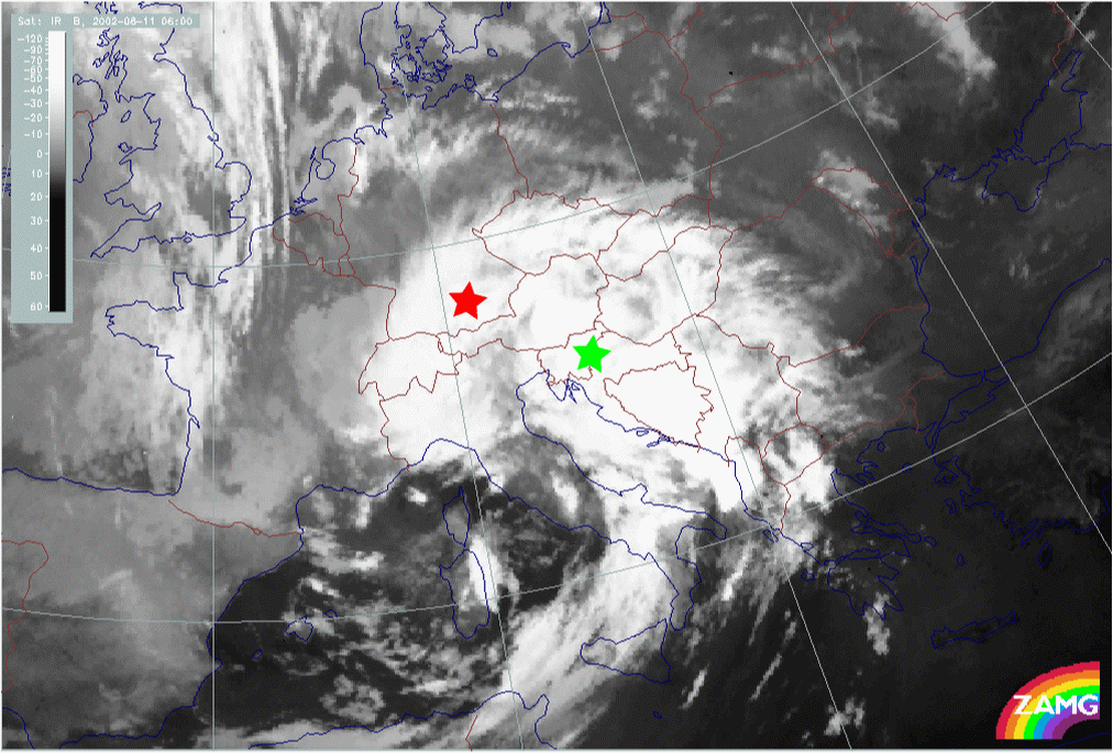
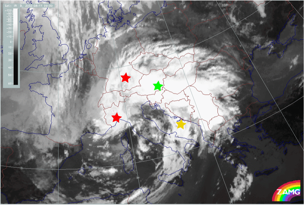
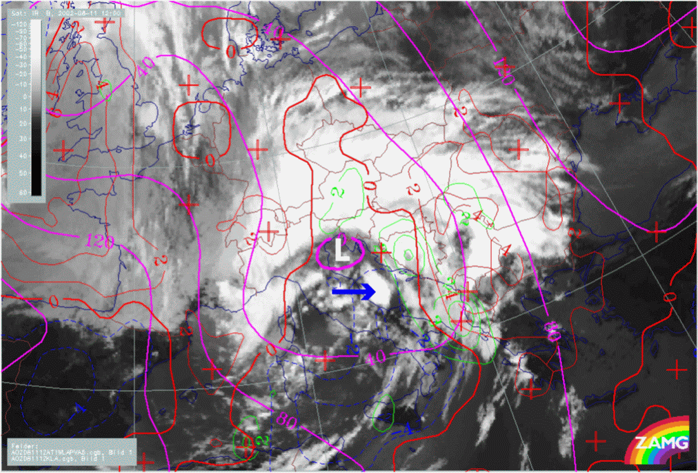
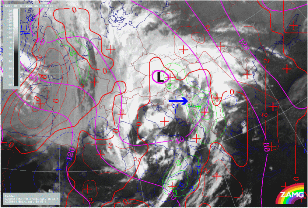
Development from Wave into Occlusion stages
Cloud systems in the development phase: Wave into Occlusion
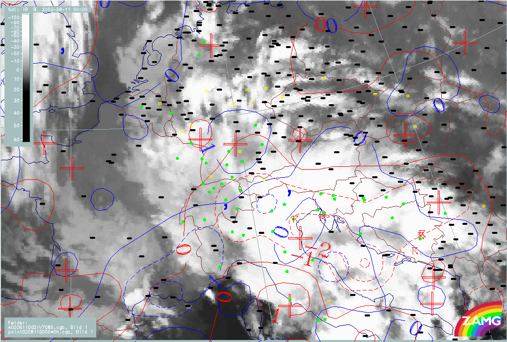
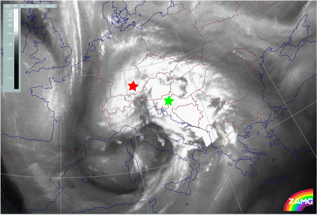
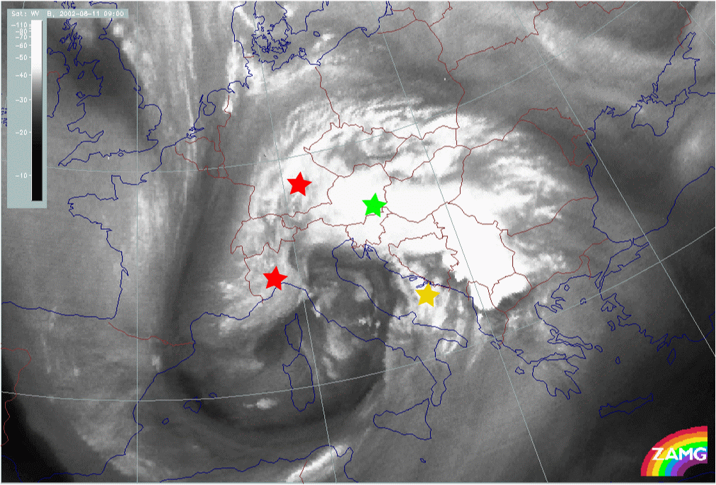
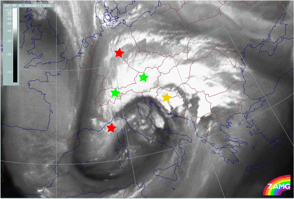
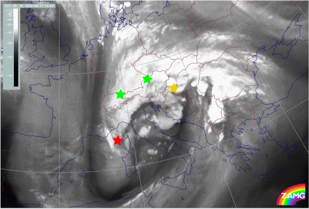
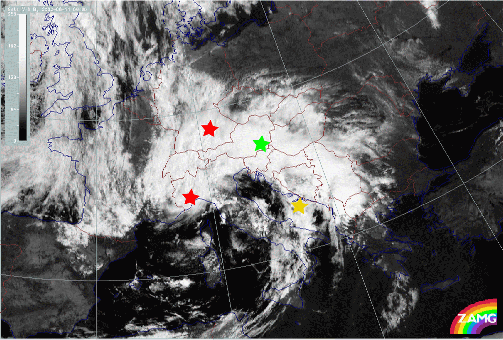
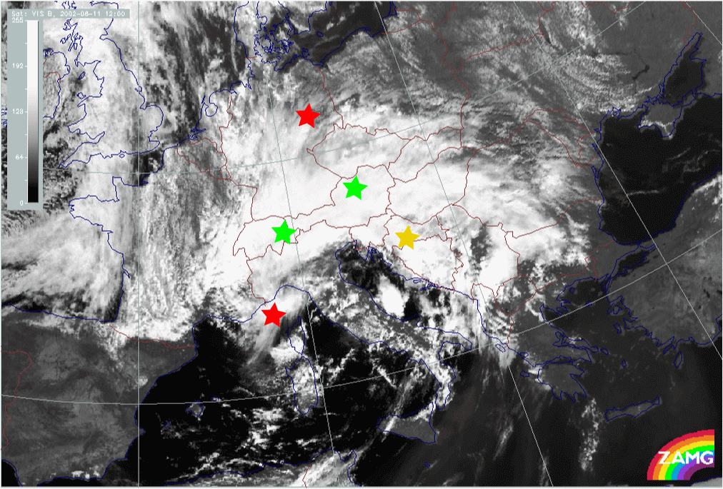
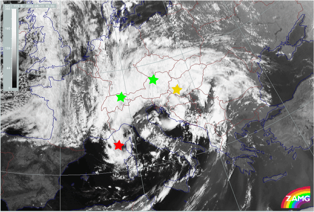
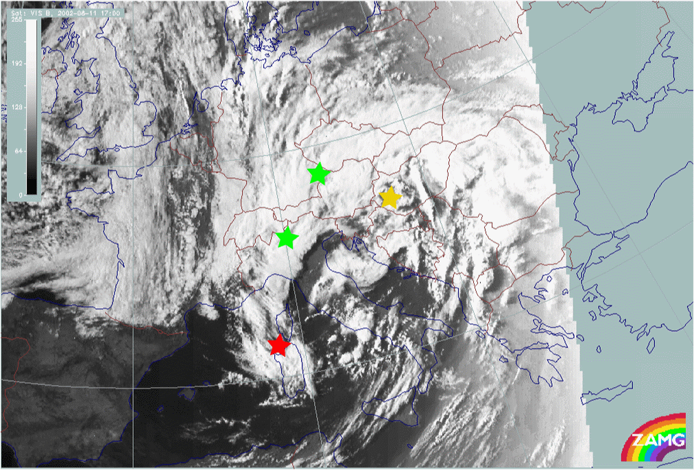
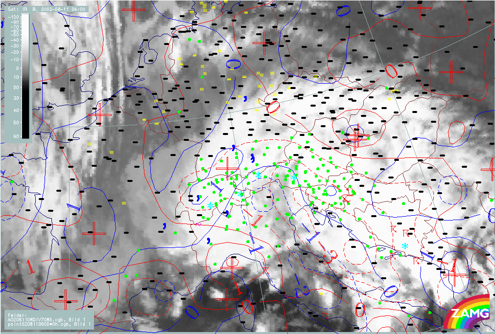
During the 11th of August Mediterranean lows develop and then develop further into an Occlusion cloud spiral: This can easily be seen in the satellite image loops (IR, WV and VIS); once again, several processes at meso- and synoptic-scale can be identified.
|
11 August 2002/00.00 UTC - Meteosat IR image; 00.00 - 18.00 UTC 3-hourly image Loop
|
|
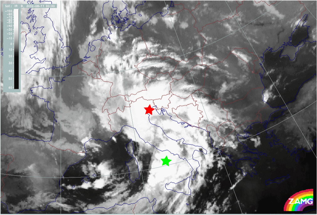
There are several interesting cloud features and cloud developments ongoing in this time interval.
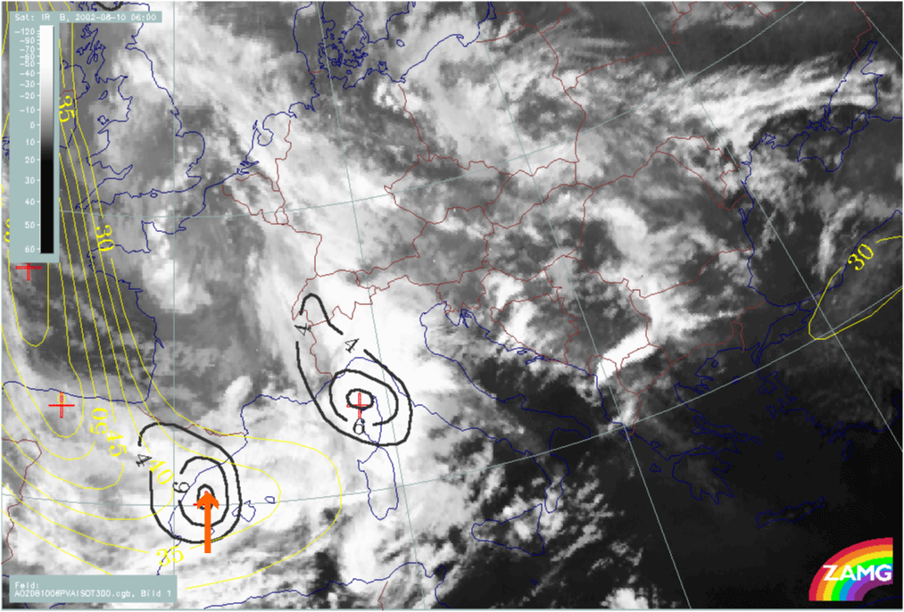
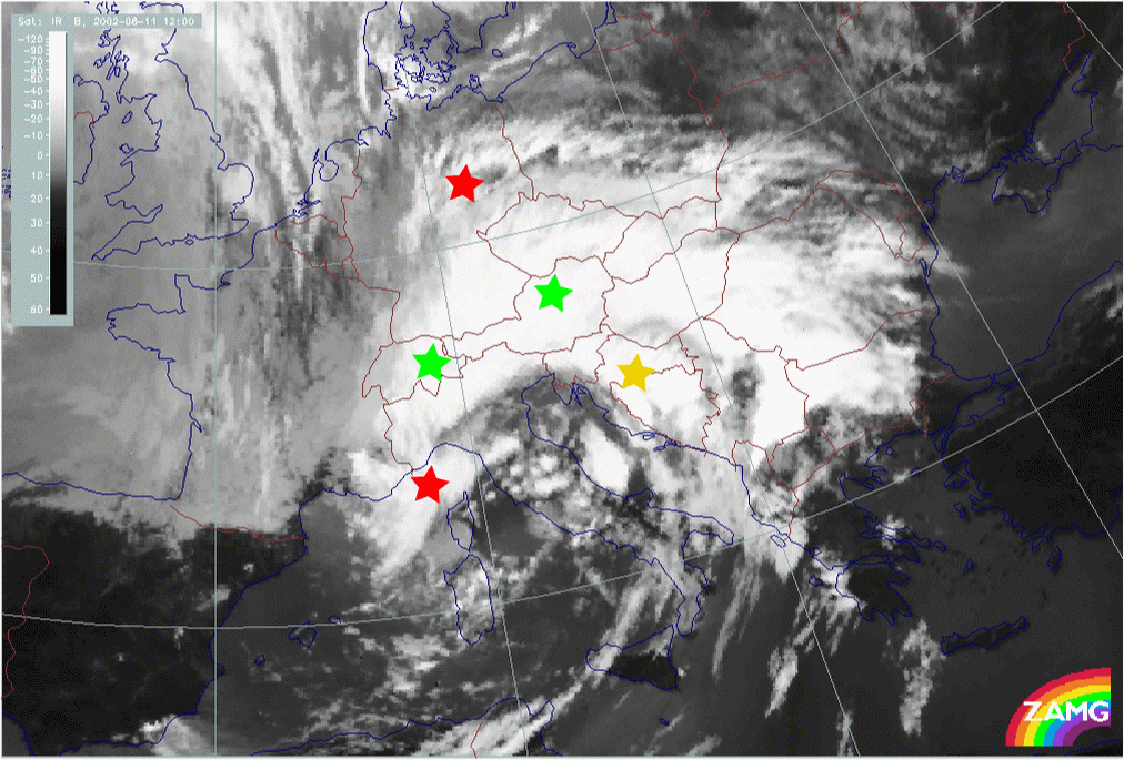
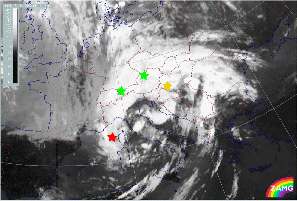
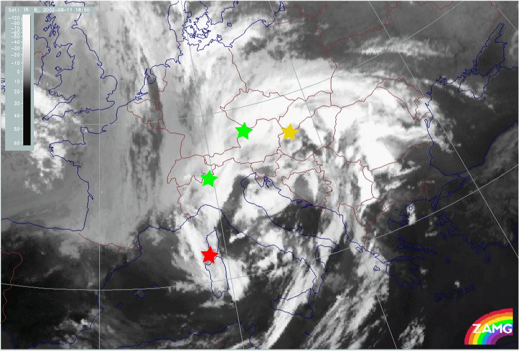
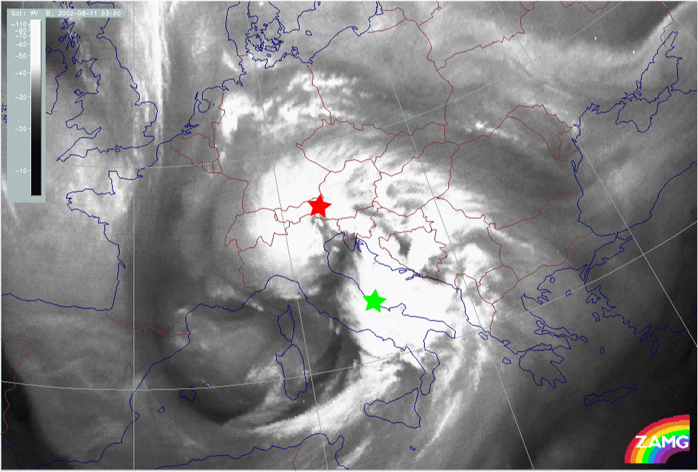
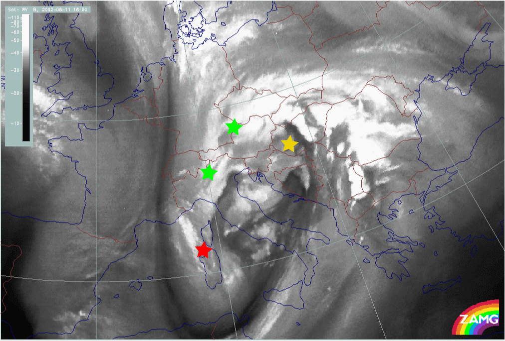
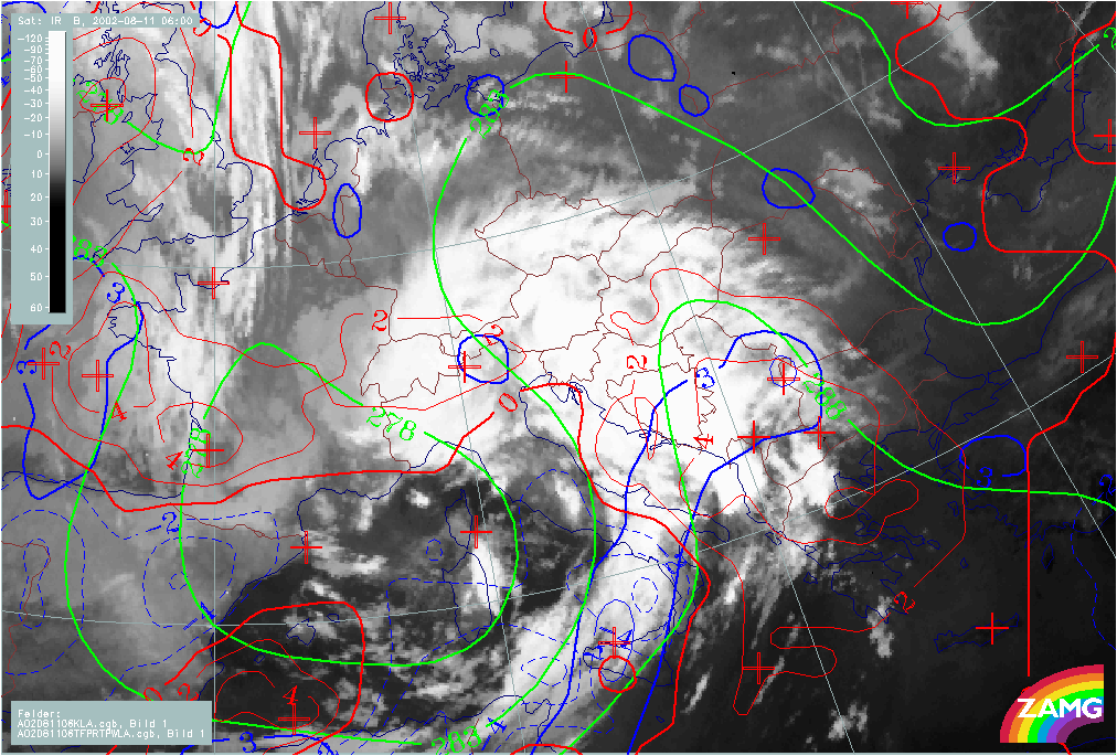
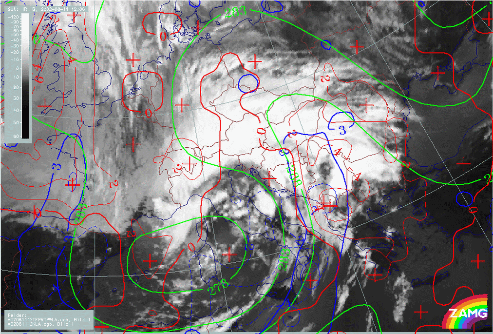
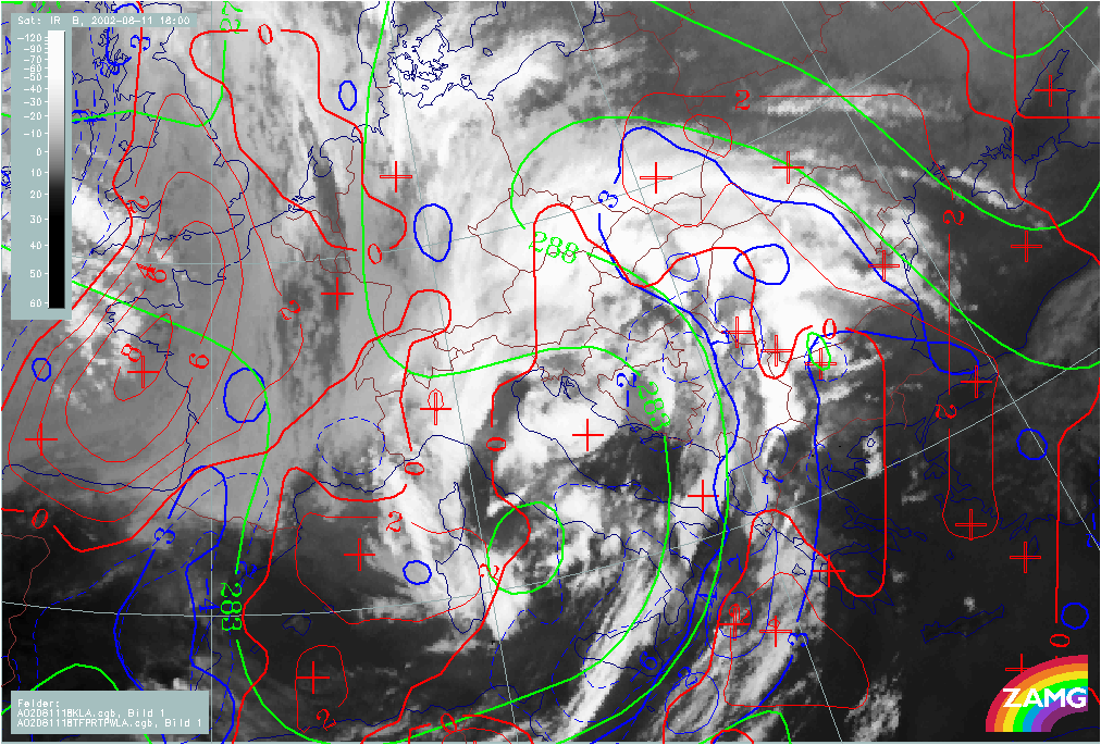
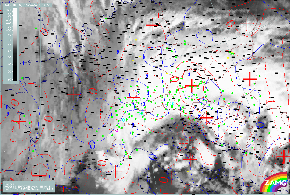
At 00.00 UTC there are two areas of interest:
- A cloud spiral over mid Italy (red star in loop above)
- A cloud intensification area over the Thyrrenian Sea (green star in loop above)
Up to 06.00 UTC the following processes can be observed:
- A NNE-ward shift of both systems:
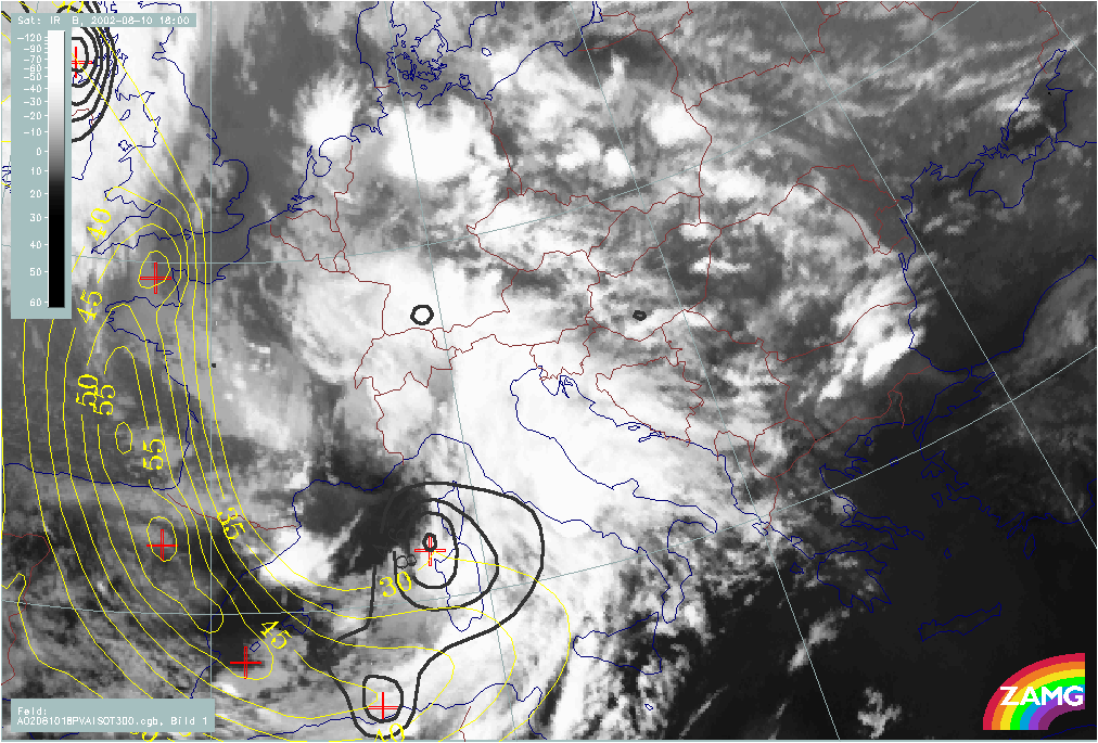
- The cloud spiral over mid Italy developing into a large Occlusion spiral, extending N-ward over Bavaria, Switzerland and the W. Alps; cloudiness of this Occlusion spiral starts to decay in the second half of this phase (red star in loop above)
- The intensification area develops into a Wave bulge and then into a well developed cloud spiral, extending over SE-Austria, Slovenia and finally over the whole of Austria (green star in loop above).
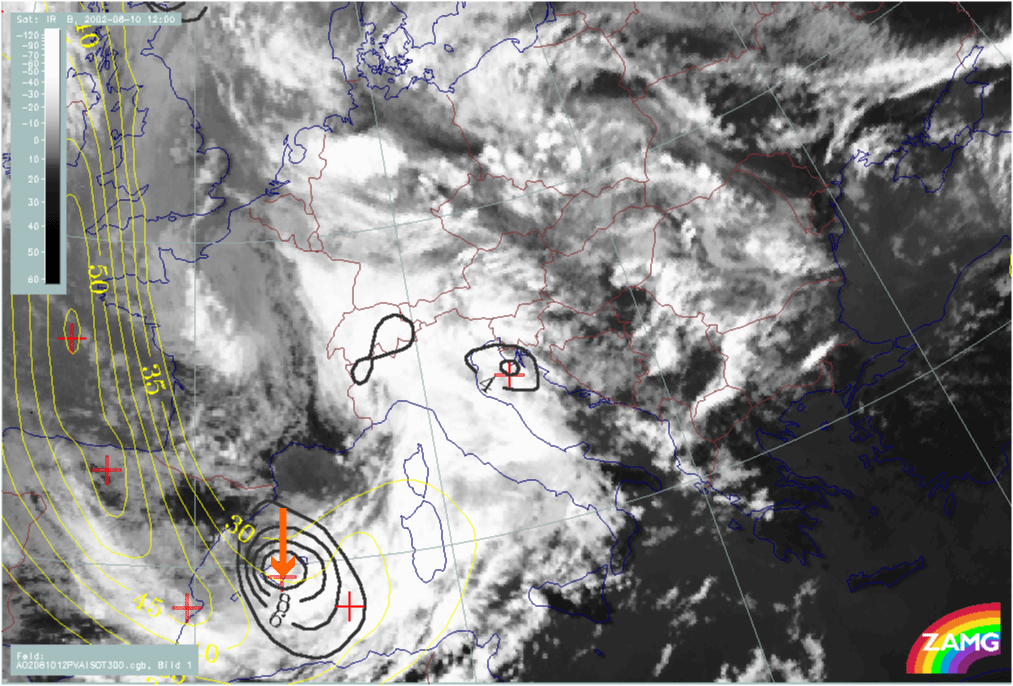
At 12.00 UTC a new Wave - like bulge can be seen over Croatia which develops from a convective area, moves N-ward and further develops into a second circulation (low) at the Occlusion cloud band (yellow star in loop above).
|
11 August 2002/00.00 UTC - Meteosat WV image; 00.00 - 18.00 UTC 3-hourly image Loop
|
|
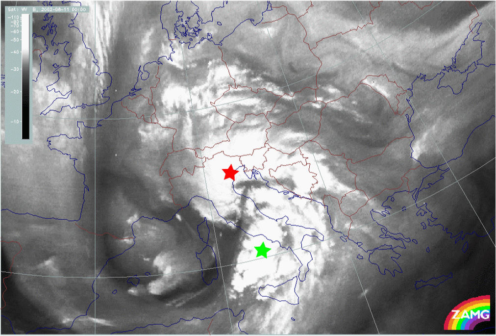
All features identified and described in the IR images are also very recognisable in the WV images:
- The cloud spiral (red stars) and the intensification area over mid Italy (green stars)
- A new wave and spiral development over Croatia (yellow stars)
In addition to the information from the IR images, pronounced Dark Stripes seen in the WV images, separate the cloud systems and indicate the different flow of dry air around the huge Upper Level Low.
|
11 August 2002/06.00 UTC - Meteosat VIS image; 06.00 - 17.00 UTC 3-hourly image Loop
|
|
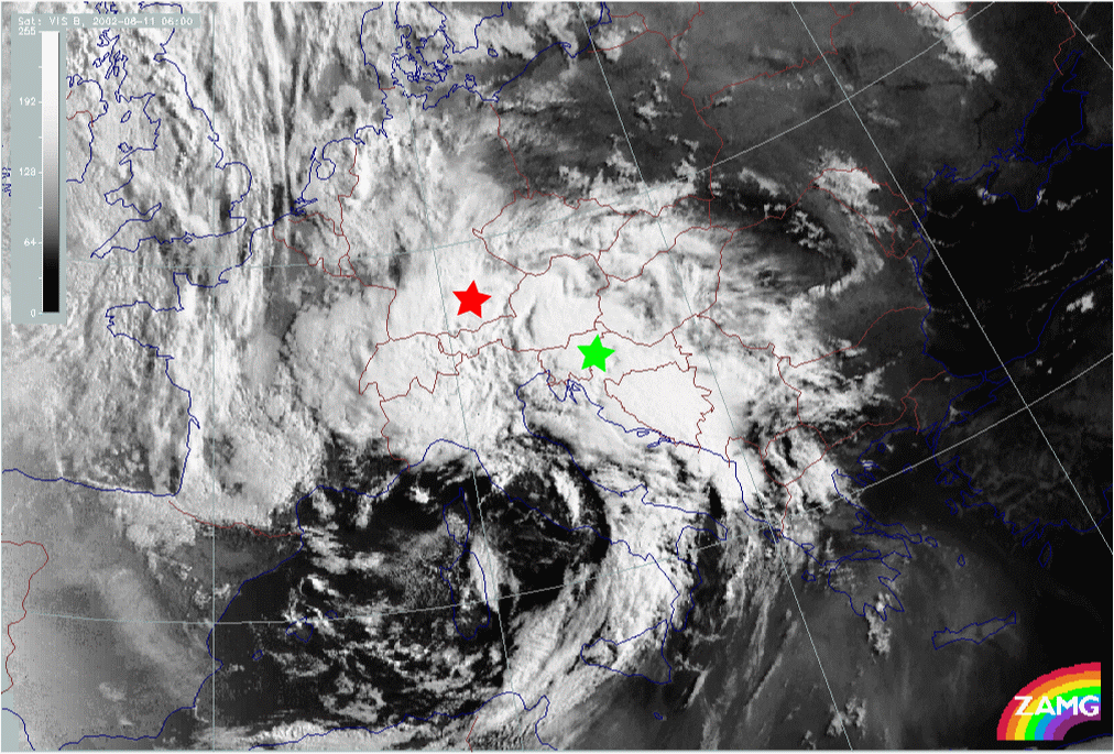
From 06.00 UTC all features described in the IR images can also be seen well in the VIS images; the new Wave area developing over Croatia is seen in the VIS image only as an intensification area, but the 2nd low developing from this Wave within the Occlusion cloud band (18.00 UTC) can be identified very well.
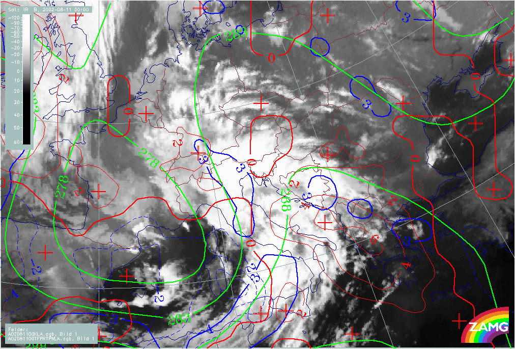
Synoptic situation of the phase of development from Wave into Occlusion: relevant numerical parameters
In loops of imagery with relevant numerical parameters, such as frontal, Wave and upper level parameters for 11 August, the different processes detected in the cloud features are generally well supported by the model fields.
|
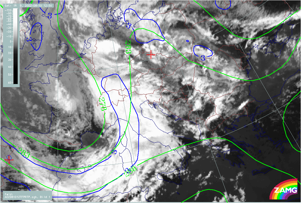
11 August 2002/00.00 UTC - Meteosat IR image; magenta: height contours 1000 hPa; green: positive vorticity afvection (PVA) 500 hPa,
red: temperature advection - WA 700 hPa; blue: temperature advection - CA 700 hPa; 00.00 - 18.00 UTC 6-hourly image Loop
|
|
As there are several Wave features recognisable in the satellite imagery during this phase, the analysis of these Waves together with the relevant model fields is of great interest:
At 00.00 UTC there are already some indications for a Wave over mid Italy in the model parameters:
- There is a very distinct bulge of WA and a CA maximum over the Thyrrenian Sea (behind the cloud spiral over mid Italy and the cloud intensification area.
- The PVA maximum, in the ideal case, following the rear of a Wave bulge, is shifted SW into the cloud intensification area.
At 06.00 UTC all parameters show a classical well developed Wave corresponding well with the cloud bulge. The main maximum of CA has slightly moved E (over S. Italy).
At 12.00 UTC, when a new Wave can be seen over Croatia, the model fields show some indications of a Wave. In particular, a small new bulge of CA protrudes to the NE.
Finally at 18.00 UTC the relevant Wave parameters are again well developed in the area of the 2nd low now appearing in the Occlusion cloud band. A separate maximum of CA which has deepened and split-off from the whole CA area is finally connected with the new 2nd low in the Occlusion cloud band.
|
11 August 2002/00.00 UTC - Meteosat IR image; blue: thermal front parameter (TFP) 500/1000 hPa, green: equivalent thickness 500/1000
hPa; red: temperature advection - WA 700 hPa, blue: temperature advection - CA 700 hPa; 00.00 - 18.00 UTC 6-hourly image Loop
|
|
Wave bulges are developing into Occlusion cloud bands. How do the relevant frontal parameters reflect this situation:
Generally speaking one can say that there are distinct frontal conditions in thickness, TFP and TA:
A zone of high gradient in thickness accompanies the Cold Front and there is a large ridge in the area of the Occlusion bands; the ridge becomes more pronounced with the development of the second Wave into an Occlusion cloud band; a secondary ridge might even be recognised within the main ridge.
While the TFP accompanies the thickness zone and Cold Front cloud bands close to the rear side very well, the Occlusion cloud band is not accompanied by a separate TFP in the area of the large thickness ridge. This might be a consequence of the extended ridge, where changes of gradients might be too small to exceed the threshold for the TFP.
The zero-line of TA is close to the cloud band, moving from the rear side of the system to the leading edge by the end of the case.
|
11 August 2002/00.00 UTC - Meteosat IR image; green: positive vorticity advection (PVA) 500 hPa, cyan: height contours 500 hPa; 00.00 -
18.00 UTC 6-hourly image Loop
|
|
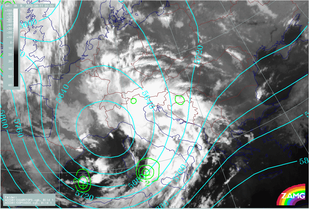
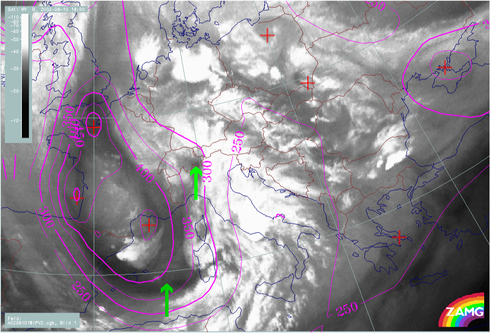
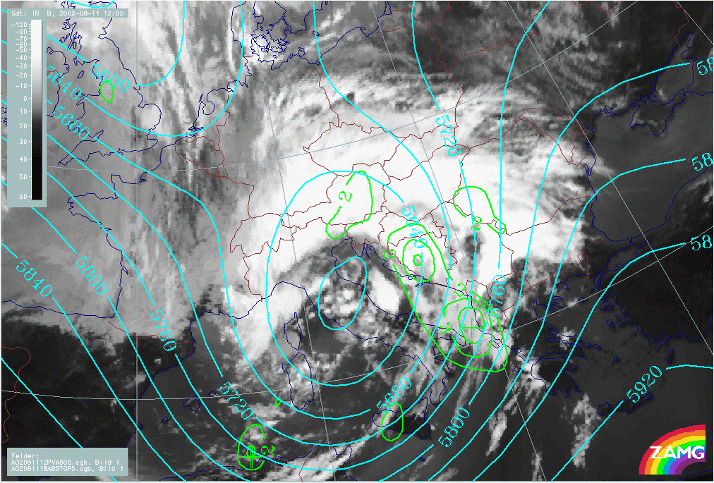
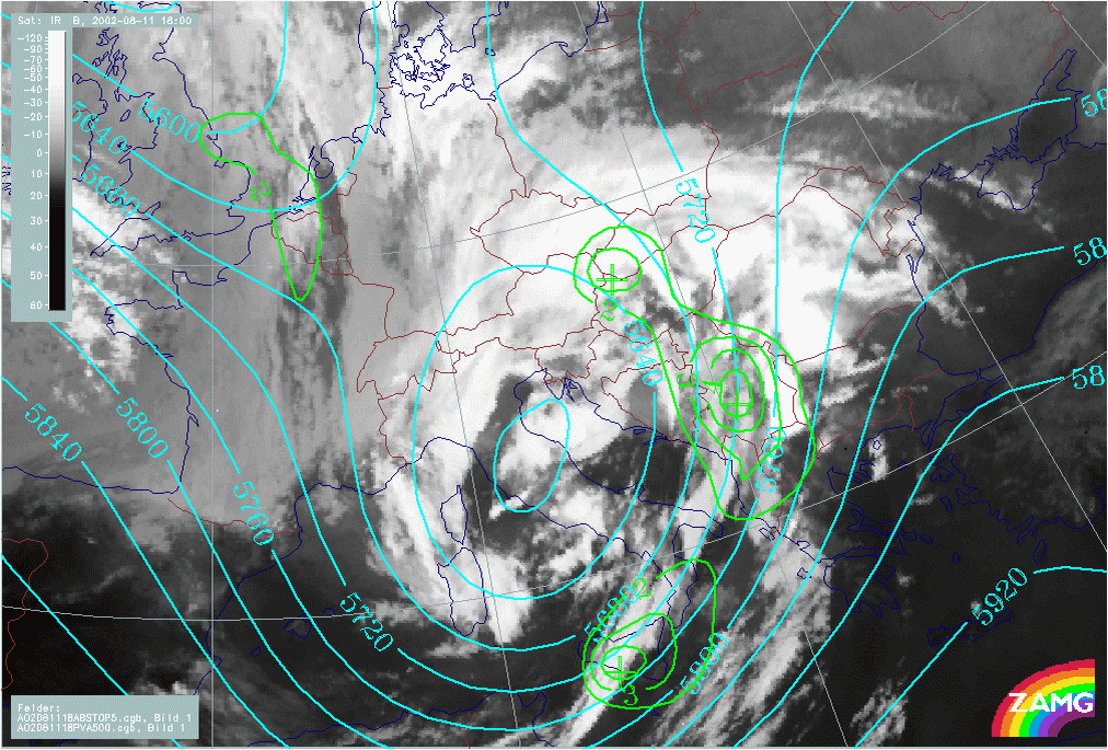
There are distinct PVA maxima located to the rear of the Cold Front and Occlusion cloud bands. As there is a large low at upper levels (500 hPa), PVA is consequence of curvature and shear at this level.
At 300 hPa pronounced PVA maxima can also be distinguished, located at the rear of the Cold Front and Occlusion cloud bands. As there are also well developed jet streaks it cannot be determined if the PVA maxima are caused by shear or curvature. There is, however, a distinct connection between the PVA max in the left exit region of a huge jet streak and the 2nd low developing over Croatia, which then moves north-ward (12.00 - 18.00 UTC).
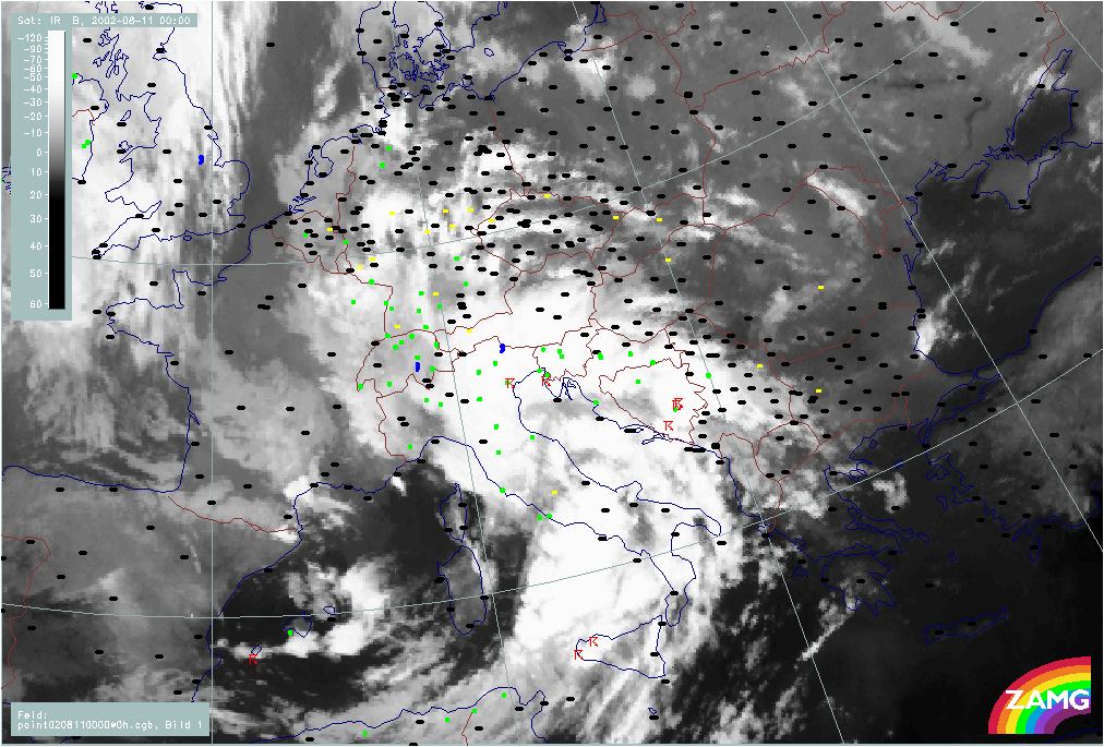
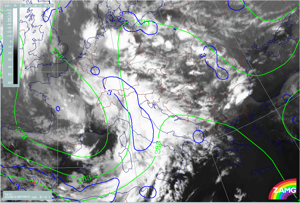
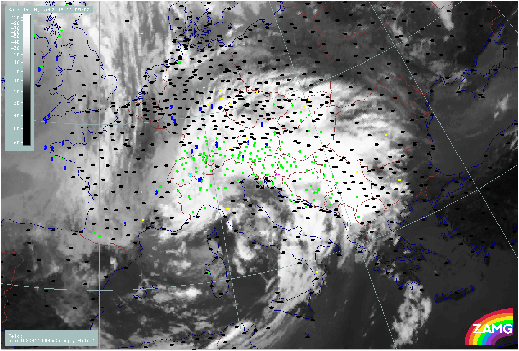
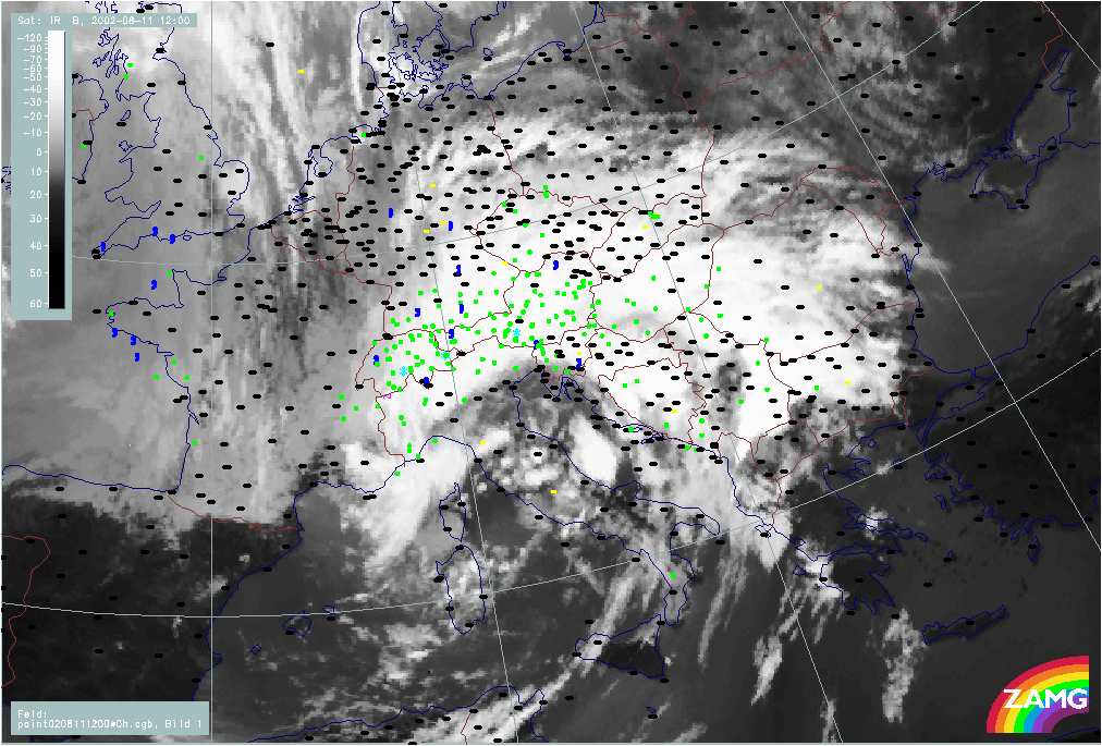
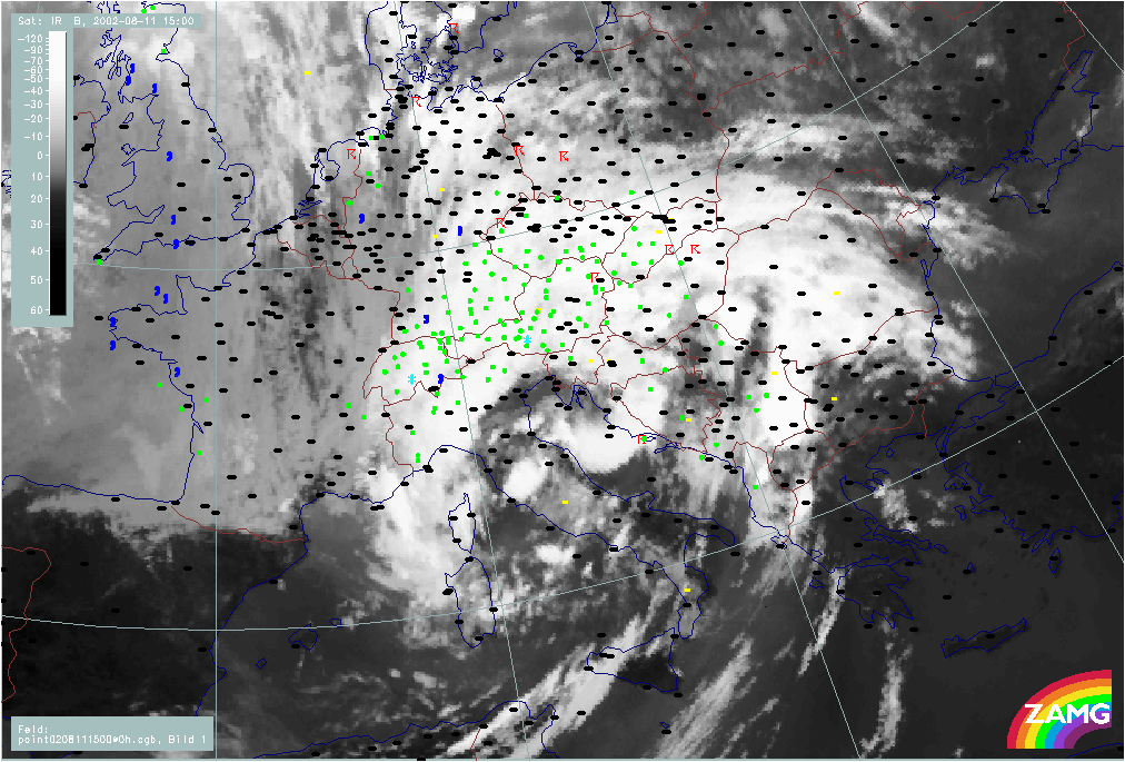
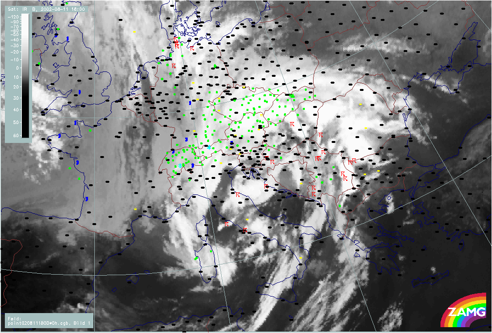
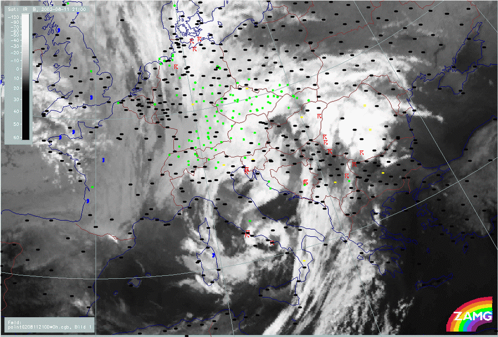
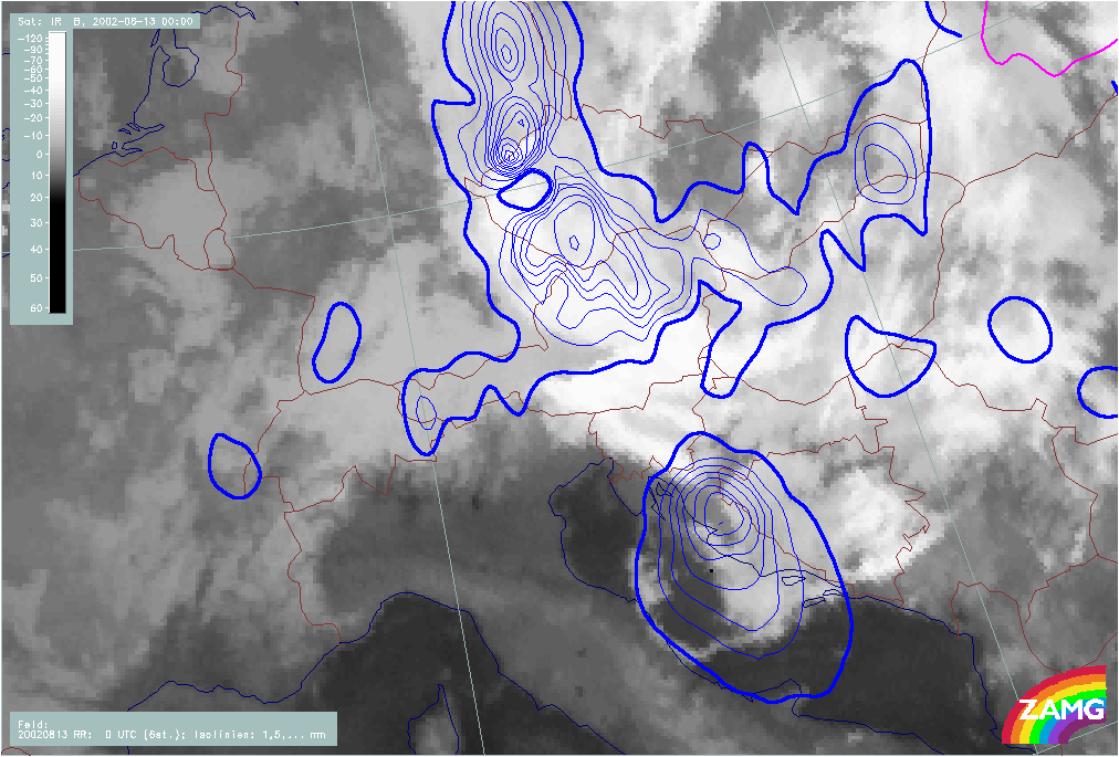
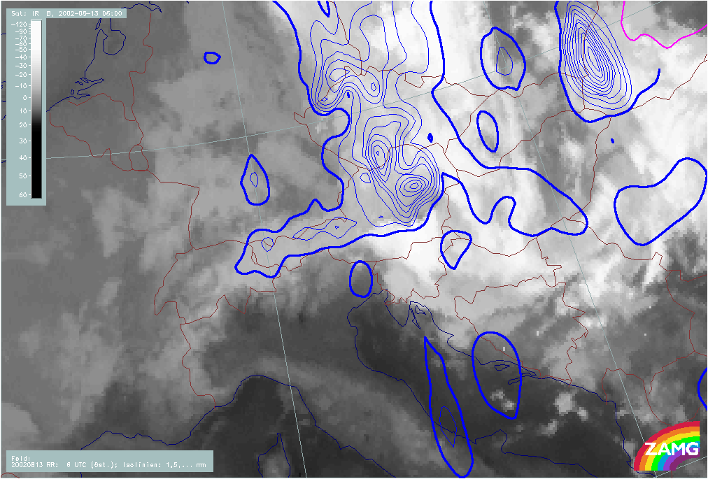
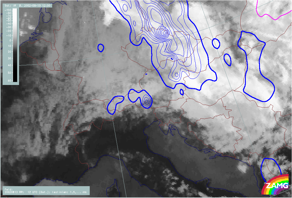
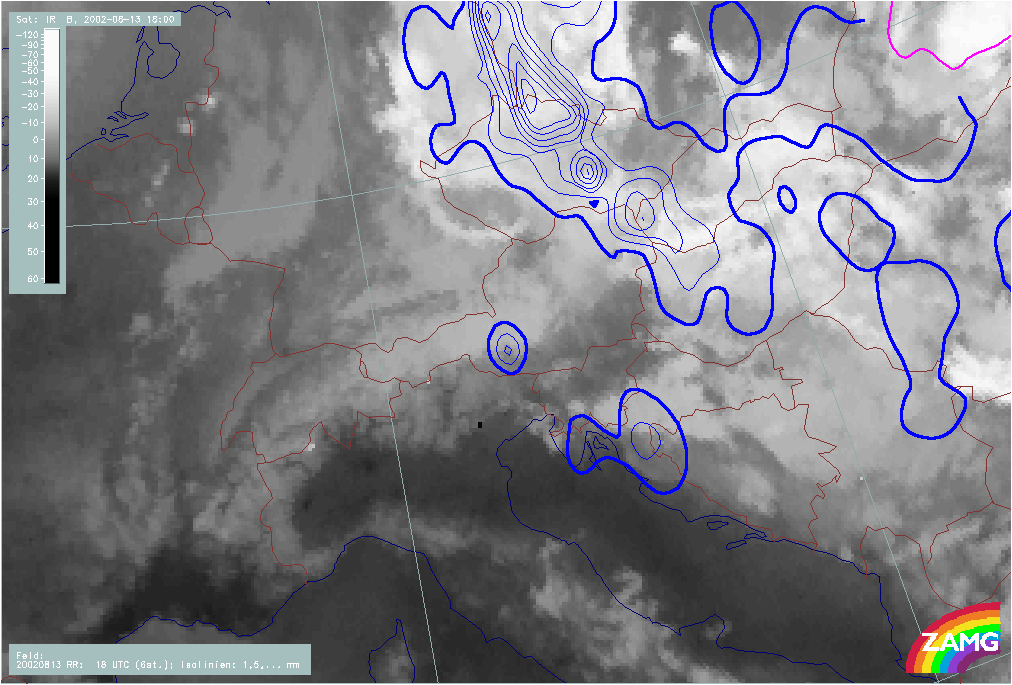
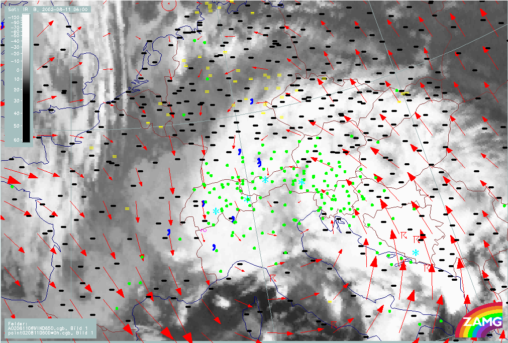
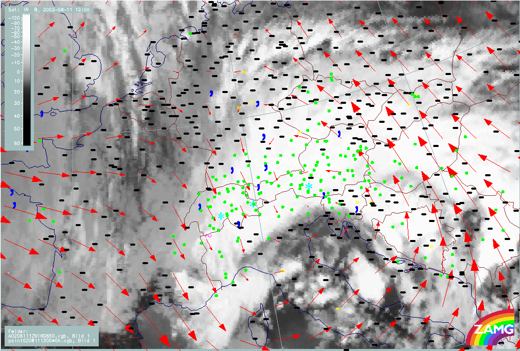
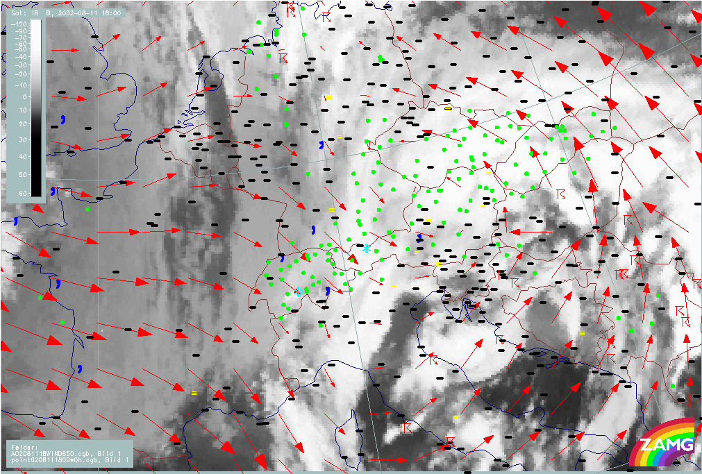
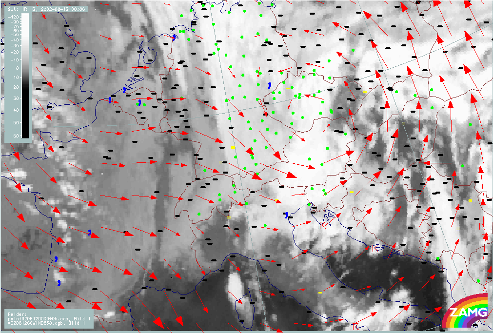
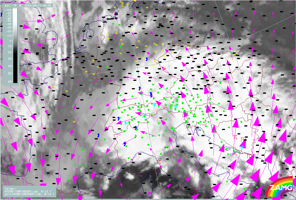
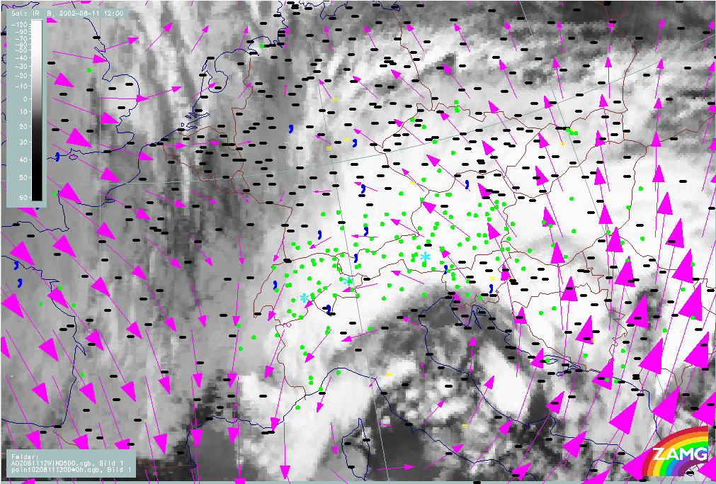
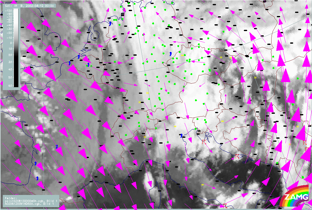
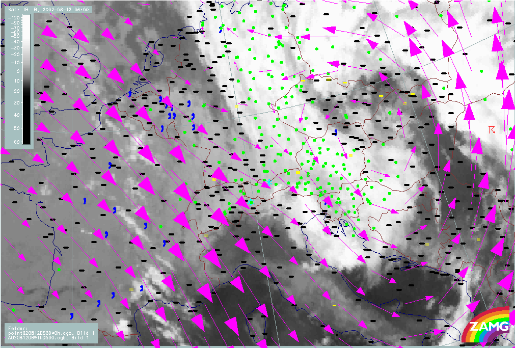
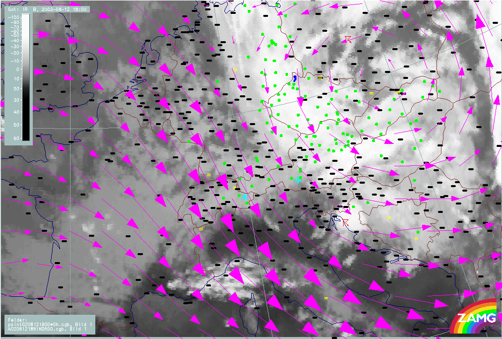
Floodphase
Sequence of weather: Rain, and rain amounts
|
11 August 2002/00.00 UTC - Meteosat IR image; weather events (green: rain and showers, blue: drizzle, cyan: snow, red: thunderstorm with
precipitation, purple: freezing rain, orange: hail, black: no actual precipitation or thunderstorm with precipitation); 00.00 - 21.00
UTC 3-hourly image Loop
|
12 August 2002/00.00 UTC - Meteosat IR image; weather events (green: rain and showers, blue: drizzle, cyan: snow, red: thunderstorm with
precipitation, purple: freezing rain, orange: hail, black: no actual precipitation or thunderstorm with precipitation); 12 August/00.00
- 13 August/12.00 UTC 3-hourly image Loop
|
|
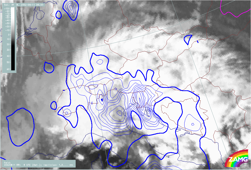
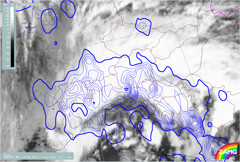
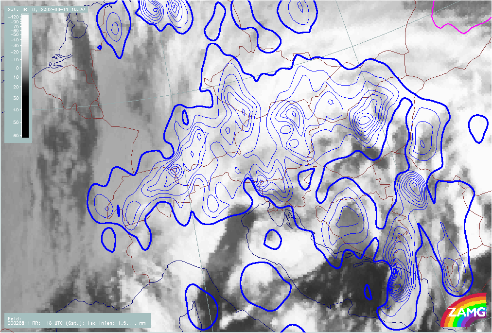
11 August 2002/00.00 UTC - Meteosat IR image; blue: 6-hourly precipitation amounts (thick line: 1mm, isoline distance: 4mm), magenta:
areas with insufficient data coverage; 11 August/00.00 - 13 August/18.00 UTC 6-hourly image Loop
|
|
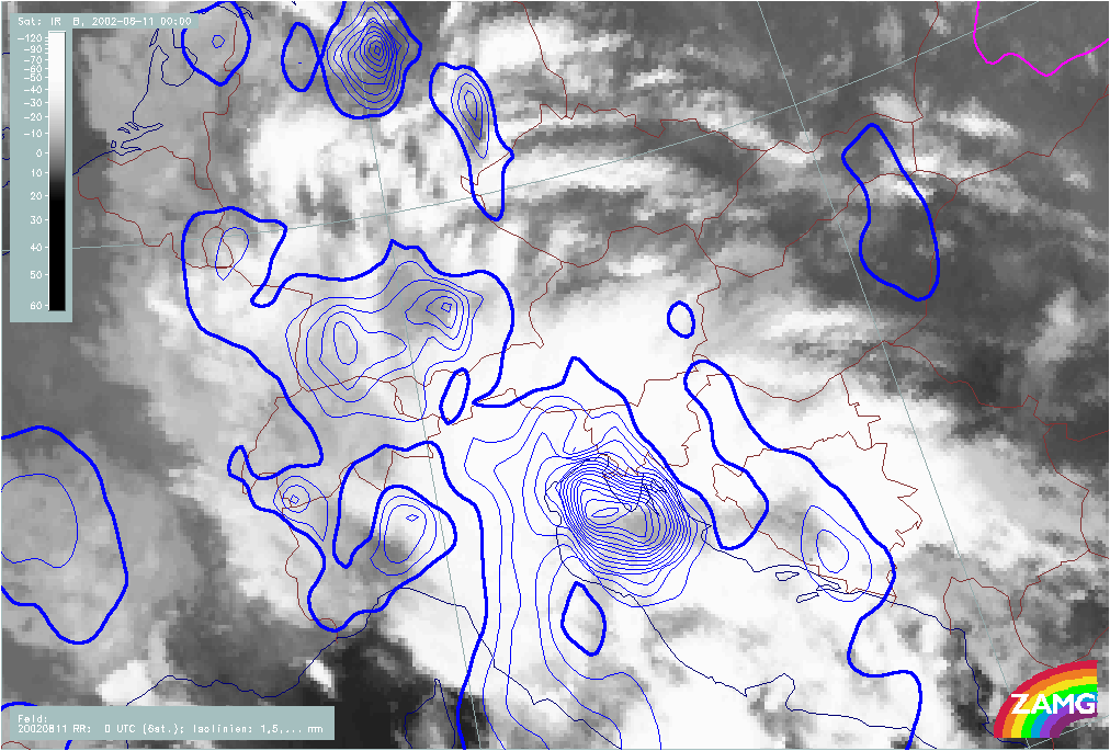
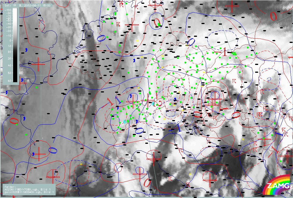
At the beginning of the period (11 August 00.00 - 09.00 UTC) the precipitation is mainly concentrated over N. Italy and is associated with the second Wave which is developing into the 2nd Occlusion cloud band. Some precipitation is observed during this phase in W. Austria and later over Switzerland from the 1st Occlusion cloud band but the amounts are rather low.
In a second phase (11 August/12.00 - 18.00 UTC) the precipitation spreads over the whole Austria and is clearly associated with the 2nd Occlusion cloud band. From there, the precipitation extends to Slovakia and the Czech Republic with high amounts caused by Stau effects. A separate maximum of precipitation, over Hungary in this phase, is associated with the 2nd low within the Occlusion cloud band developing from a 3rd Wave (Croatia).
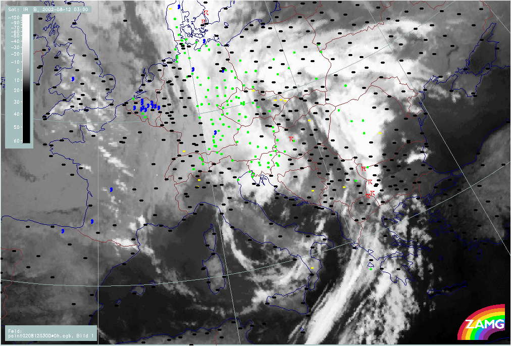
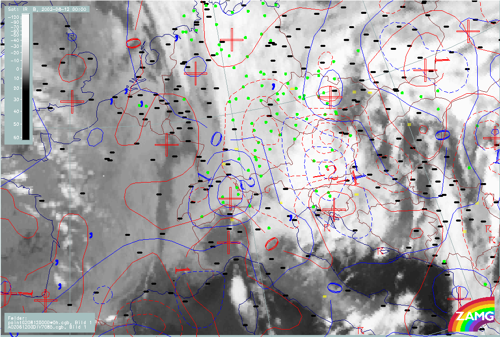
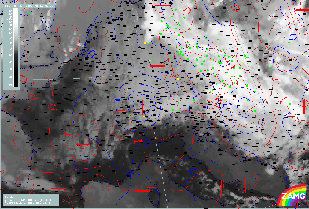
In the time frame from 12 August/00.00 - 06.00 UTC, in addition to the already mentioned countries, pronounced precipitation starts and remains over East Germany, while the neighbouring countries of Hungary, Slovenia and Slovakia now have lower amounts of precipitation.
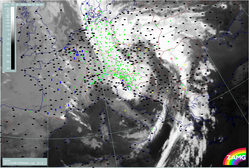
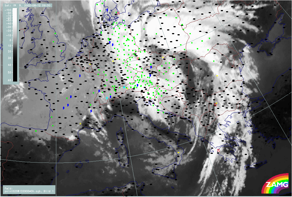
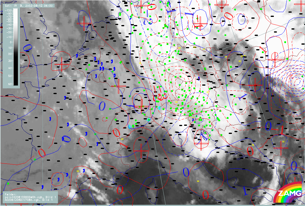
In the time phase 12 - 13 August, precipitation amounts remain high over East Germany, W. Czech Republic and very high over N. Austria (Salzburg, Upper and Lower Austria).
Relationships between precipitation and relevant parameters
Wind fields at 850 and 500 hPa
|
11 August 2002/00.00 UTC - Meteosat IR image; weather events (green: rain and showers, blue: drizzle, cyan: snow, red: thunderstorm with
precipitation, purple: freezing rain, orange: hail, black: no actual precipitation or thunderstorm with precipitation; red: wind
vectors at 850 hPa; 11 August/00.00 - 13 August/12.00 UTC 6-hourly image Loop
|
11 August 2002/00.00 UTC - Meteosat IR image; weather events (green: rain and showers, blue: drizzle, cyan: snow, red: thunderstorm with
precipitation, purple: freezing rain, orange: hail, black: no actual precipitation or thunderstorm with precipitation; magenta: wind
vectors at 500 hPa; 11 August/00.00 - 13 August/12.00 UTC 6-hourly image Loop
|
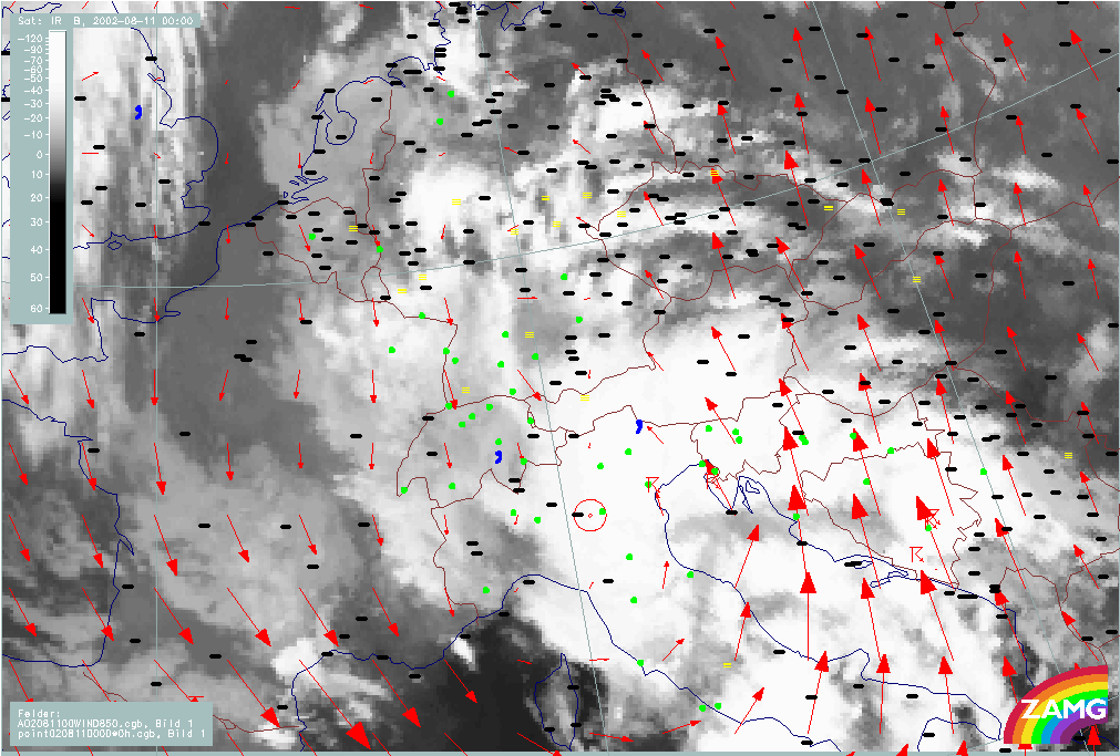
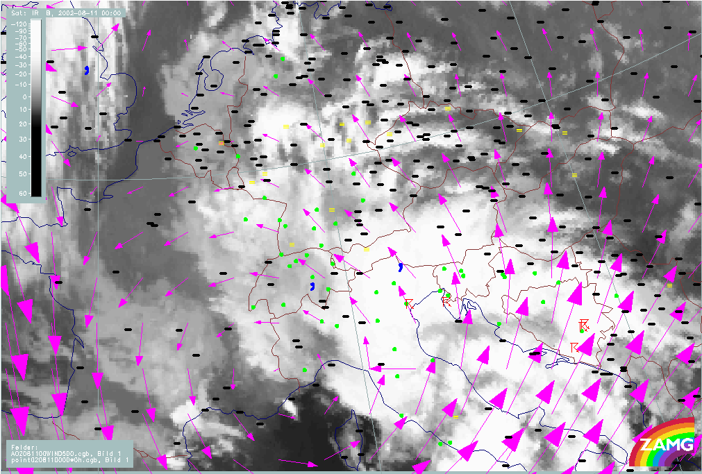
In both loops above the movement of the cyclonic vortex in the wind field from N. Italy across E. Austria and the Czech Republic to Poland can be observed very clearly. At 500 hPa the circulation is, initially, more to the W, over the W. Alps, and the displacement at this level is a bit more eastward than at the 850 level.
The distinct Stau effects at the Alps first start in the western part but very soon move to the eastern parts where they remain for the duration of this case.
Fields of divergence at 850 and 700 hPa
|
11 August 2002/00.00 UTC - Meteosat IR image; weather events (green: rain and showers, blue: drizzle,cyan: snow, red: thunderstorm with
precipitation, purple: freezing rain, orange: hail, black: no actual precipitation or thunderstorm with precipitation); blue: thermal
front parameter 500/850 hPa; red: divergence 850 hPa (red dashed: convergence); blue: divergence 700 hPa (blue dashed: convergence); 11
August/00.00 - 13 August/12.00 UTC 6-hourly image Loop
|
|
The fields of convergence at both levels show well marked maxima with extraordinarily high values. The movement of the maxima is similar to that already seen in the fields: from W. Austria to E. Austria and then northward to the Czech Republic and S. Poland. They agree very well with the precipitation areas.
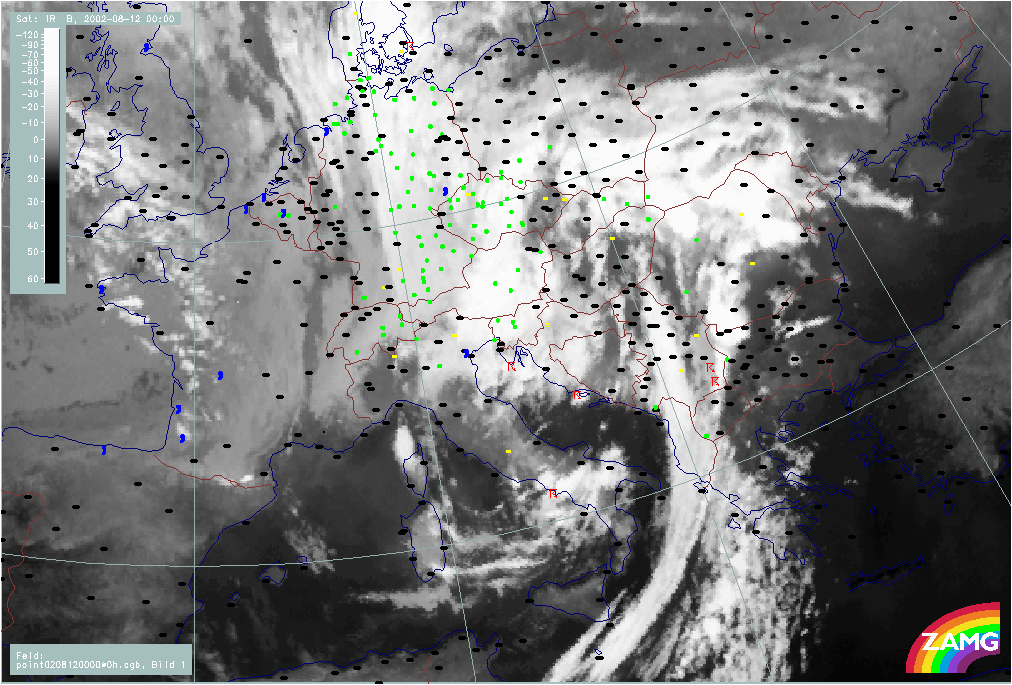
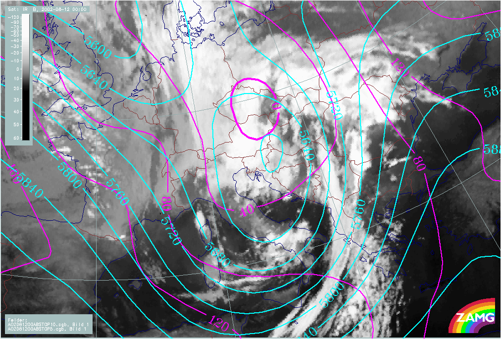
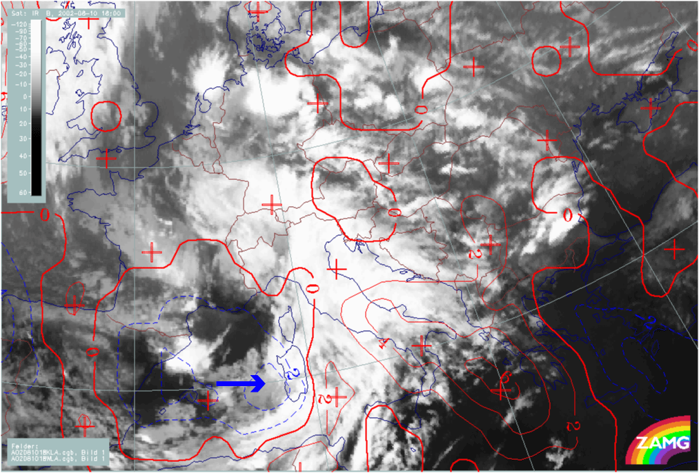
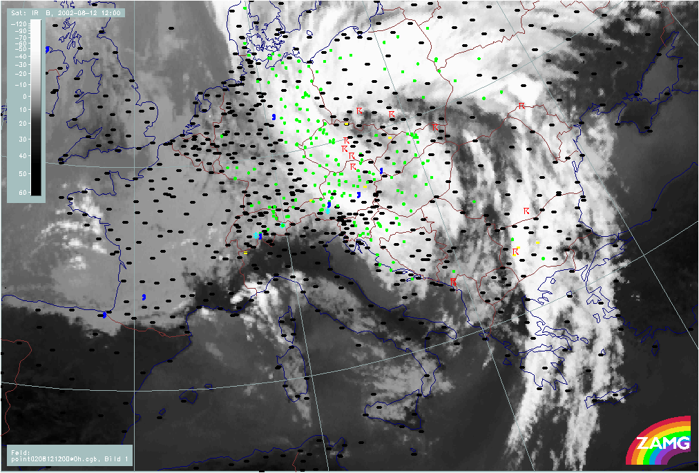
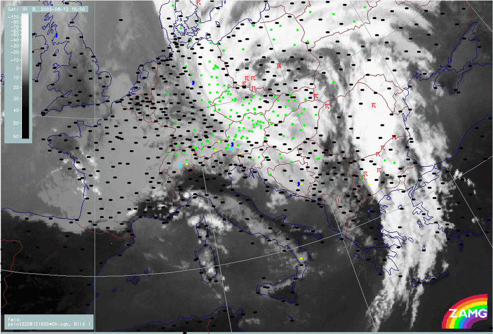
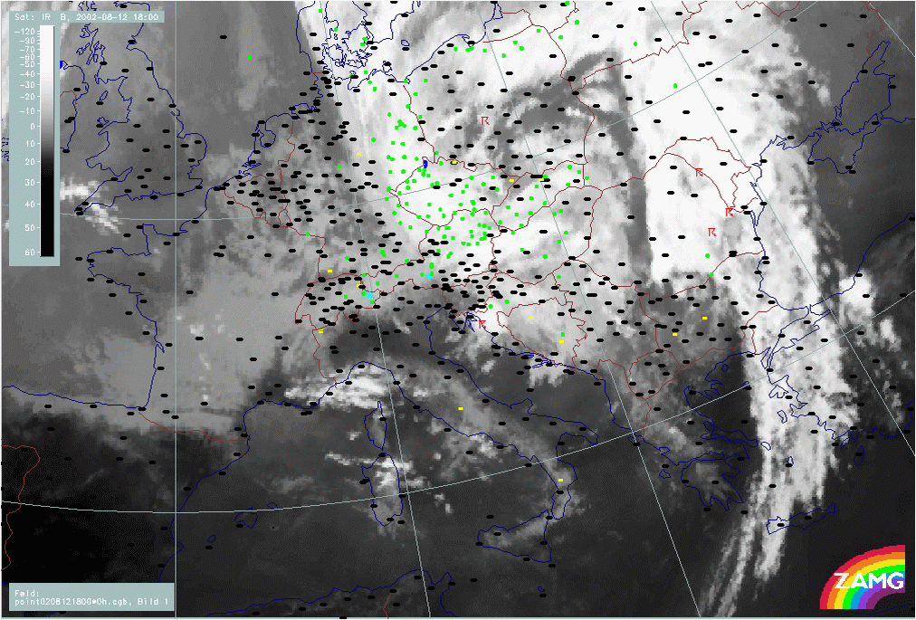
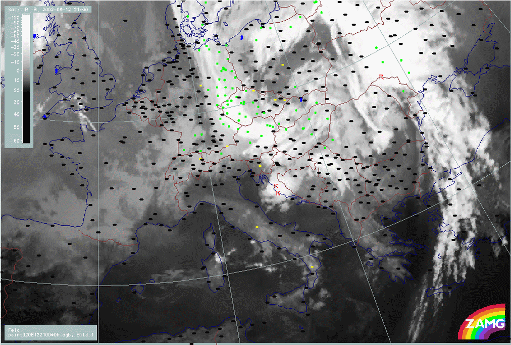
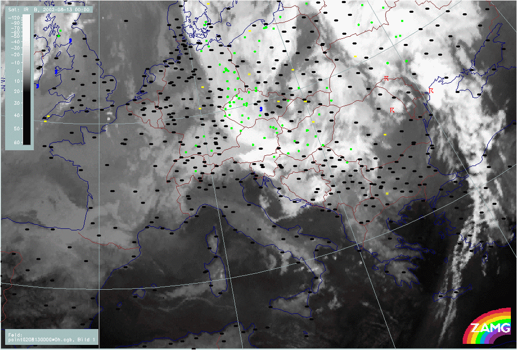
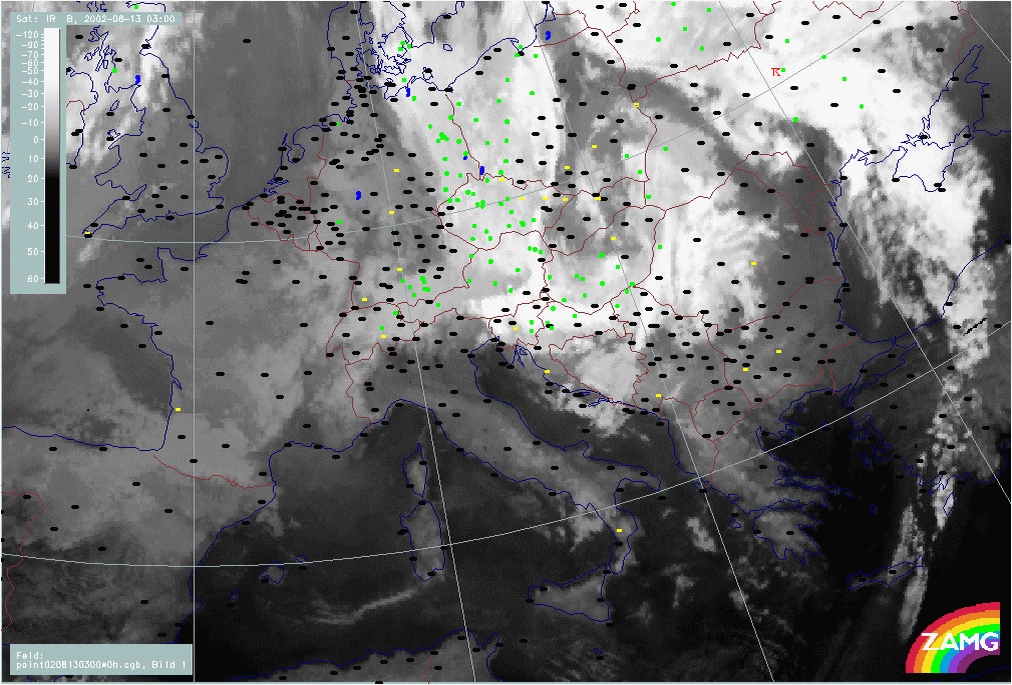
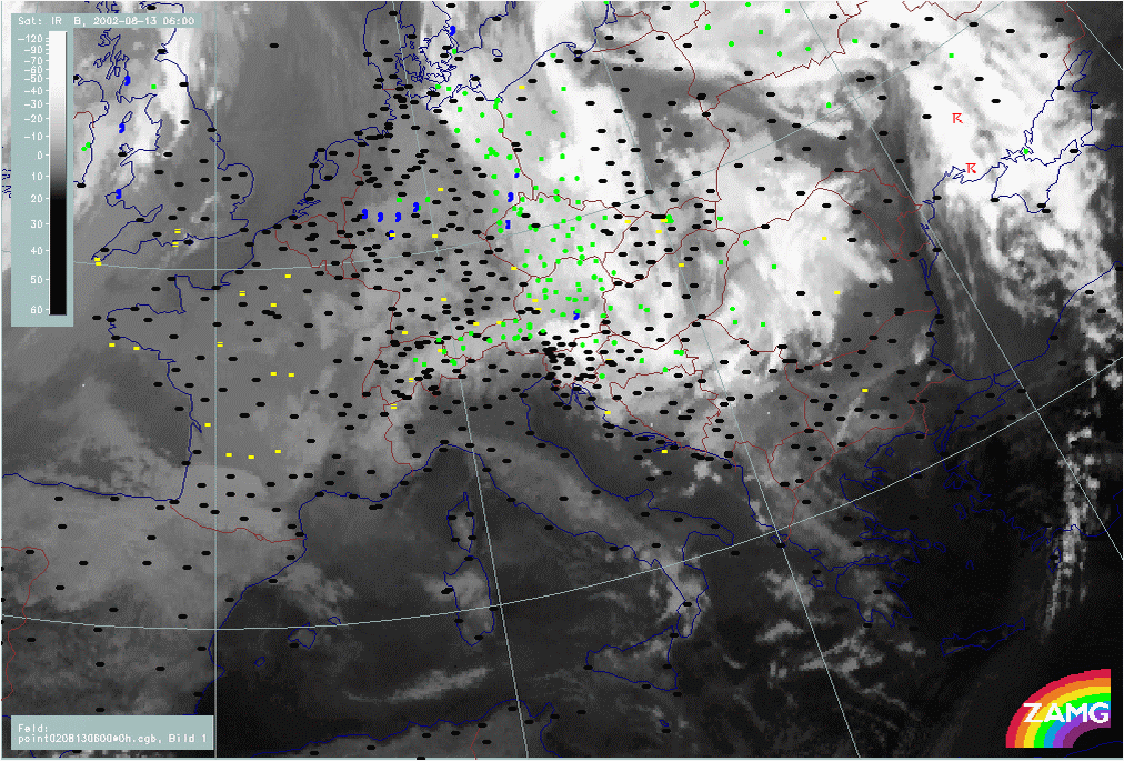
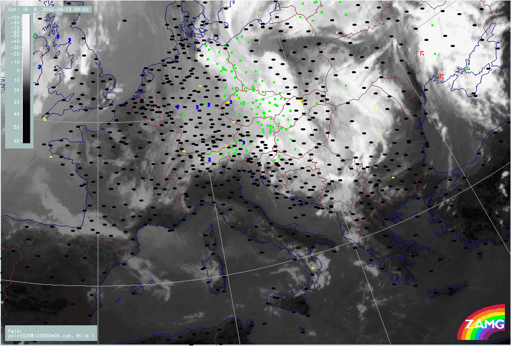
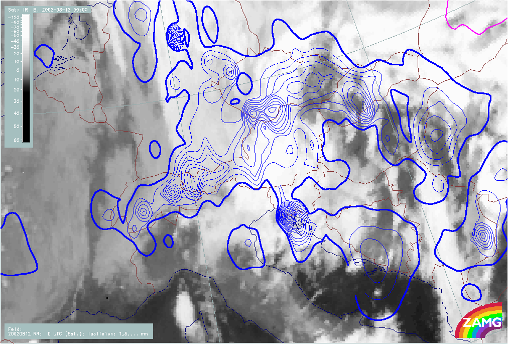
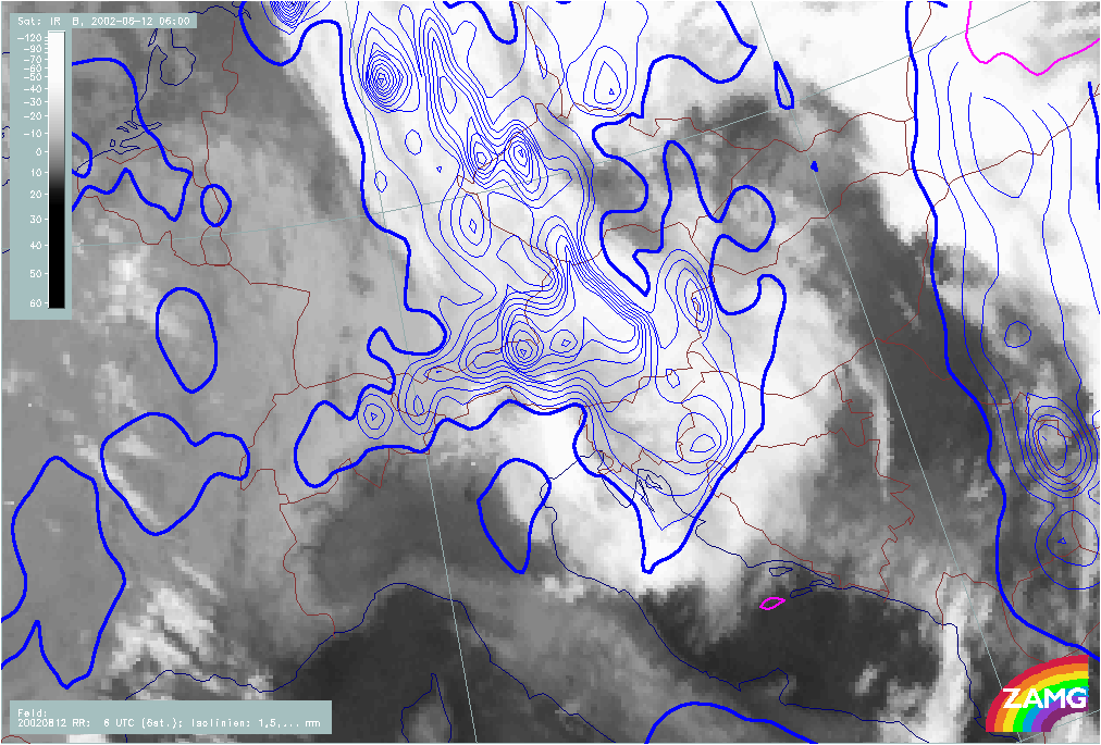
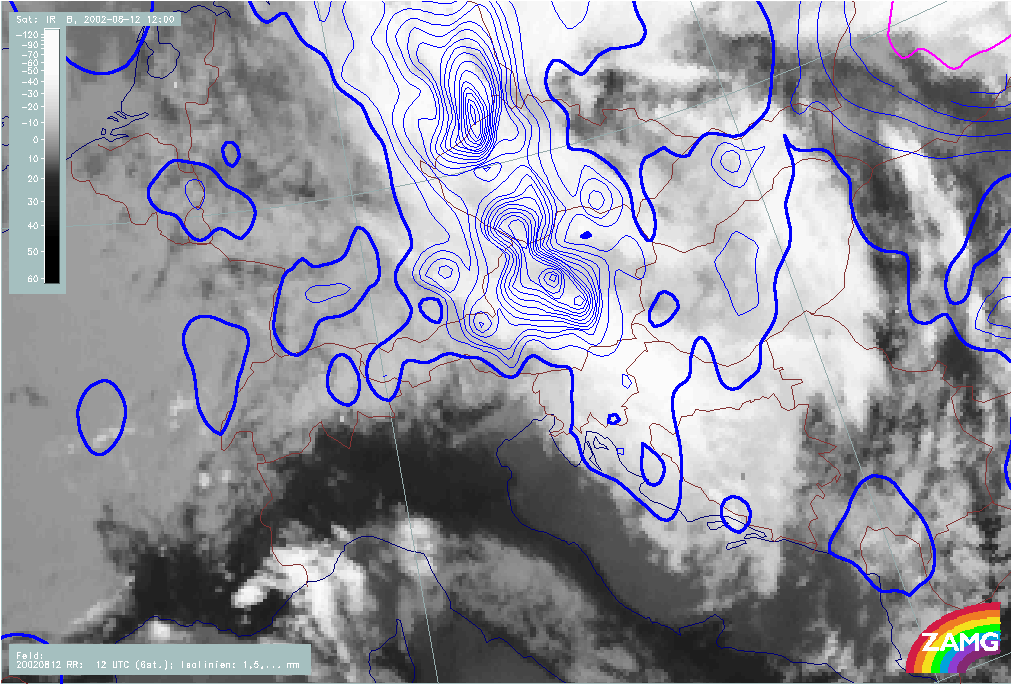
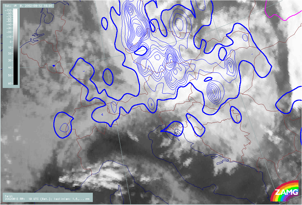
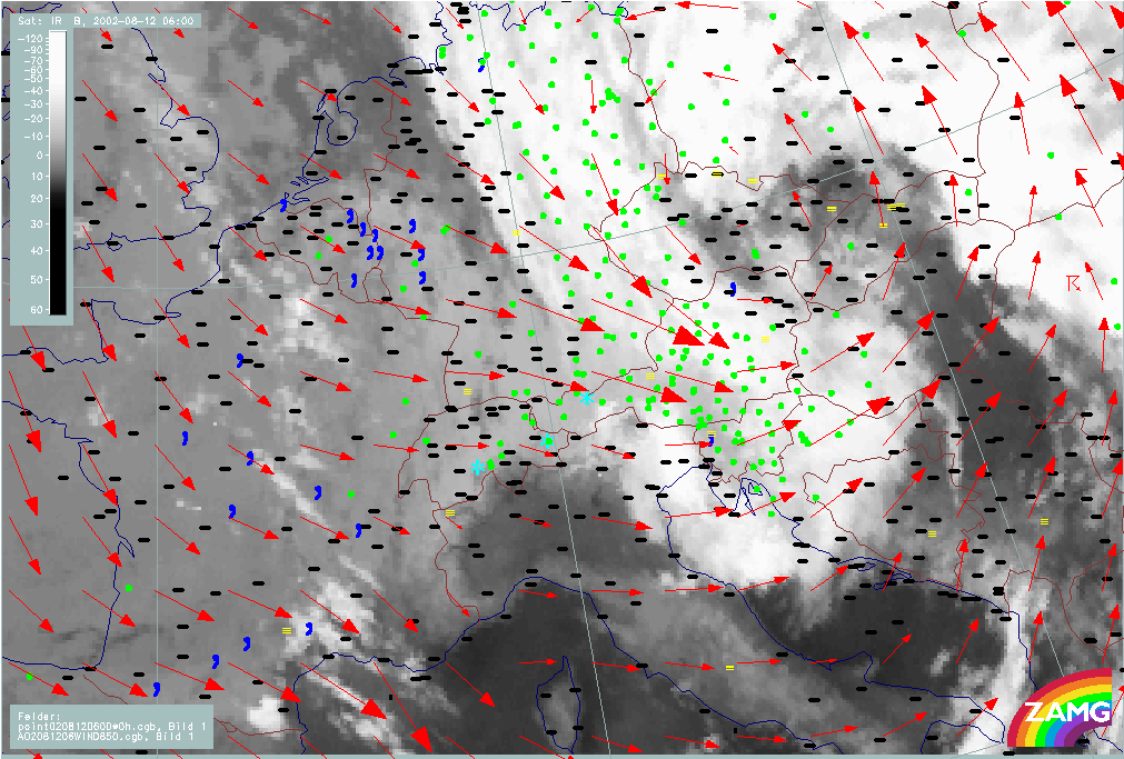
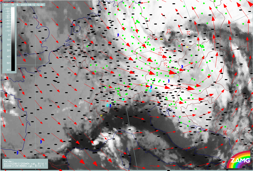
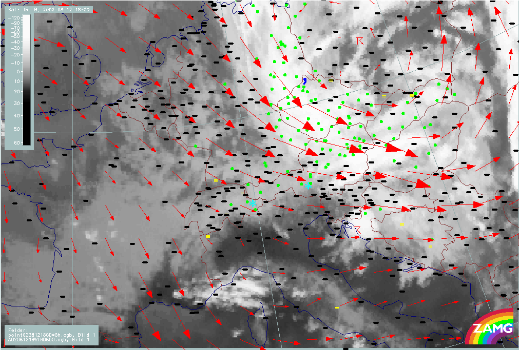
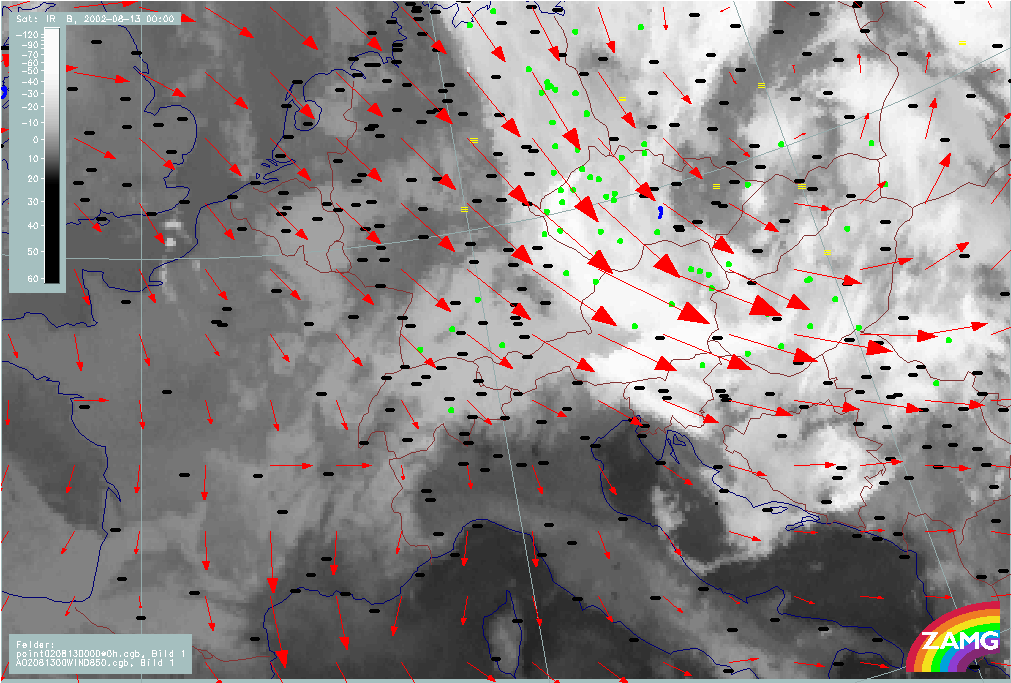
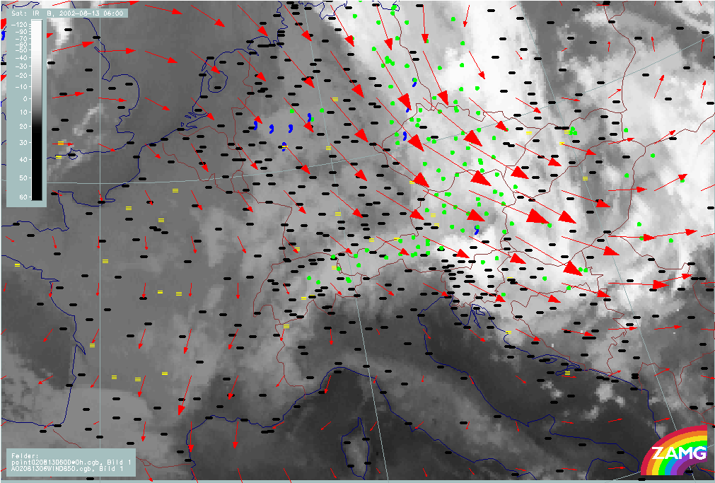
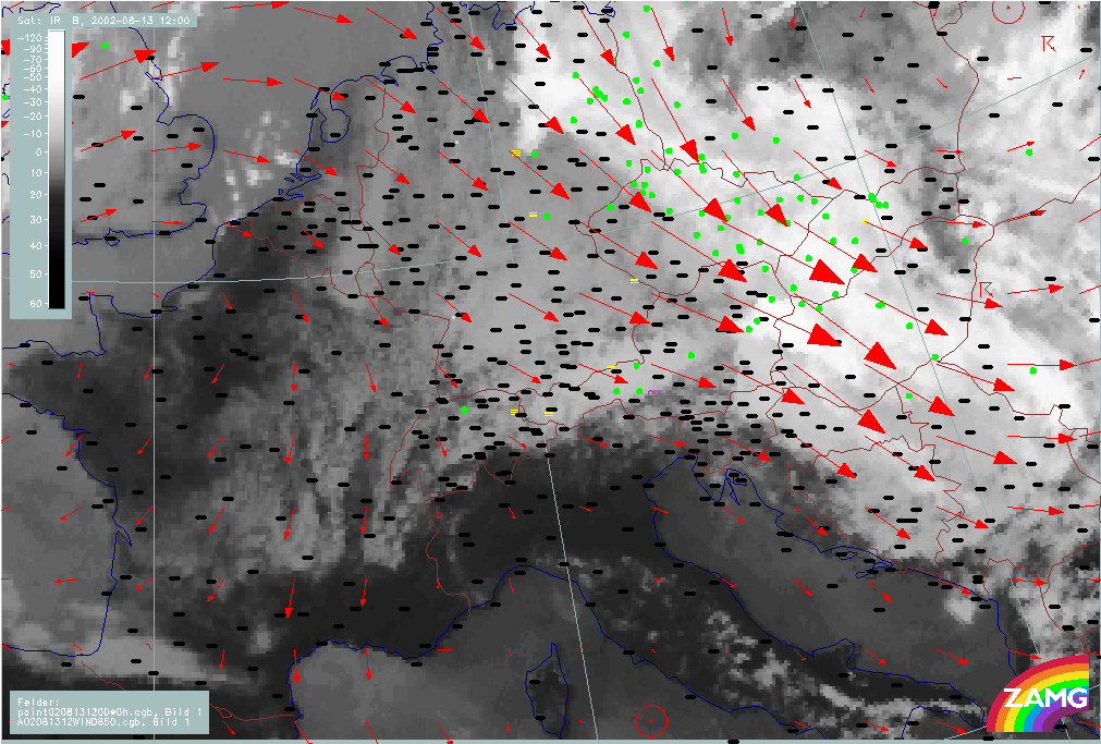
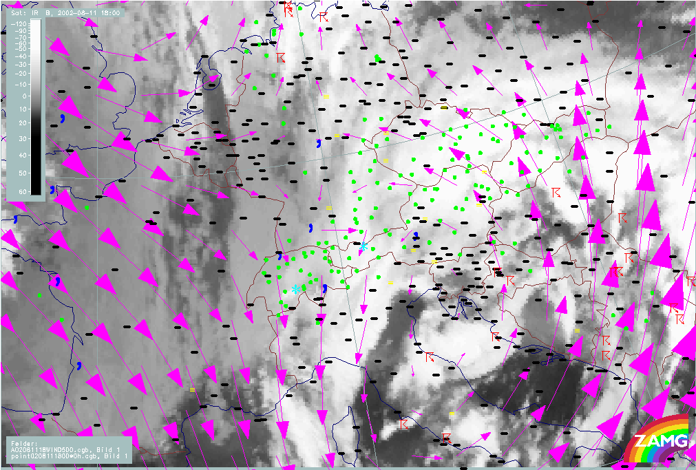
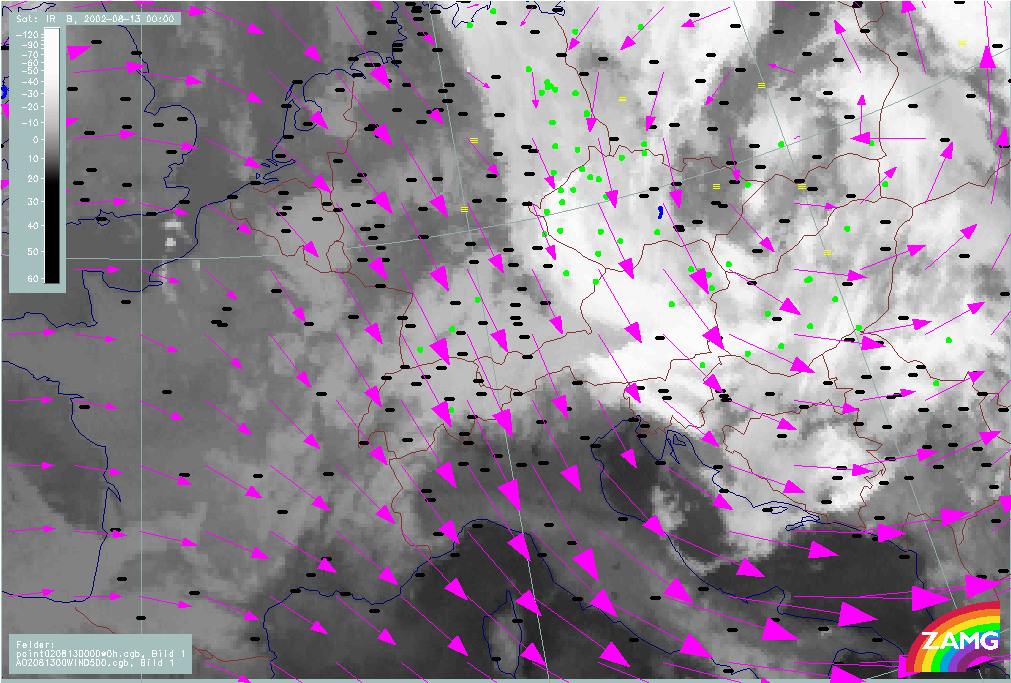
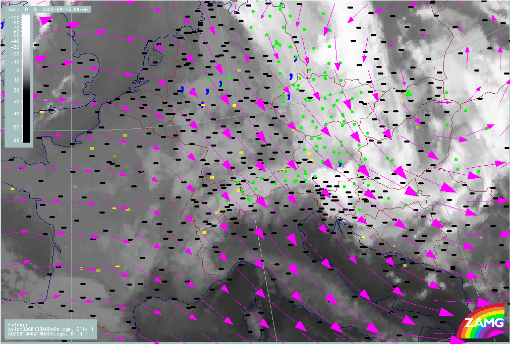
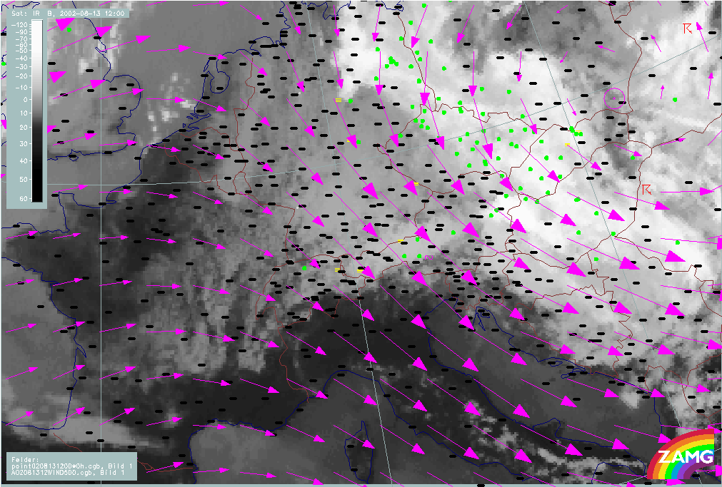
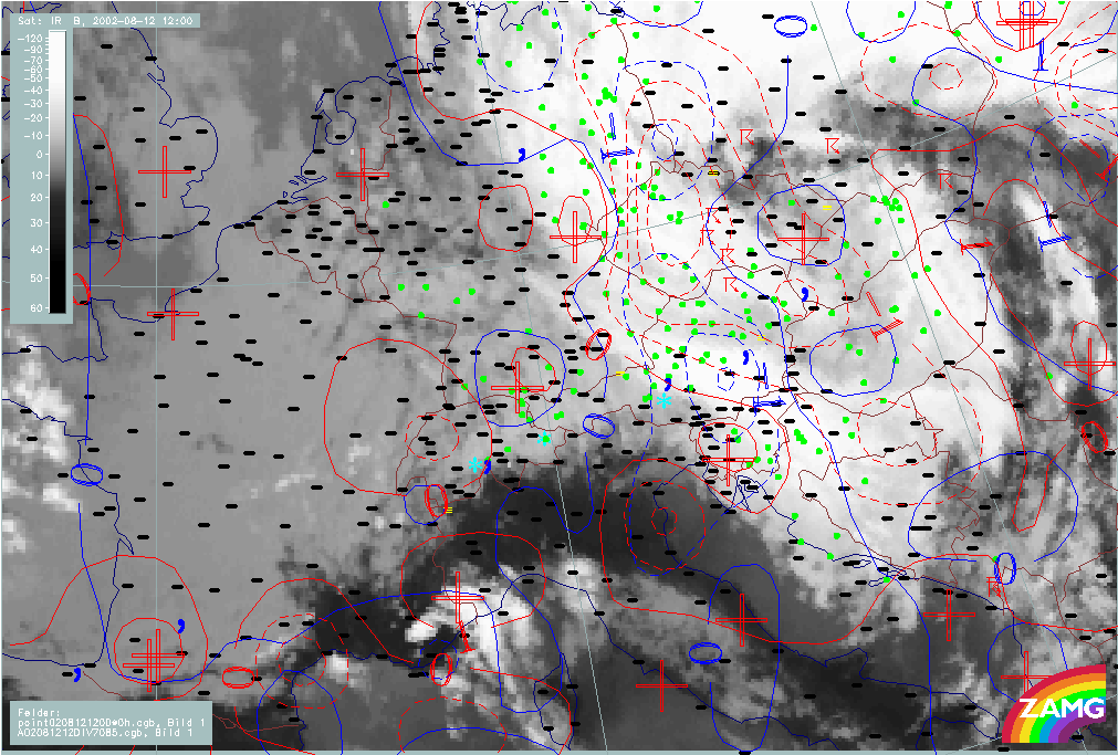
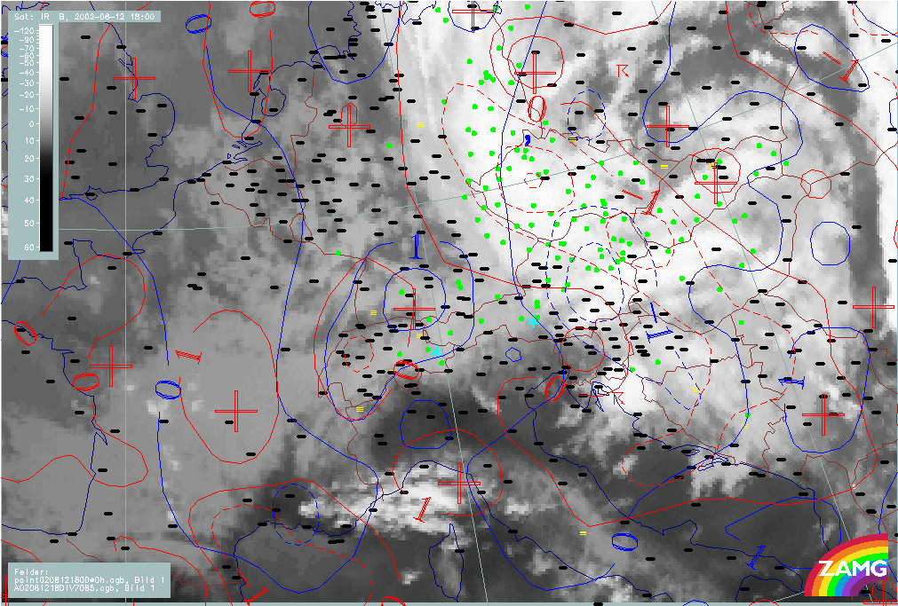
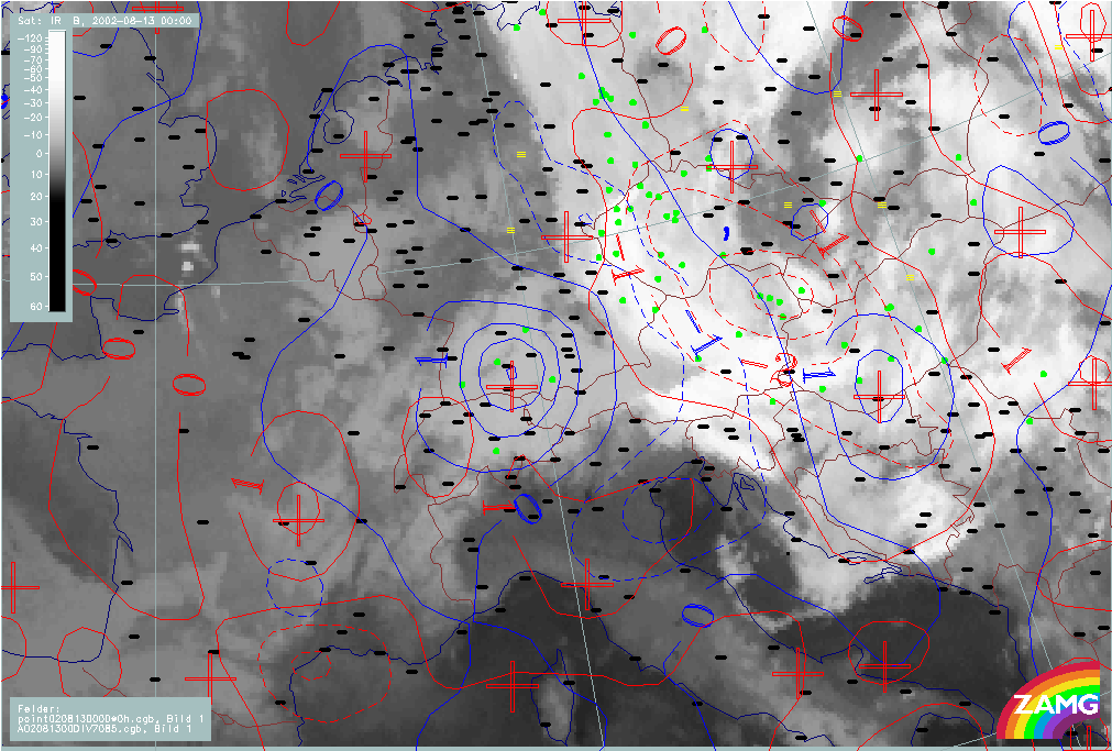
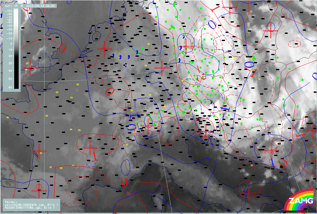
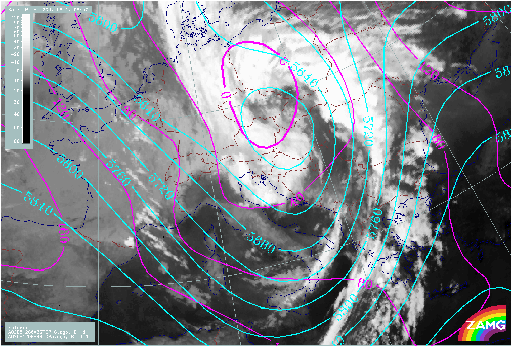
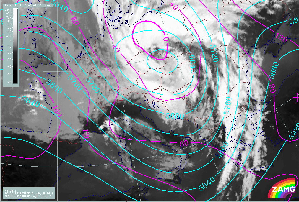
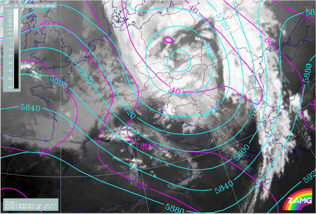
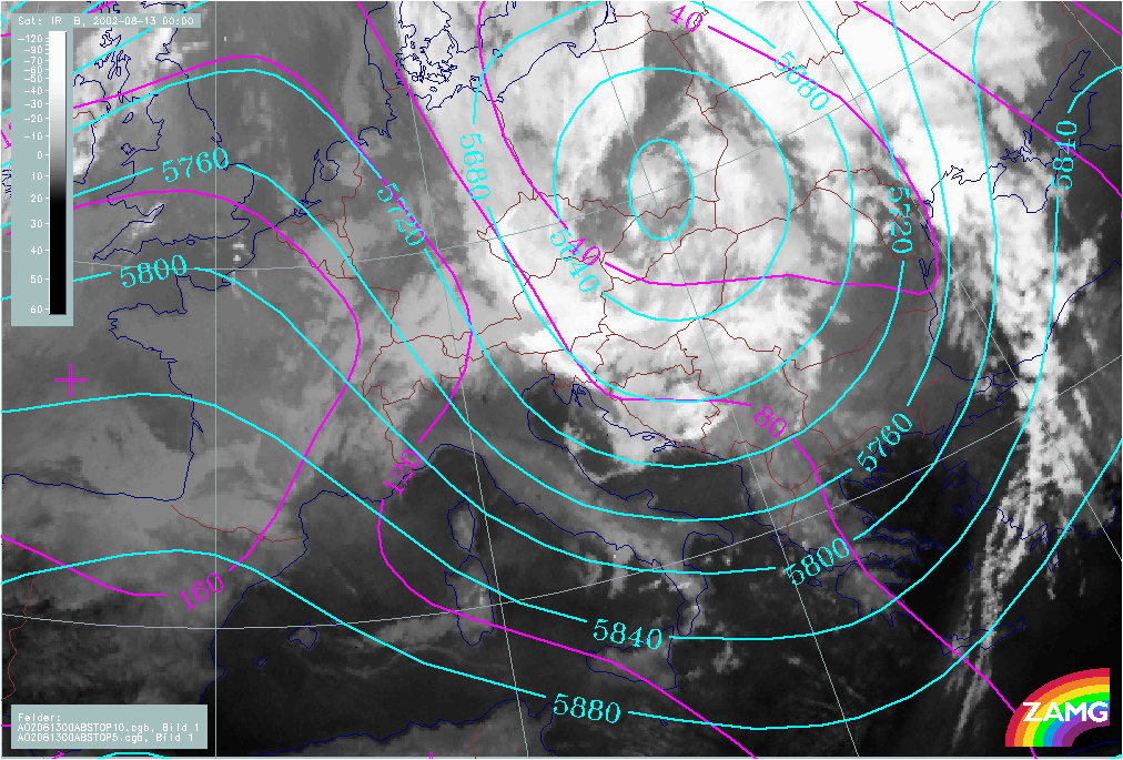
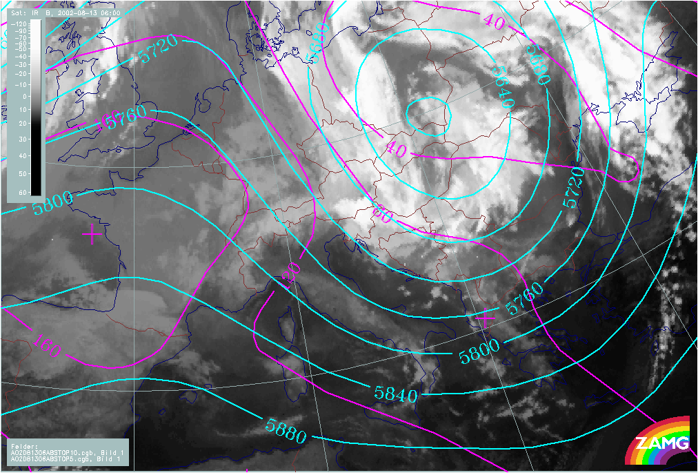
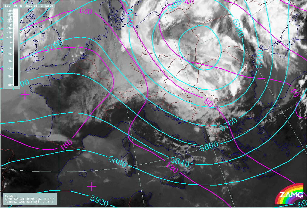
"5b Path": Propagation of Mediterranean low northeastwards
|
12 August 2002/00.00 UTC - Meteosat IR image; magenta: height contours 1000 hPa; cyan: height contours 500 hPa; 12 August/00.00 - 13
August/12.00 UTC 6-hourly image Loop
|
|
The path of the Mediterranean surface and Upper Level Lows exactly follows that of a classical 5b low, from the Mediterranean over Hungary and E. Austria further to the North across Slovakia and the Czech Republic to Poland. As a consequence of this path and taking into account Stau effects at the mountains, severe weather can be expected over the whole of Austria and surrounding countries. This catastrophic case led to a disastrous flood situation effecting not only the countries mentioned above, but also much of eastern Germany.