Interpretation
Geopotential Height 300 hPa.
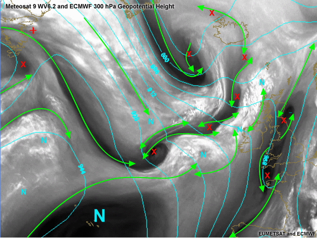
The most striking feauture in the loop was the rapid development of a depression south-west of Iceland. In this image the geopotential height (cyan) is compared to the deformation zones (green). As for the Rapid Cyclogenesis near Iceland, no strong signal is seen yet in the upper layers (as you would expect). A marked trough identifies the development. A second remarkable trough is found over the UK. The deformation zones indicate two vorticity maxima captured by a sharp upper level trough.
In between the Rapid Cyclogenesis and the upper level trough over the UK a broader deformation zone is found west of Ireland. The geopotential height shows some weak upper level trough. Quasi geostrophic forcing could be associated with this and one should monitor this accordingly.
Isotachs and PVA 300 hPa.
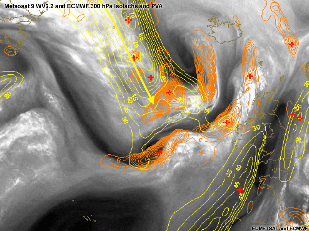
Several wind maxima are found in the image. One is seen over the Atlantic west of Spain and France associated with the anti-cyclone over the Azores. A second wind maximum is found over England and the North Sea. The most important wind maximum is found over the Atlantic and is associated to our Rapid Cyclogenesis system. The development of this system is taking place in the left exit region of the Jet. In orange, a pronounced PVA maximum can be witnessed. Further development of this system to a mature depression may still be expected.
Height of PV equals 1
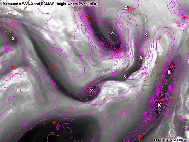
The height (in pressure) at which the potential vorticity (PV) equals 1 PV units (10-6 m-2 s-1 K kg-1) is plotted in this image in magenta. A pretty decent match is found with the vorticity maxima that are found by our "Expert". Especially when looking at Rapid Cyclogenesis the quick developments taking place can sometimes be misinterpreted by the model (e.g. model being too slow or too fast or diganosing a wrong track for the cyclone). Your knowledge of the water vapour images and its interpretation can then make a difference and help you to prefer one model over the other. In this case the PV anomaly South-West of Iceland is diganosed correctly in shape. The maximum would however be expected to be found near the cusp as opposed to where it is found now (more south) by the ECMWF +18 hour forecast.
Relative Vorticity 500 hPa.
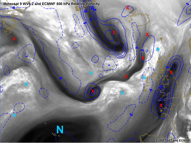
The relative vorticity in 0.5° resolution of ECMWF is plotted in this image. The small scale vortices are not being picked by the model (obvious because of the model resolution). Again it can be observed that the diagnosis of the Rapid Cyclogenesis South-West of Iceland is a bit too fast by the model. The true maximum as indicated by the cusp and by the X in this image is found more to the NNW. These things are important and can help you to prefer one model over the other. The important questions the forecaster has to deal with when forecasting the evolution of Rapid Cyclogenesis like this are:
- Is the deepening rate of the low pressure centre in accordance with the reality?
- Will the low pressure take the track as suggested by the NWP?
- What will the changes in the forecast be if there are signs of model inconsistencies?
These questions have also lead to some research in European Weather Services in which the information from (potential) vorticity is changed after interpretation of the WV images. The technique, which is known as PV inversions, can help to improve the forecast and help in forecasting high impact weather more correctly. It
has to be pointed out that changing PV field subjectively with the satellite
image information is not a straightforward process, and it can also lead to
erroneous interpretations, and great care has to be taken when applying PV inversion
techniques in operational forecasting.
The method briefly can be summarised as follows:
- Possible mismatches between the PV field in the analysis and features in the WV imagery are identified.
- PV is modified at sensitive levels, based on shear vorticity information. Modified initial state is "tuned" to fit observations.
- PV inversion is carried out.
- The model is re-run from the modified initial state.