Chapter I: Introduction
Introduction
Extreme weather conditions such as icing, turbulence or the presence of volcanic ash can put aircraft navigation into major difficulties. If an aircraft encounters these phenomena, the navigation gets extremely challenging. Therefore the correct assessment of the weather conditions is essential to ensure save flight conditions. This training module is dedicated to forecasters/aviation forecasters. The main intention is to provide a guideline on how to assess the potential of hazardous weather events such as volcanic ash.
Consider a major eruptions of a volcanoe producing an enormous amounts of ash clouds. Moreover these clouds are heading towards your country. If you were a forecaster, what would you do then? Look at satellite imageries. Which ones would you use?
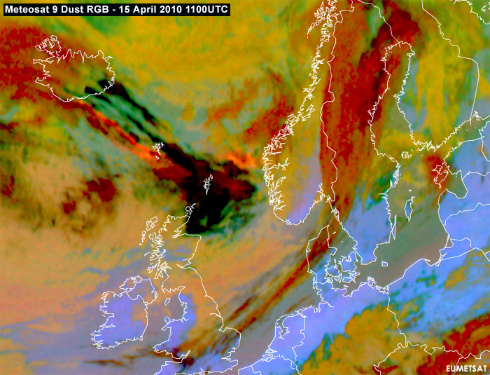
Figure 1.1: Meteosat 9 Dust RGB showing in peach color the ash cloud emmitting from the Eyjafjallajökull volcano in Iceland on 15.April 2010
Volcanic eruptions are known to have high impact on their environment and therefore they have posed a big threat on people throughout history. The eruptions of the Icelandic volcano Eyjafjallajökull in April 2010 which lead to enormous damages, demonstrate the forces of nature. Between 1975 and 1994 more than 80 jet airplanes were damaged due to unplanned encounters with clouds of volcanic ash. Seven of these encounters caused in-flight loss of jet engine power, putting the passengers lives at severe risk. Subsequent analysis of the damaged engine components revealed the major impact on the flight conditions.
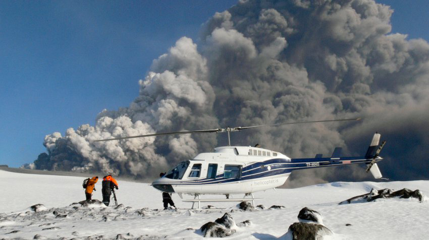
Figure 1.2: Filmteam of National Geopgraphic getting close to Eyjafjallajökull. Source Spiegel.de
Apart from causing windshield abrasion, volcanic ash affected the interior engine vents and led to engine failure. This was linked to the fact that volcanic ash has a melting point below jet engine operating temperatures. The ash melted in the hot section of the engine and attached to the turbine blades. Apart from repair and replacement costs, volcanic ash can cause enormous financial loss when air traffic is restricted. The major eruptions of the Icelandic volcano Eyjafjallajökull of 14 April had high impact on the air traffic management in Europe.

Figure 1.3: Eruption of Eyjafjallajökull. Source REUTERS
From 15 to 21 April, about 100.000 flights were cancelled. Economical reports expected a financial loss of about 4 billion Euros. Questions arose whether the coordination and crisis management of the air traffic could have been done more effectively. Although opinions might differ in regard to the level of threat of the volcanic ash cloud, it is clear that the damage caused by these clouds can be enormous. These damages depend on the concentration of ash particles and on the height of the ash cloud. However the concrete assessment of the height and concentration of the ash cloud can be very challenging. For this purpose satellite imageries as well as numerical dispersion models are needed.
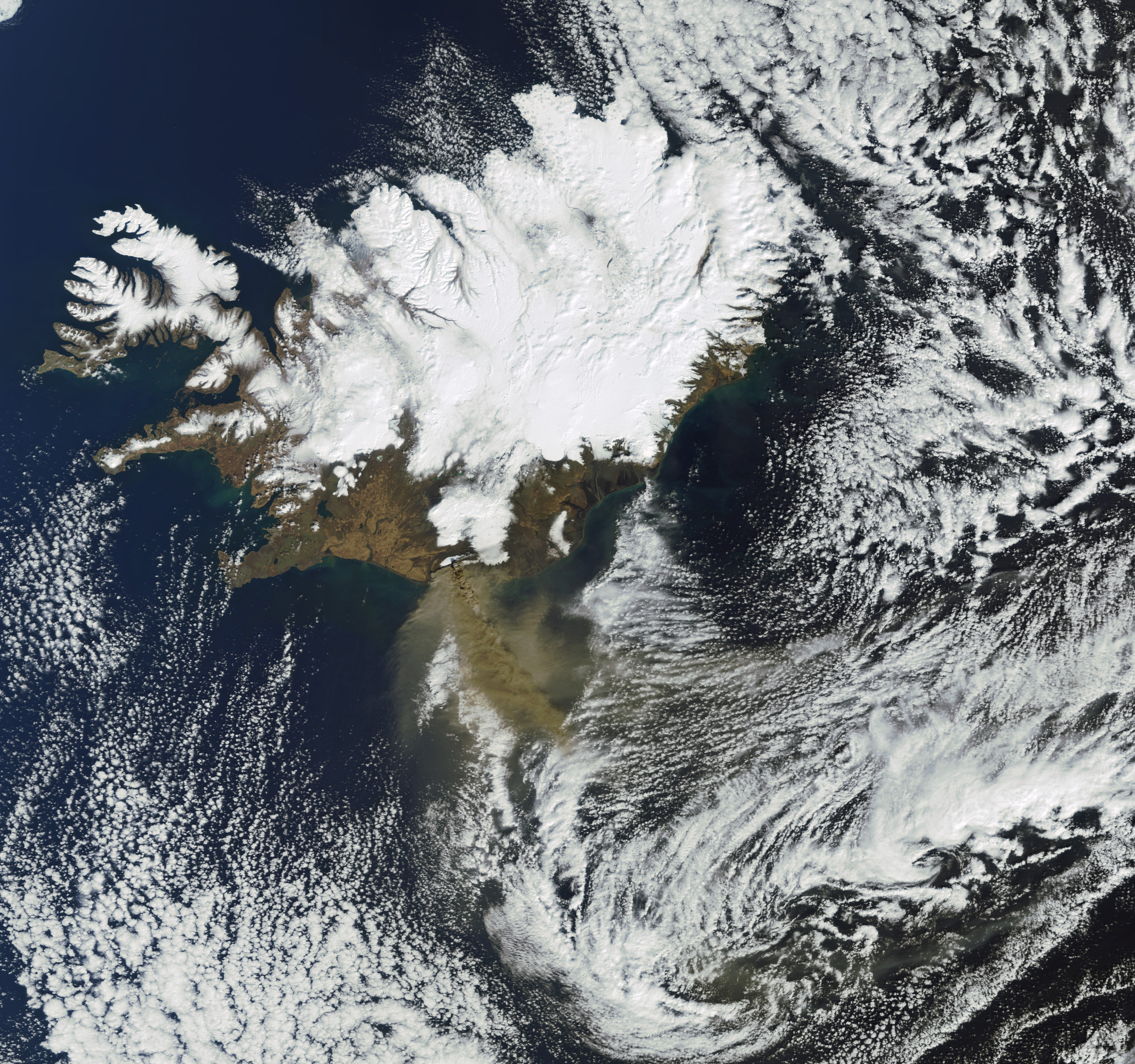
Figure 1.4: True color image of MERIS instrument onboard ENVISAT satellite of 17 April 2010 showing erupting Eyjafjallajökull and emitting ashcloud. Source ESA
There is no doubt that with improved expertise in monitoring and predicting volcanic ash clouds, the handling of situations as experienced in April can get easier. This part of the training module will guide you through different data sources and methods how to deal with the prediction of volcanic ash clouds.