Synoptic Situation
The cloud system under investigation is first observed to the south of Iceland, where it can be recognized as a wave structure. This wave intensifies rapidly while moving to central Europe via Great Britain. The heavy storm takes place over the Tatra Mountains (Slovakia, South Poland). The process is accompanied and strongly influenced by the lowering of dry stratospheric air. This can be followed excellently in WV imagery. The typical cloud dissolution can be seen in IR Imagery as shown in the animation below.
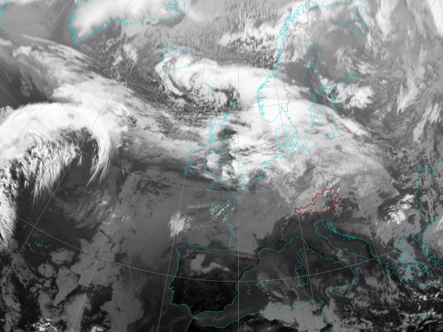
17 Nov 2004, 12 UTC - Meteosat-8 IR10.8
|
|
Satellite Overview
Meteosat-8 IR10.8 time sequence
The first chapter dealing with the synoptic situation describes the development seen with infrared imagery. 3-hourly sequences are shown.
Meteosat-8 WV6.2 time sequence
In this chapter the development seen in water vapour imagery is described. The WV channel is very useful for following the downward protusion of dry stratospheric air which plays a key role in this case study. Also the jet stream can be seen very well in WV images. 3-hourly sequences are shown.
RGB Composites
Airmass RGB: Meteosat-8; 6.2-7.3, 9.7-10.8, 6.2i: time sequence
The Airmass RGB has been designed for the early detection of rapid cyclogenesis and combines useful features of different MSG channels. Dry descending stratospheric air is shown in a reddish colour in the images. 3-hourly sequences are shown.
Basic Synoptical Parameters
Geopotential Height 1000 hPa + 500 hPa, IR Images: time sequence
In the following chapter the cloud configurations seen in satellite images are related to the basic synoptic fields represented by geopotential height in 1000 and 500 hPa. 6-hourly sequences are shown.
Summary
In this first chapter the transformation of a wave structure into a storm cyclone can be observed in IR images. Upper air processes play a crucial role within this case study. Downward-protruding stratospheric air and strong wind speeds at a high tropospheric level interact with a low-level baroclinic zone, leading to the rapid development of a storm cyclone.
The WV images are useful for following the development of a dry slot which already hints at an upper PV anomaly. The position of the jet stream can also be revealed by the WV images.
The Airmass RGB shows the strong influence of downward-protruding dry air. This dynamic development can be nicely seen in the time sequence.
Geopotential height is used to get a first insight into the synoptical structure. The rapid development of the deepening wave is shown by surface pressure fields. The rapid cyclogenesis is further related to a broad upper air trough.
The role of upper air processes like the jet stream and the upper PV anomaly as well as the advection of vorticity and temperature will be further investigated in the next chapter.